6. Florida GOES-8 movies
The met data used herein are derived from the NCEP/NCAR reanalysis
fields. NCEP and NCAR cooperated to produce a 40-year record of global
analyses of atmospheric fields in support of the needs of the research
and climate monitoring communities. This effort involved the recovery
of land surface, ship, rawinsonde, pibal, aircraft, satellite and other
data, quality controlling and assimilating those data with a data
assimilation system which is kept unchanged over the reanalysis period
1957 through 2000. This eliminated perceived climate jumps associated
with changes in the data assimilation system. Further details can be
found at the
NCEP/NCAR CDAS/Reanalysis Project homepage.
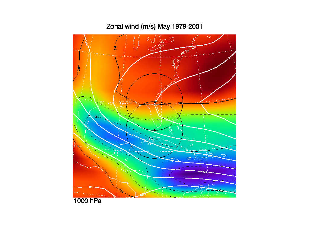
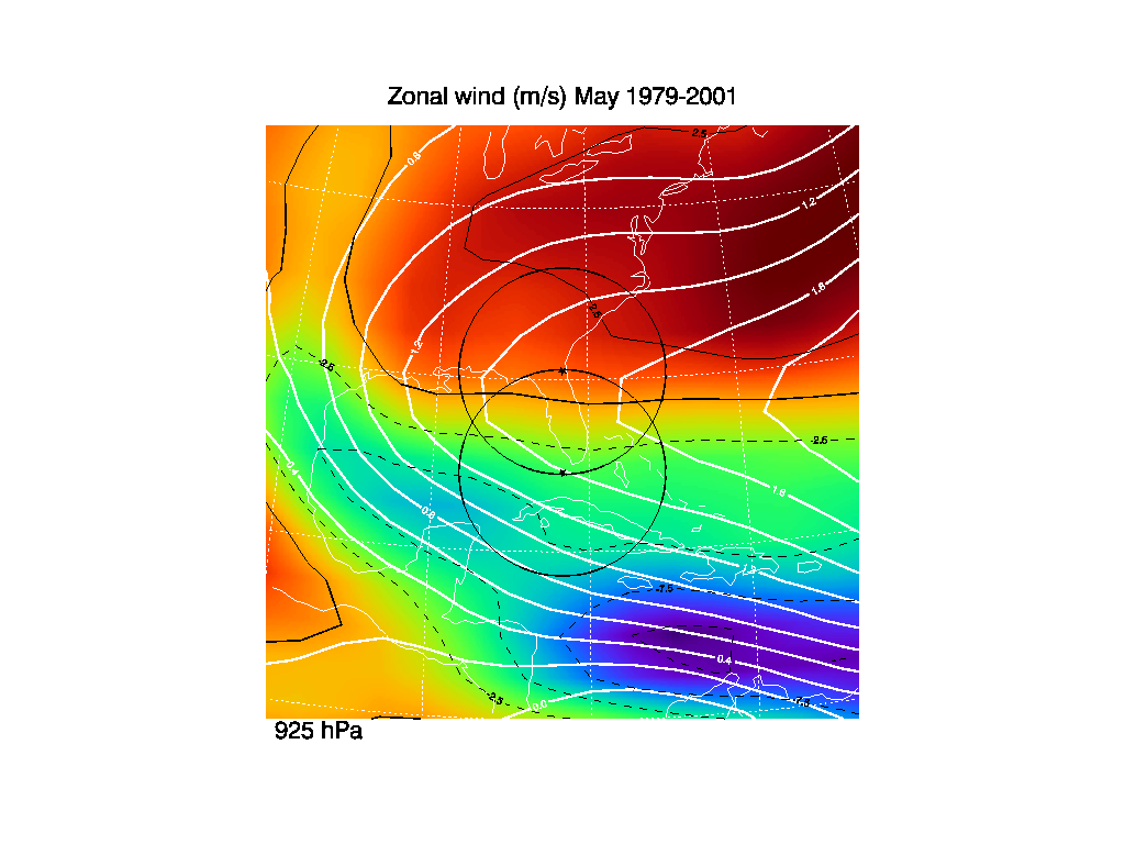
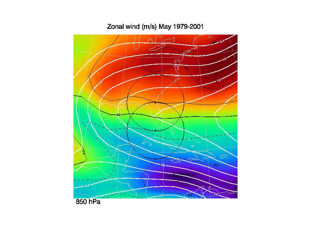
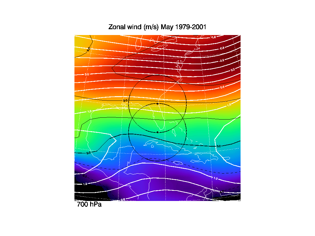
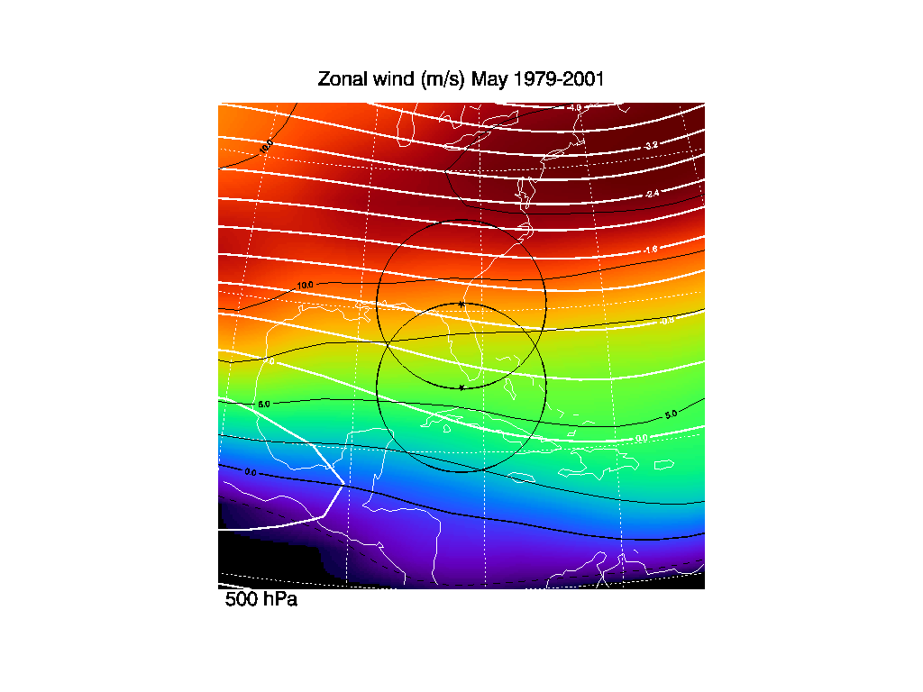
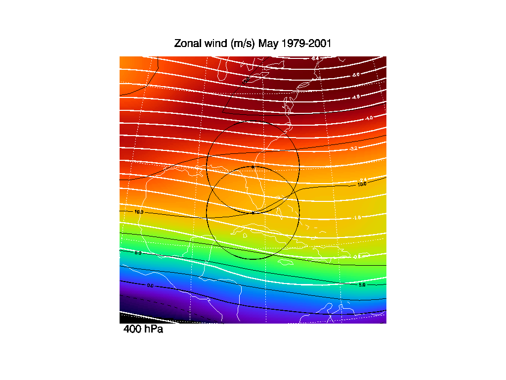
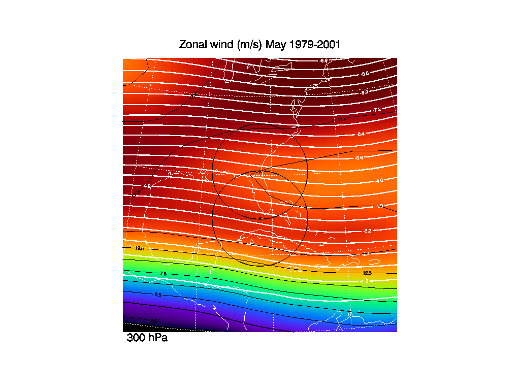
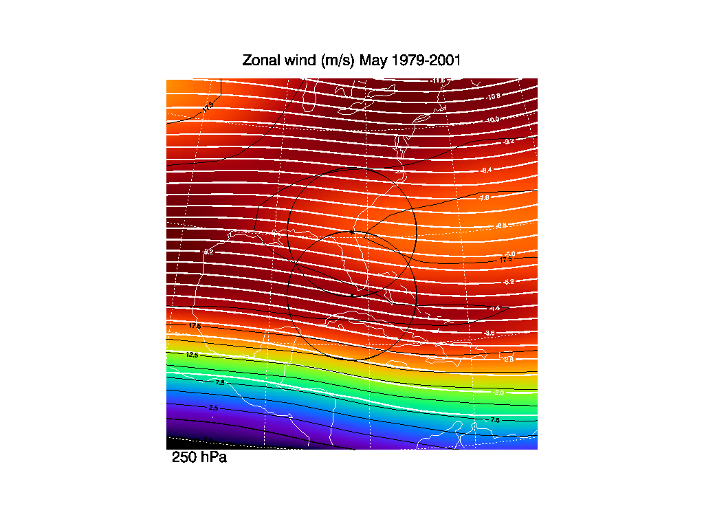
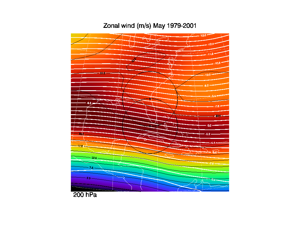
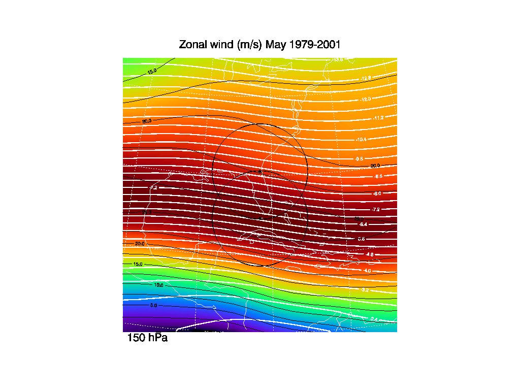
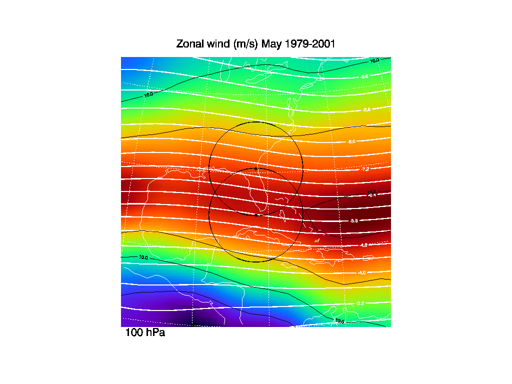
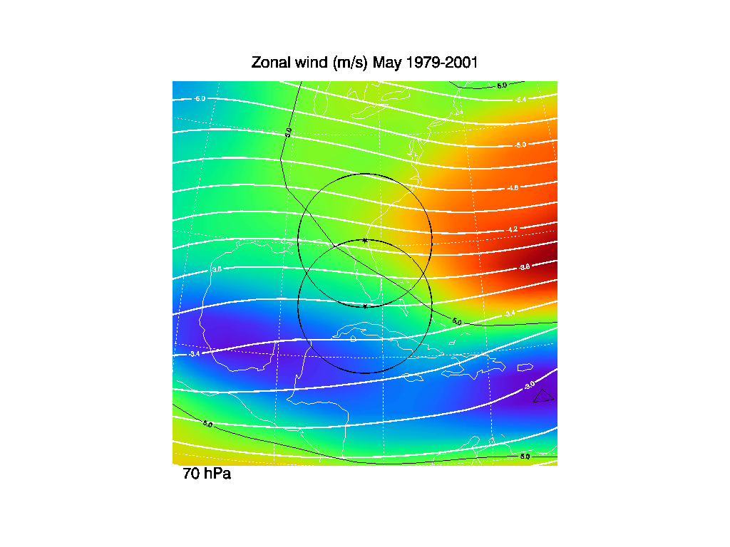
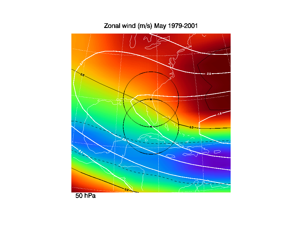
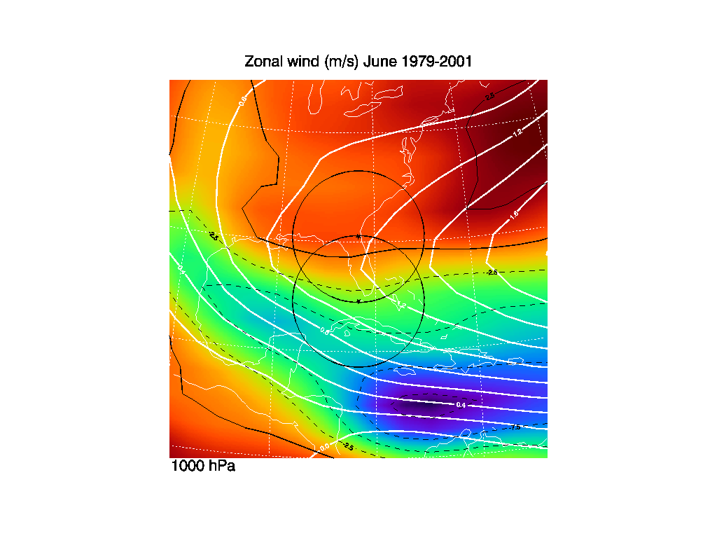
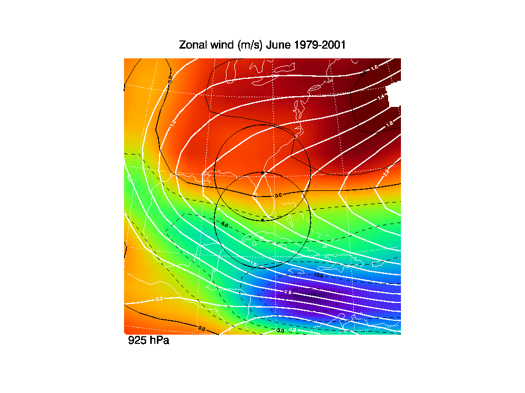
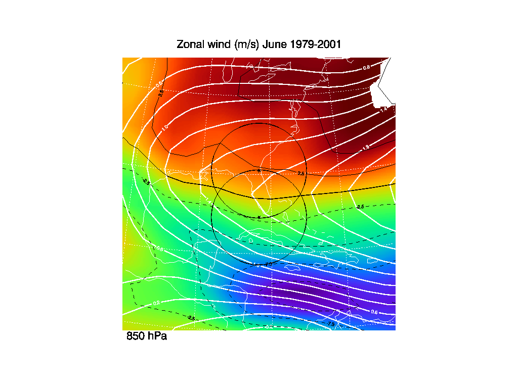
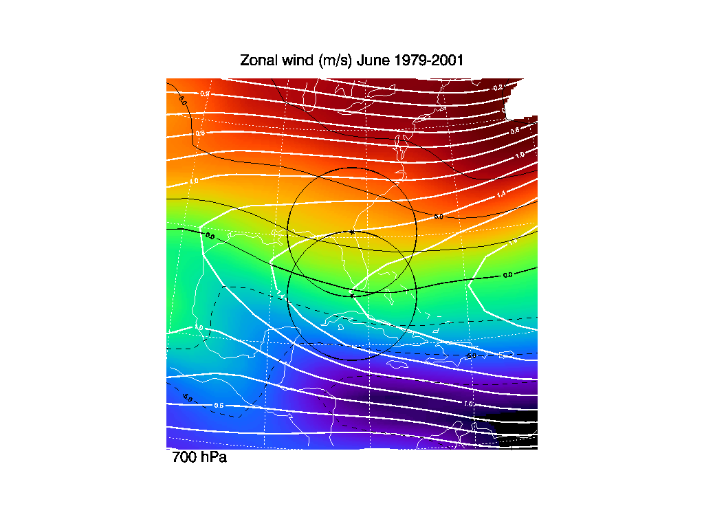
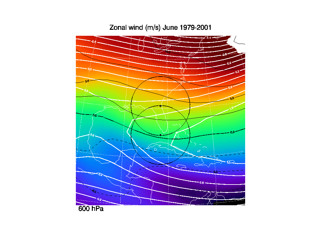
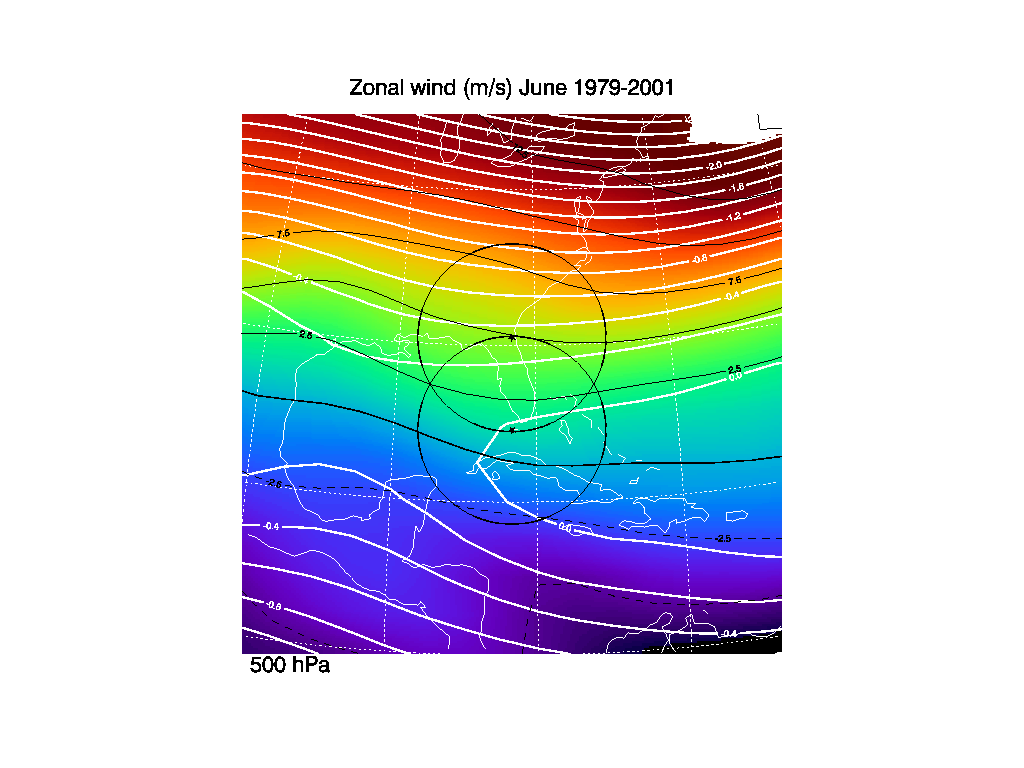
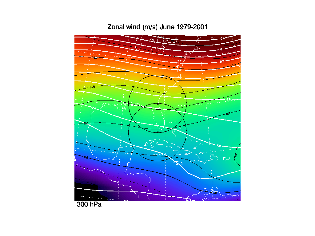
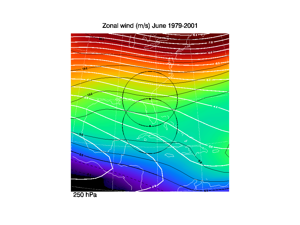
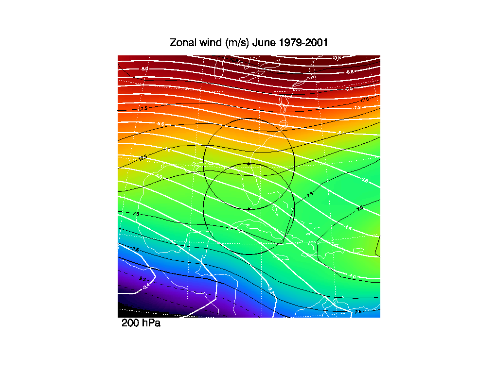
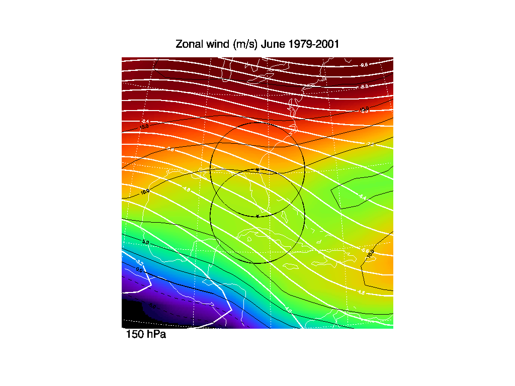
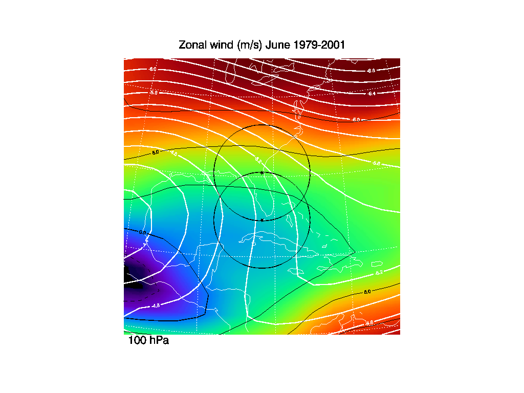
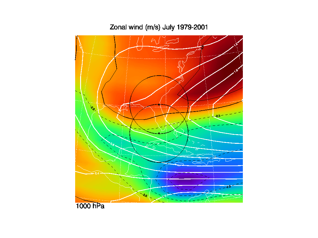
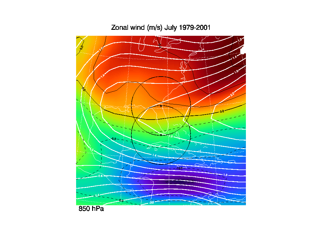
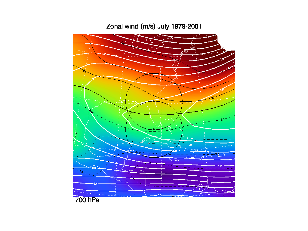
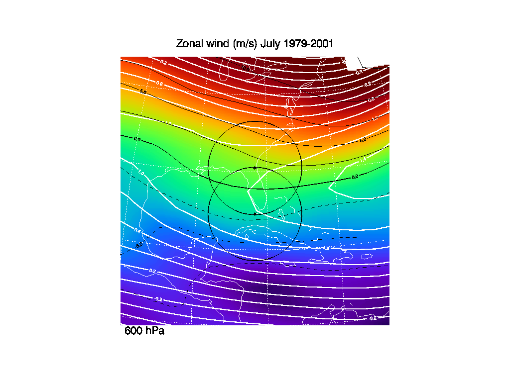
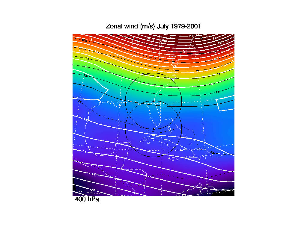
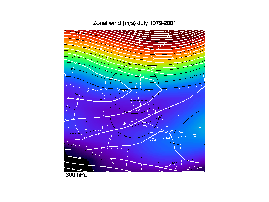
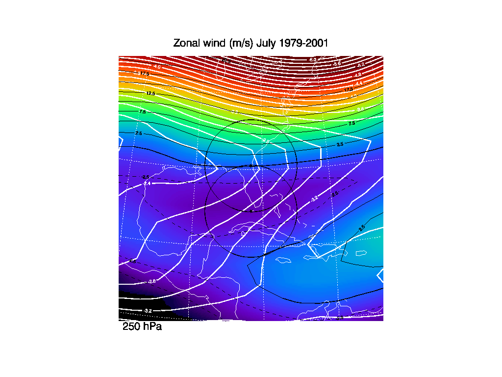
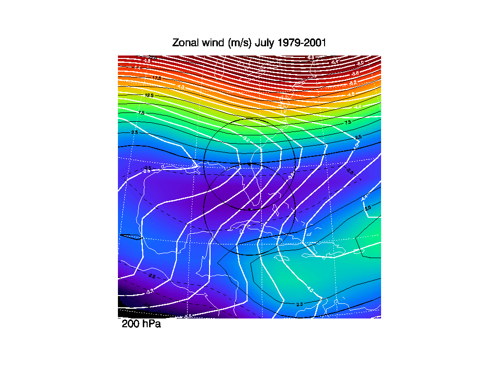
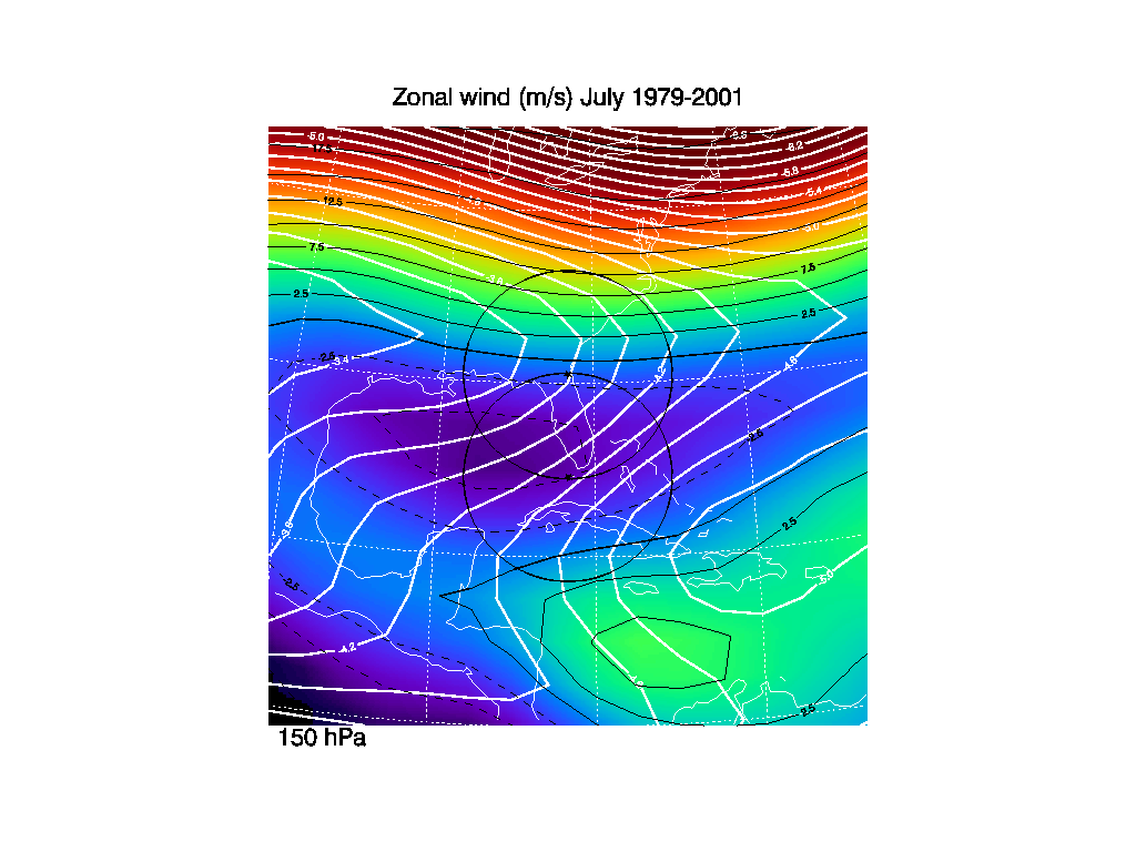
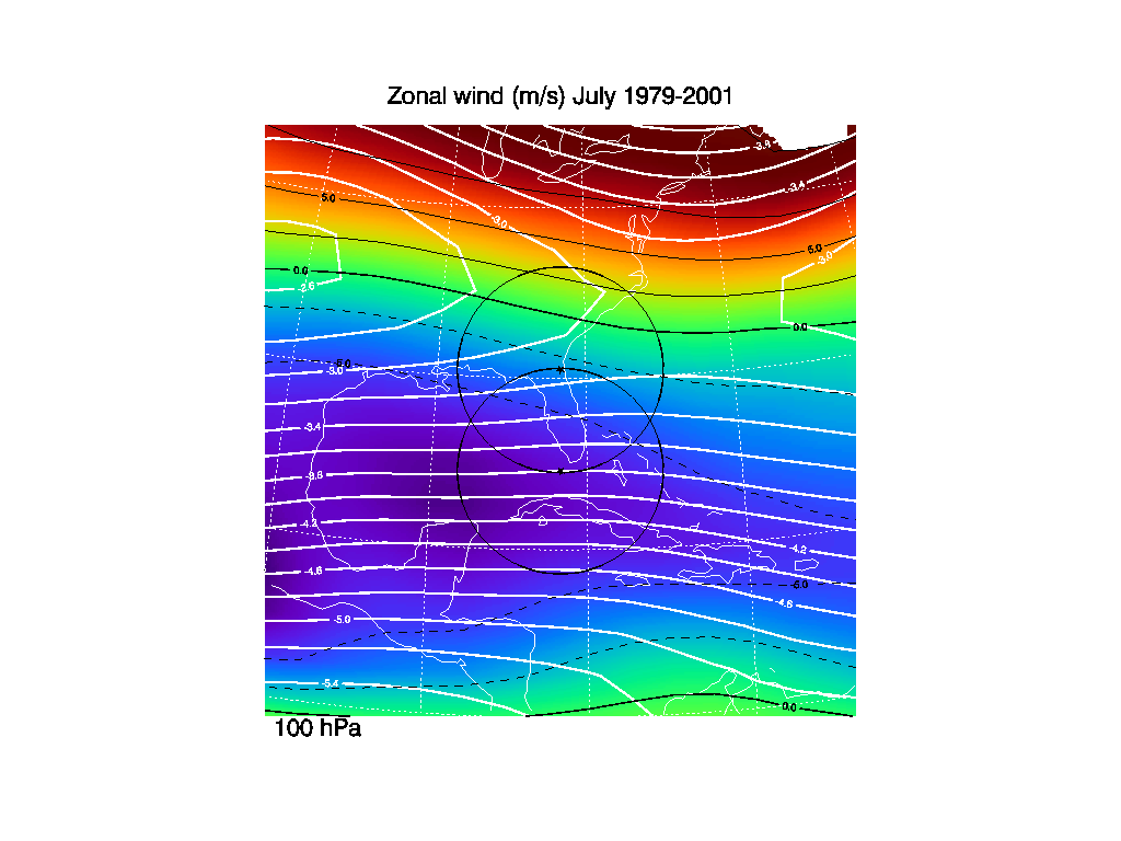
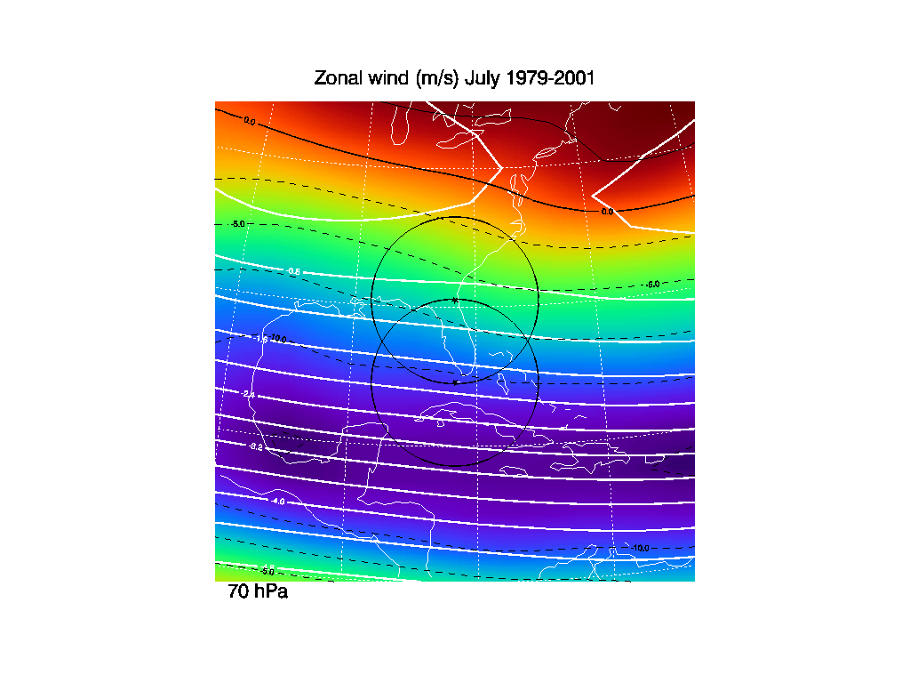
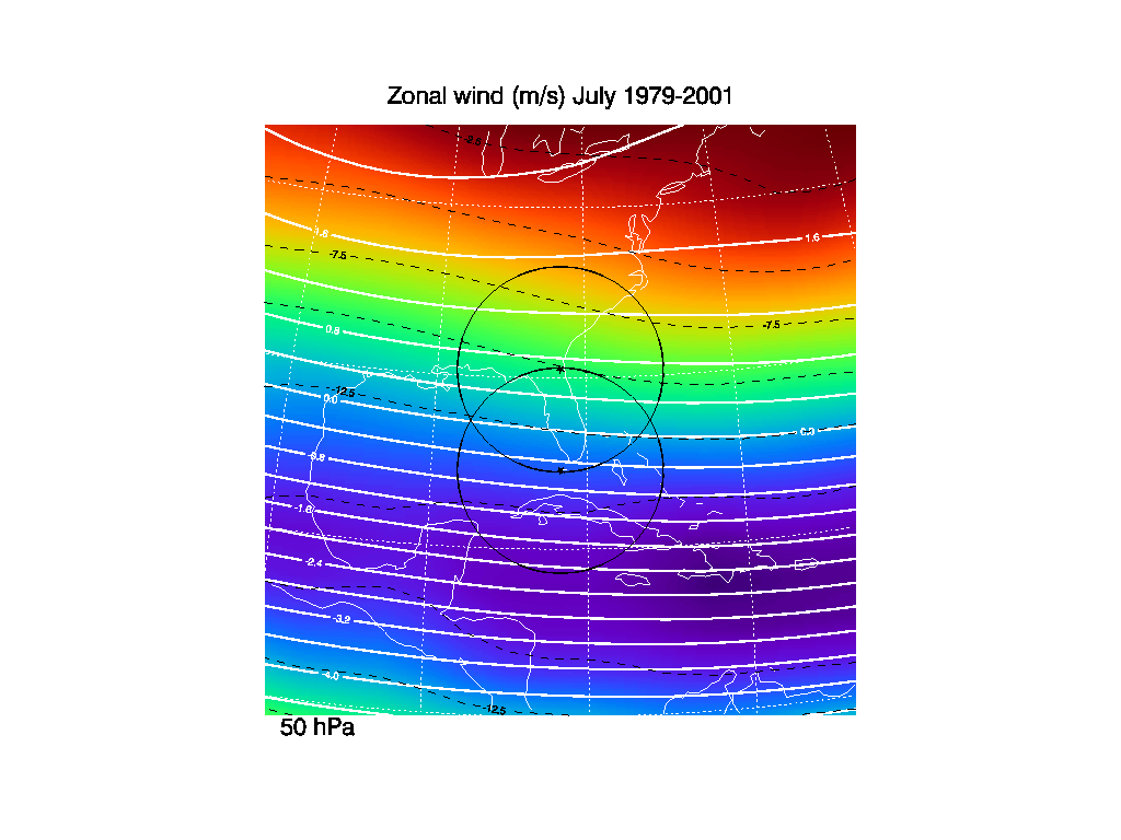
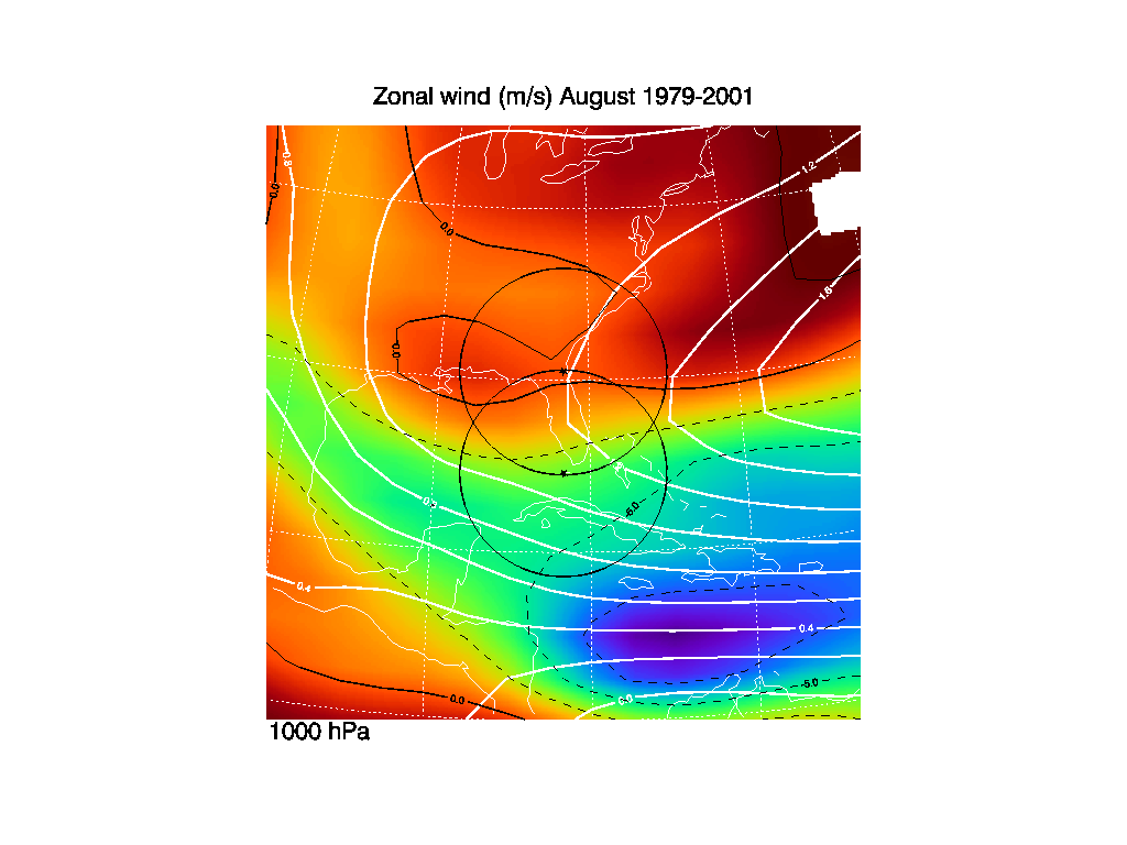
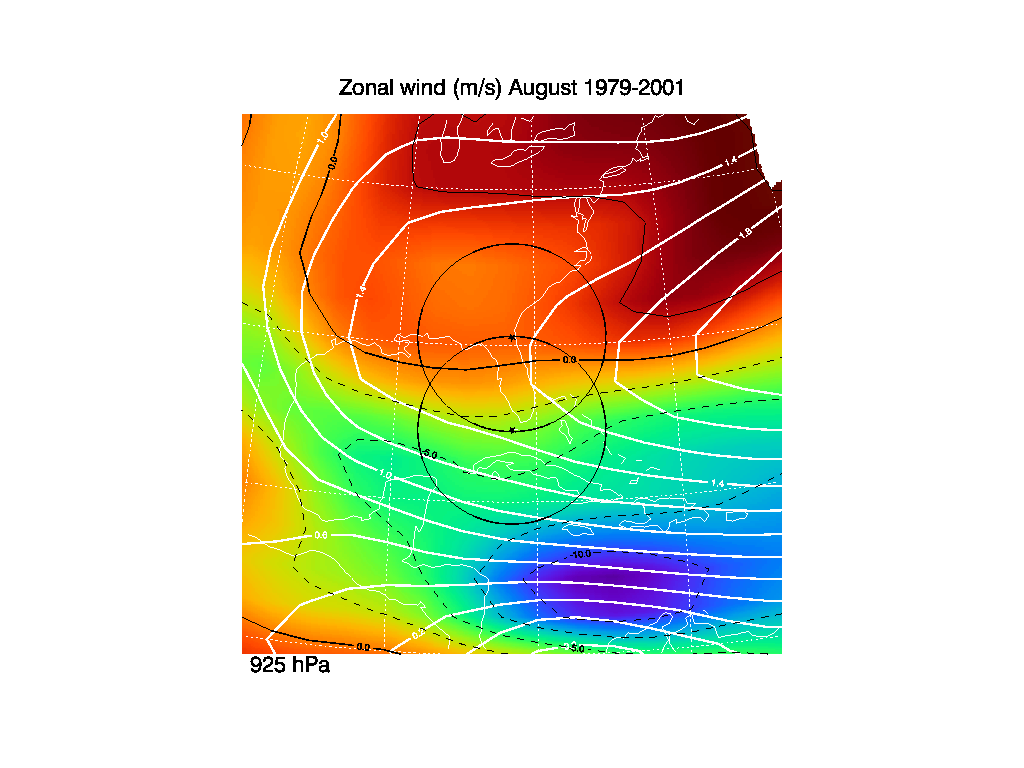
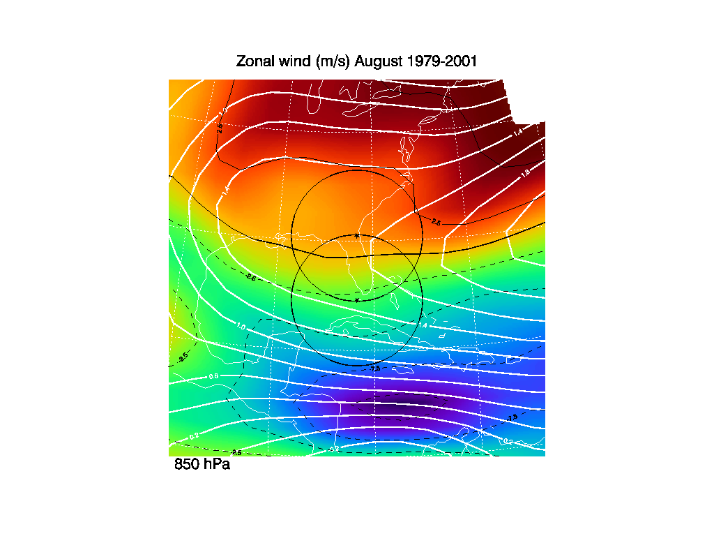
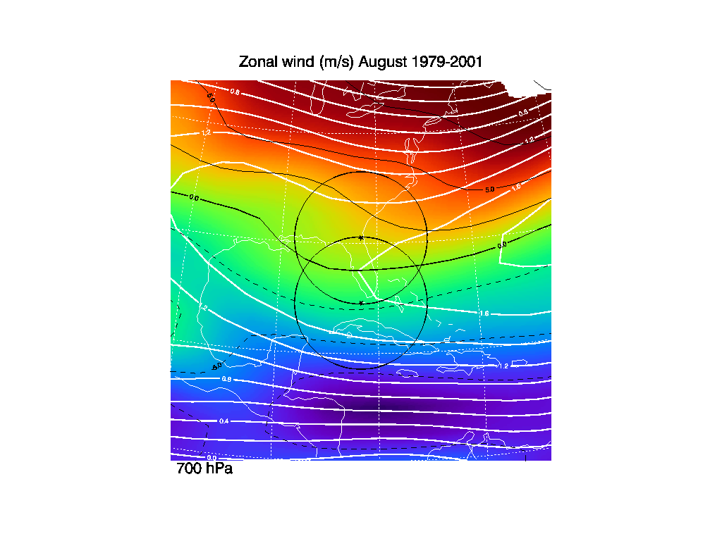
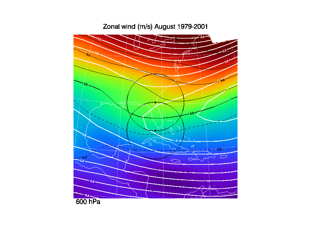
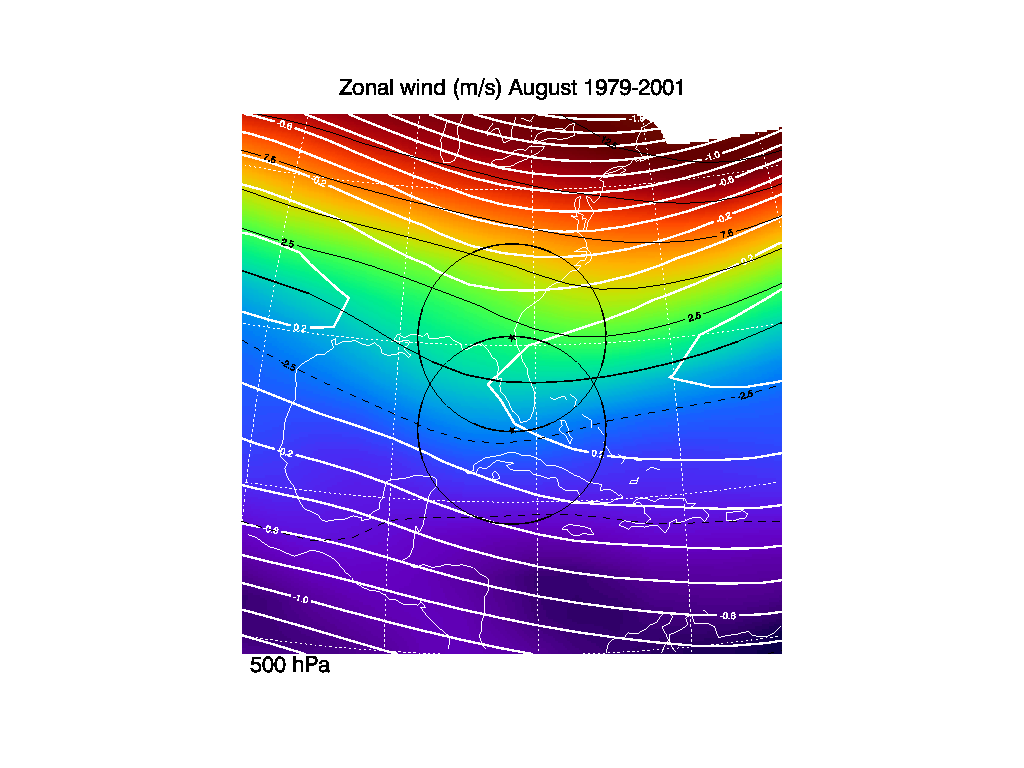
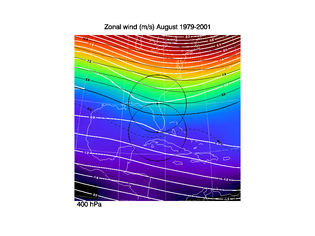
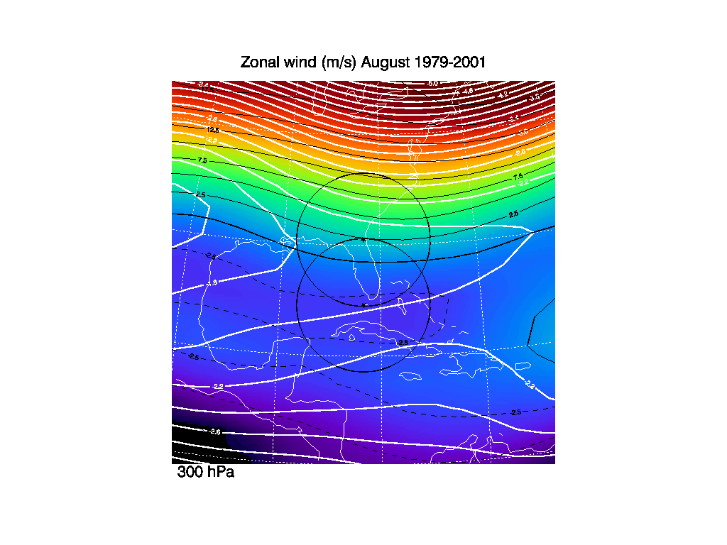
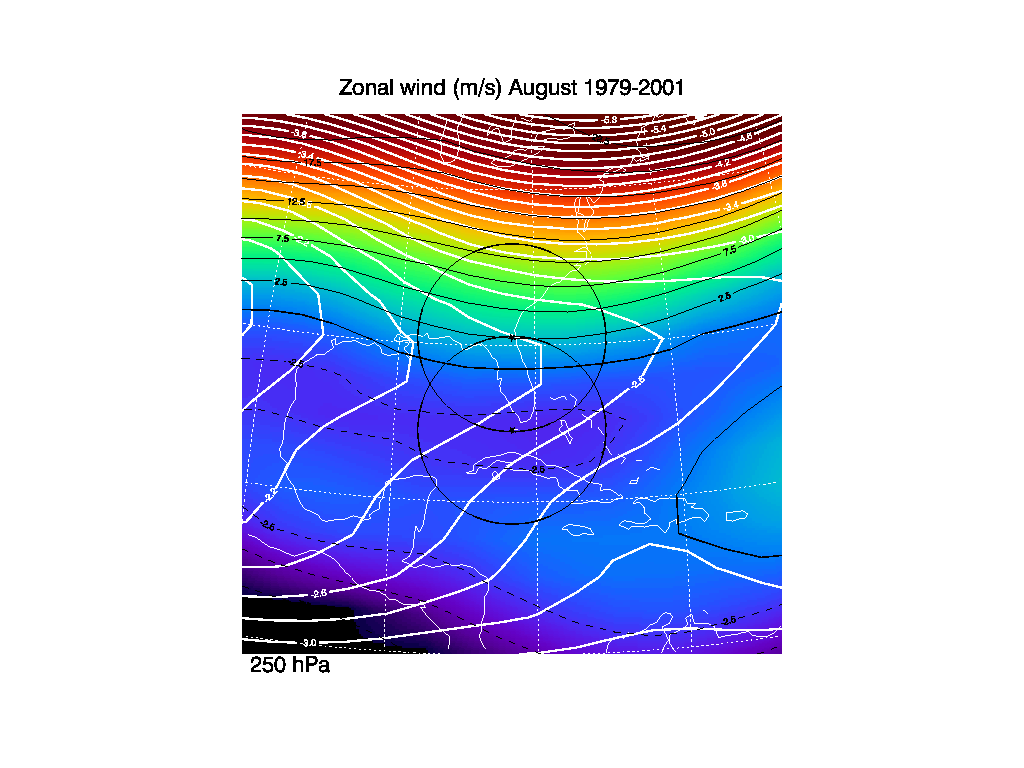
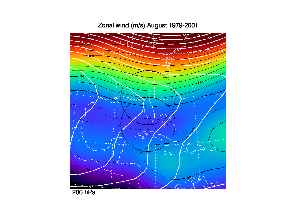
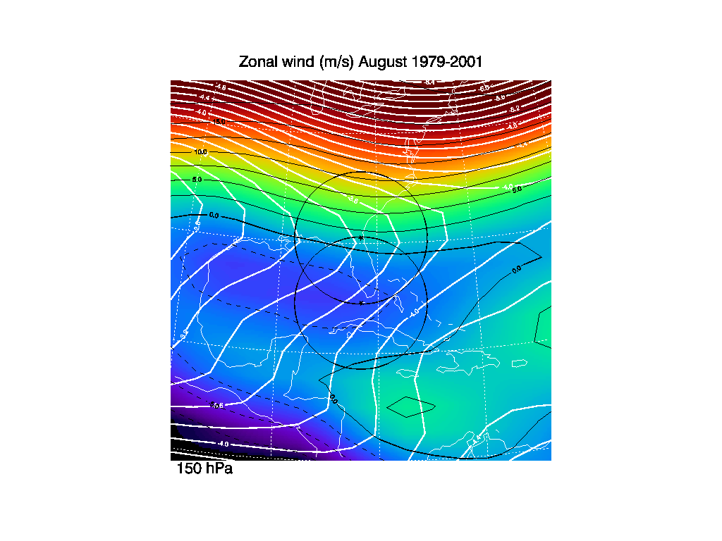
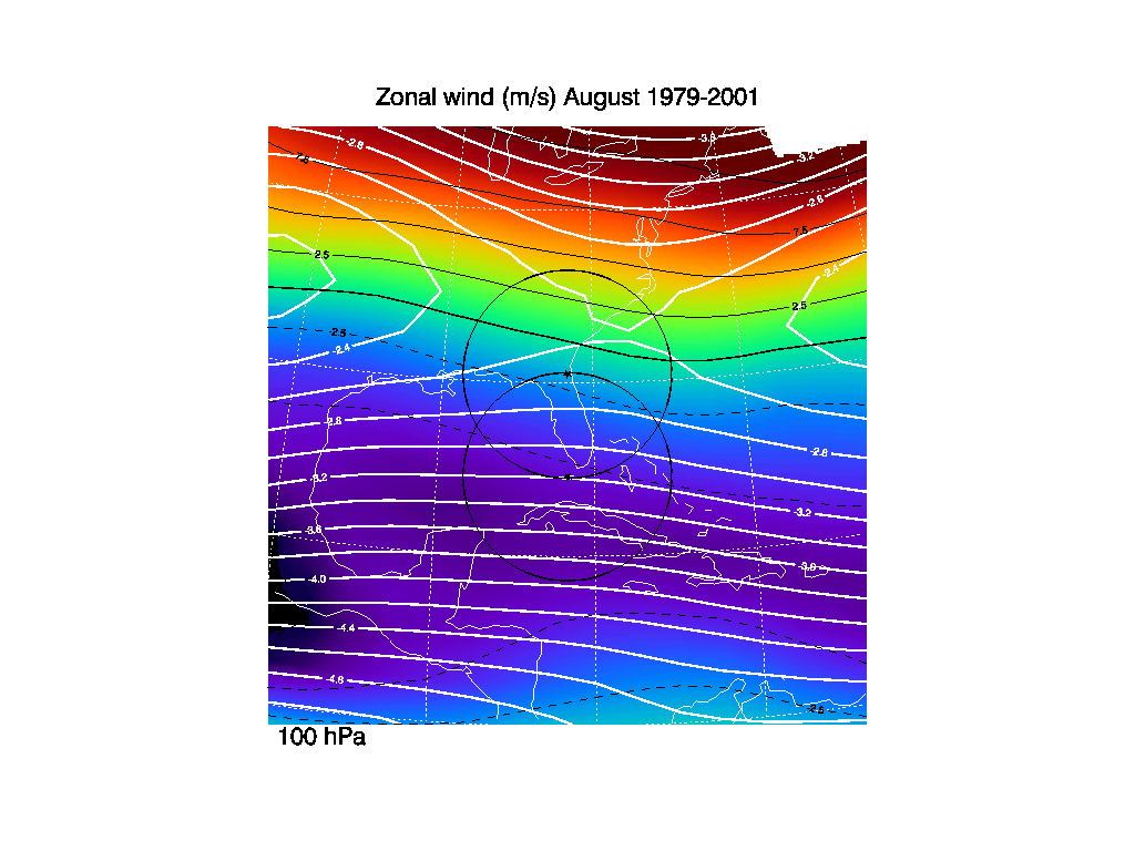
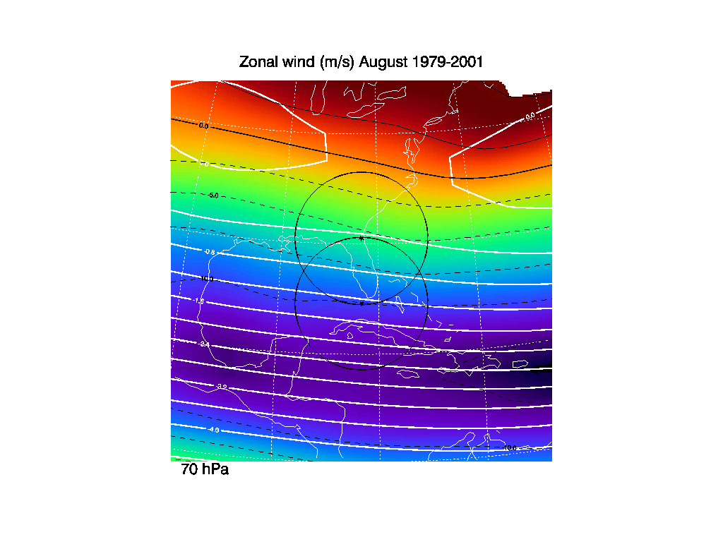
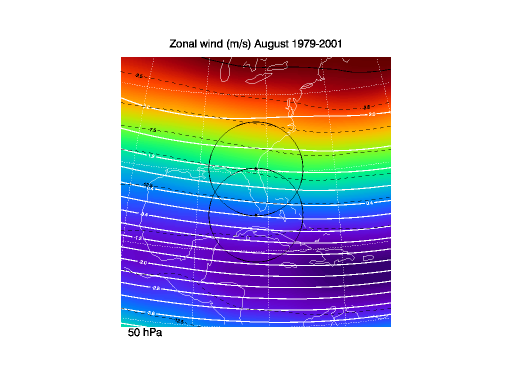
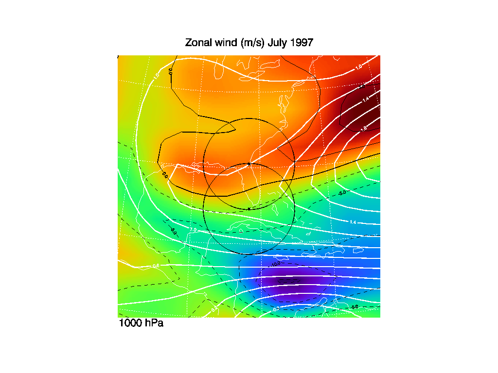
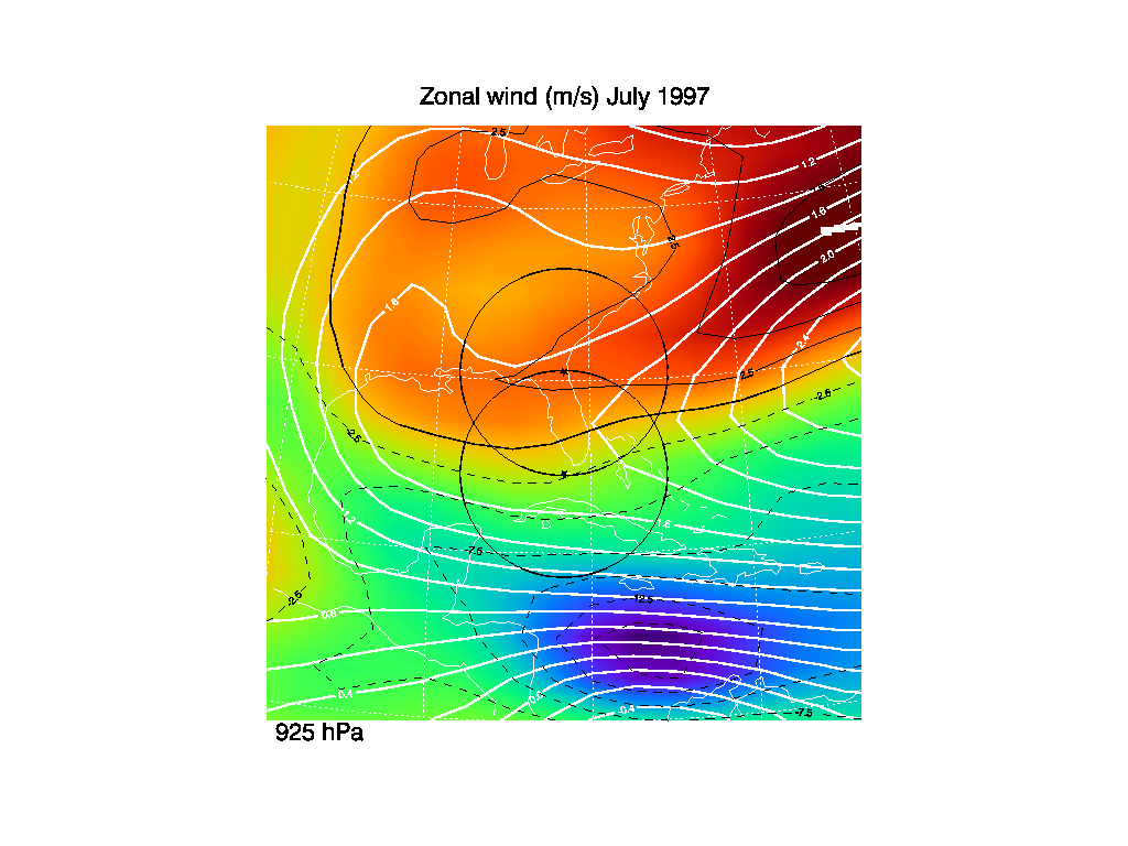
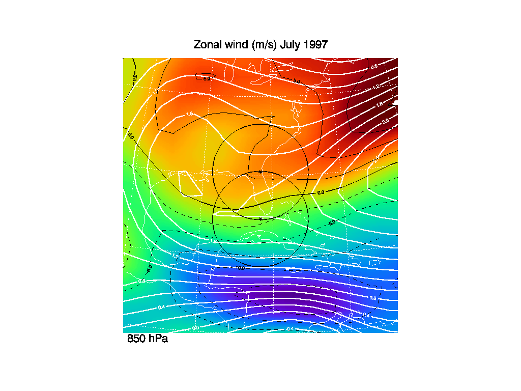
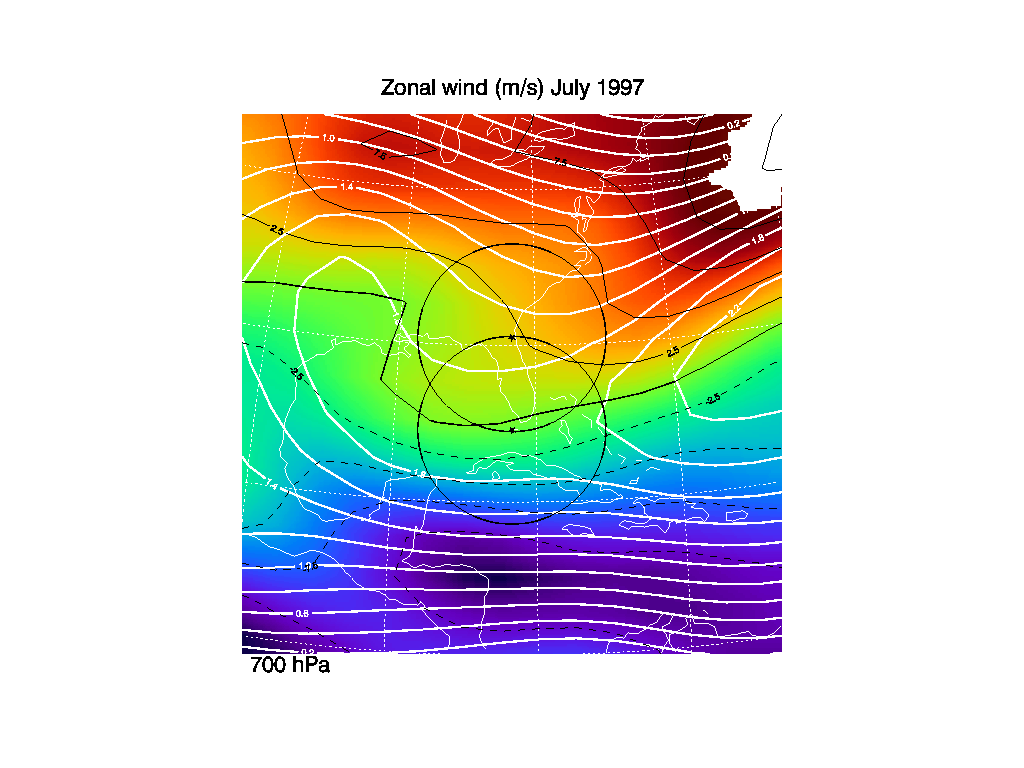
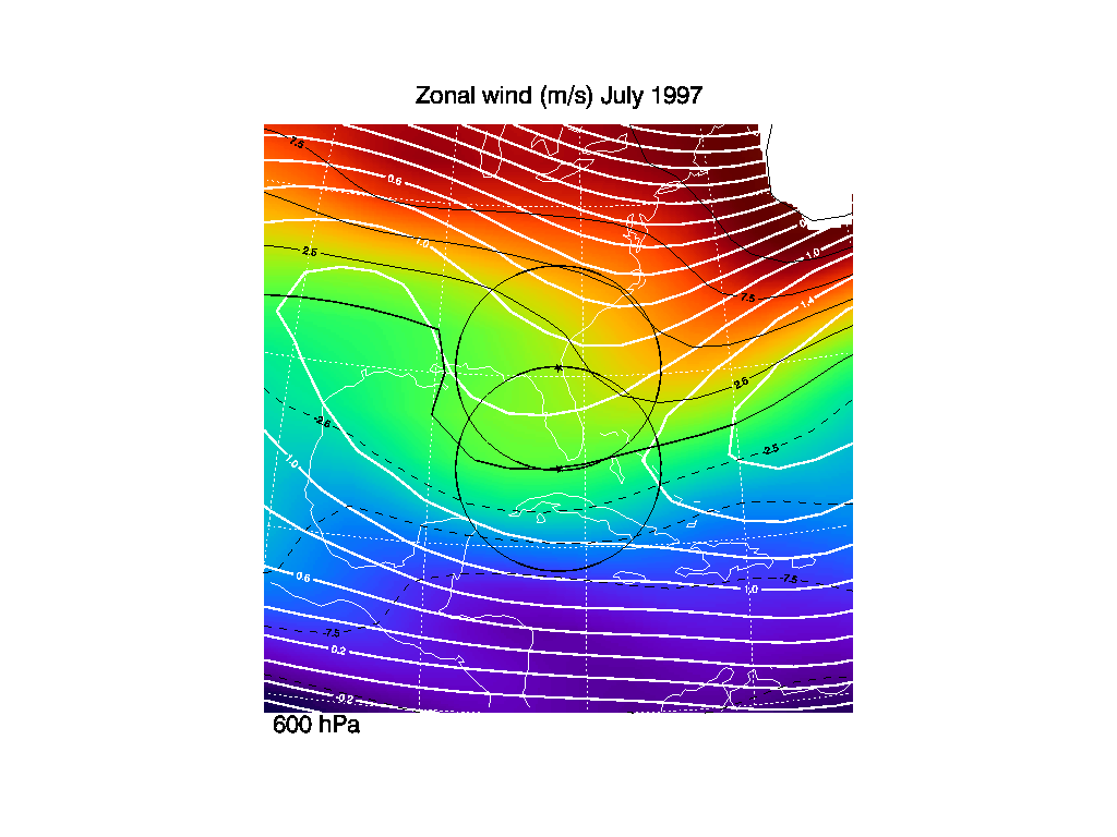
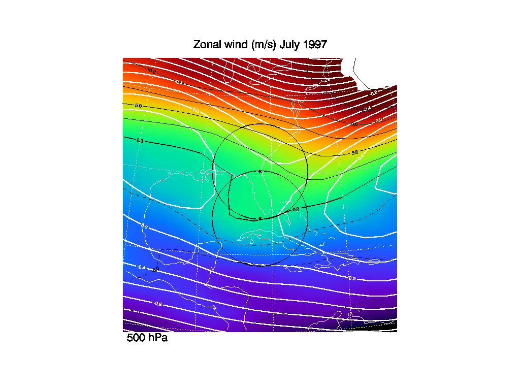
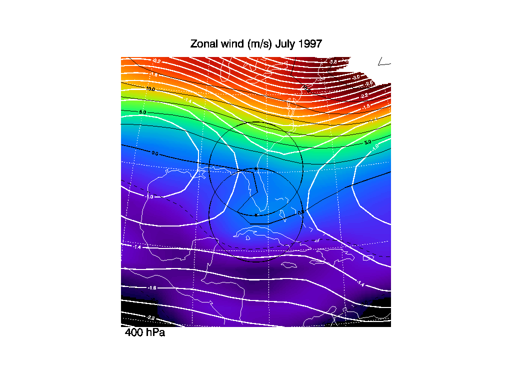
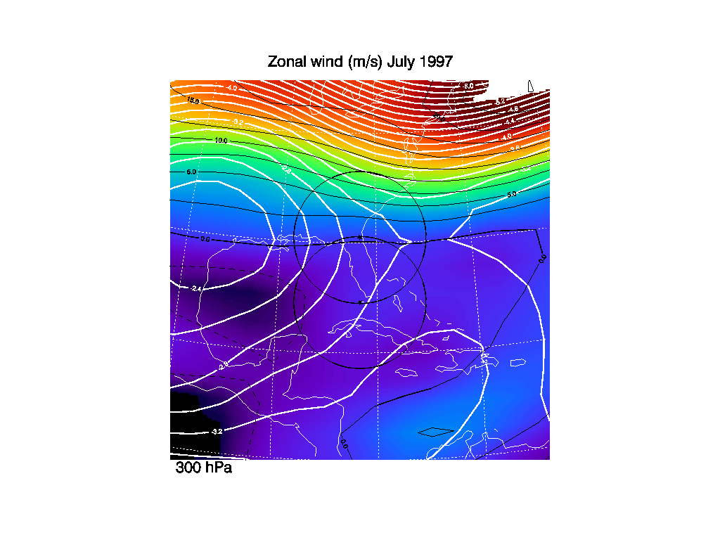
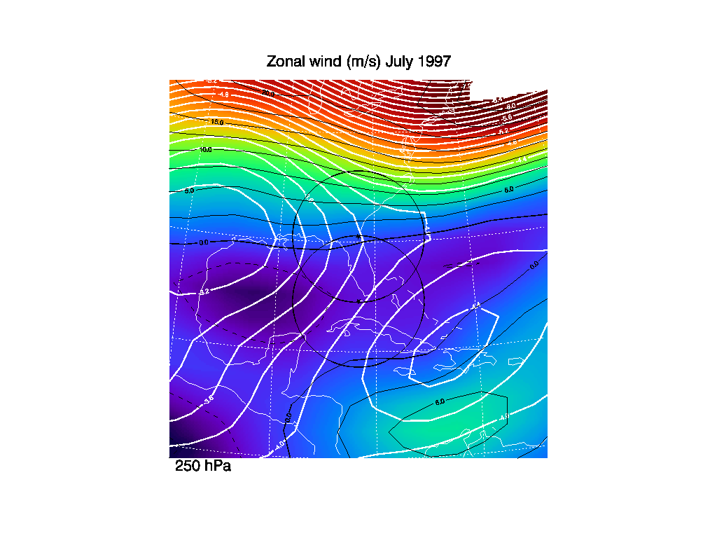
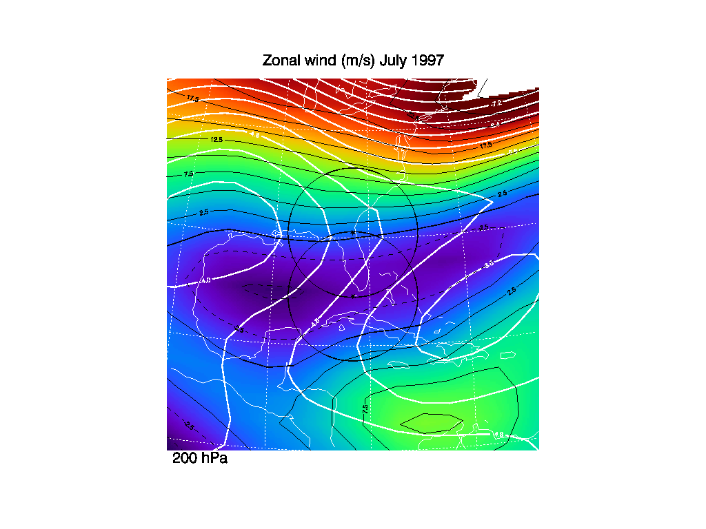
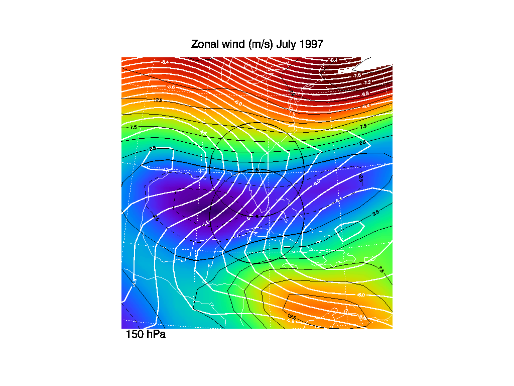
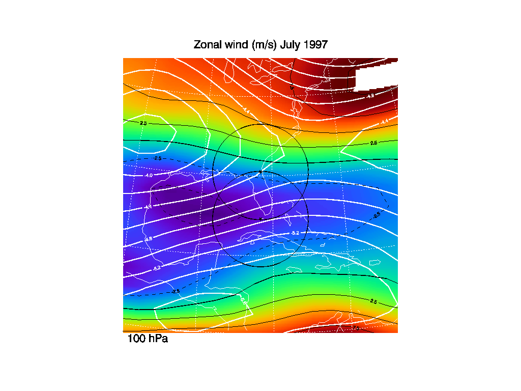
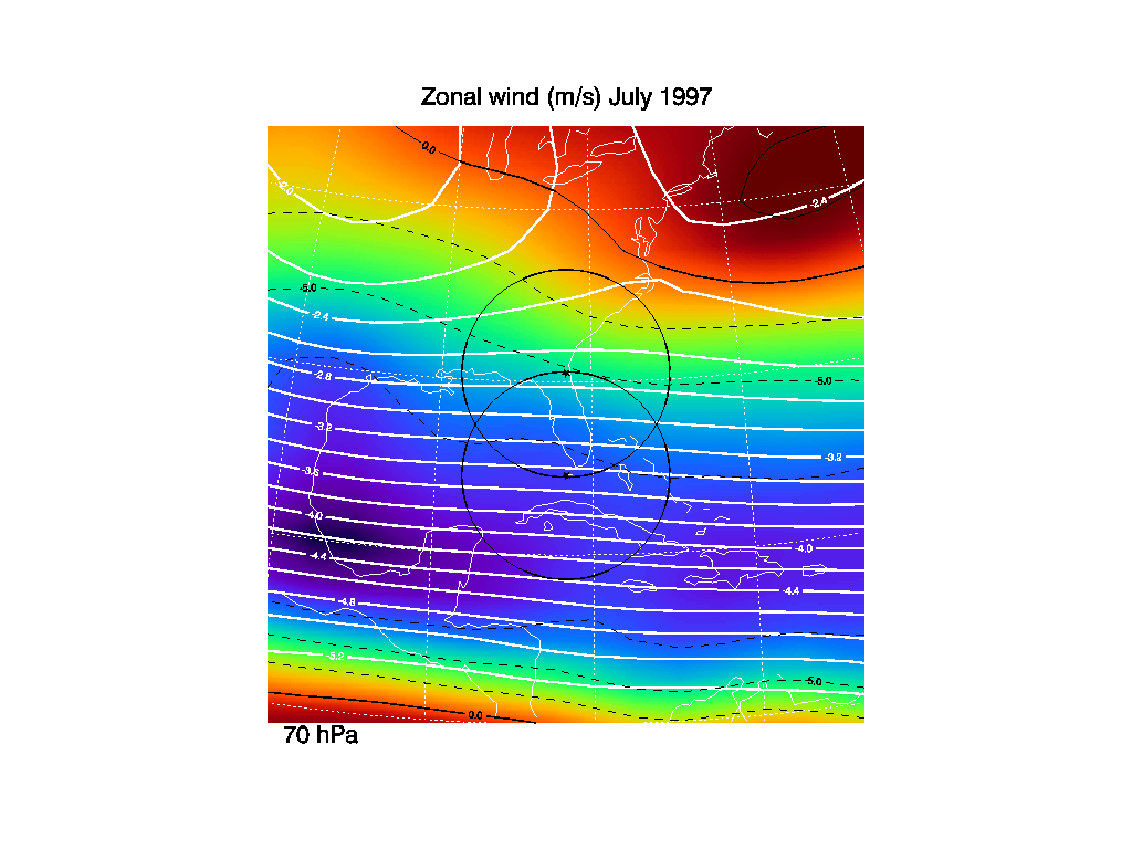
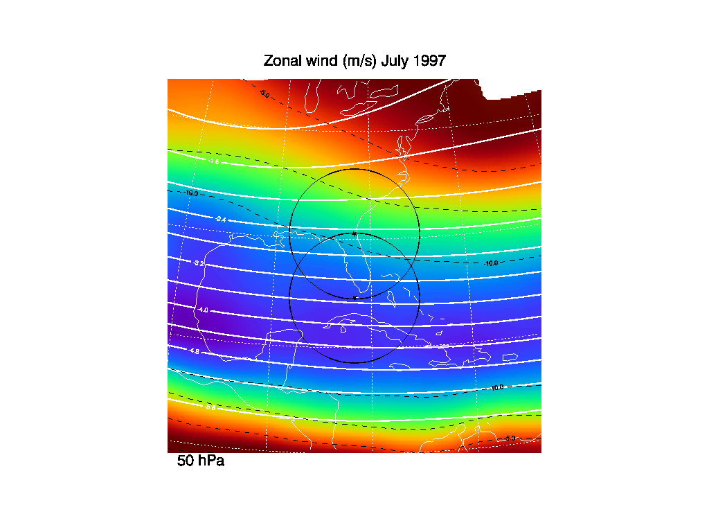
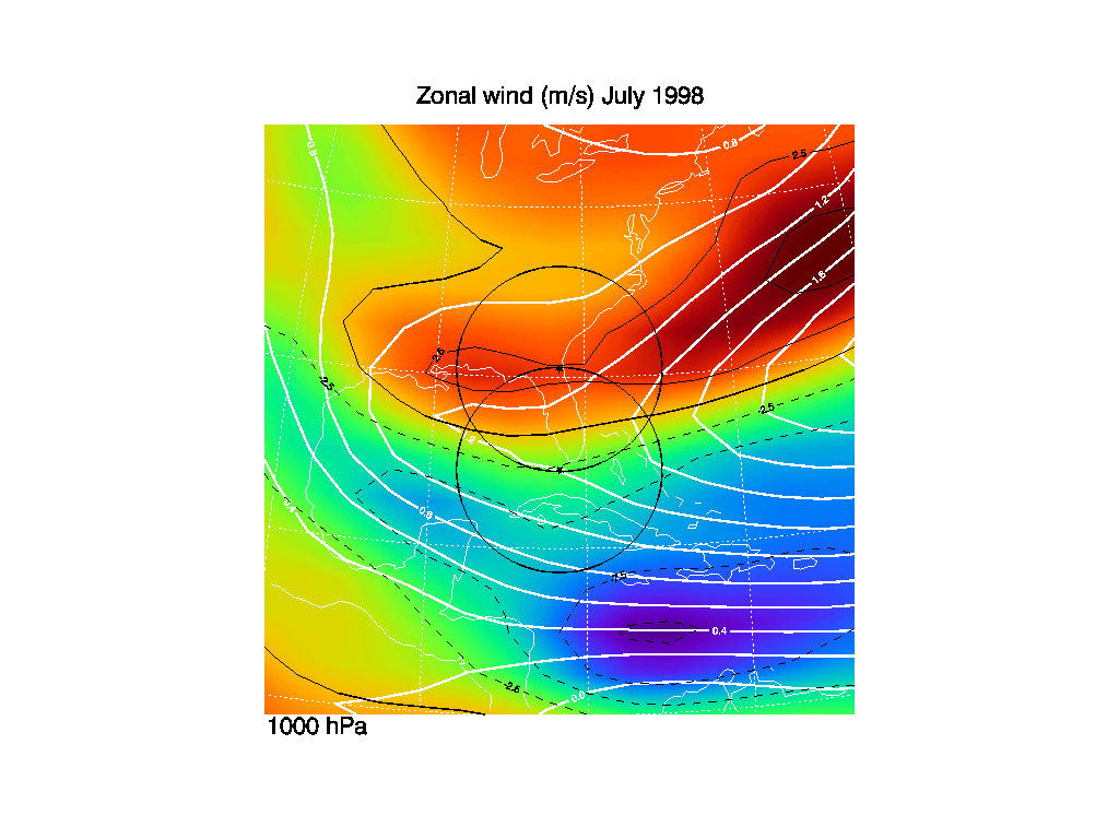
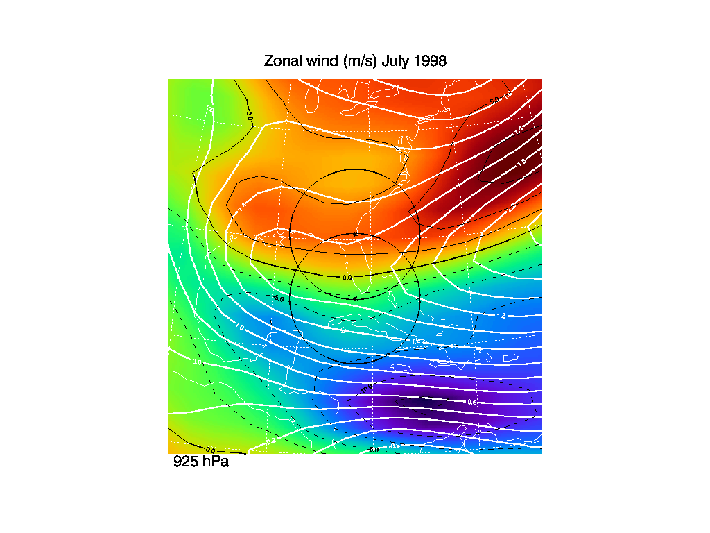
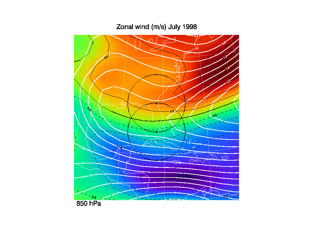
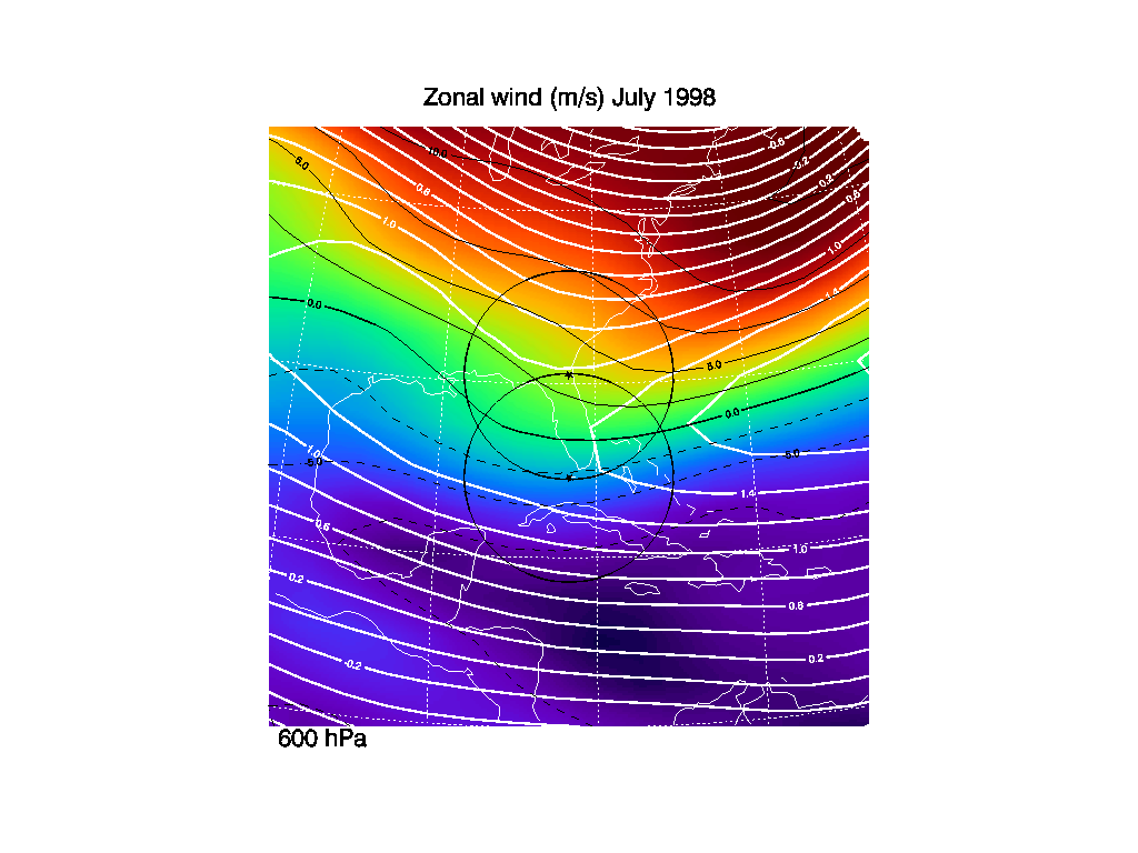
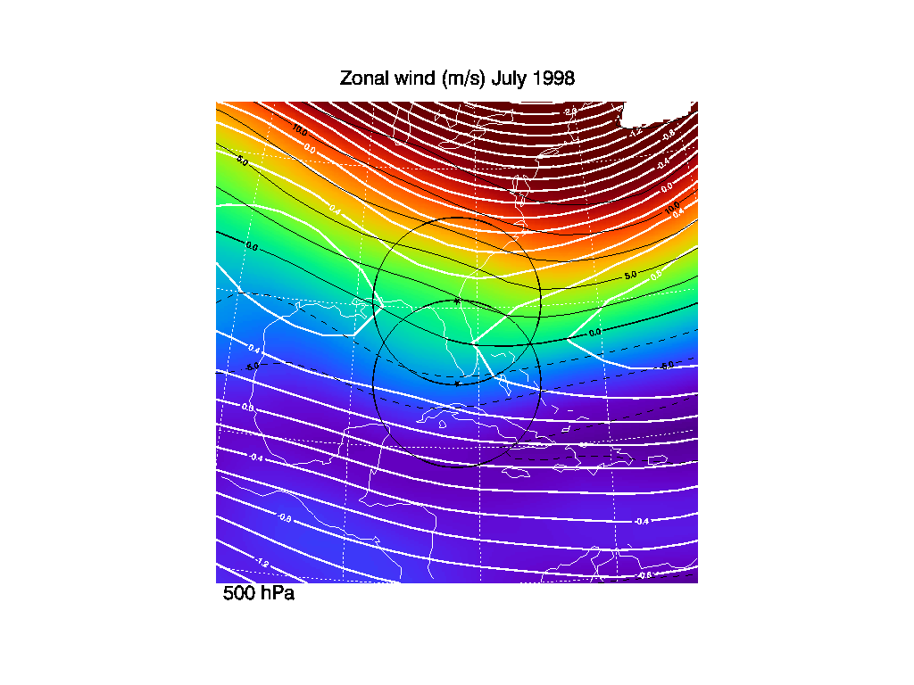
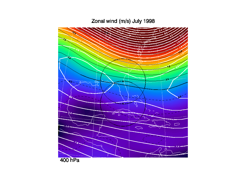
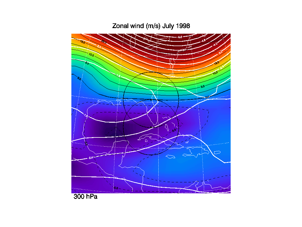
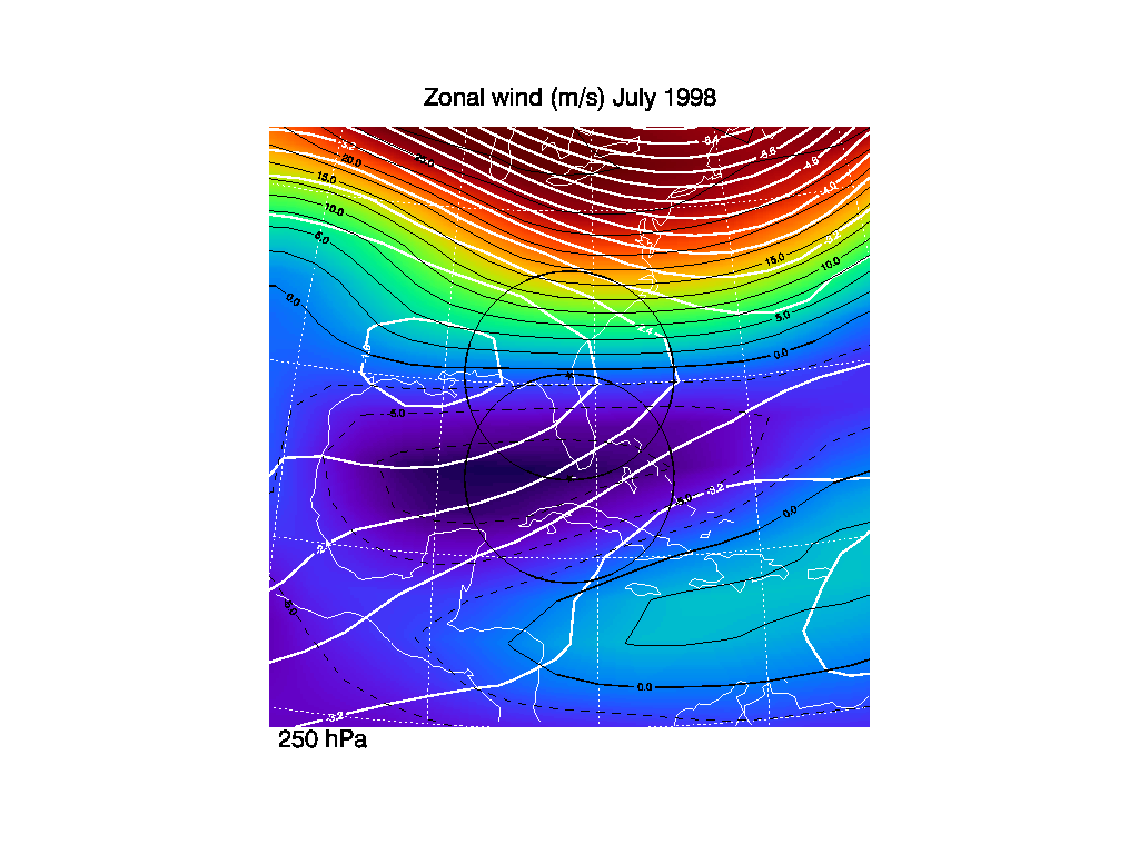
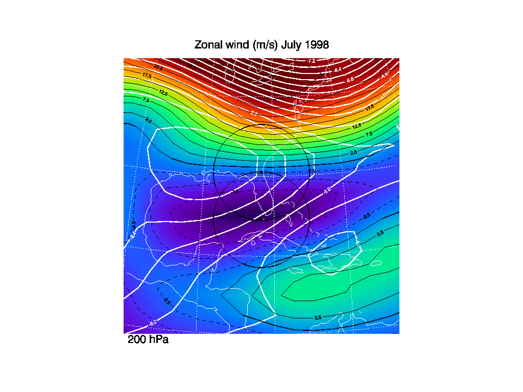
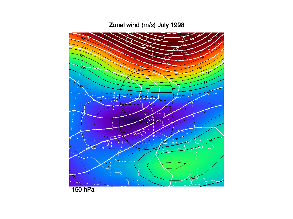
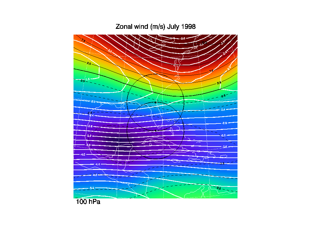
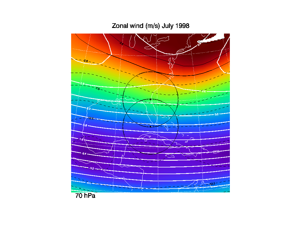
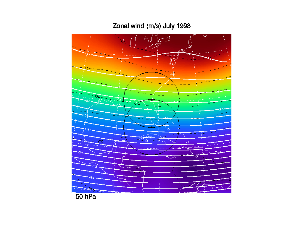
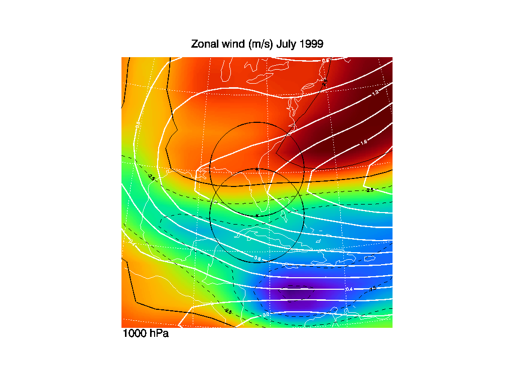
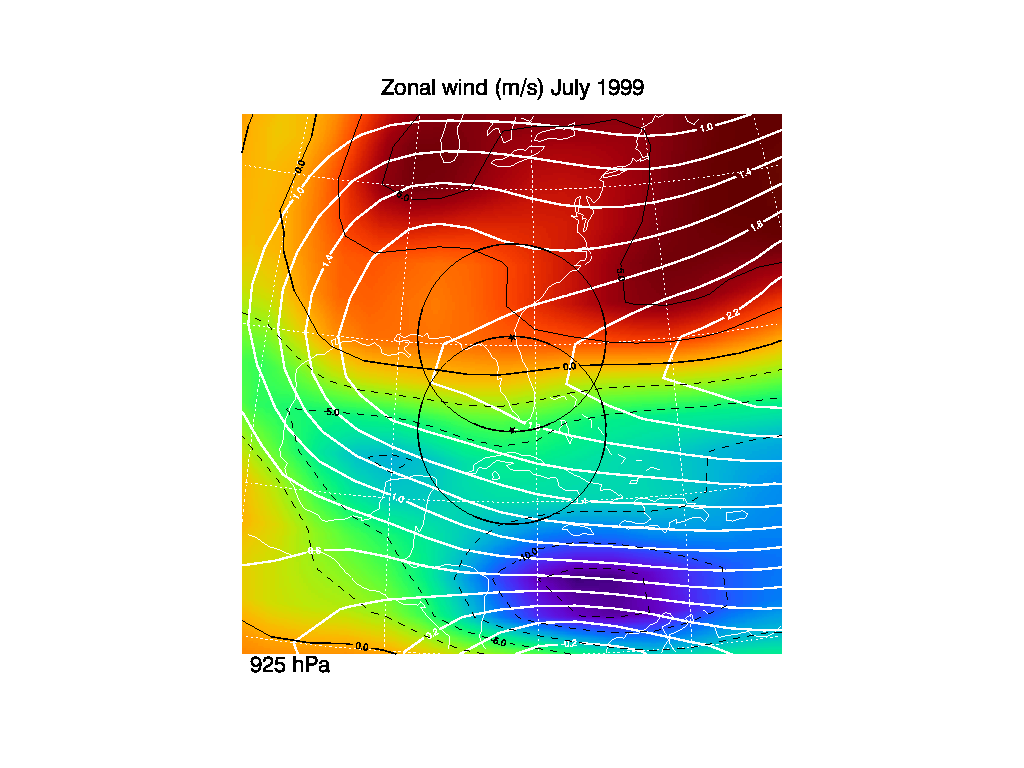
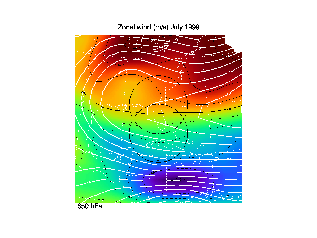
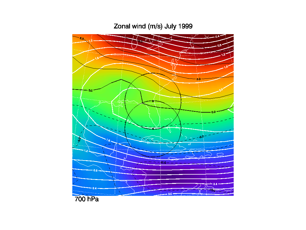
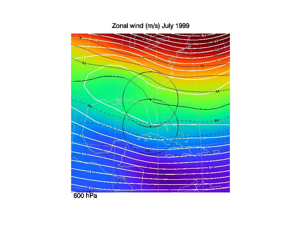
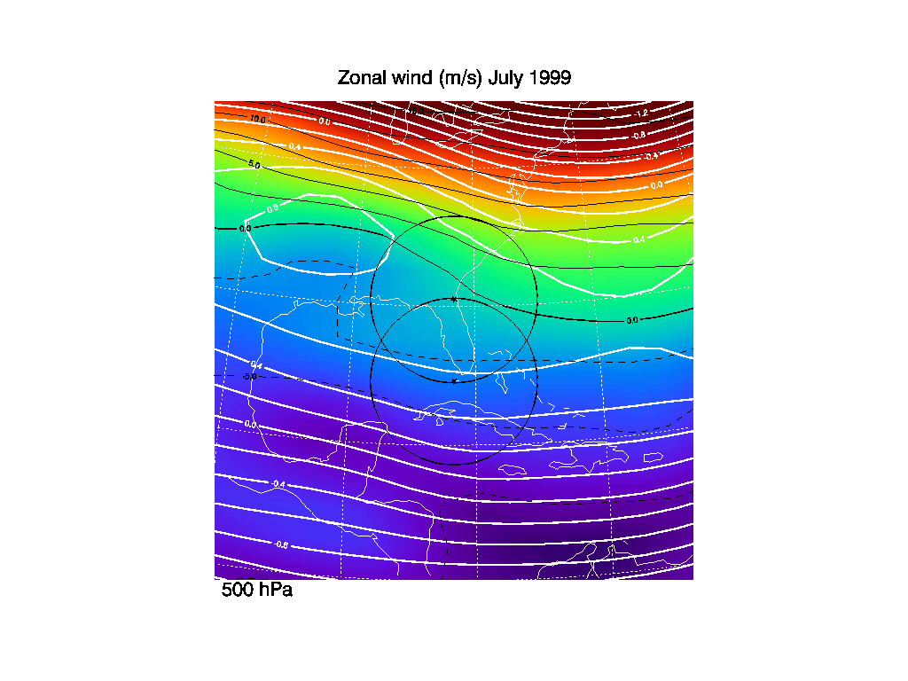
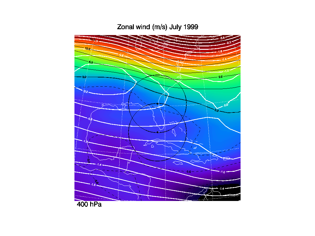
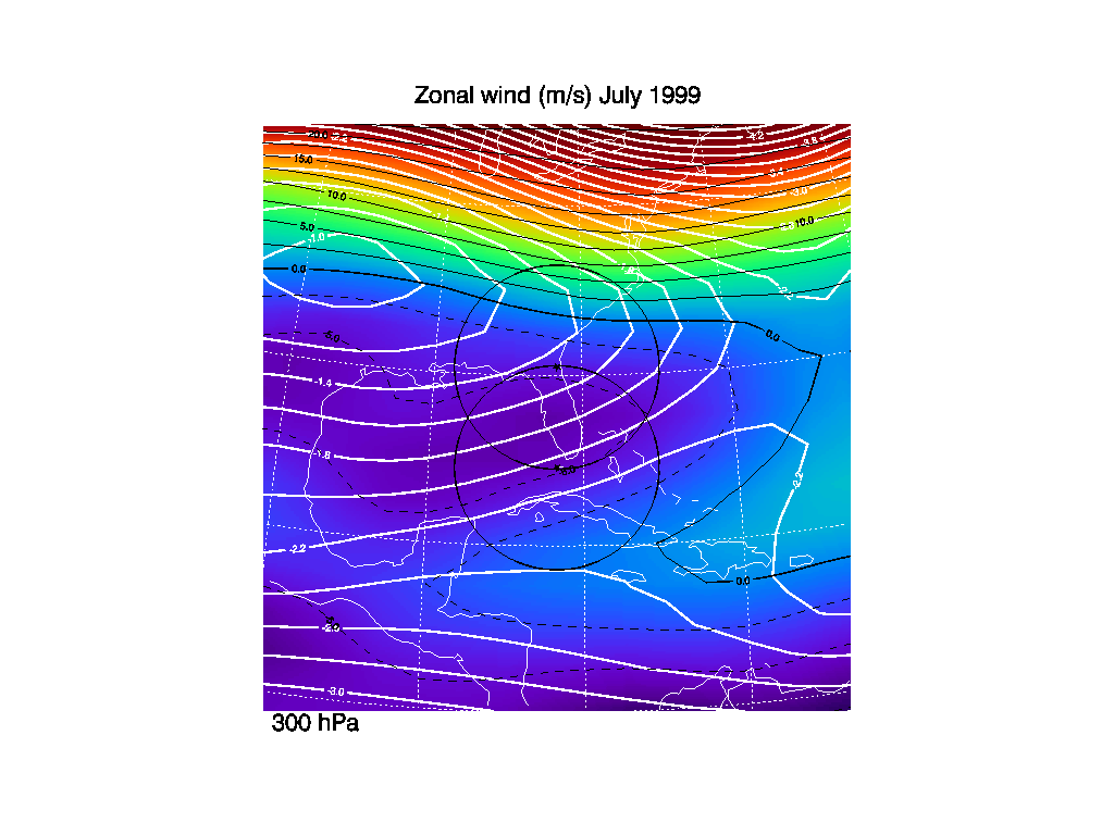
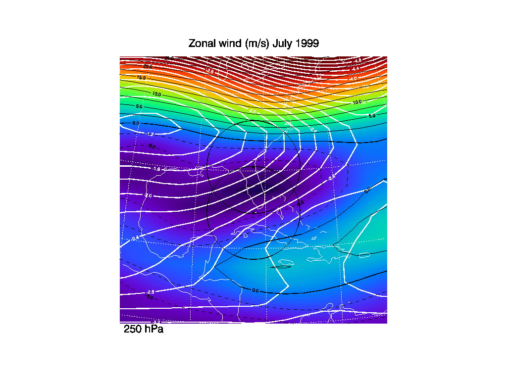
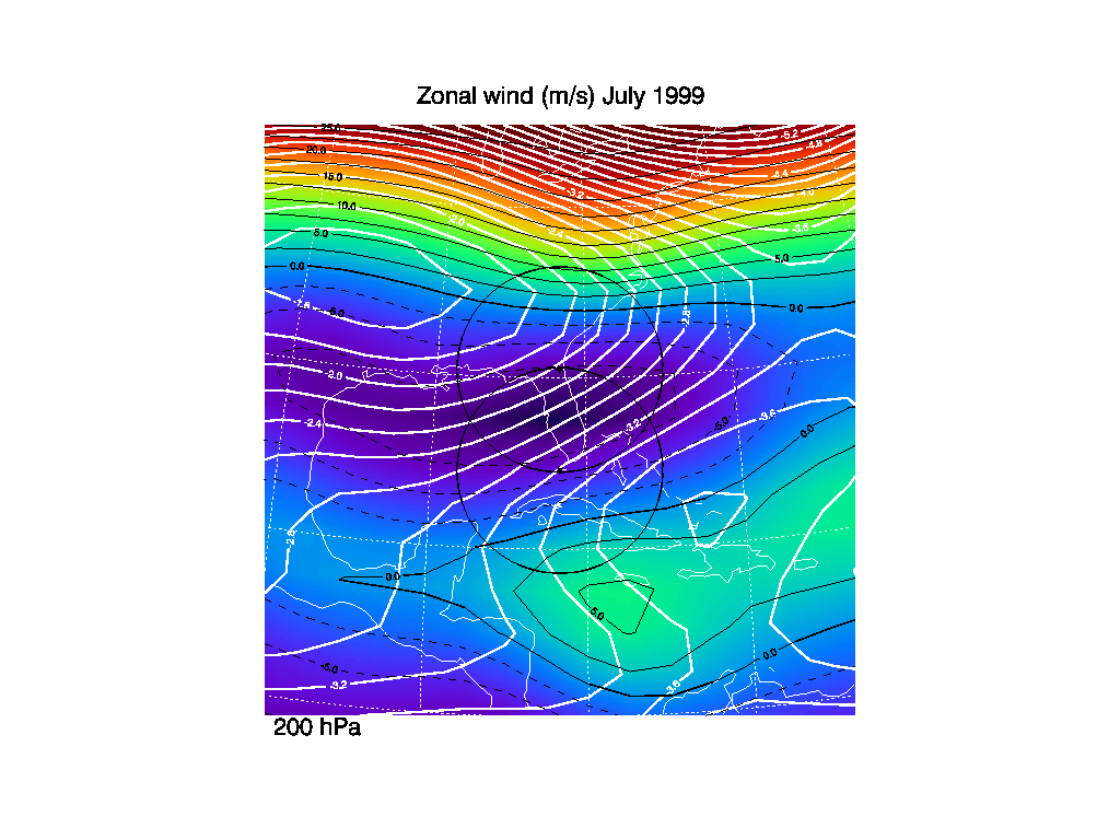
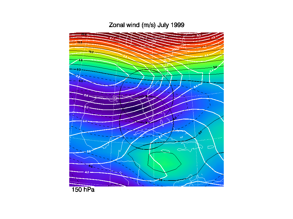
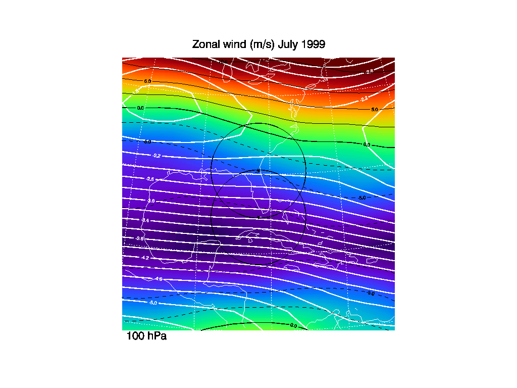
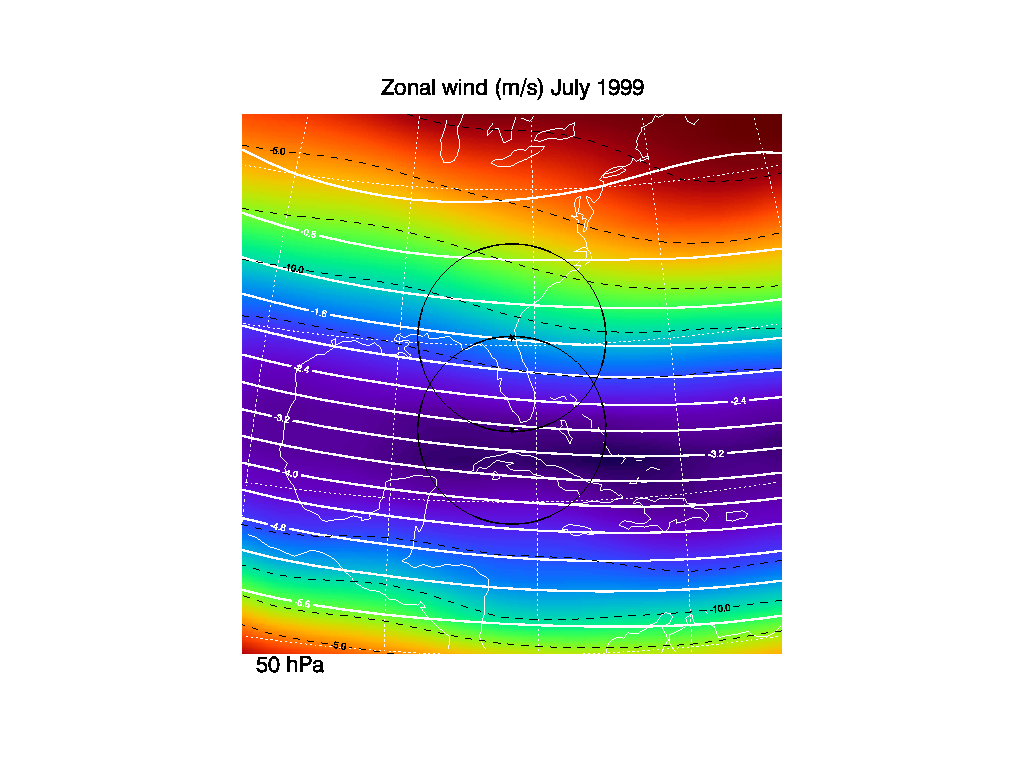
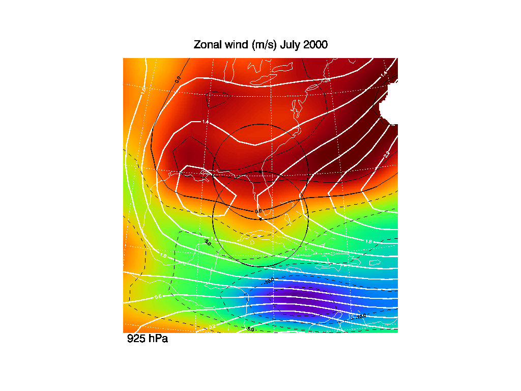
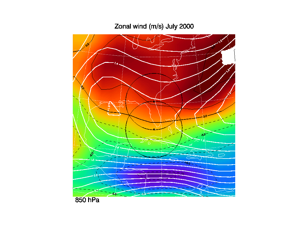
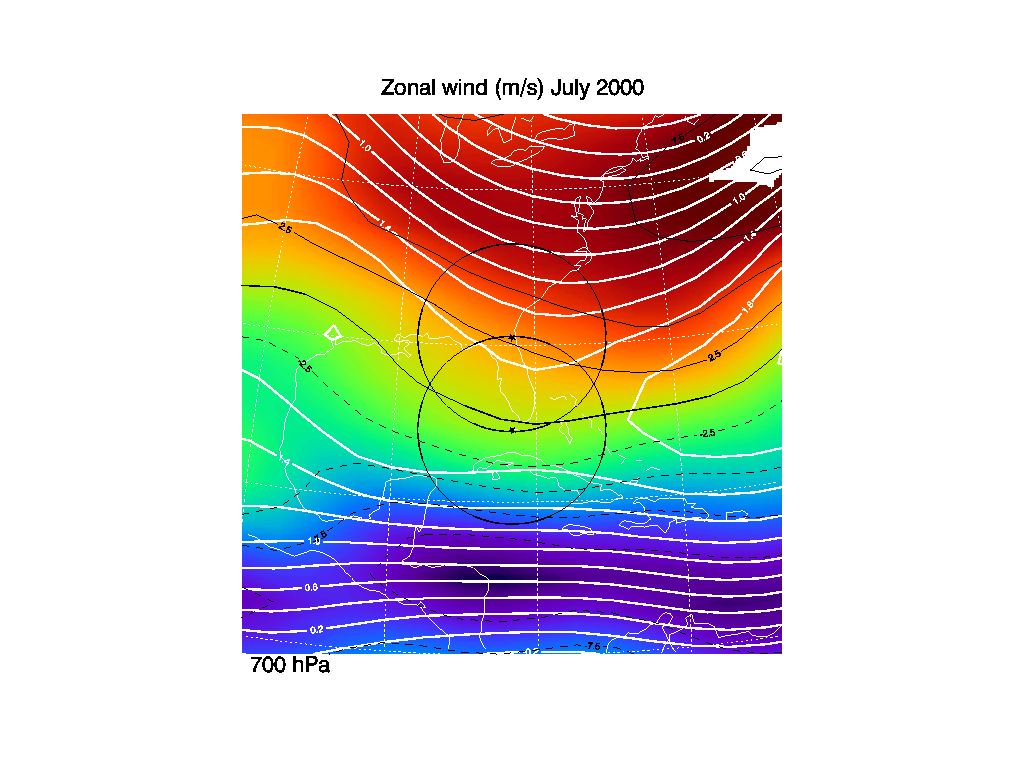
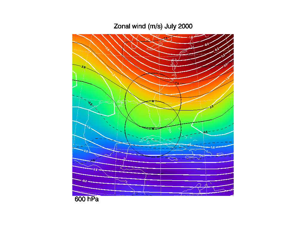
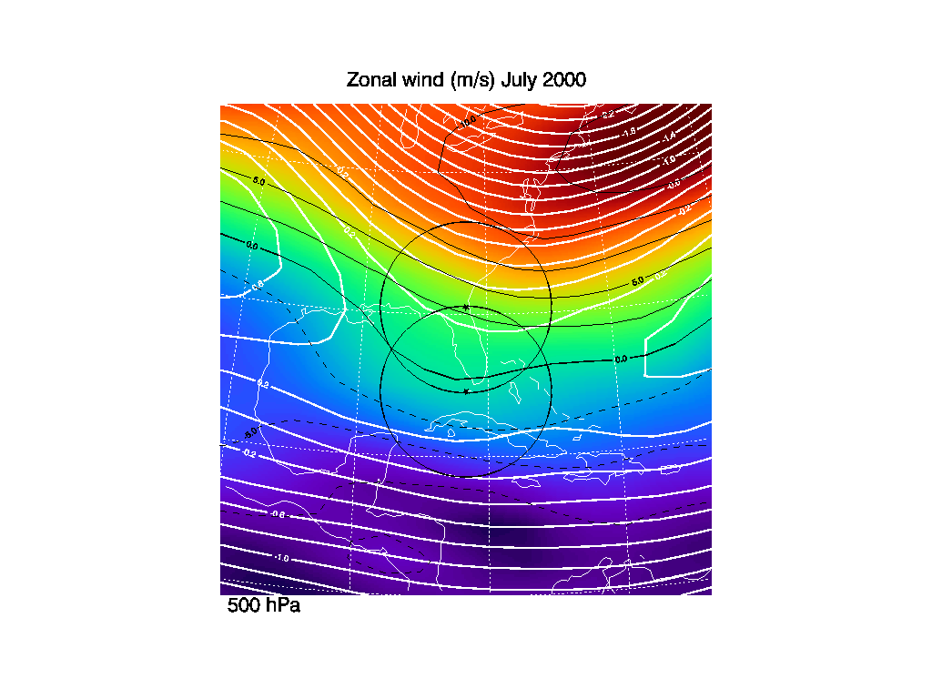
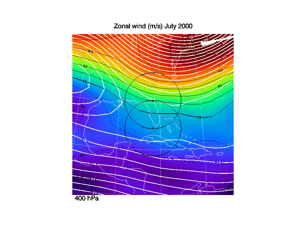
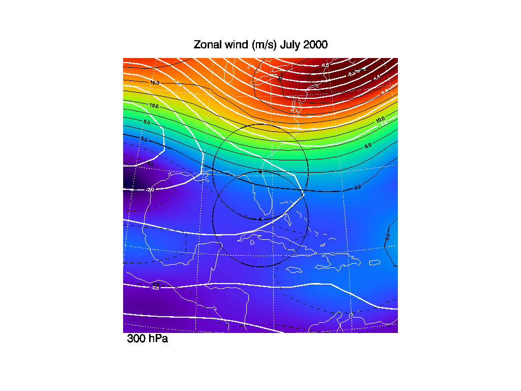
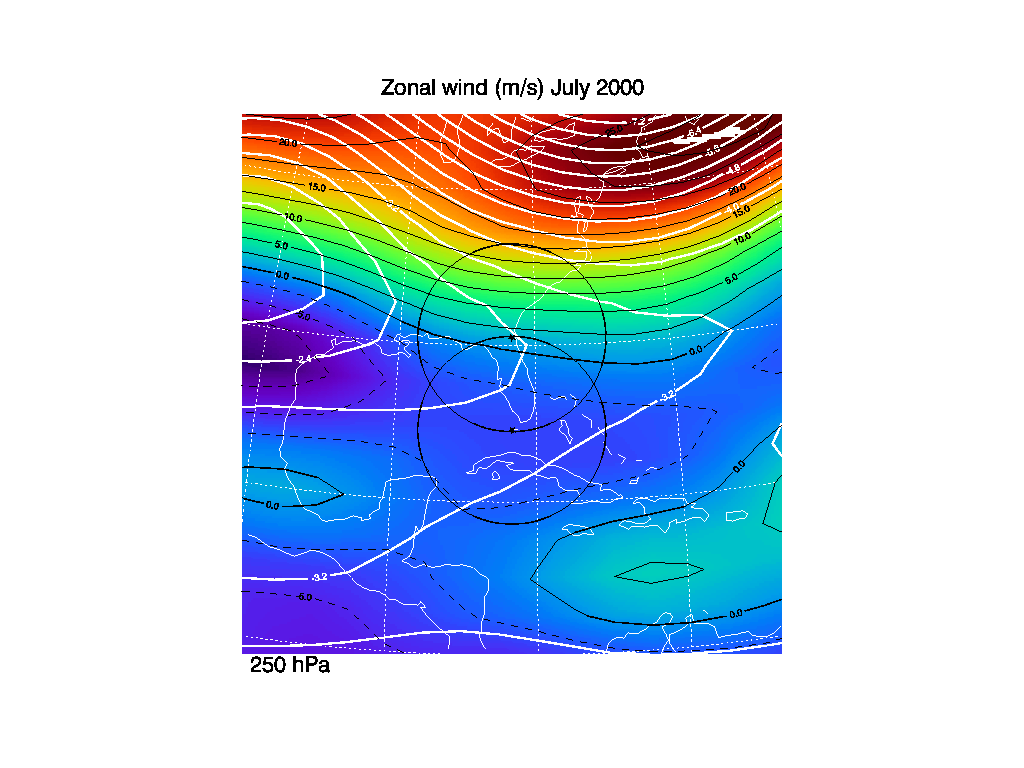
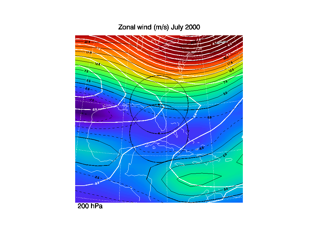
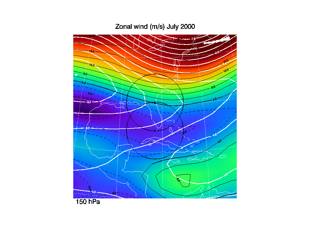
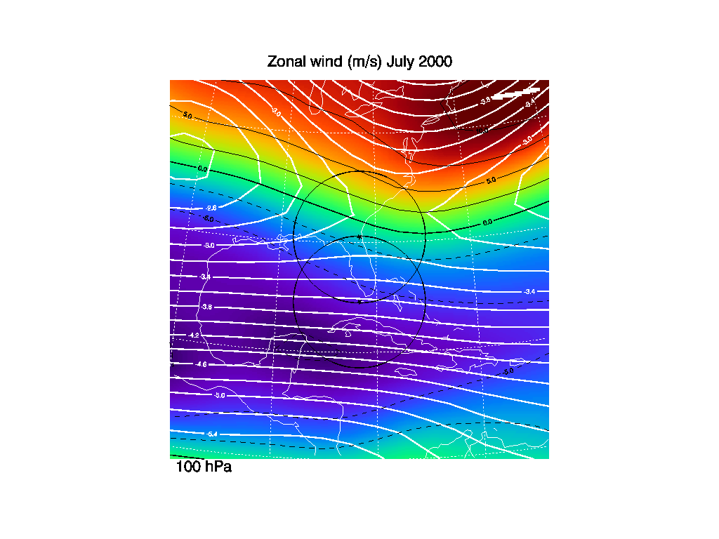
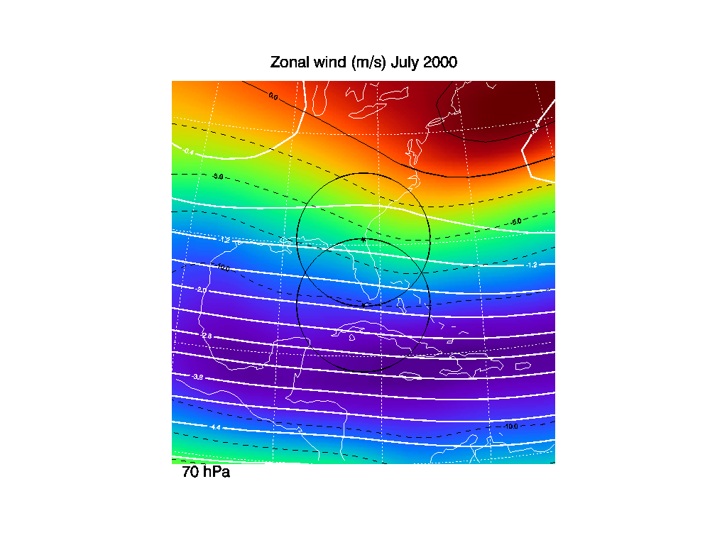
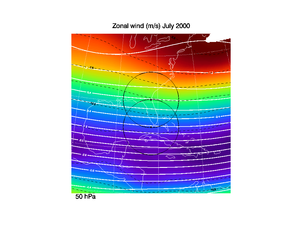
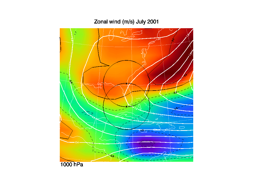
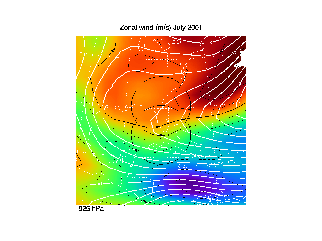
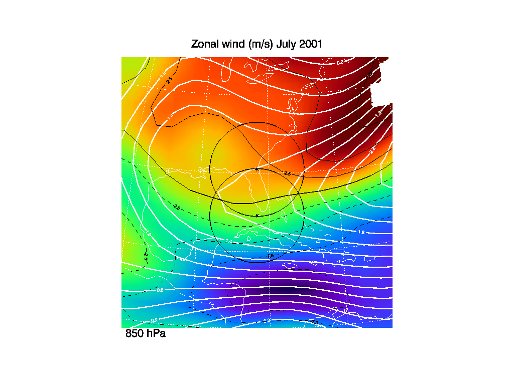
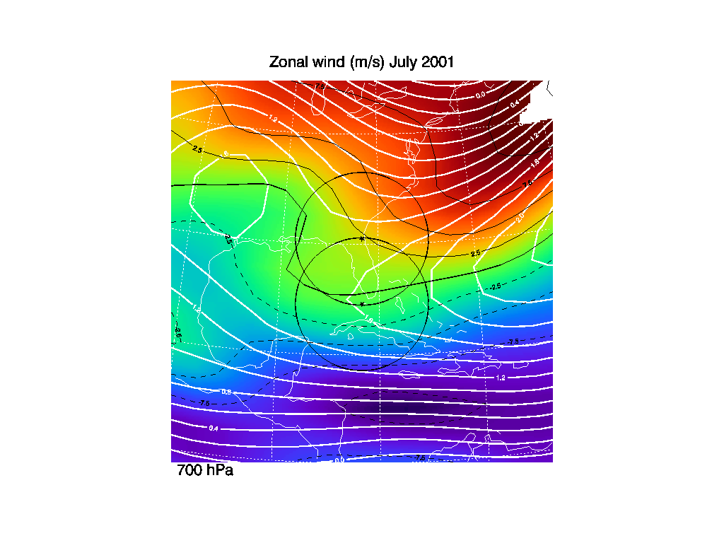
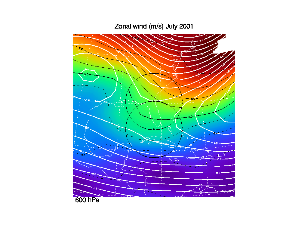
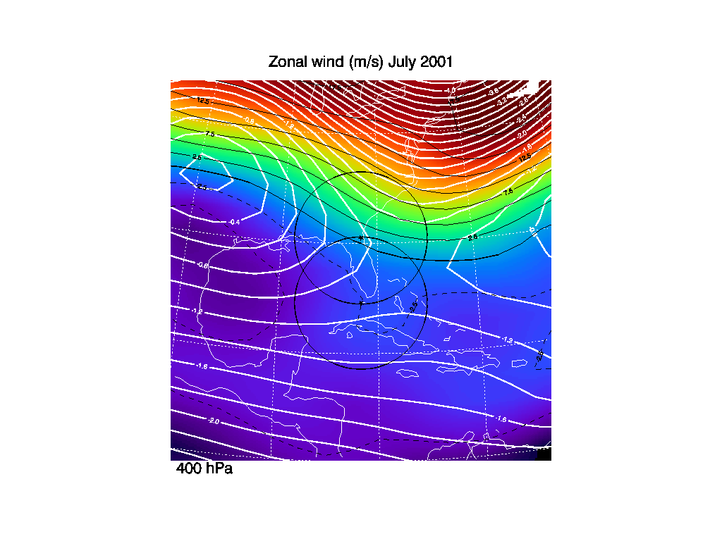
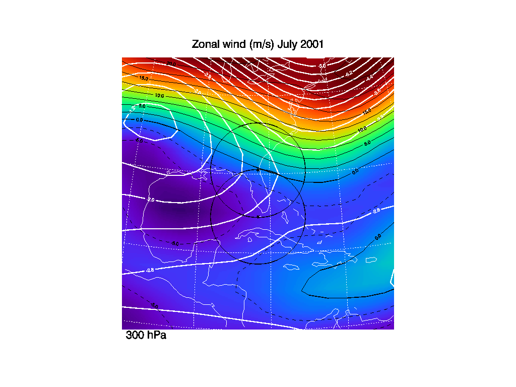
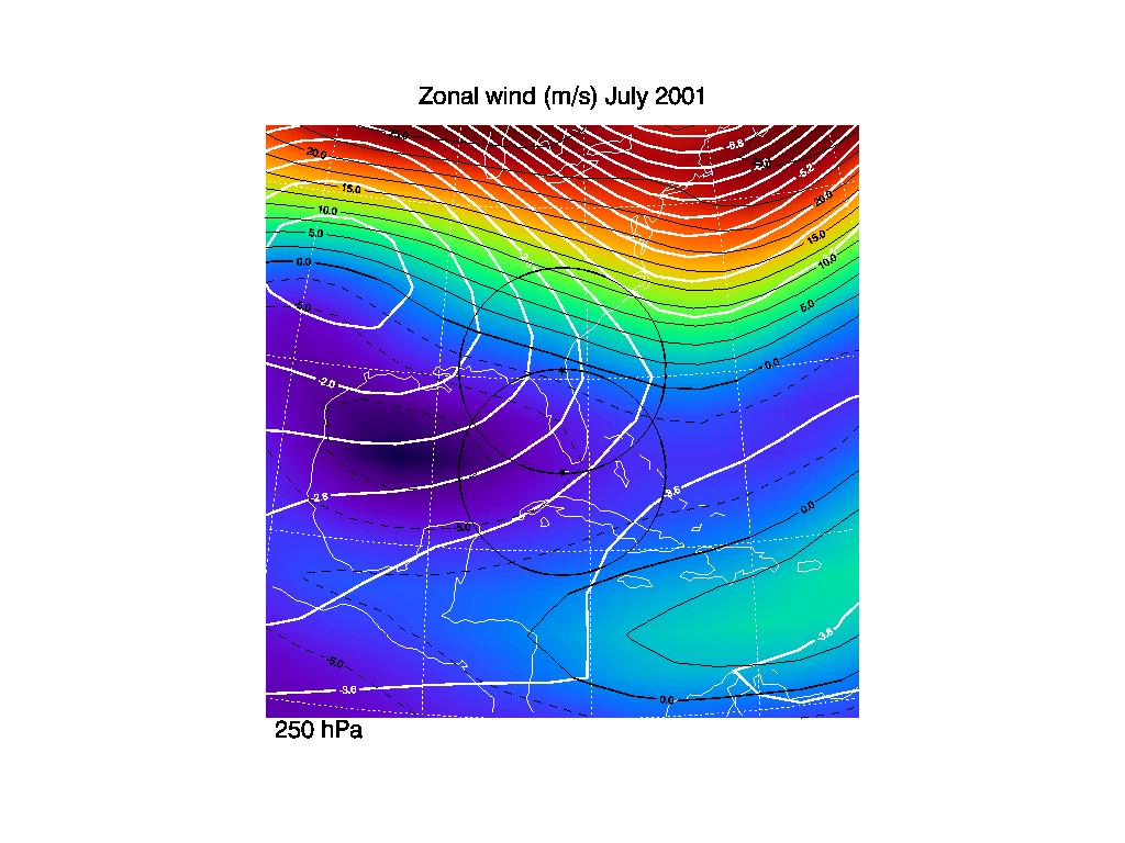
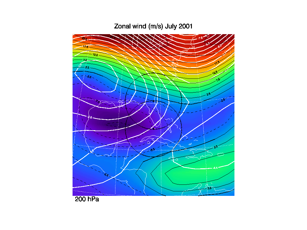
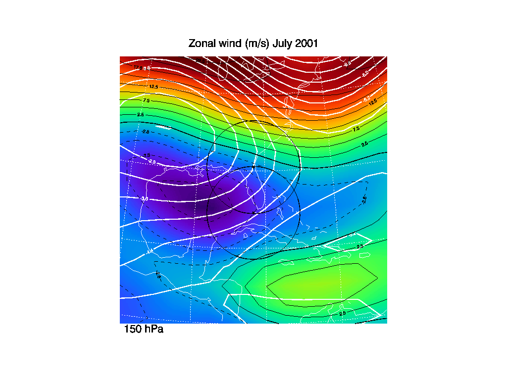
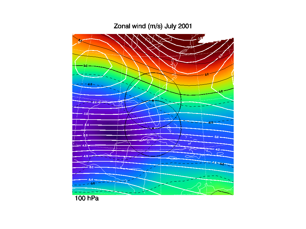
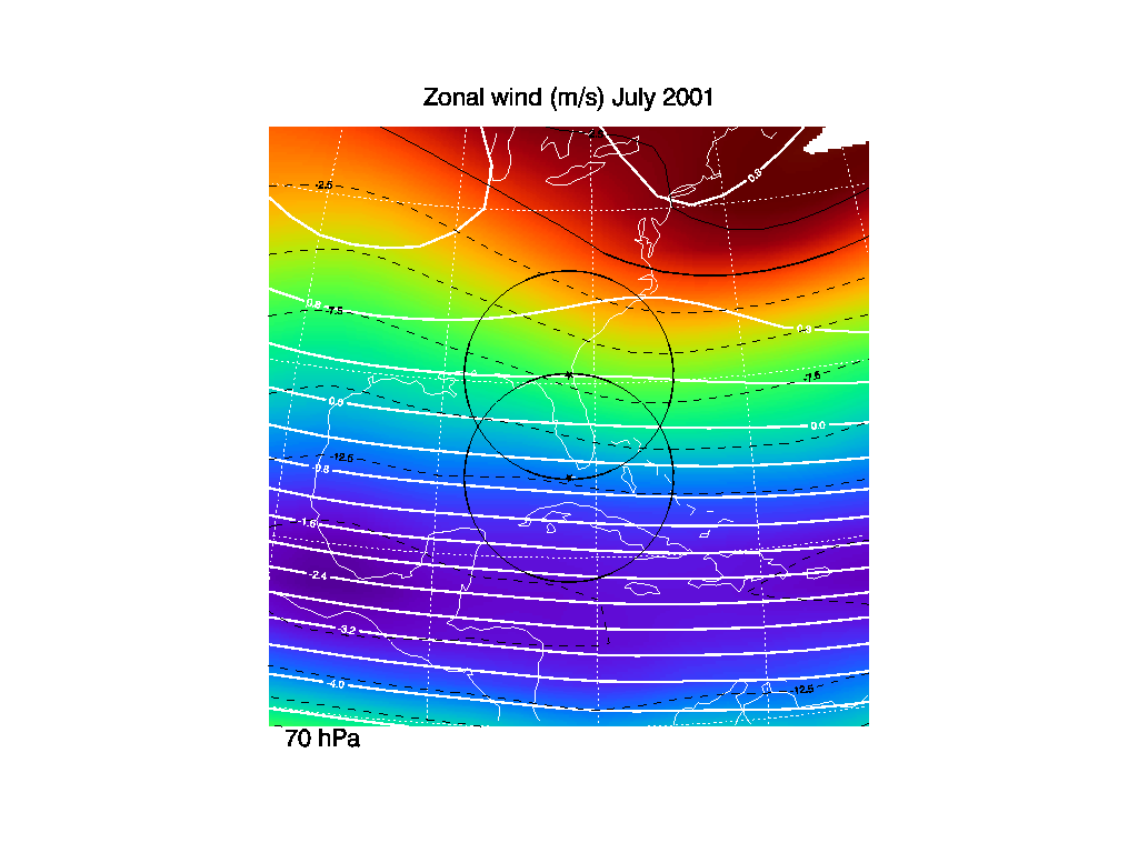
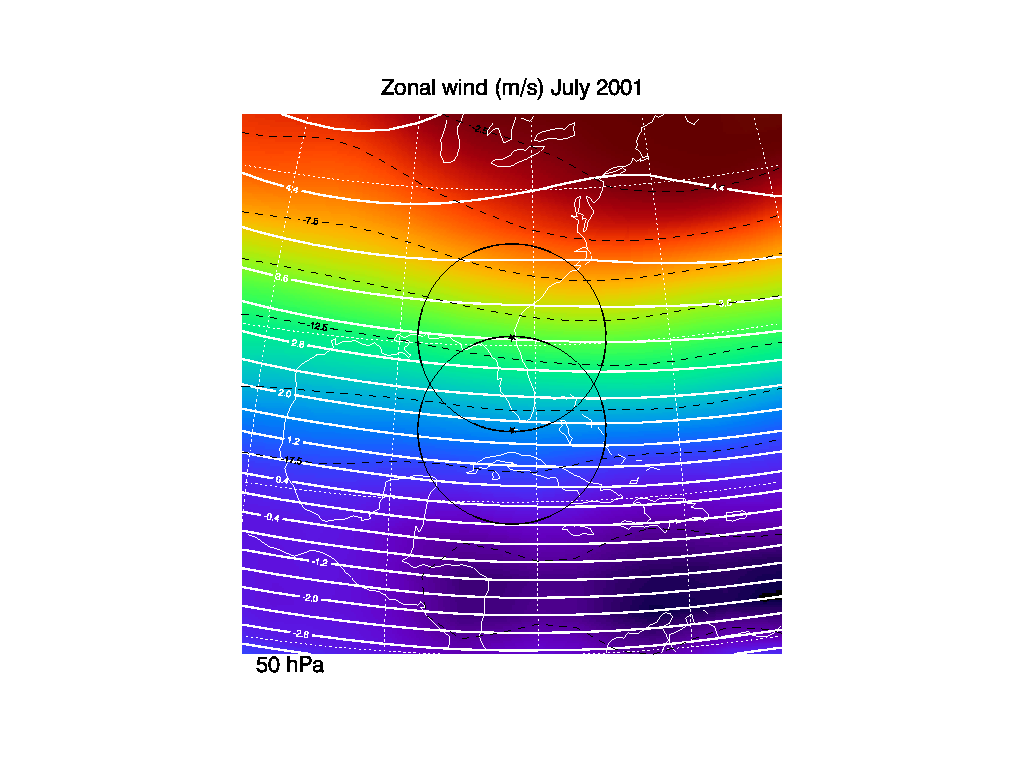
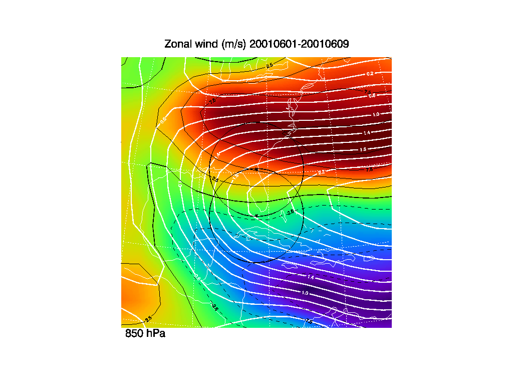
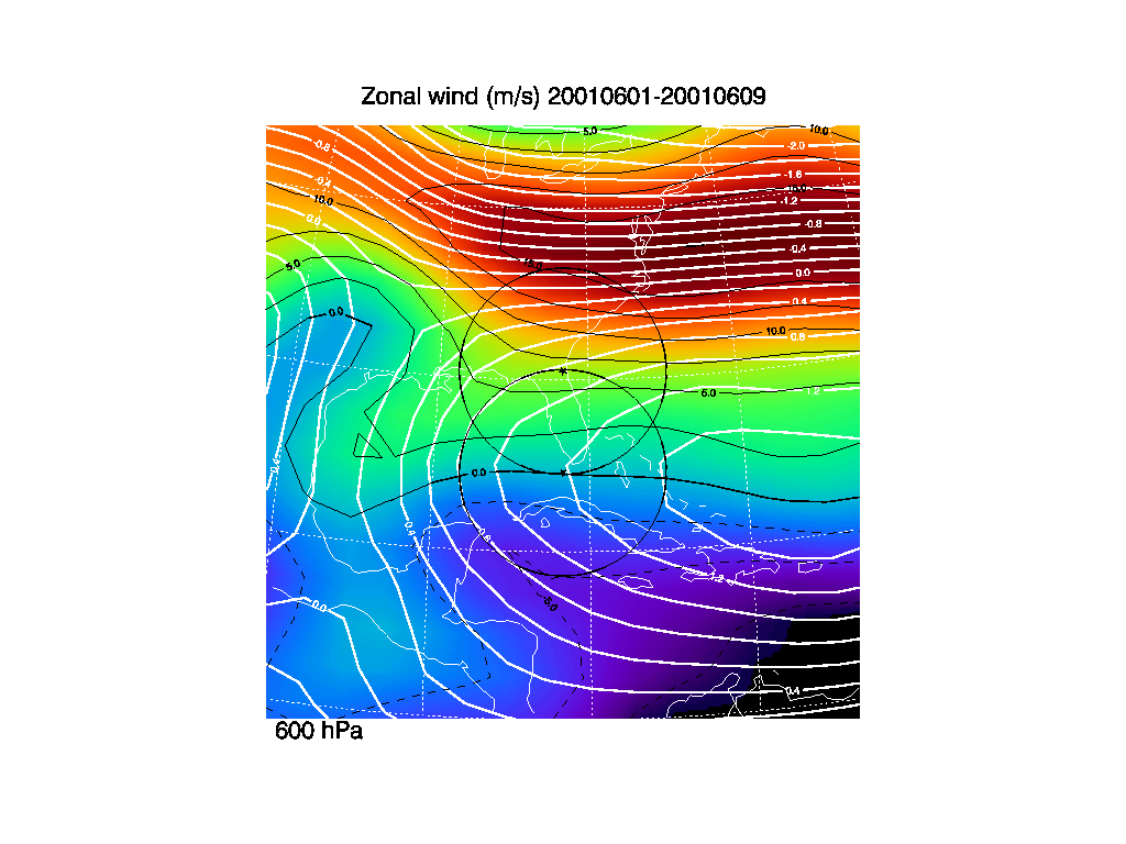
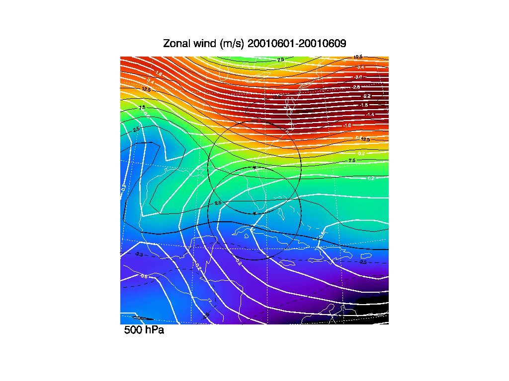
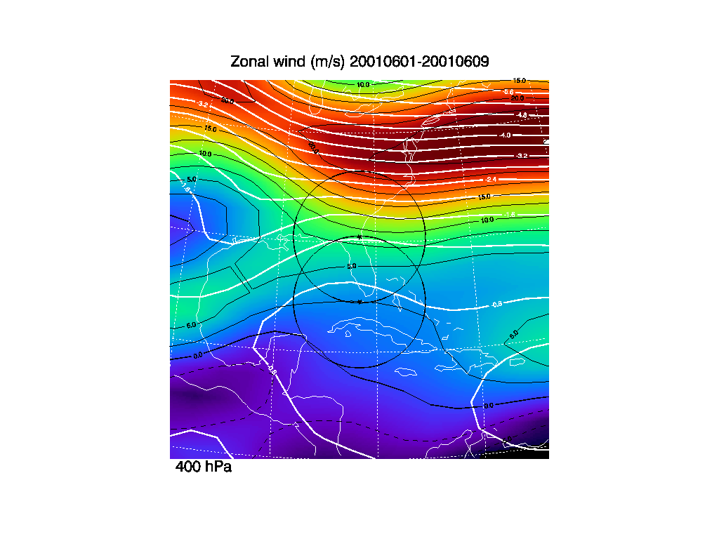
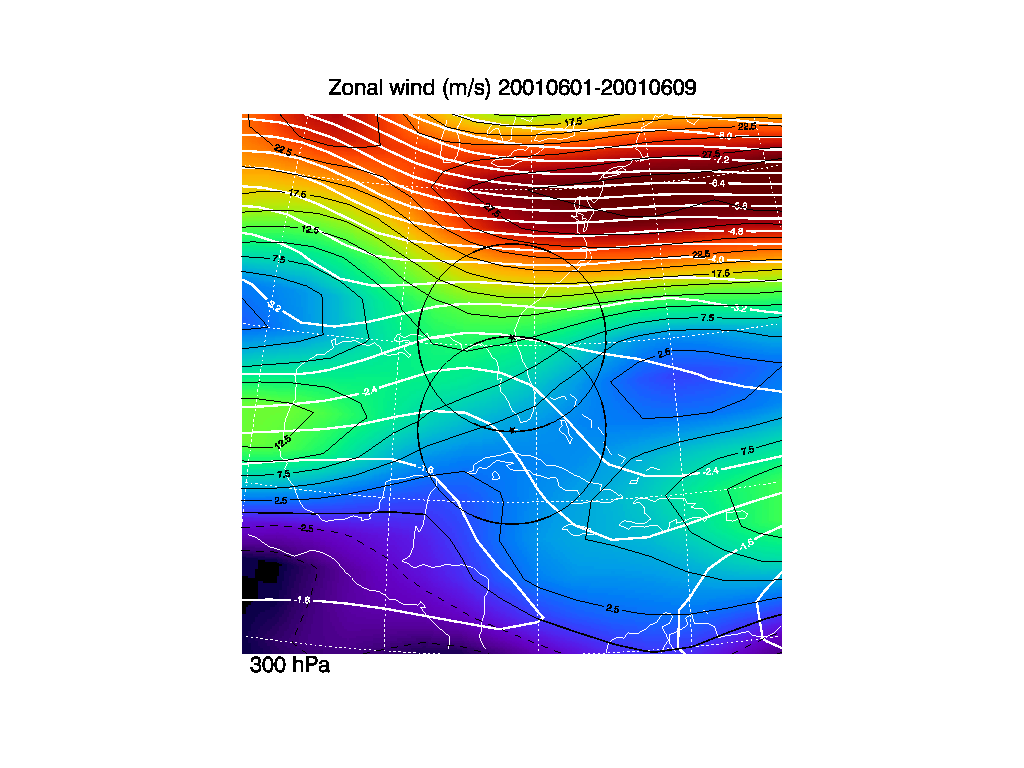
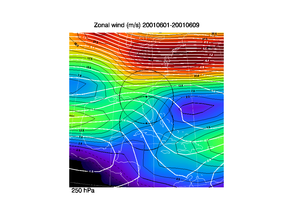
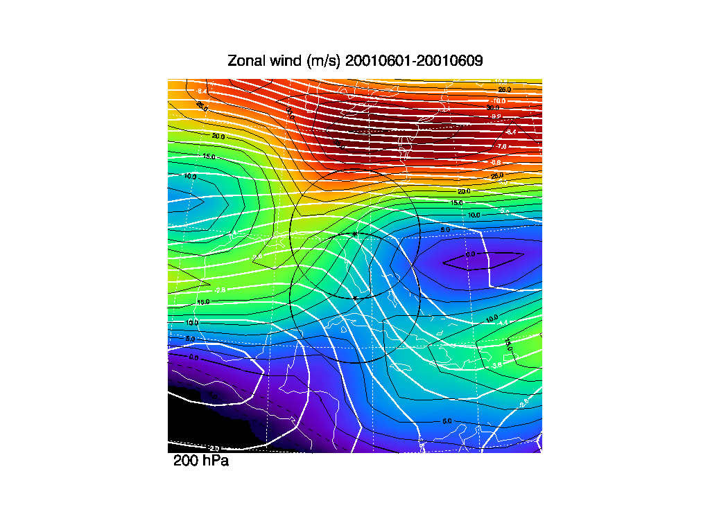
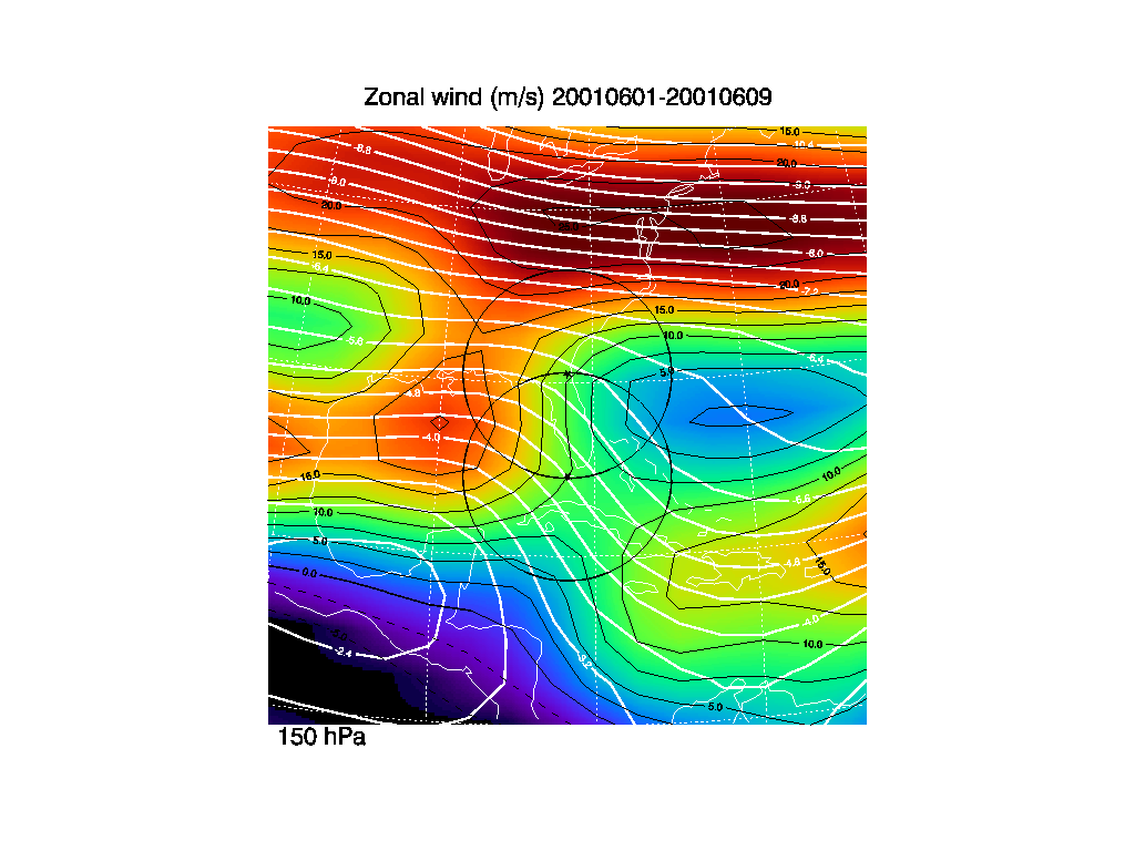
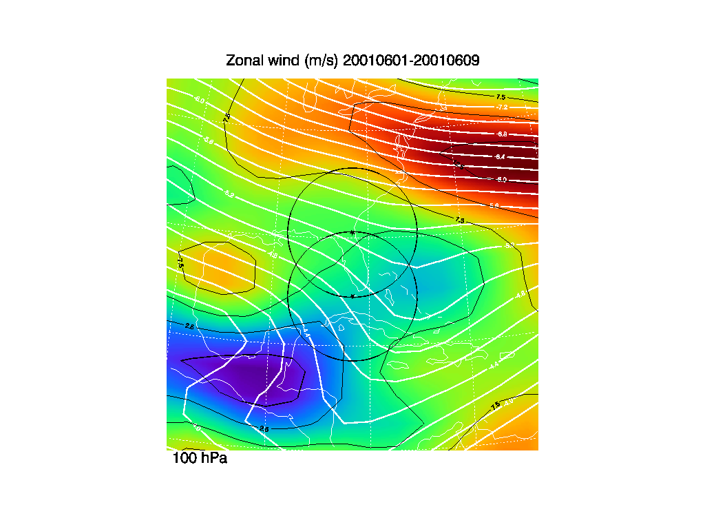
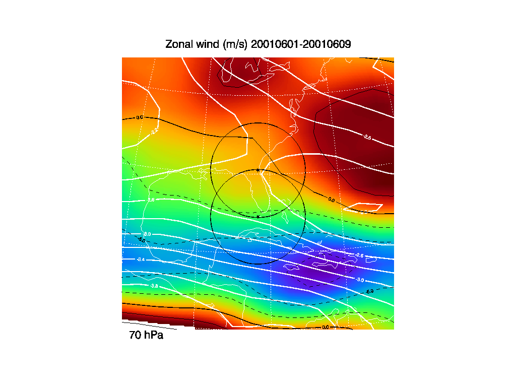
1. Zonal wind averages
These zonal wind time averages (color) are derived from the NCEP/NCAR
reanalysis data from 1979-2001. Contours are indicated for every 2.5
m/s (black line). Dashed line indicate easterly winds. The thick
solid white lines are the non-divergent wind stream lines derived from
the zonal and meridional wind averages. The stream line values have
been normalized by dividing by the Earth's radius.
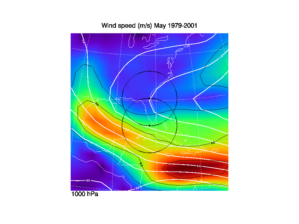
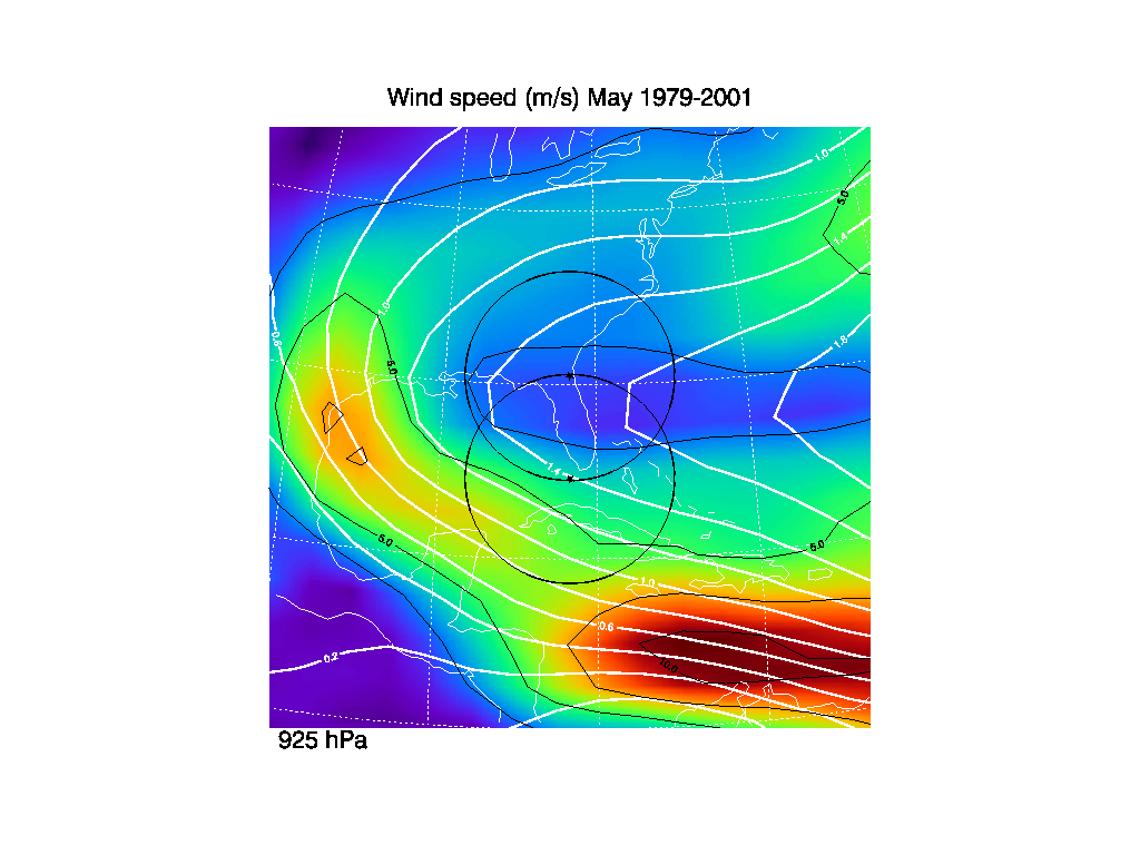
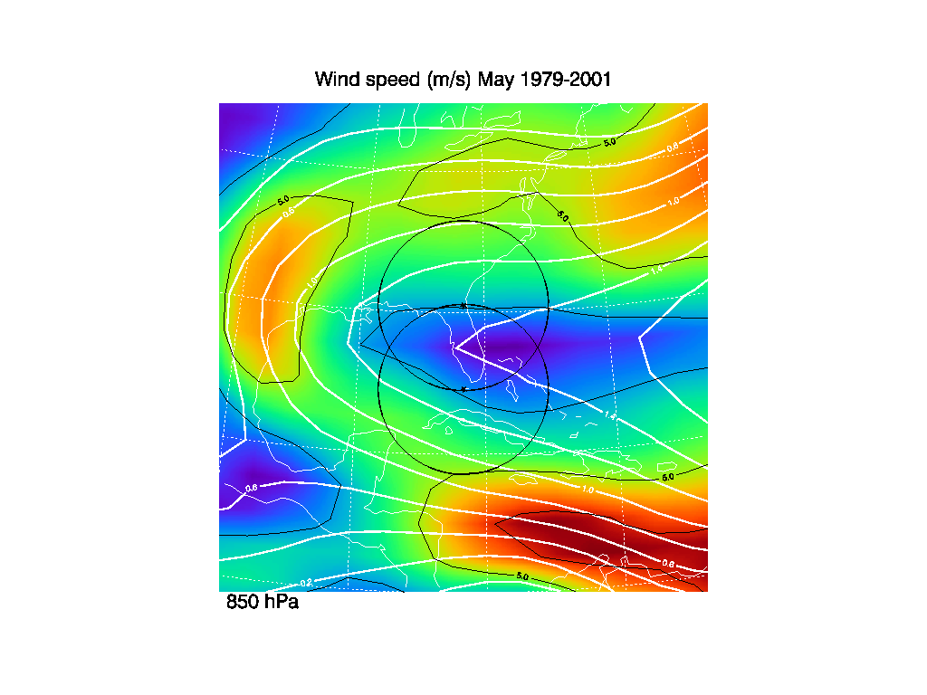
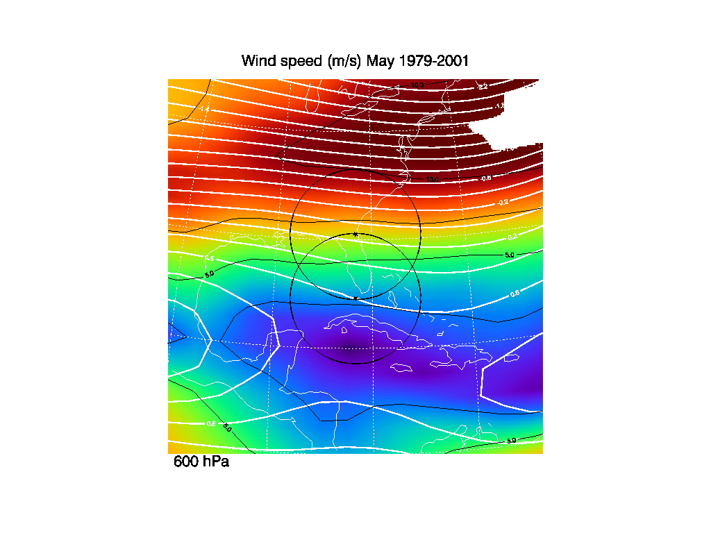
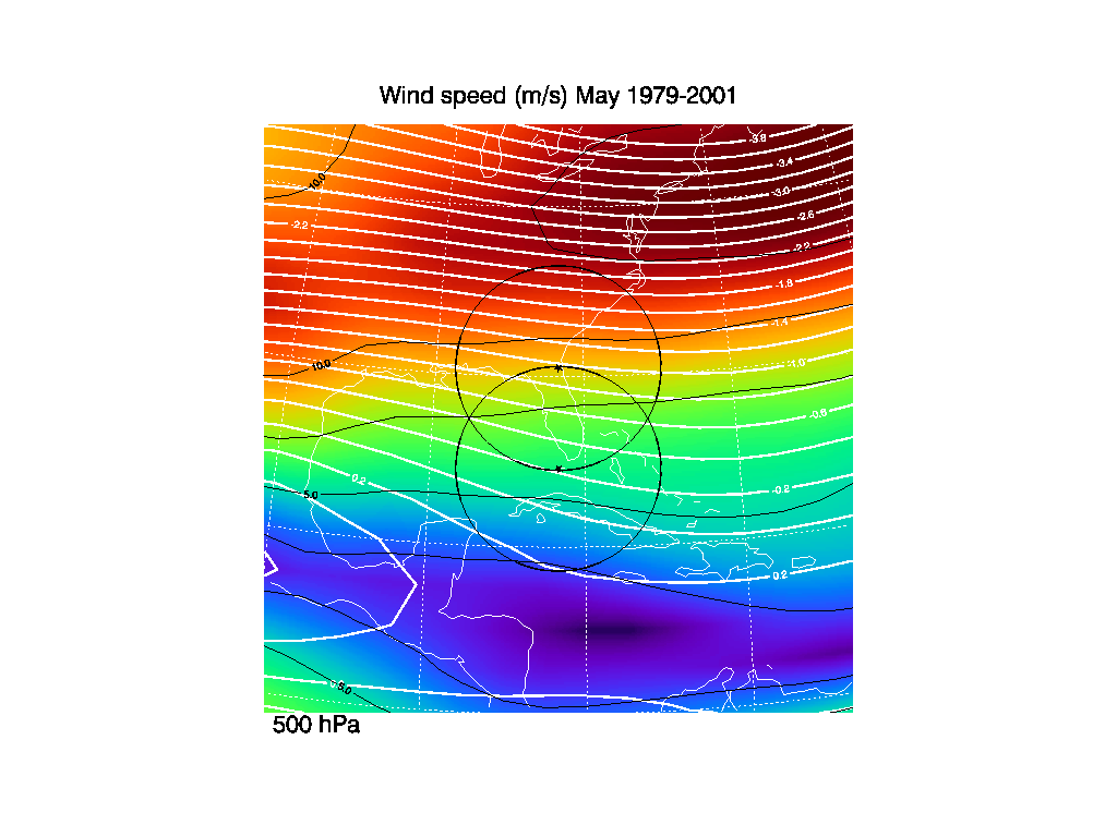
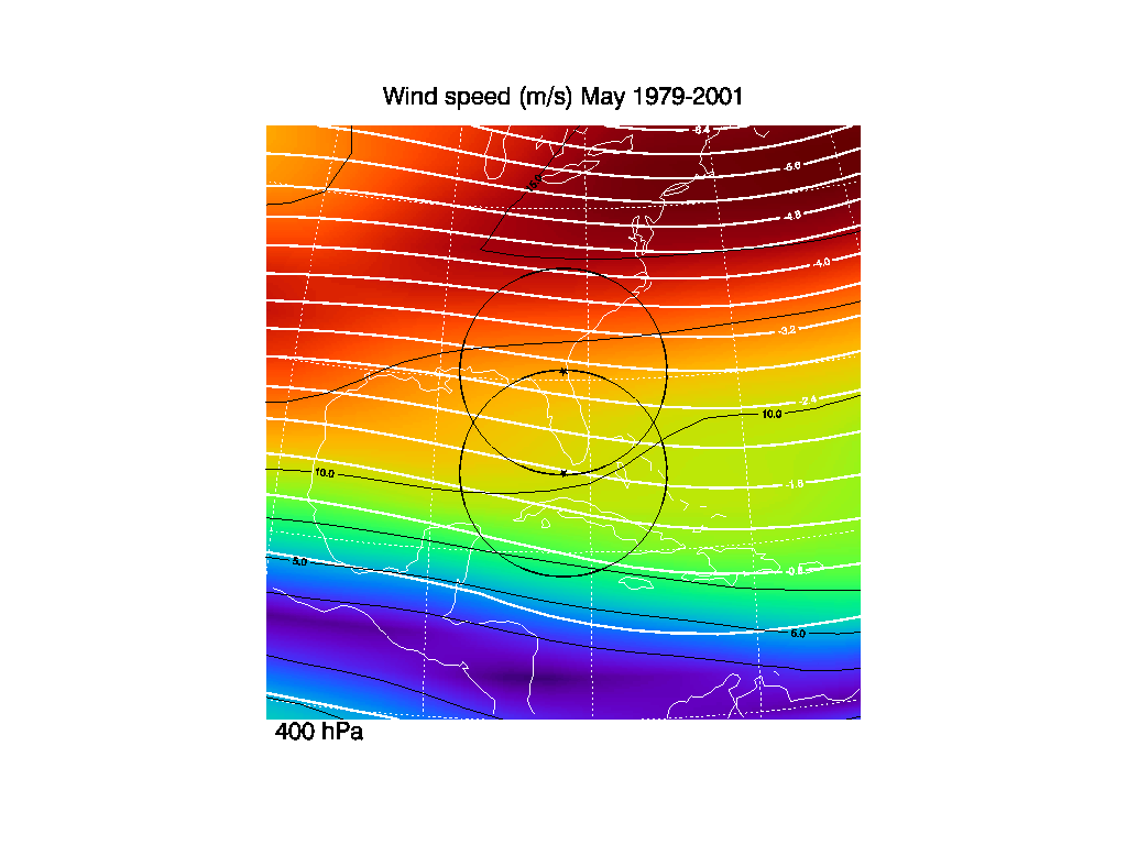
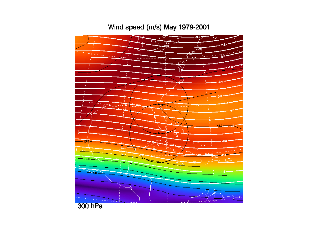
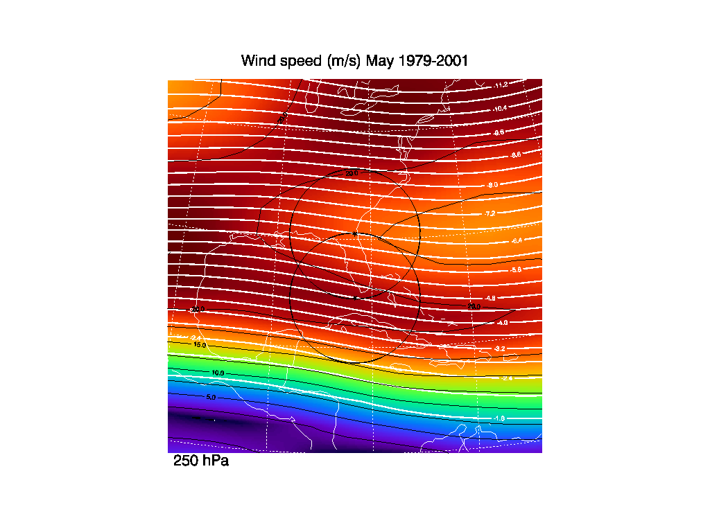
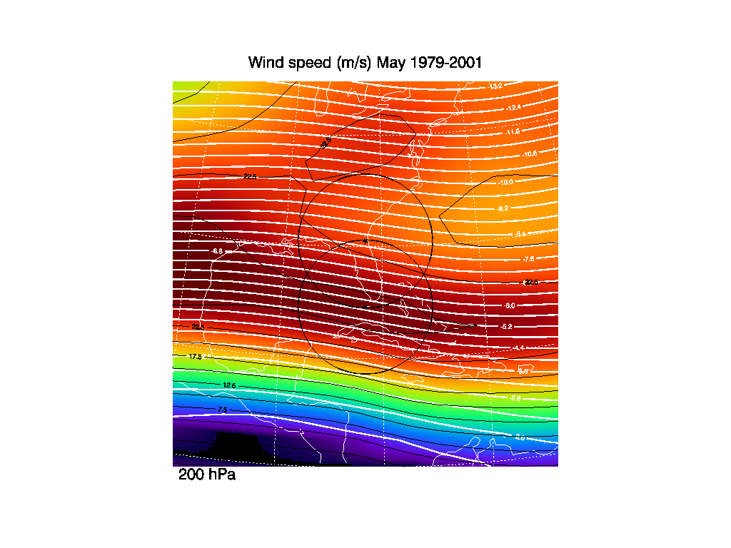
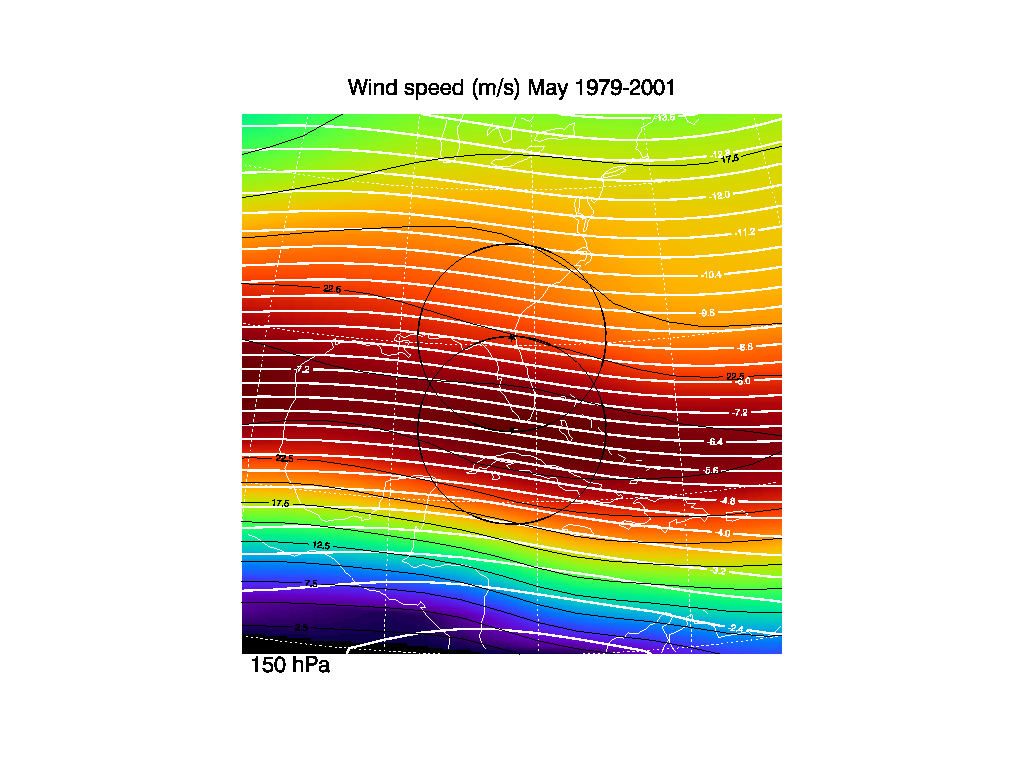
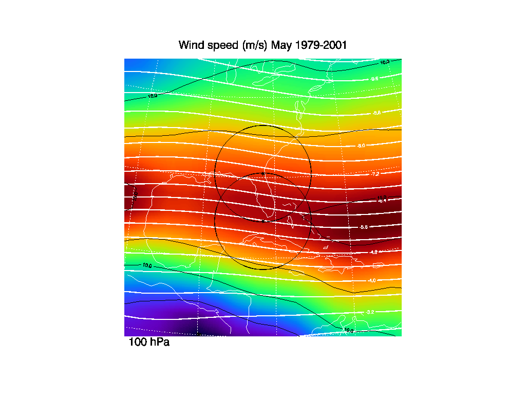
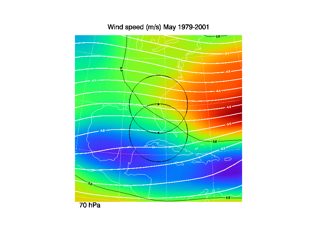
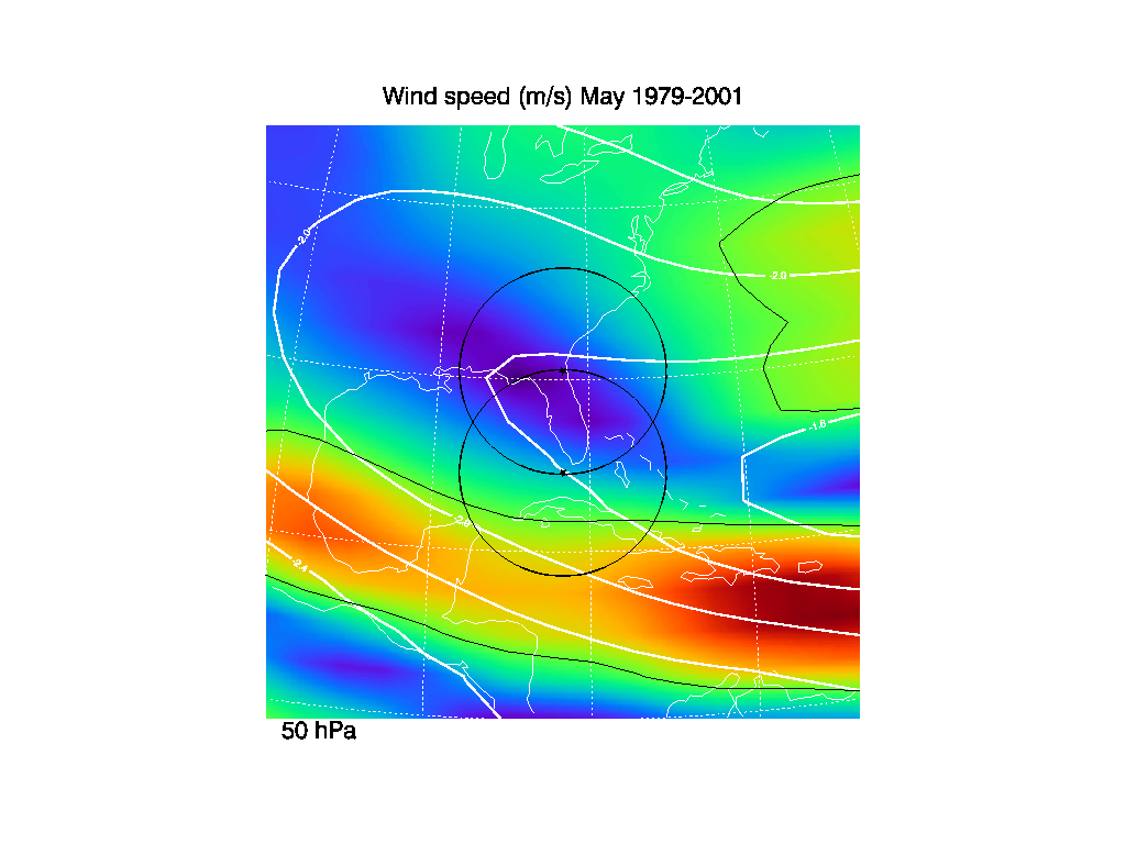
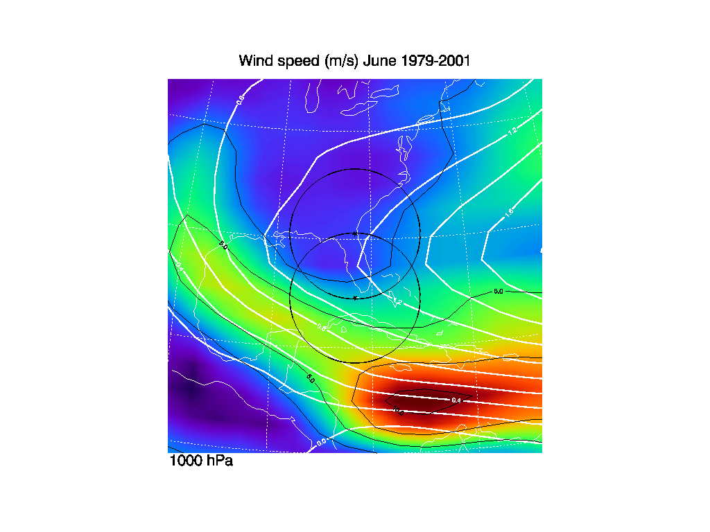
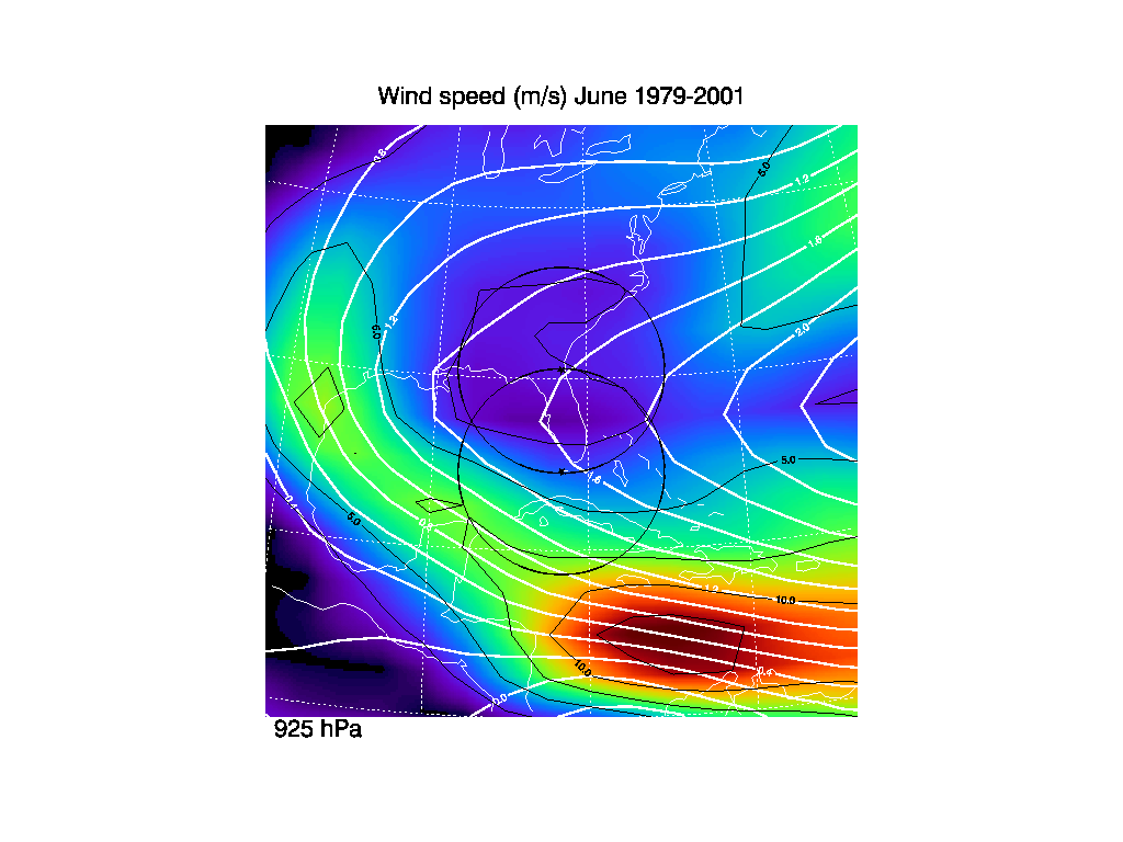
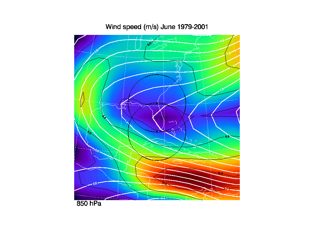
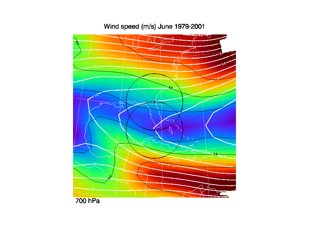
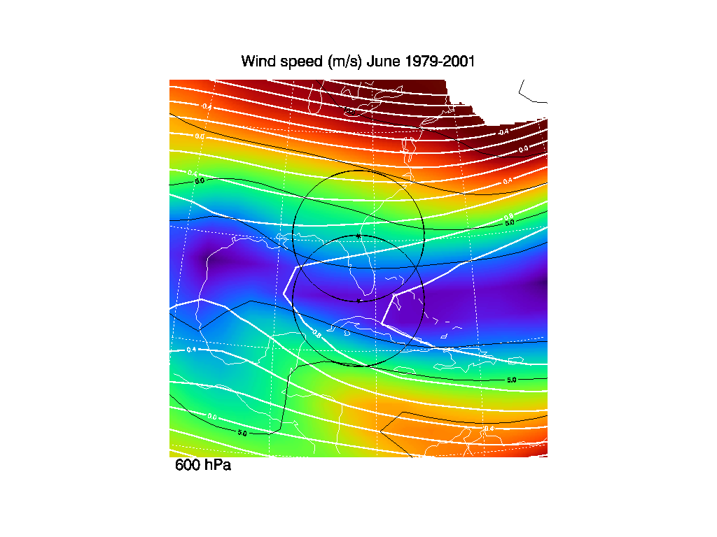
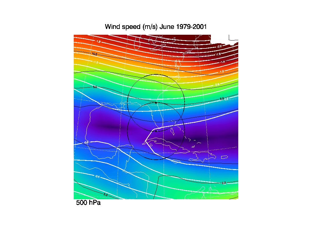
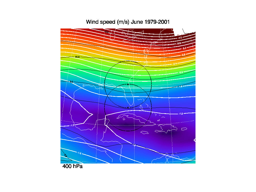
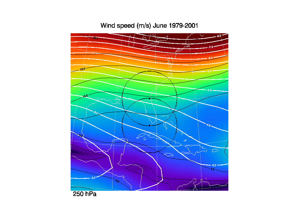
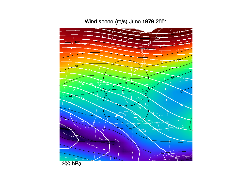
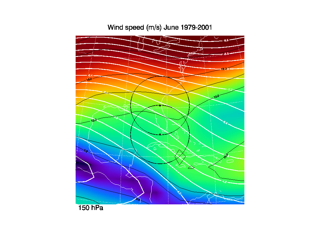
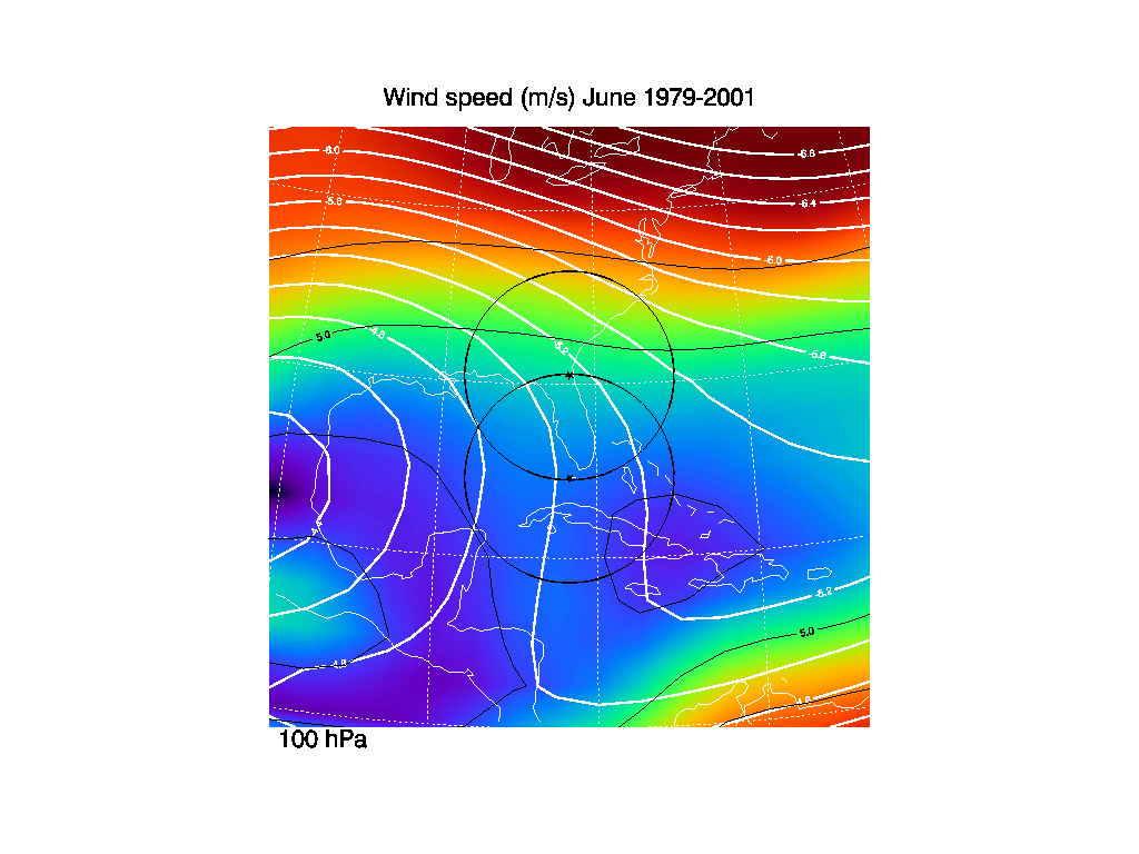
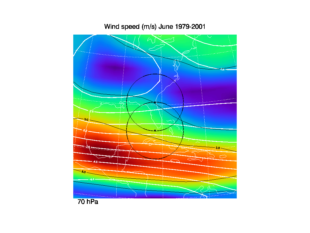
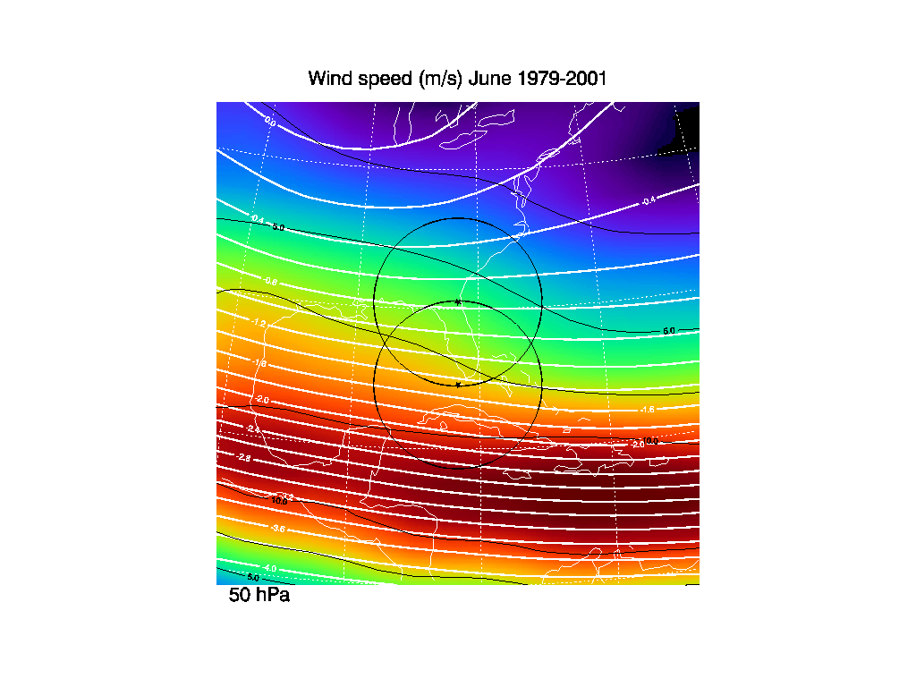
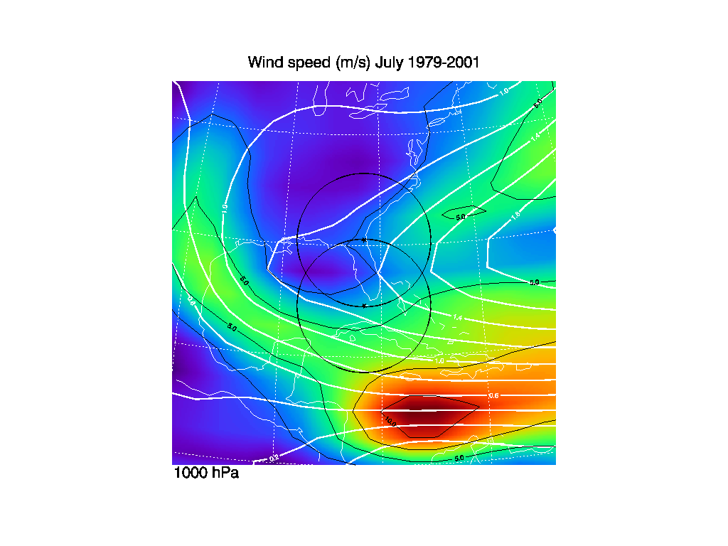
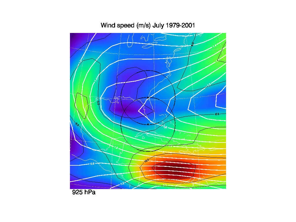
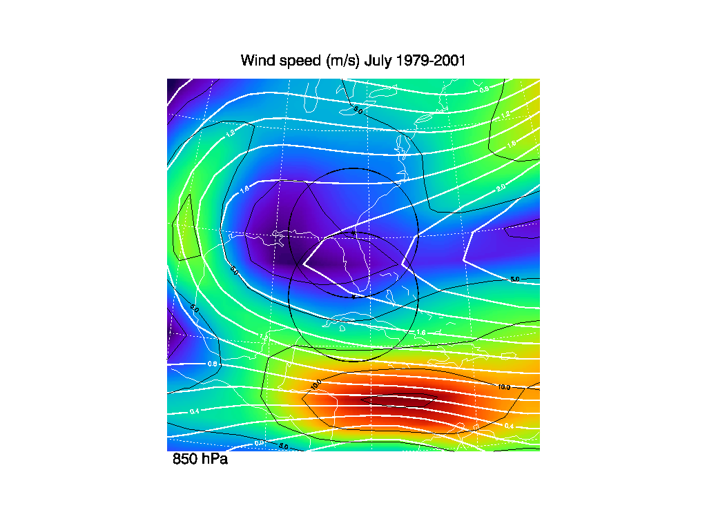
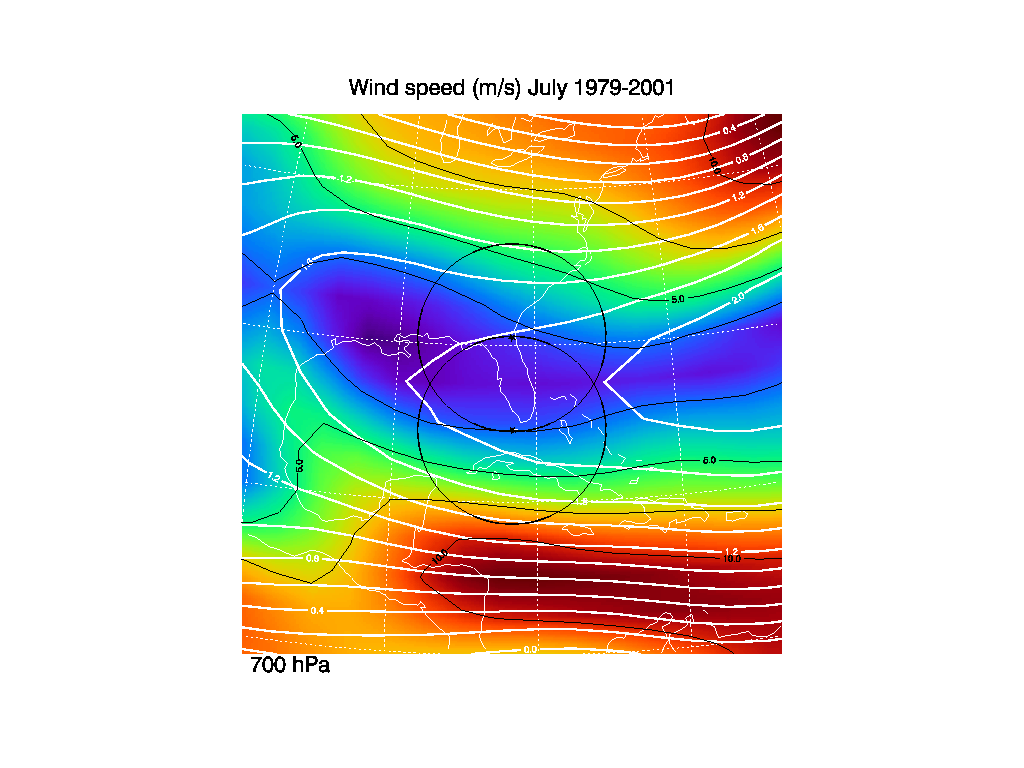
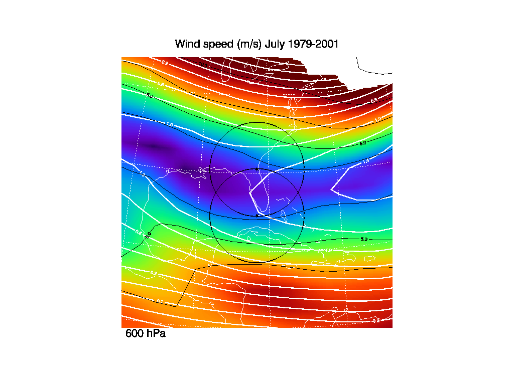
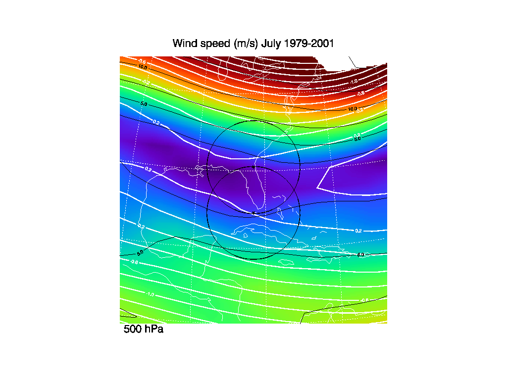
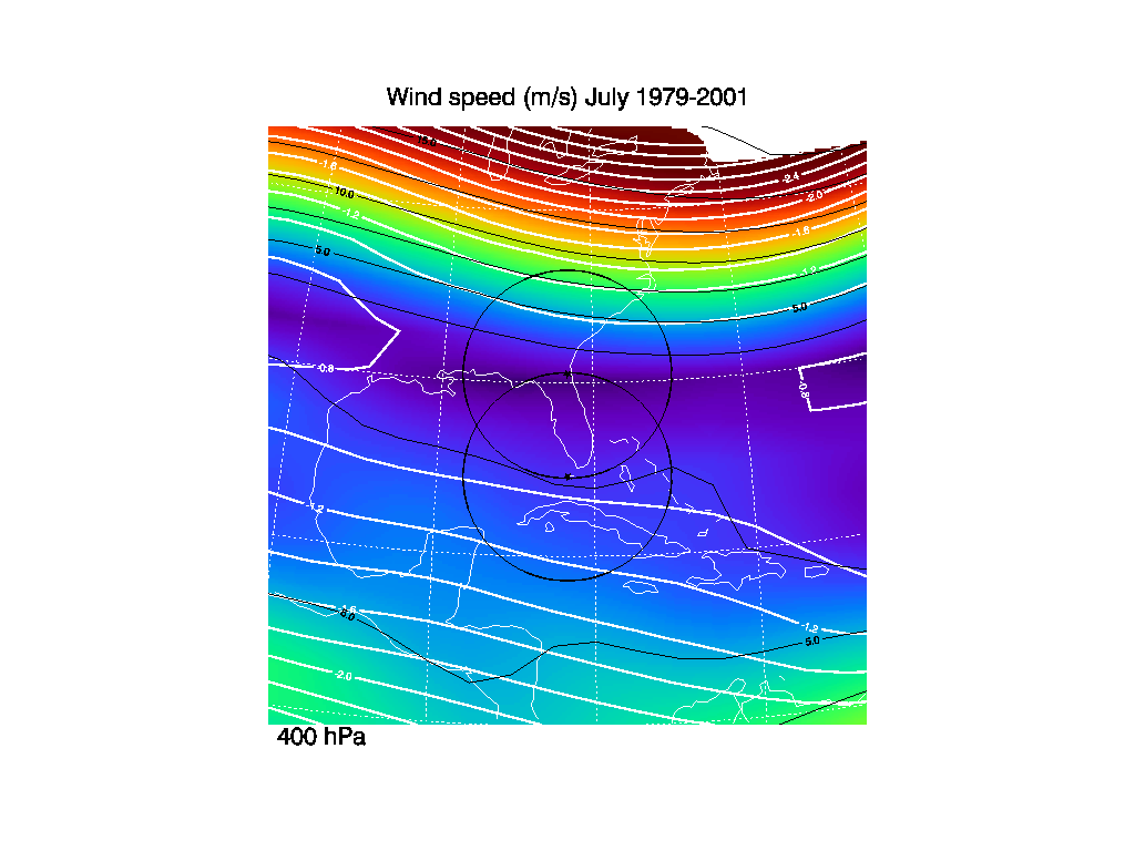
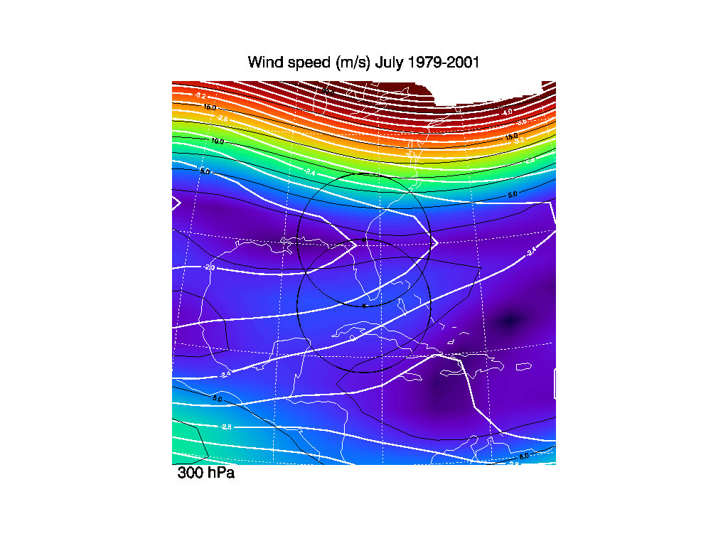
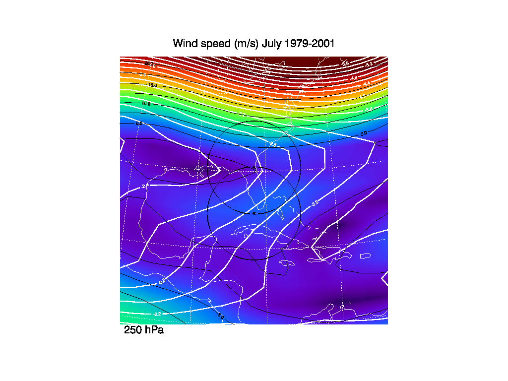
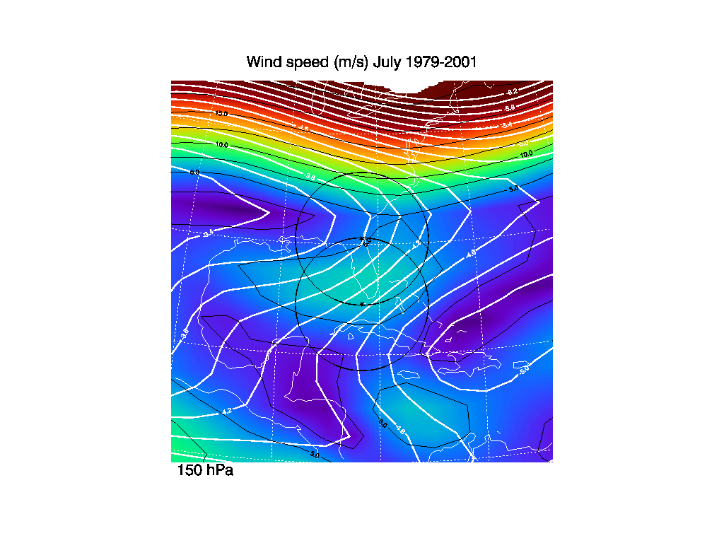
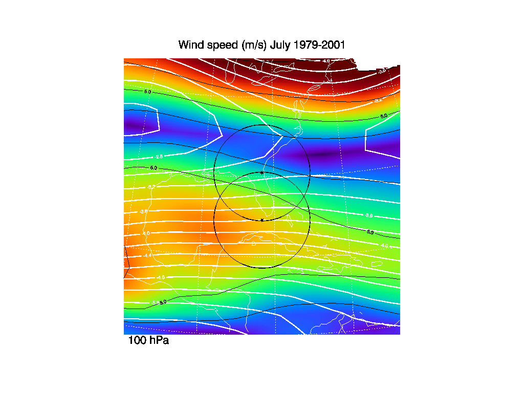
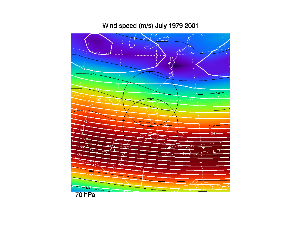
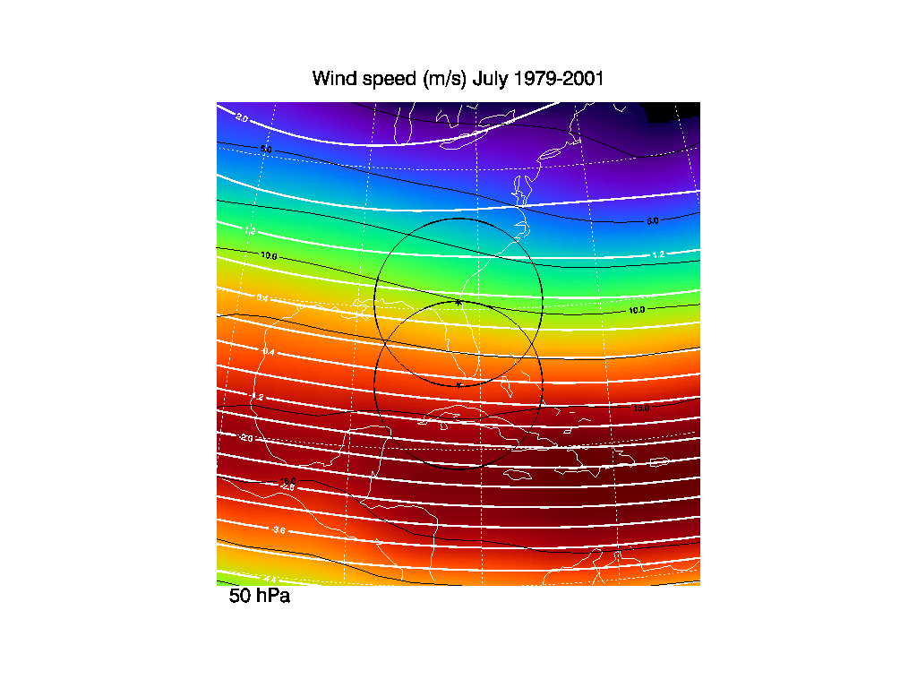
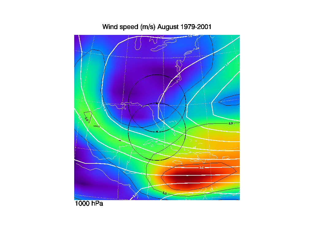
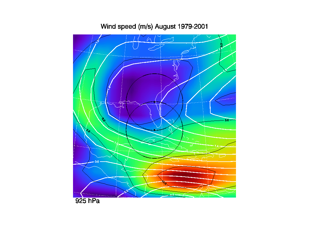
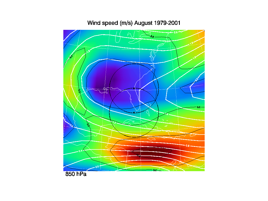
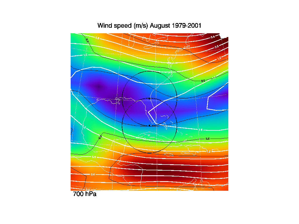
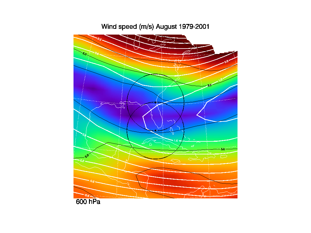
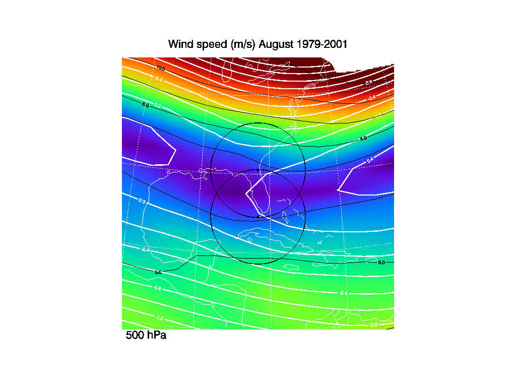
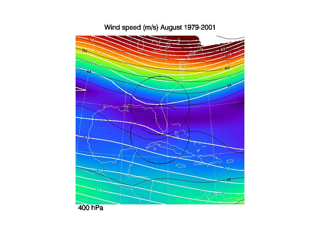
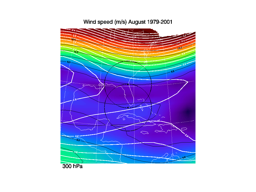
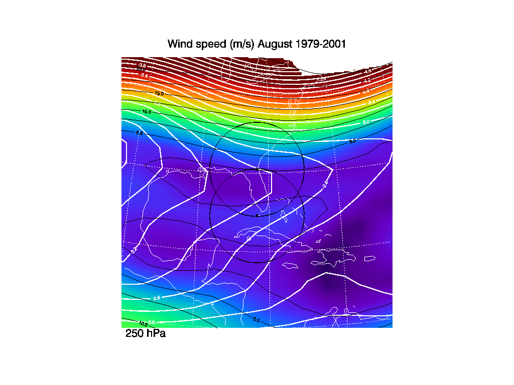
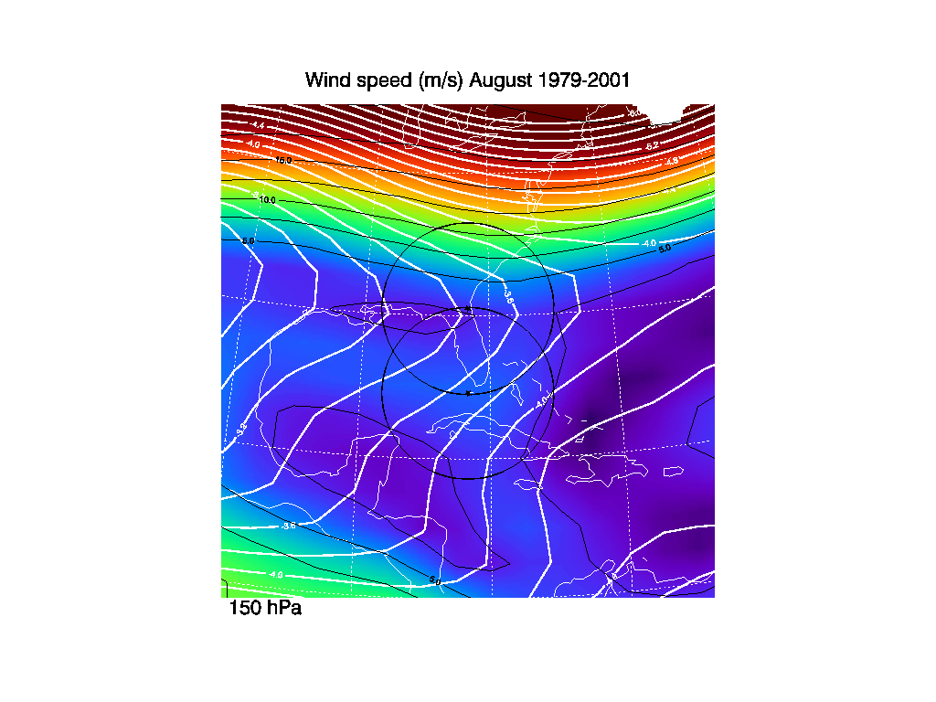
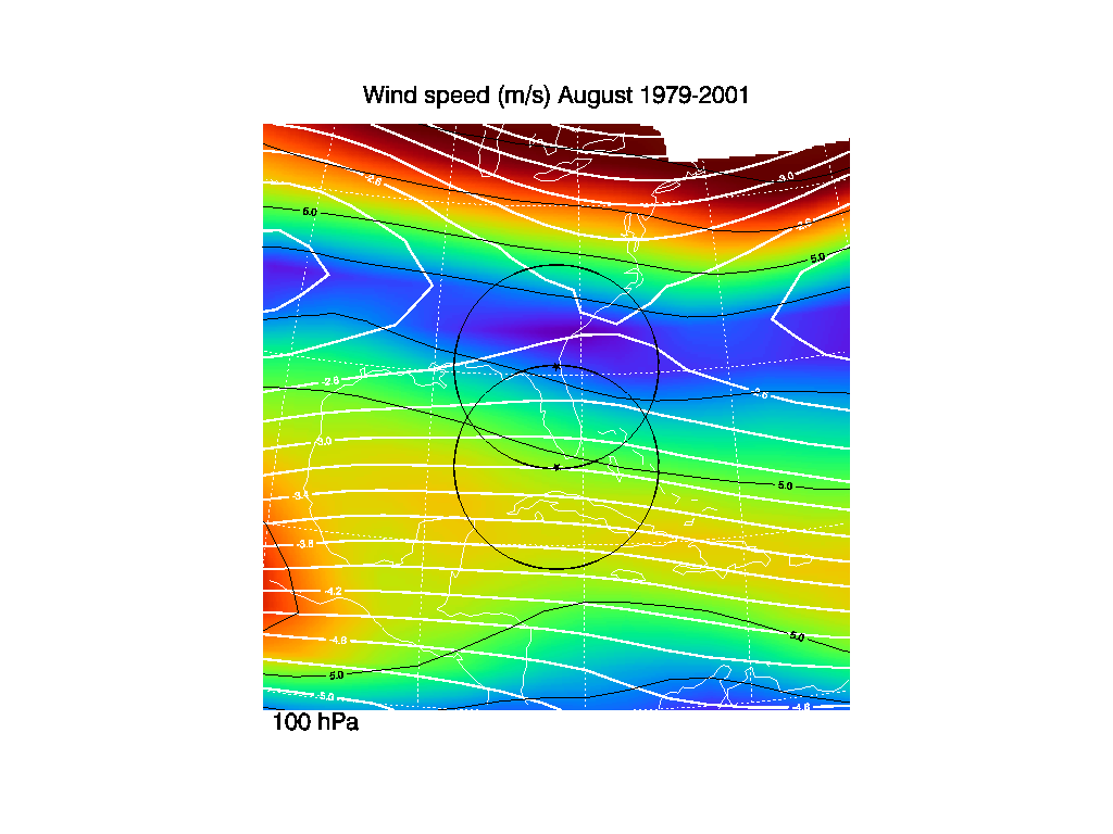
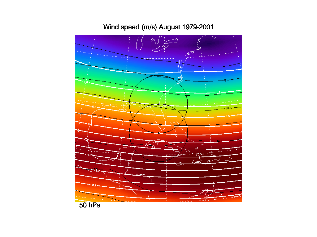
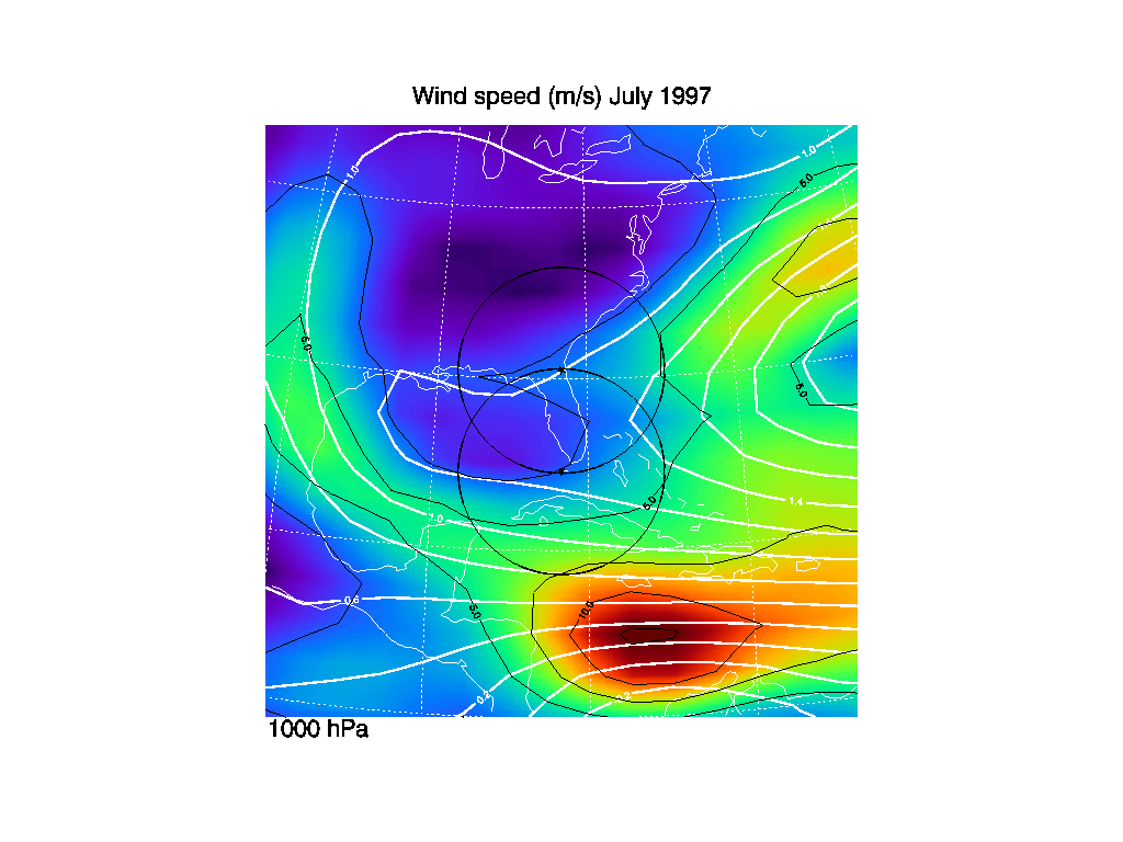
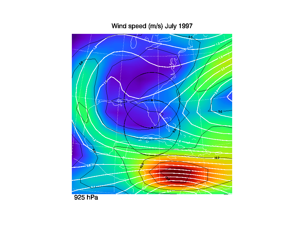
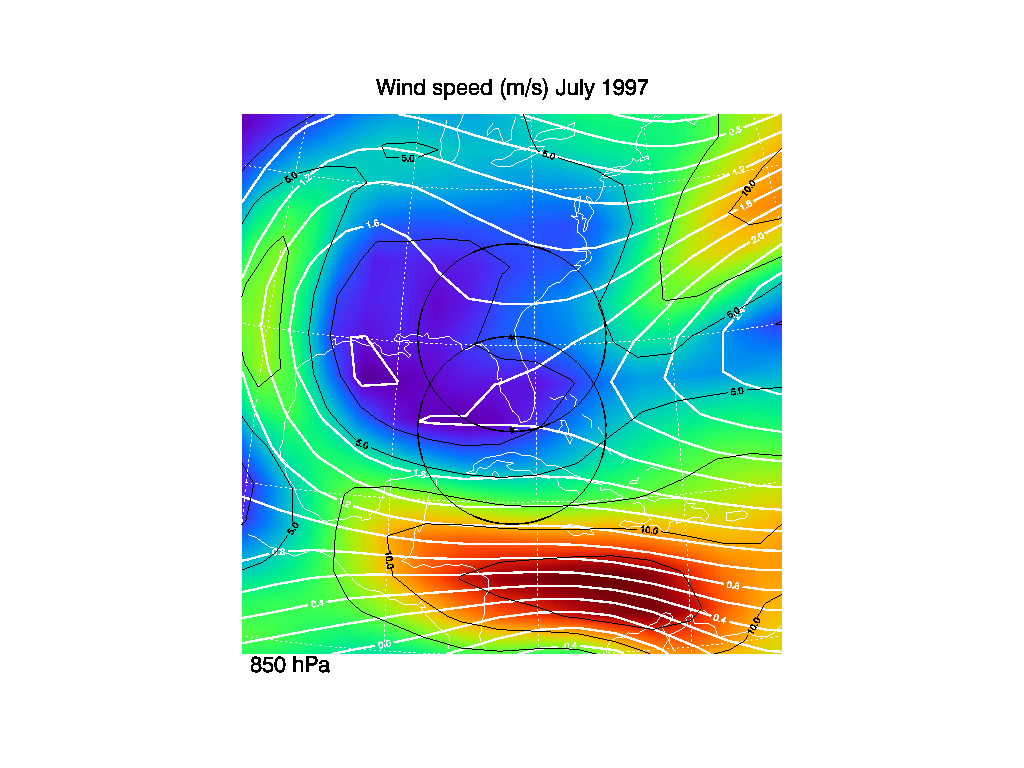
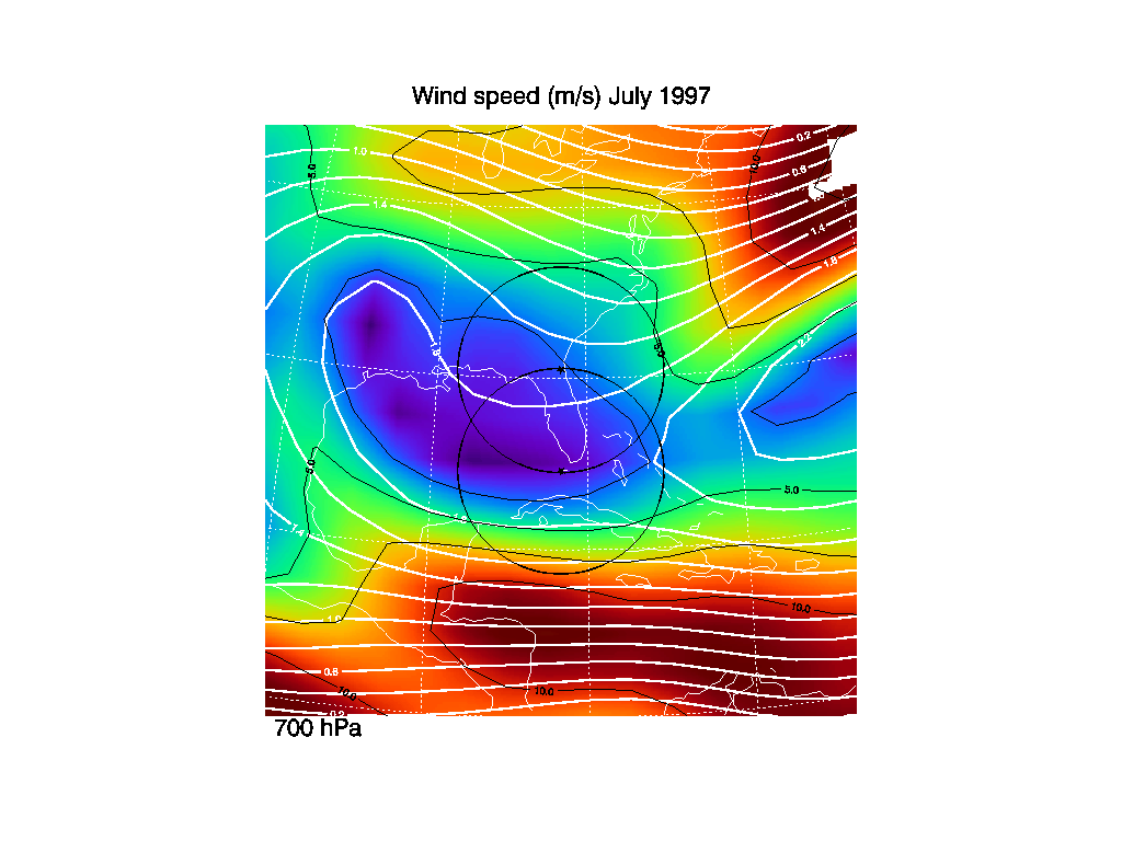
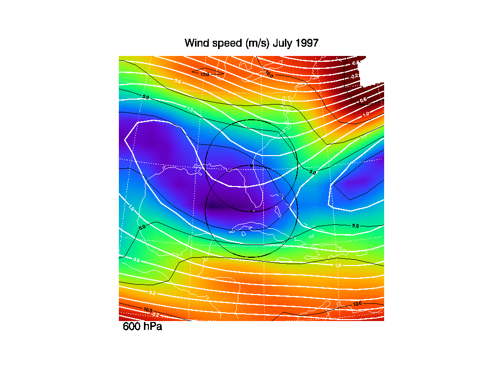
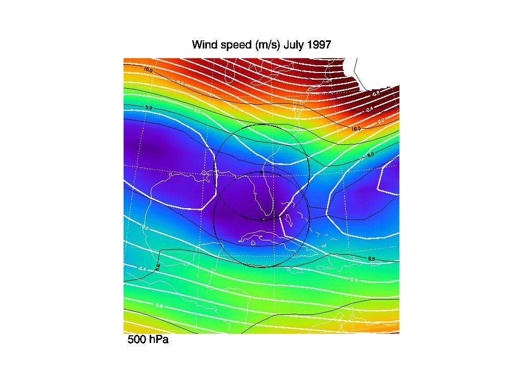
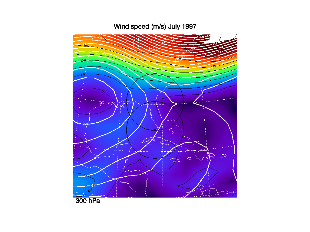
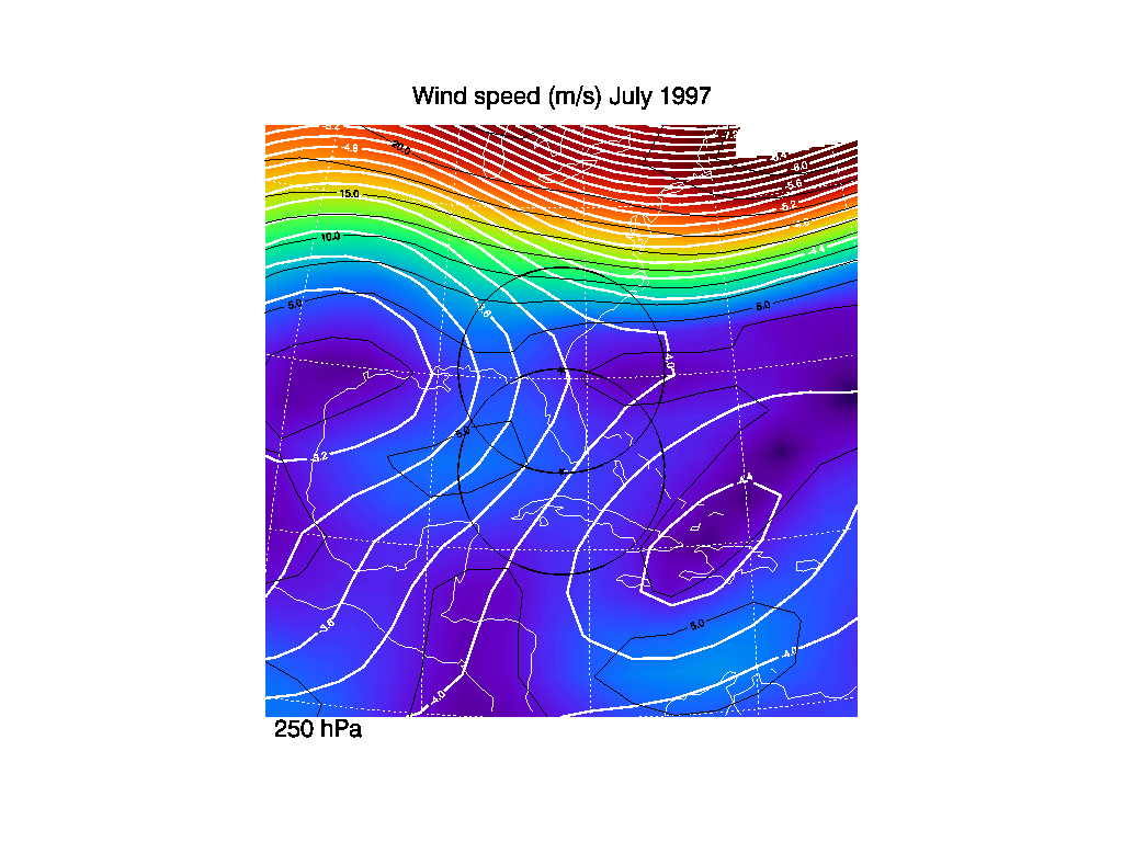
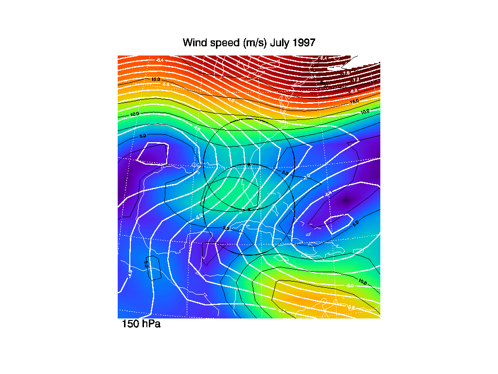
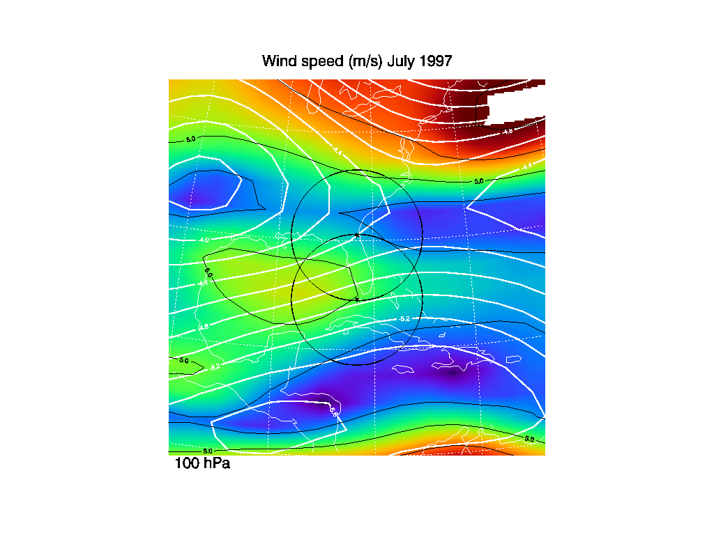
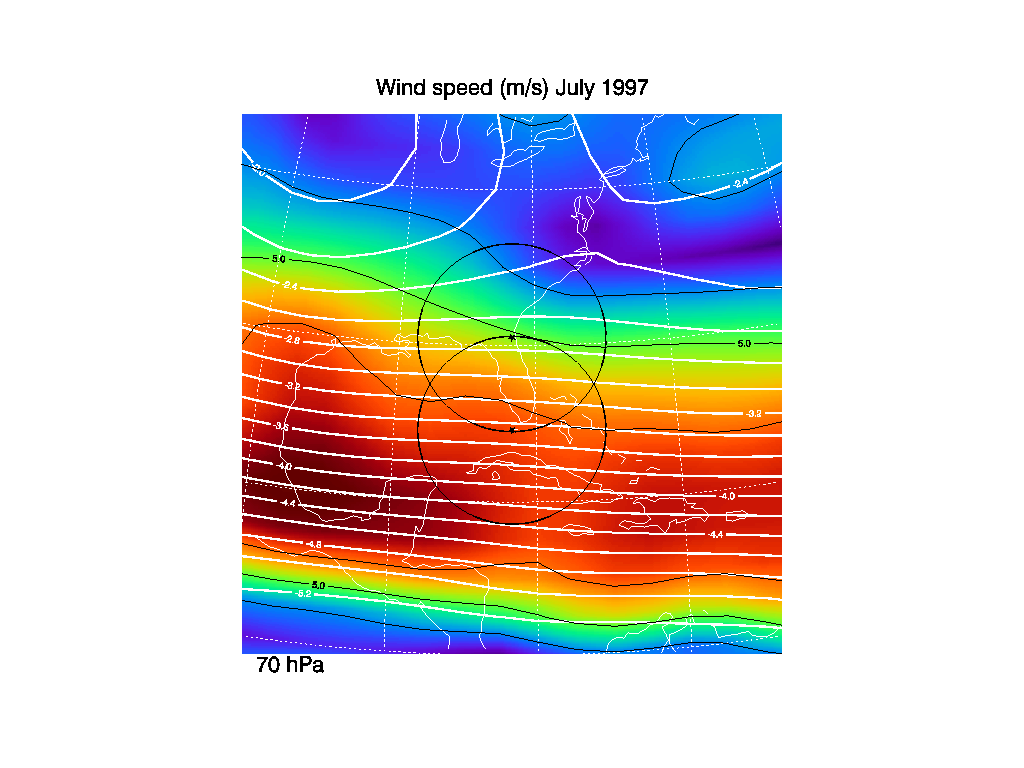
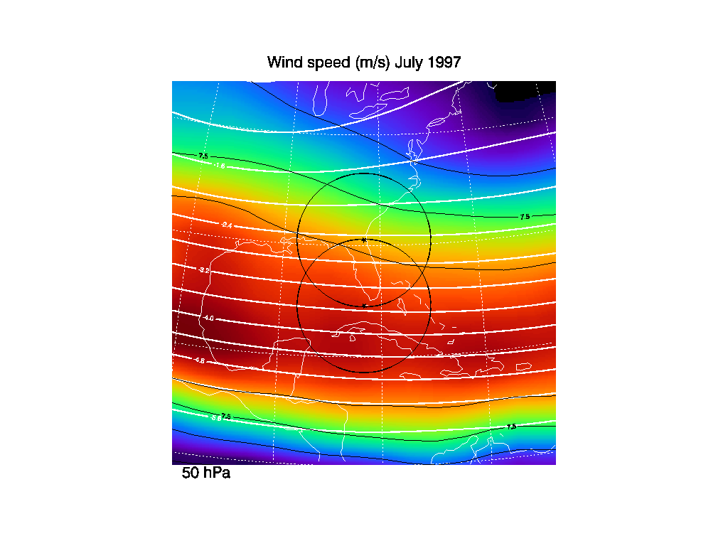
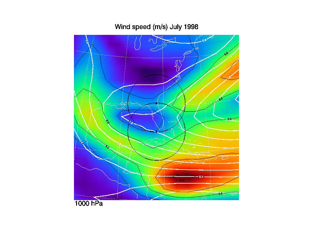
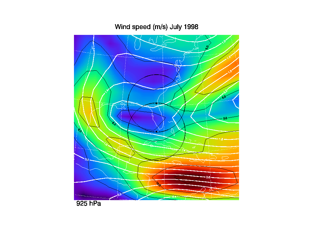
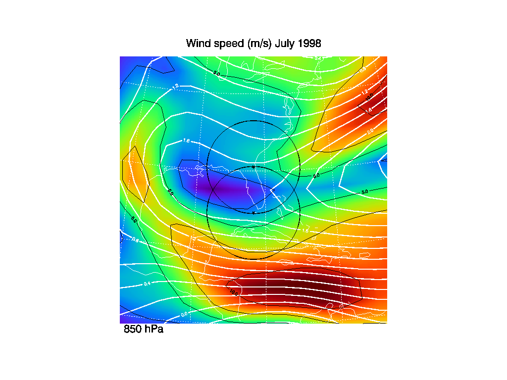
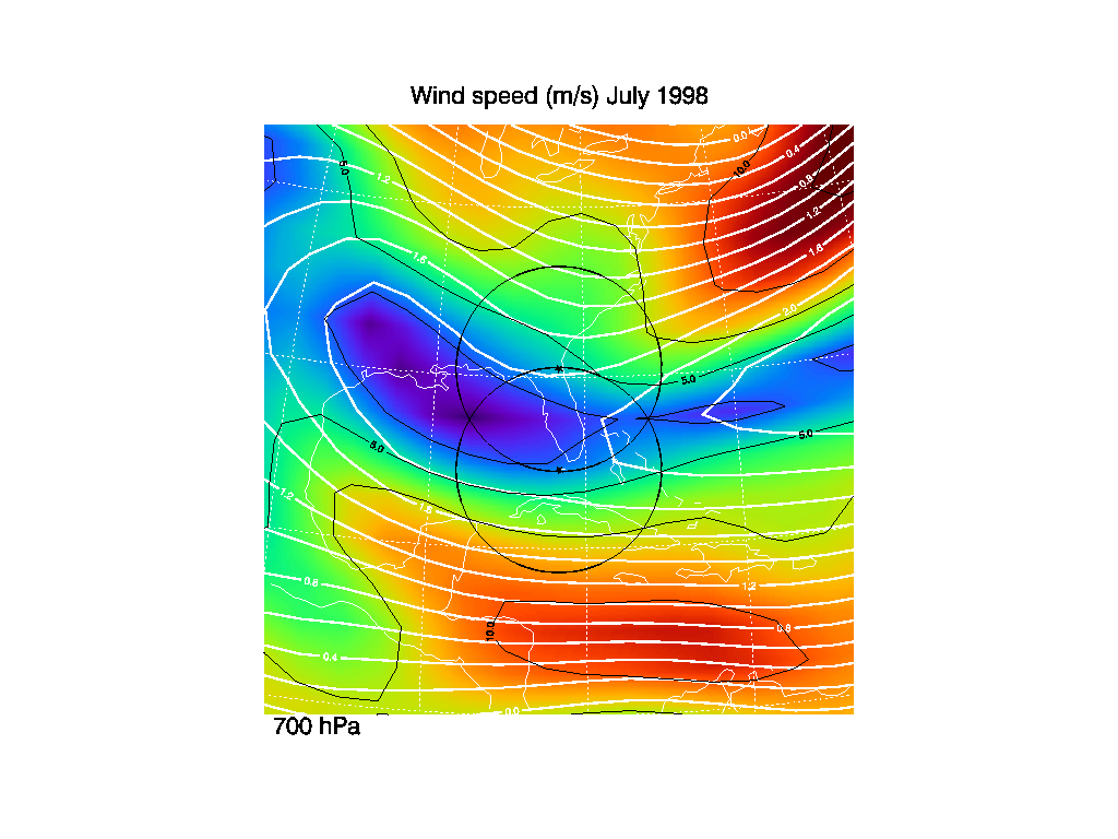
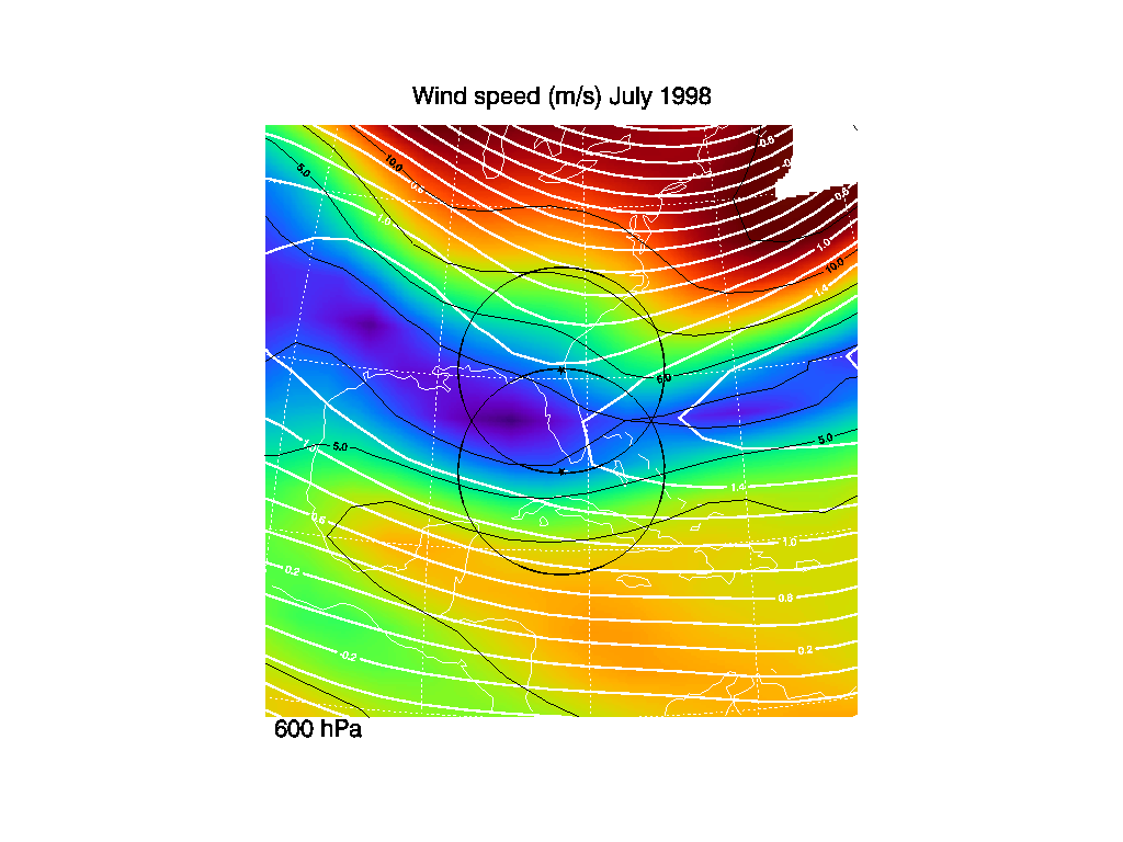
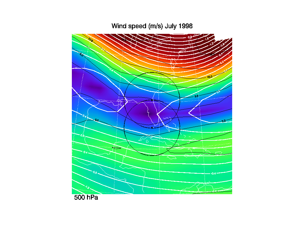
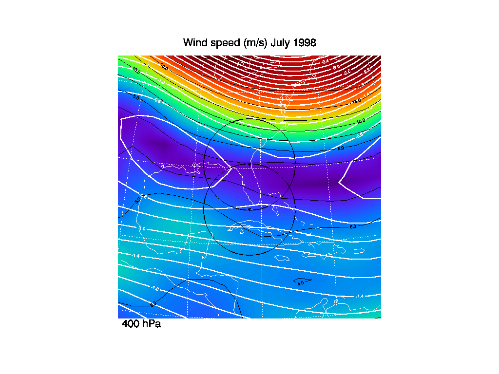
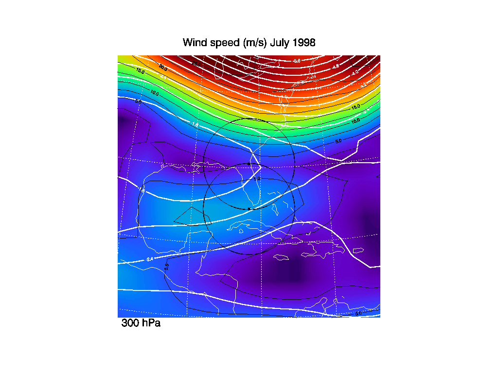
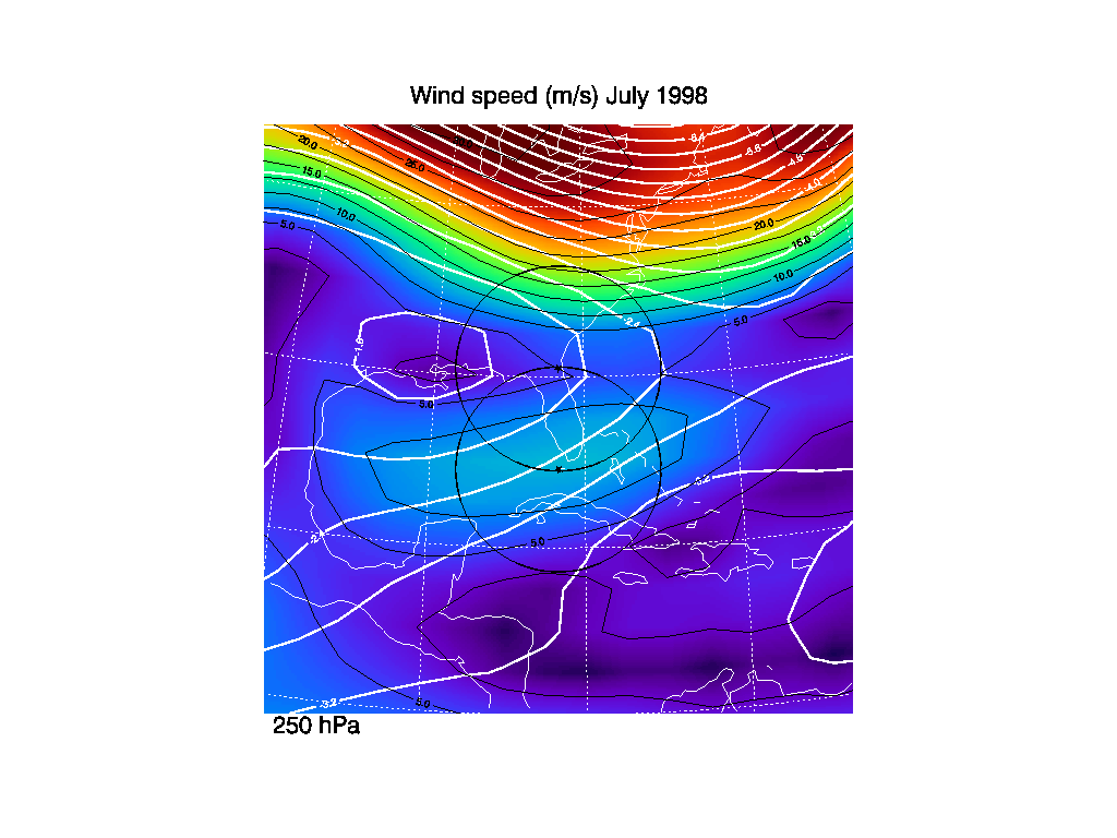
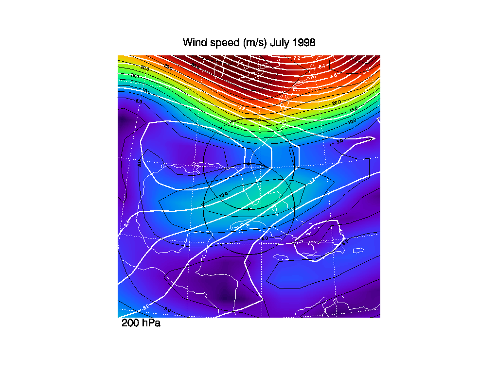
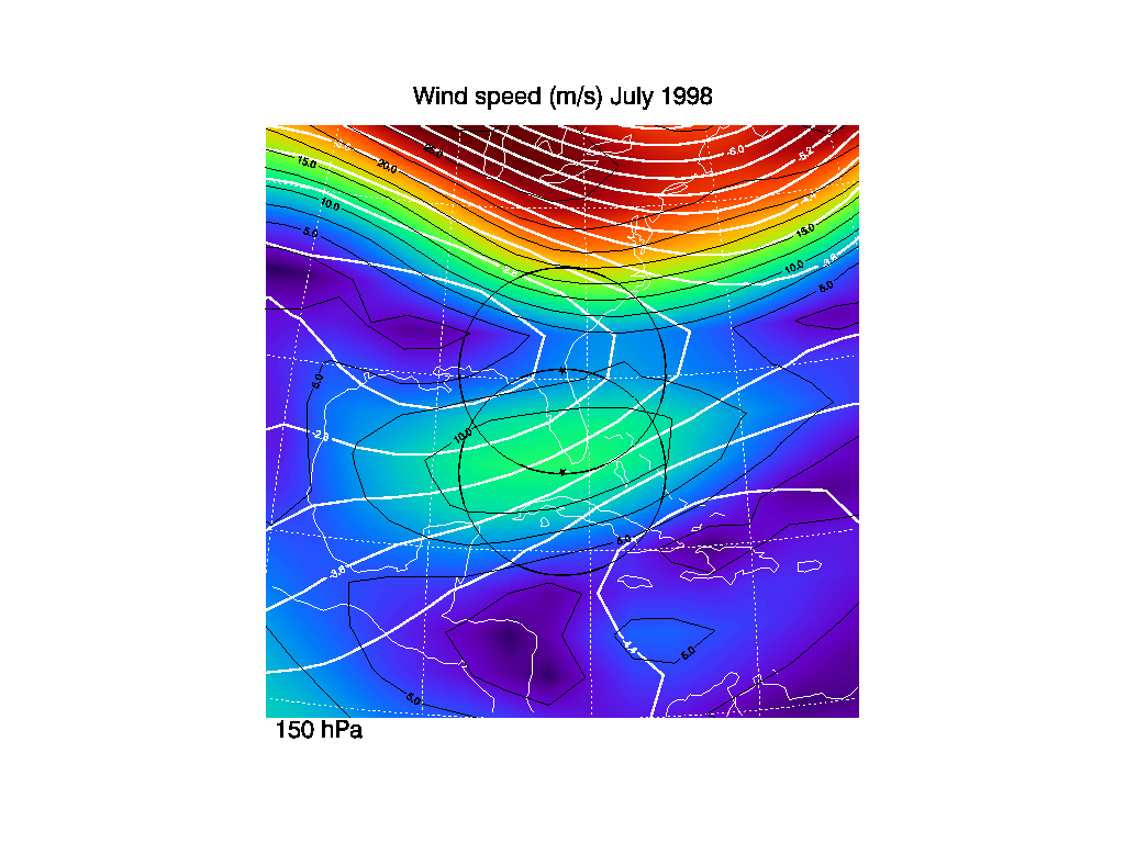
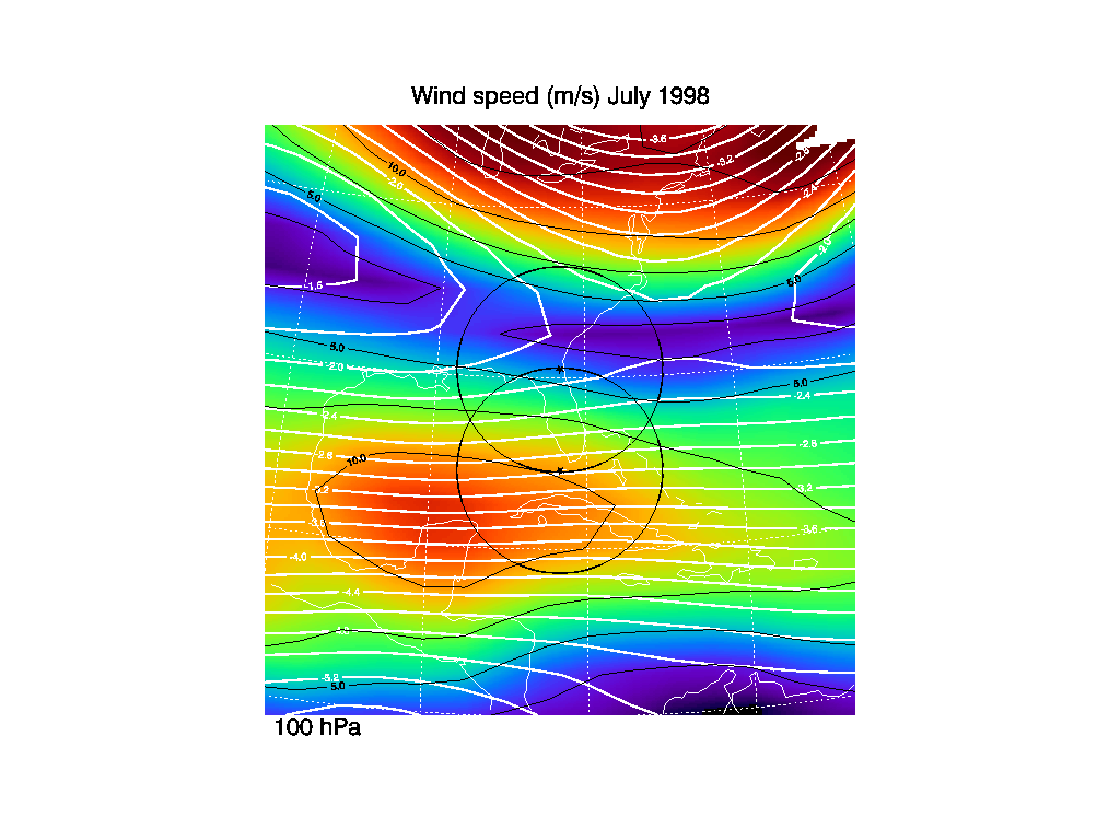
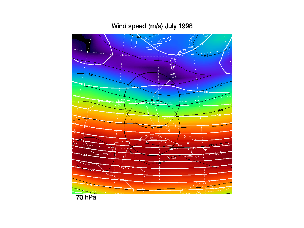
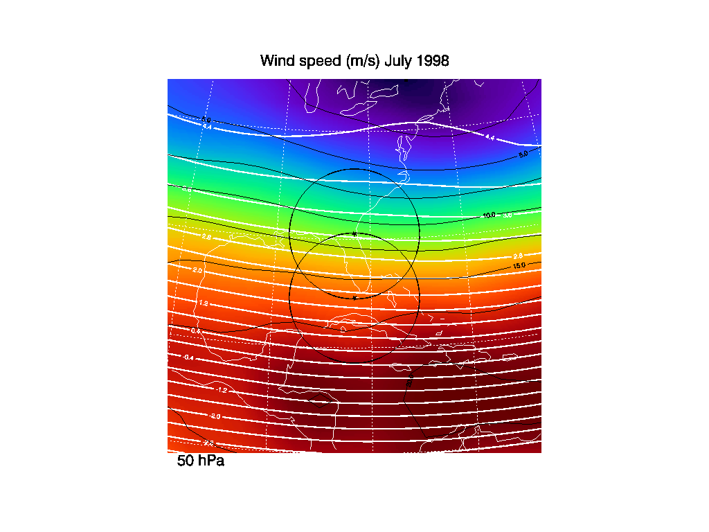
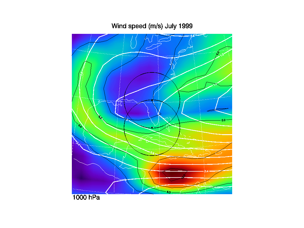
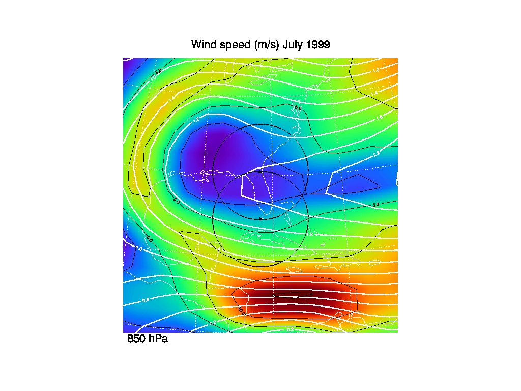
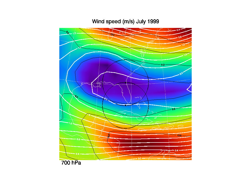
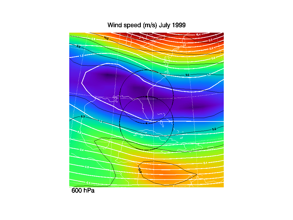
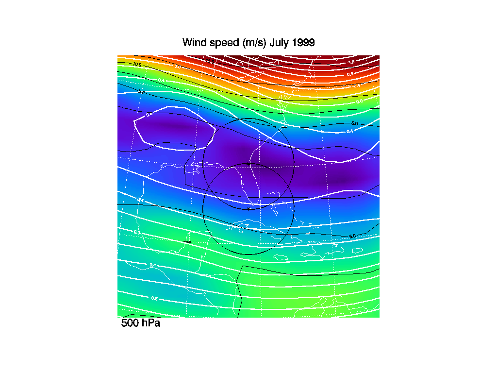
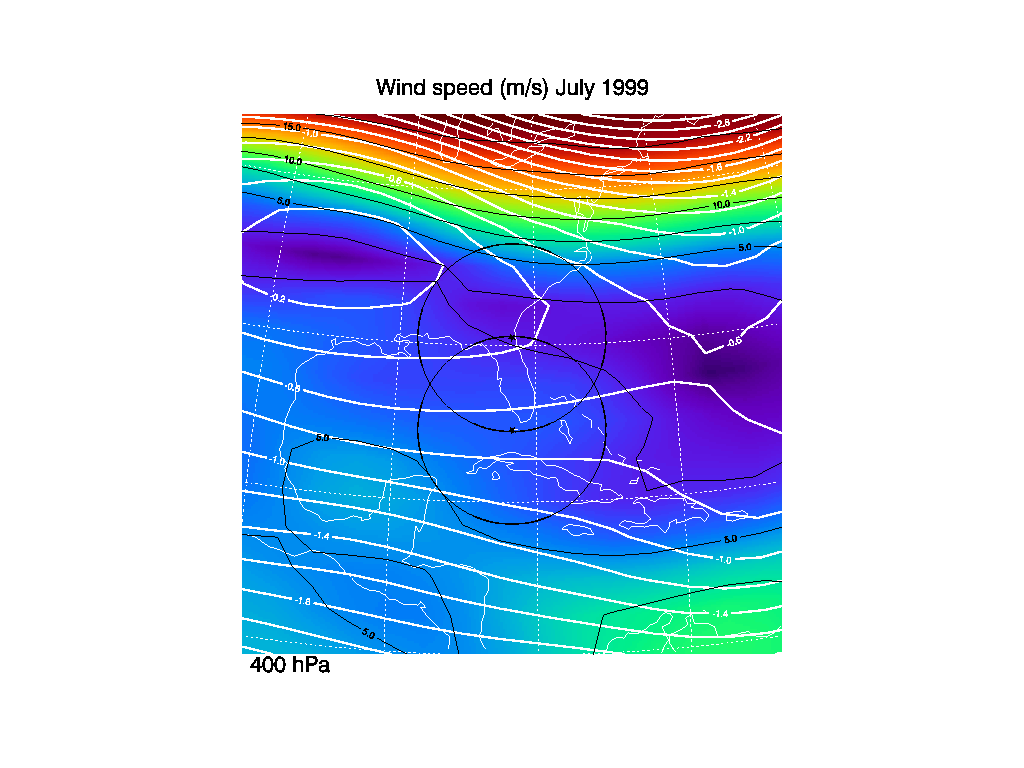
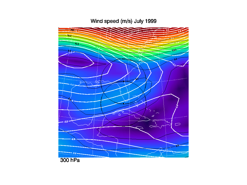
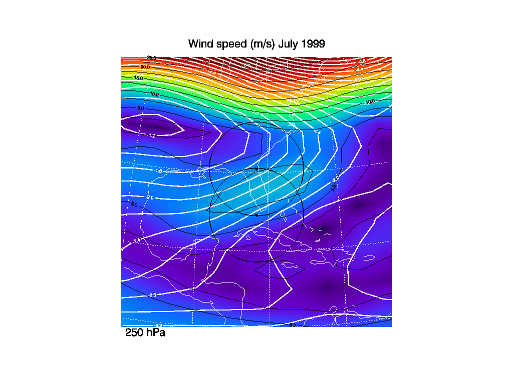
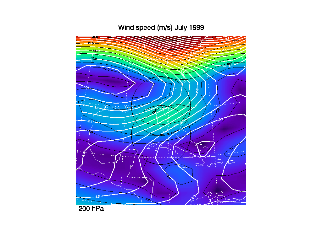
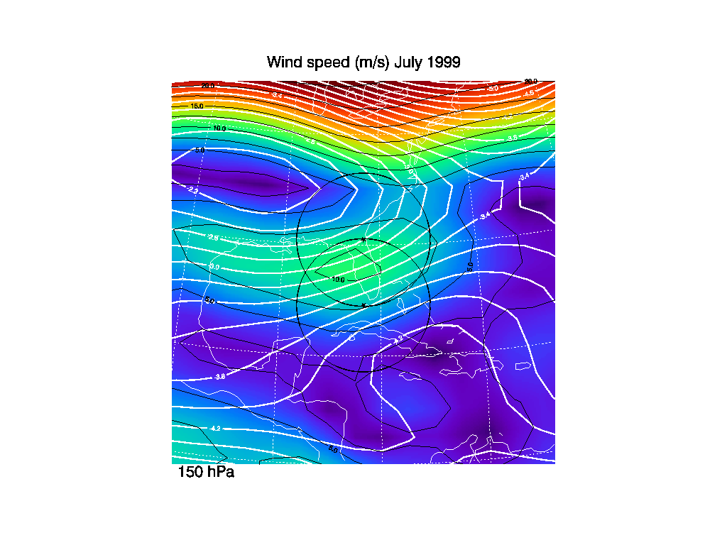
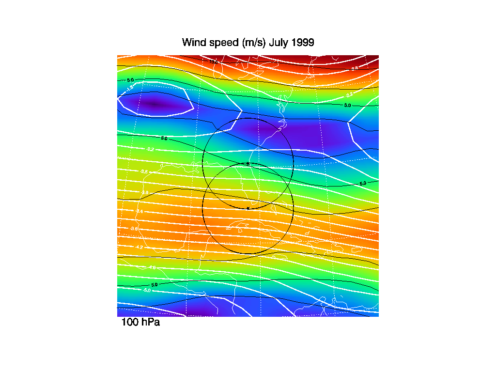
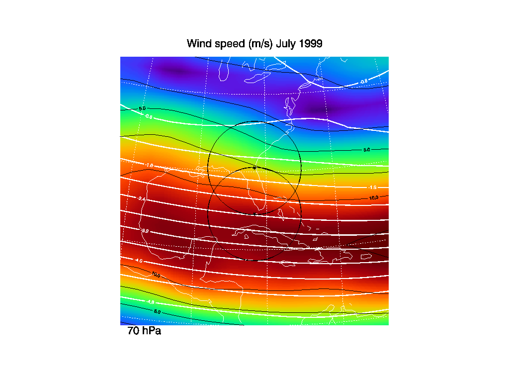
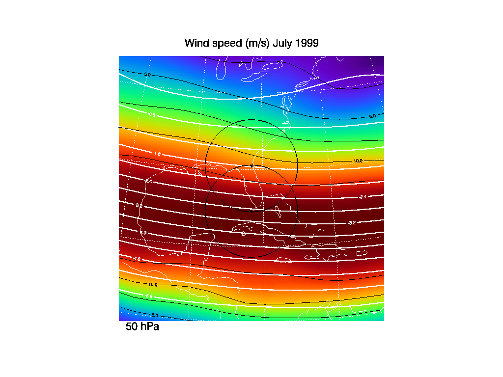
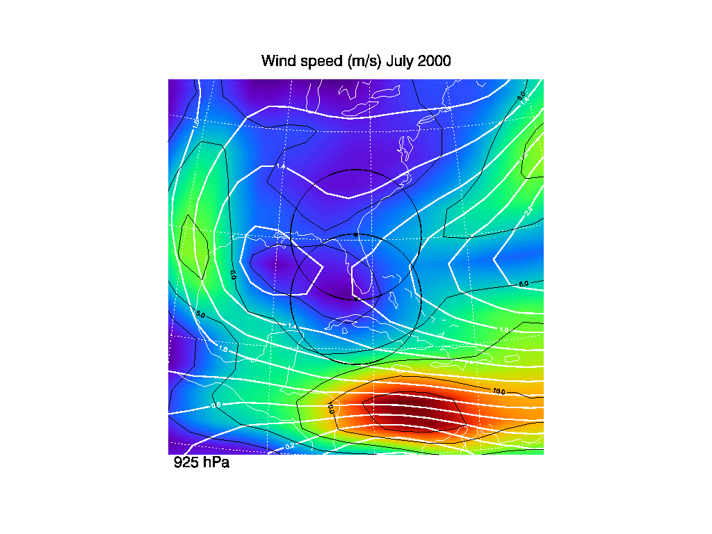
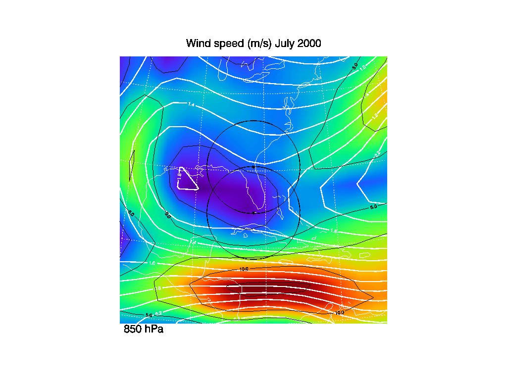
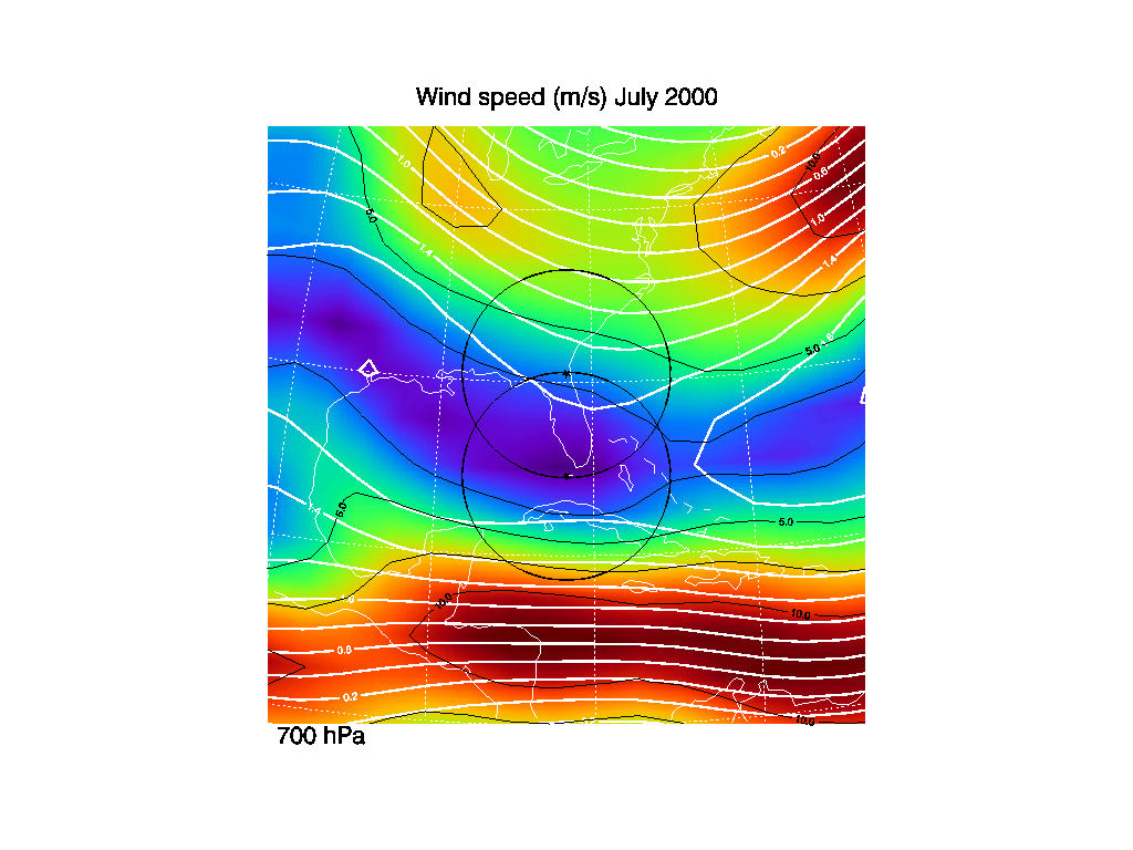
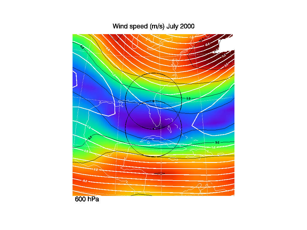
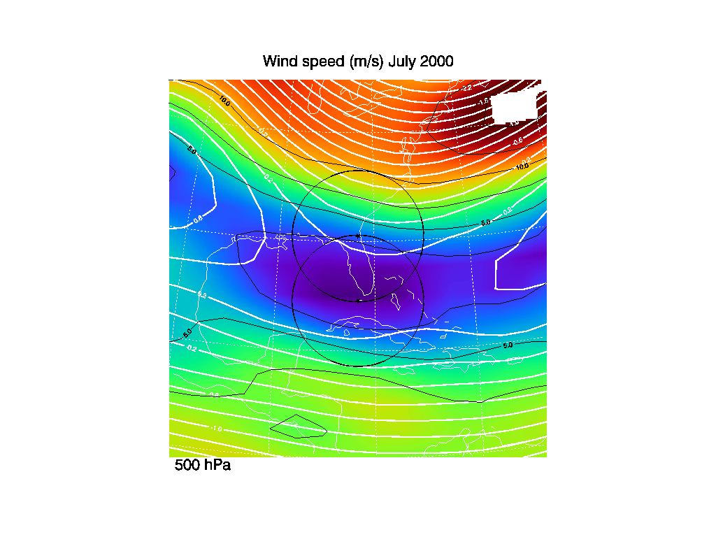
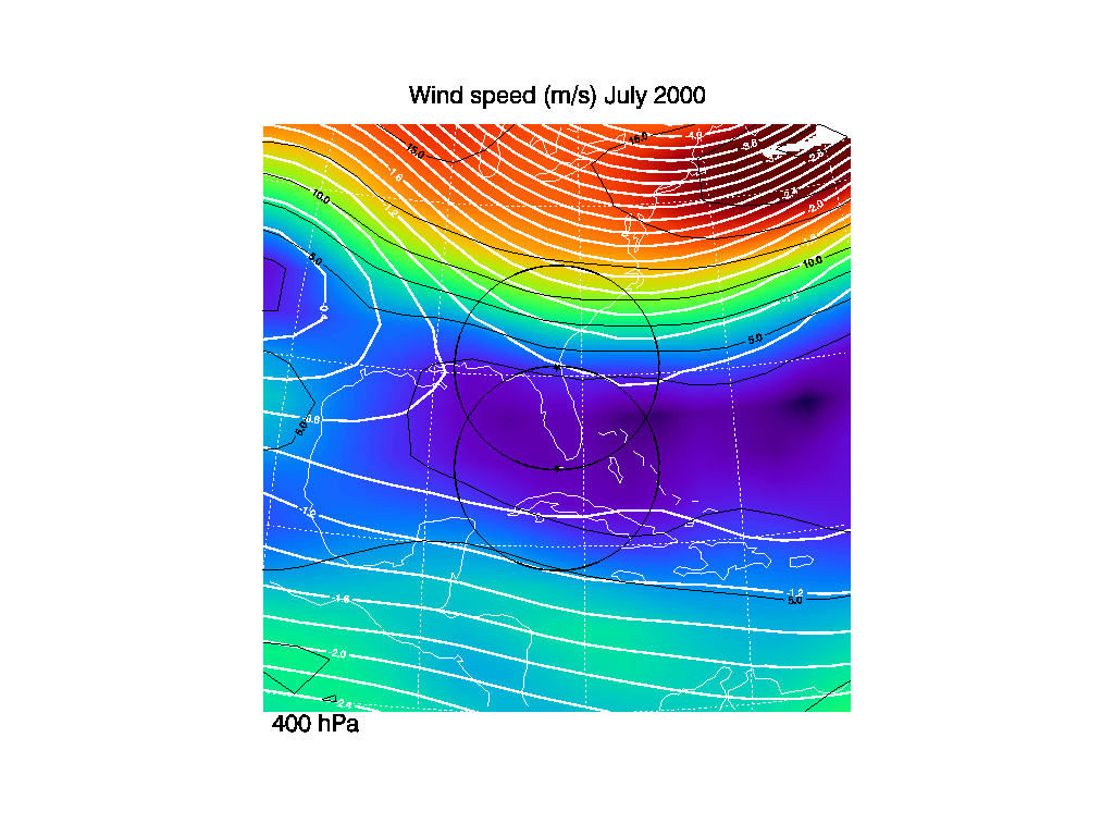
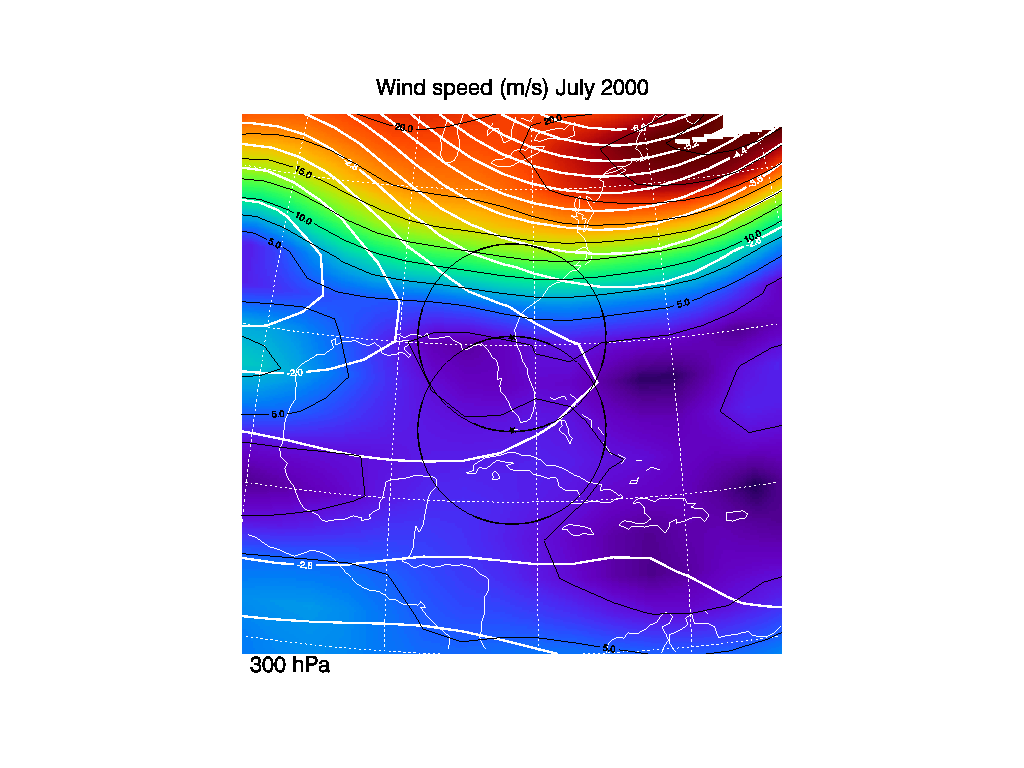
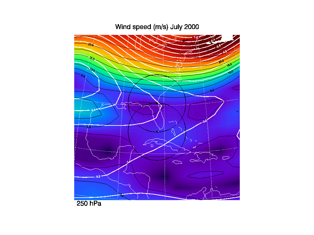
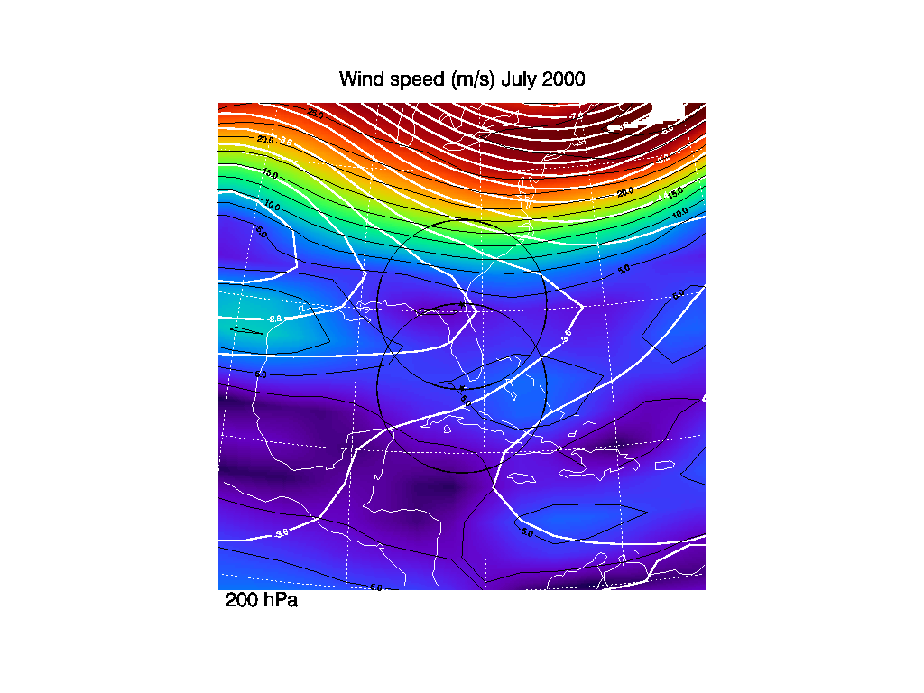
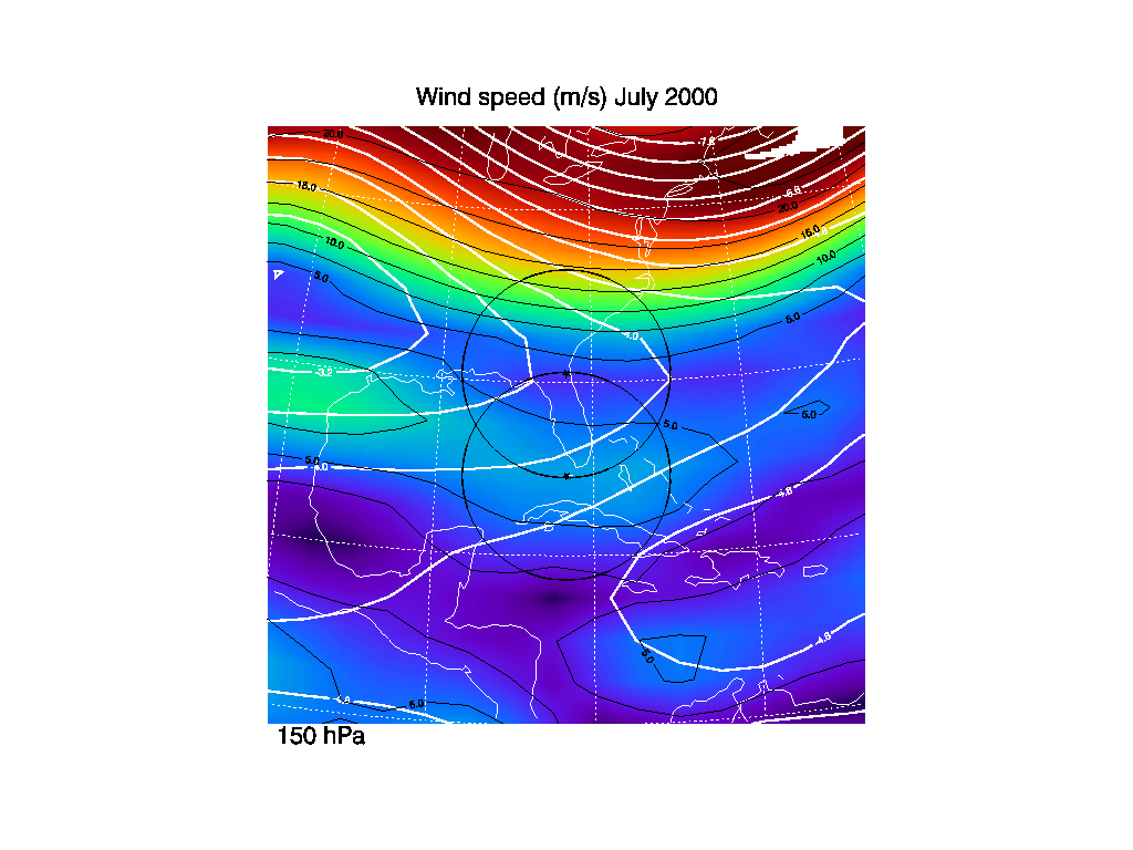
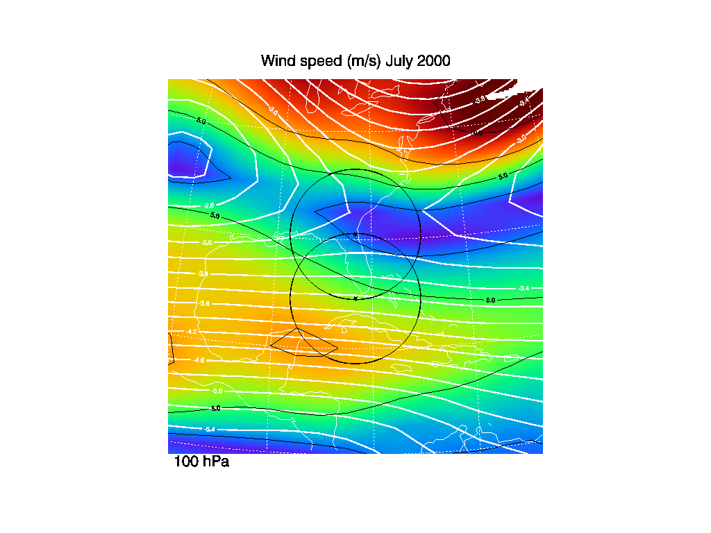
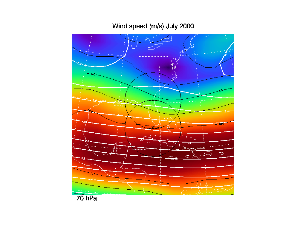
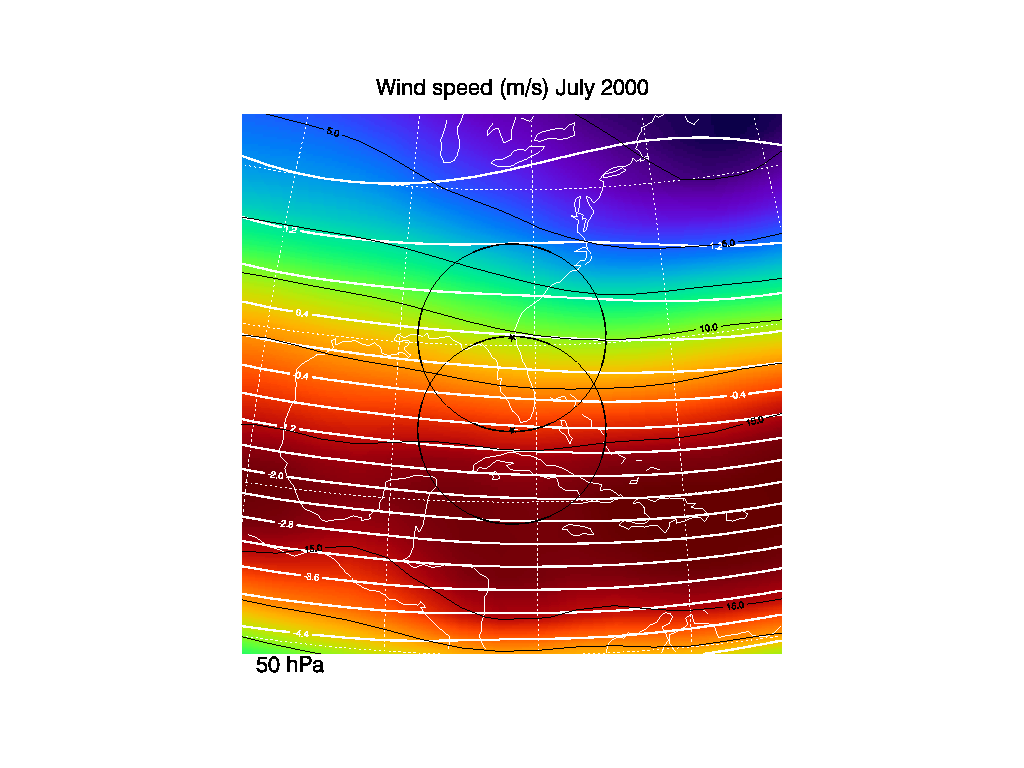
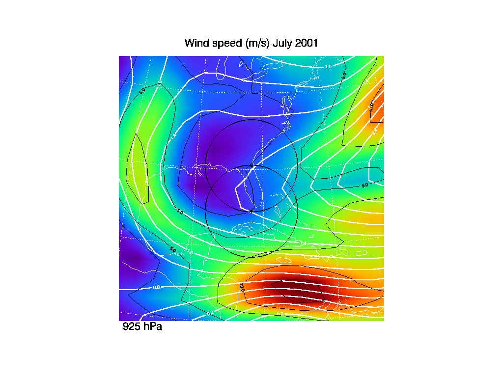
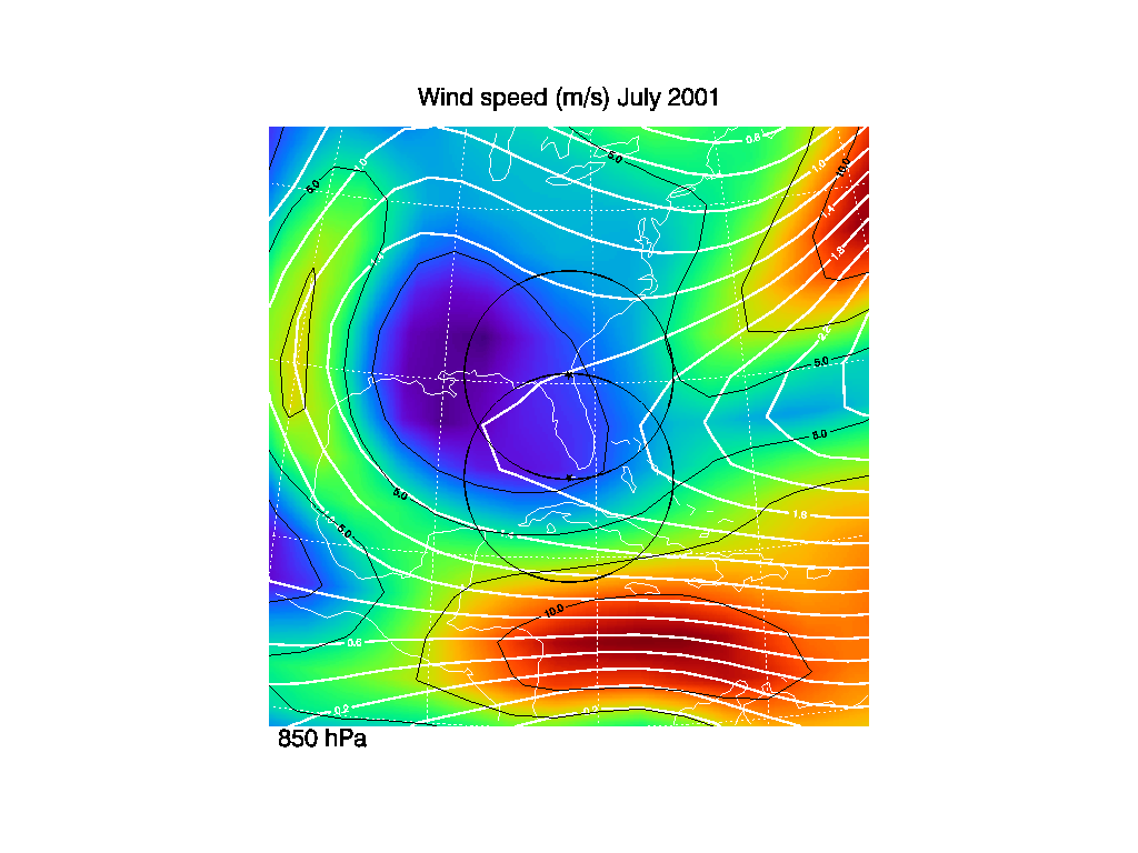
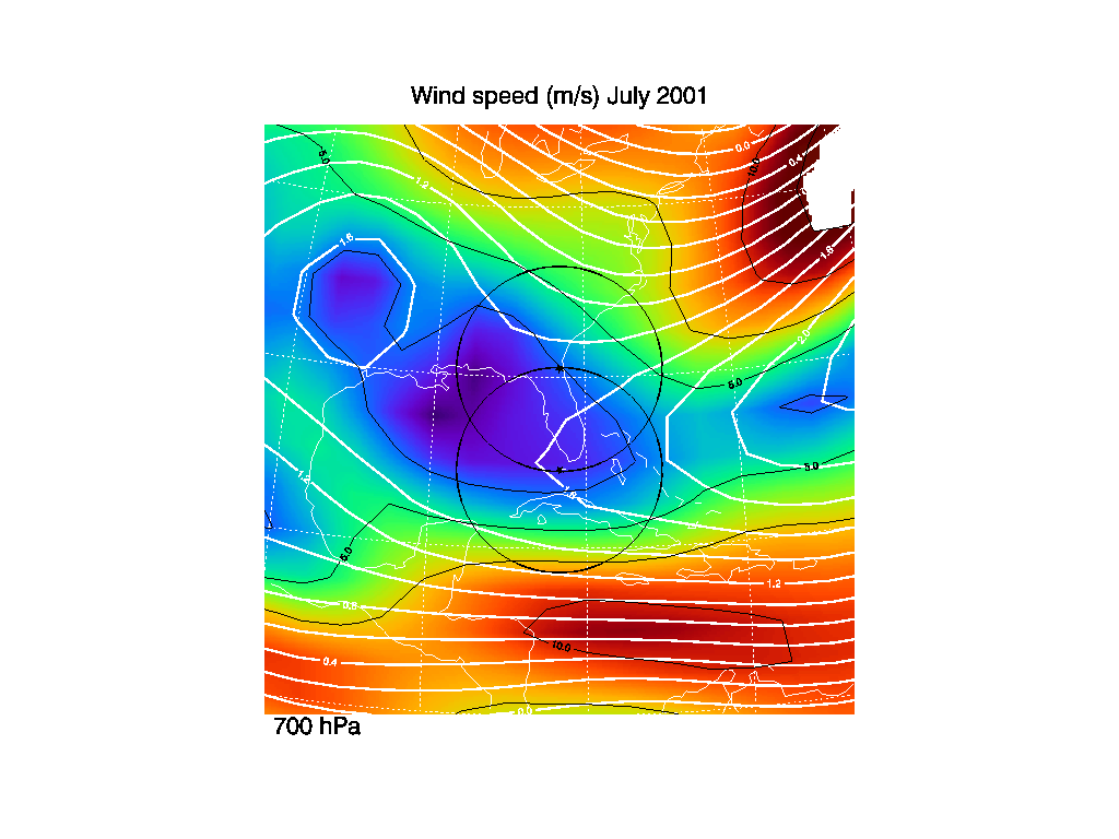
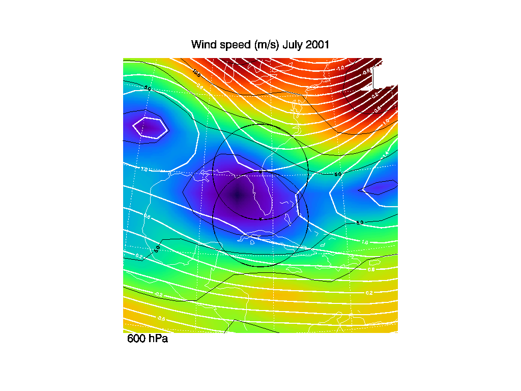
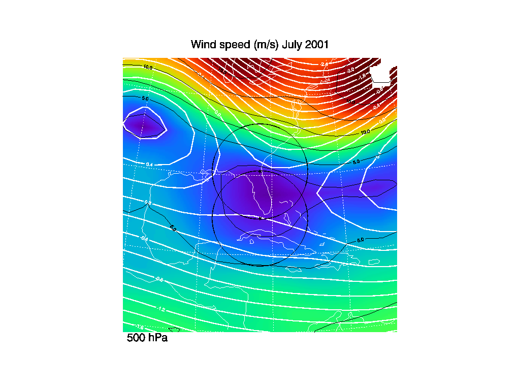
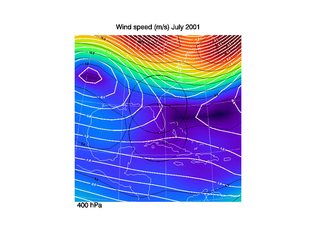
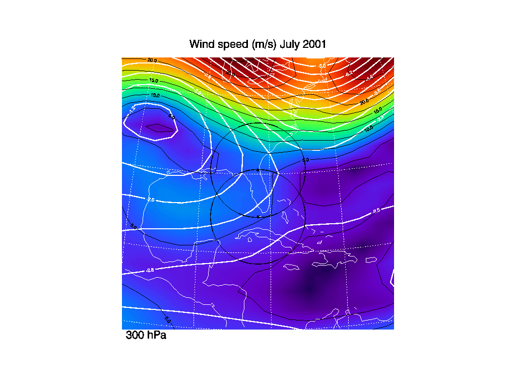
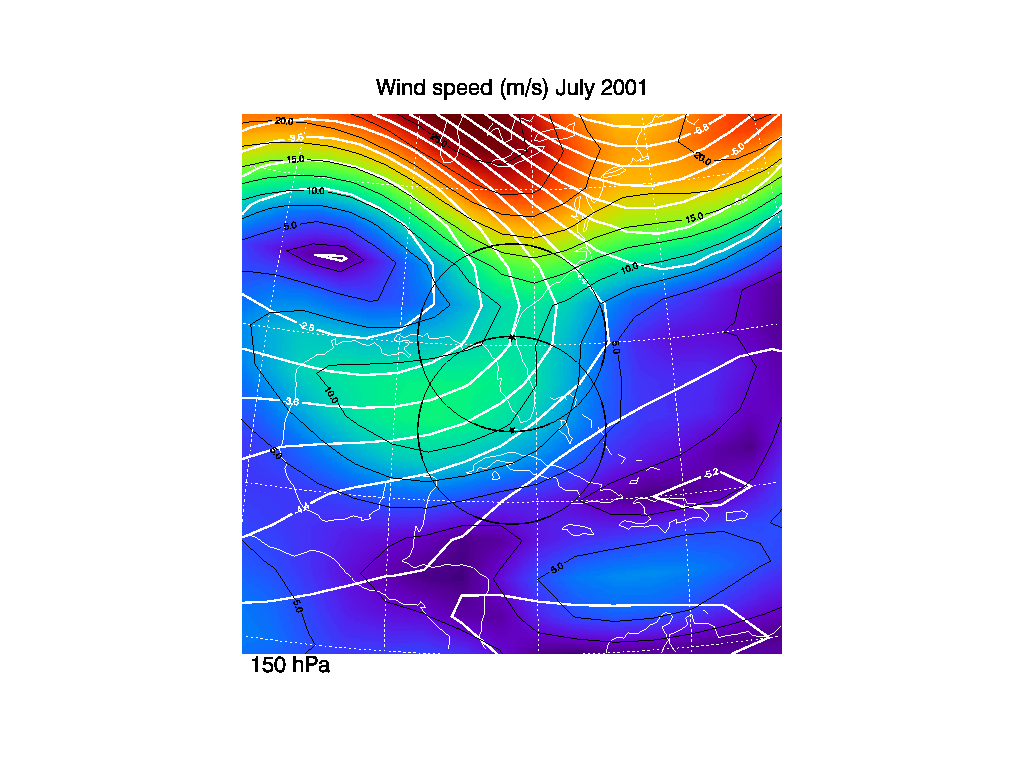
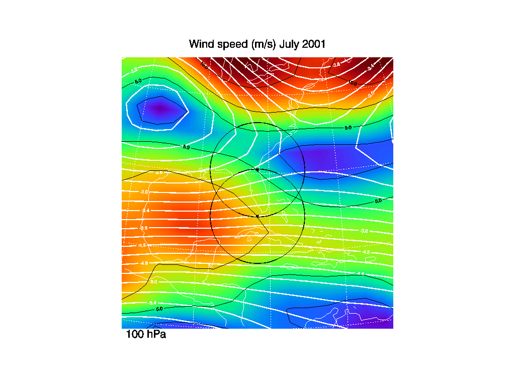
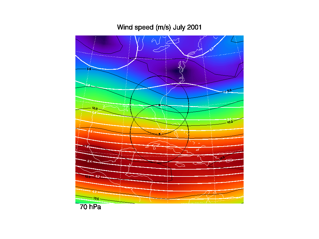
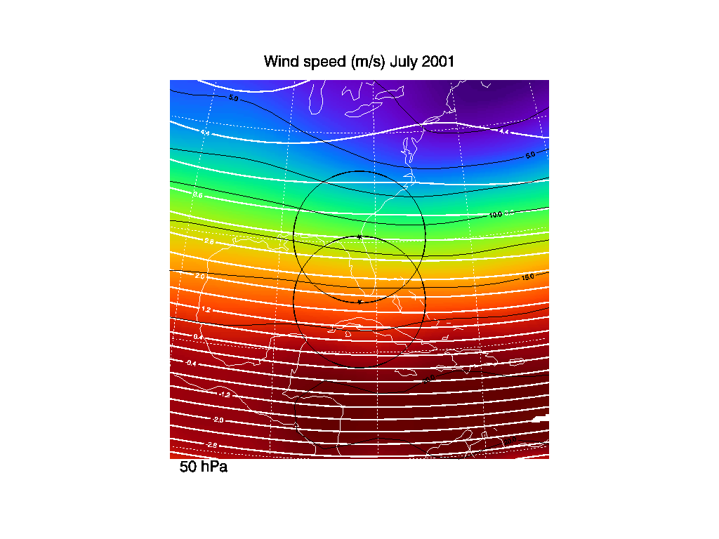
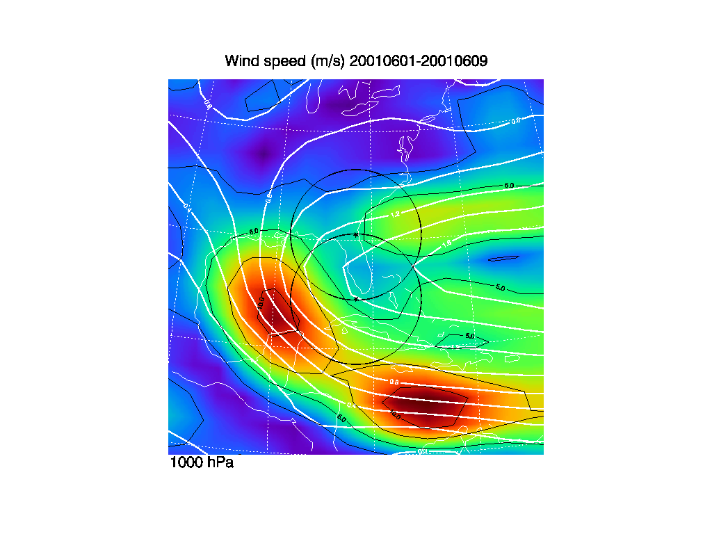
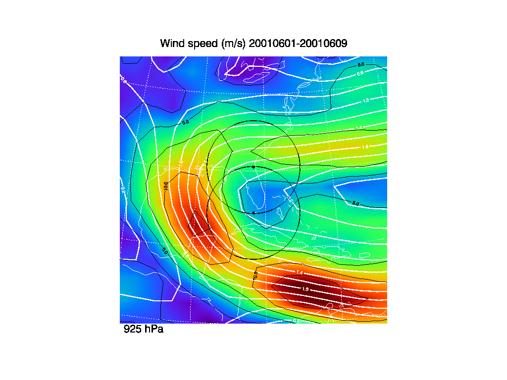
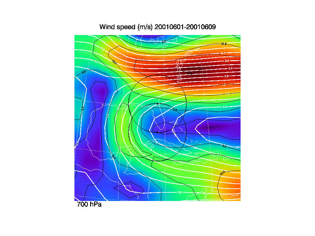
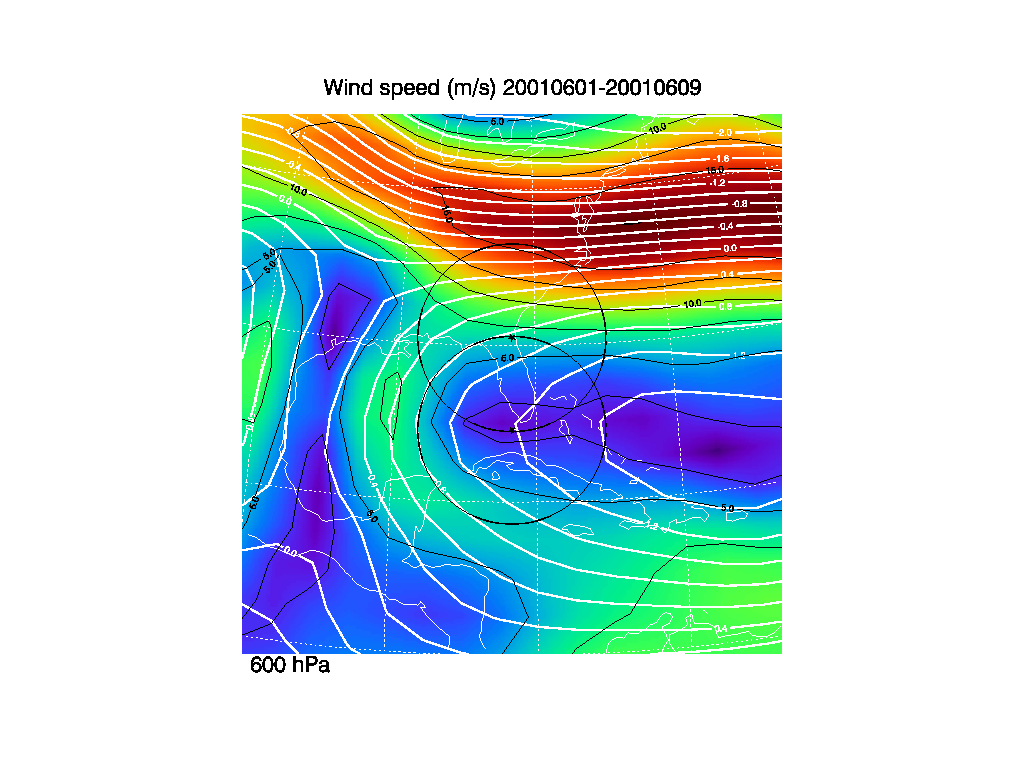
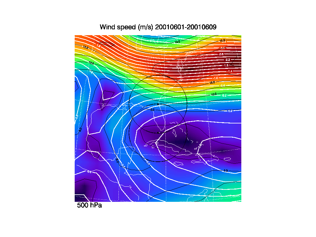
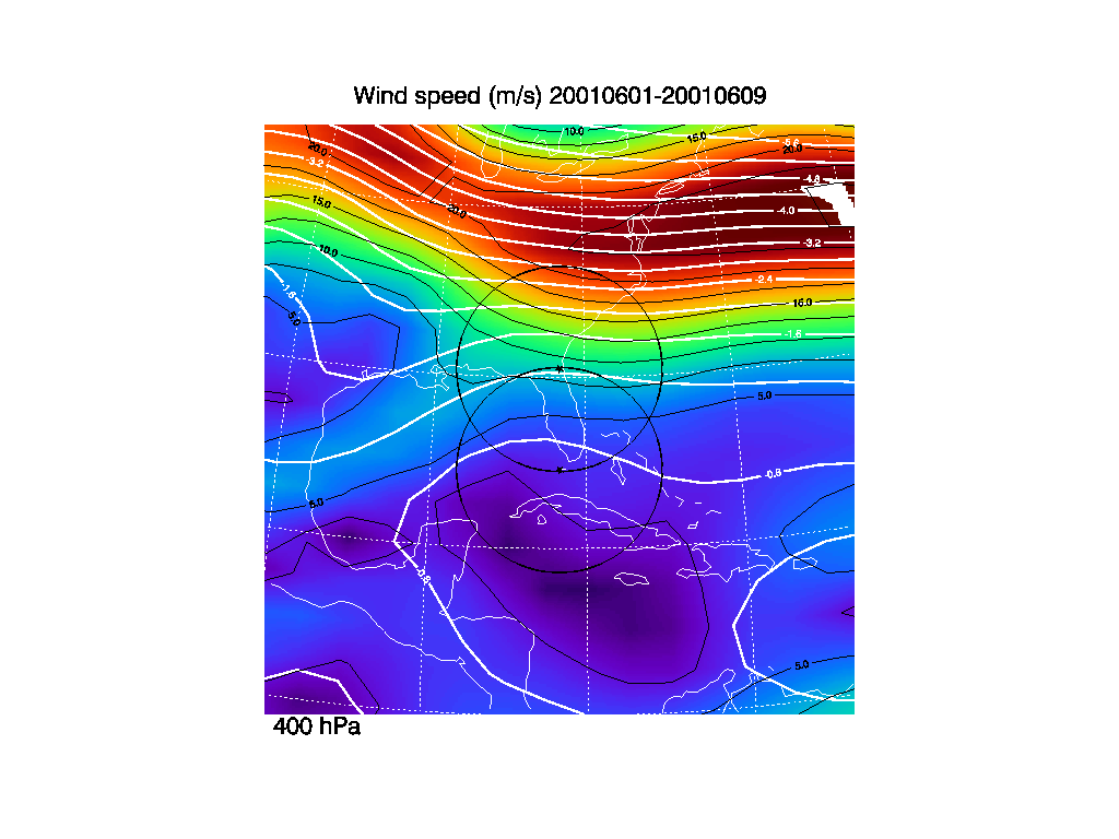
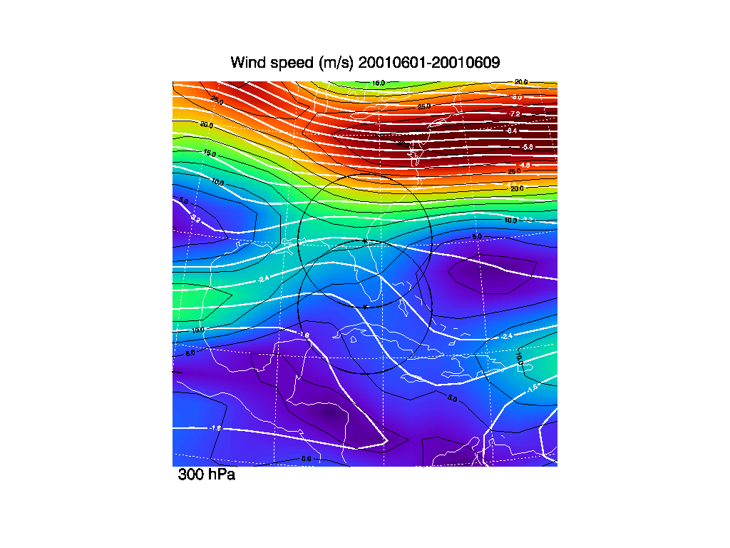
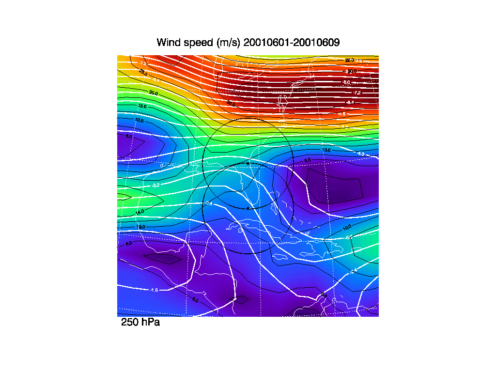
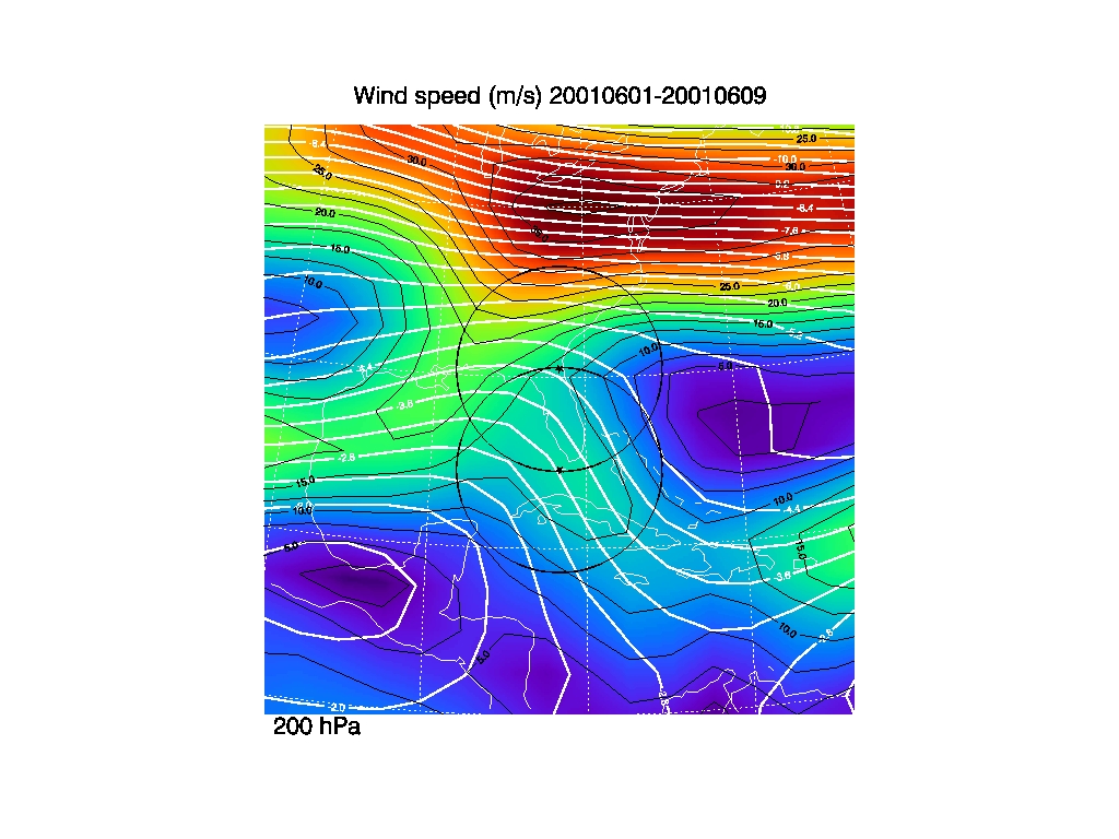
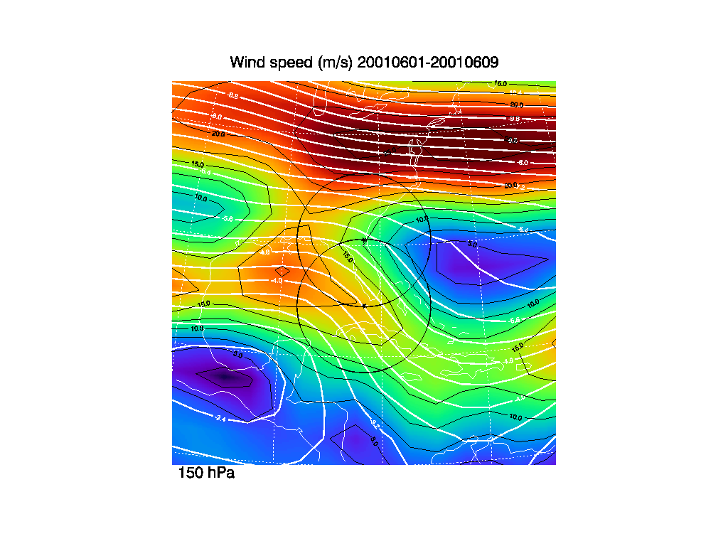
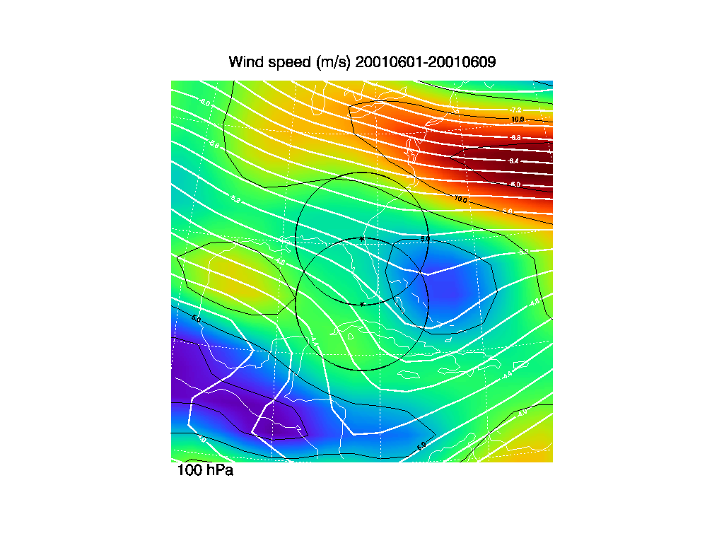
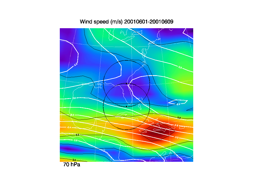
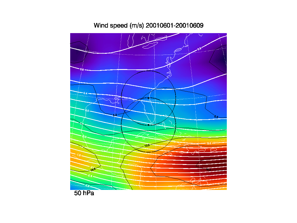
2. Total wind averages
These total wind time averages (color) are derived from the NCEP/NCAR
reanalysis data from 1979-2000. The total wind is derived by averaging
the zonal and meridional winds for the 22 year period, and then Utotal
= sqrt(u^2+v^2). Contours are indicated for every 2.5 m/s (black
lines). The thick solid white lines are the stream lines derived from
the zonal and meridional wind averages. The stream line values have
been normalized by dividing by the Earth's radius.
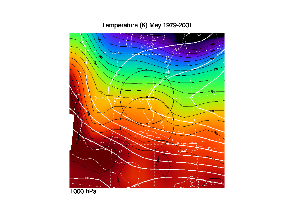
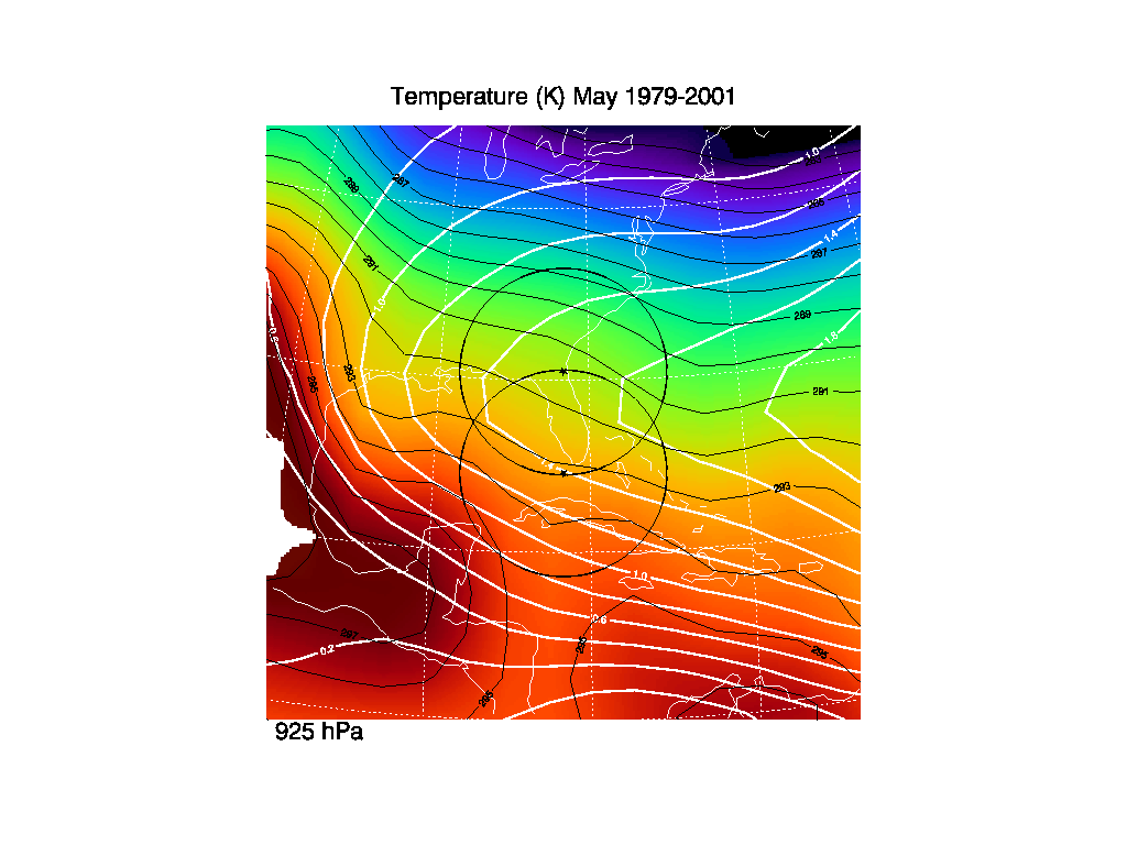
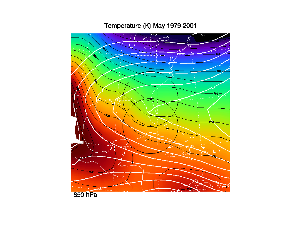
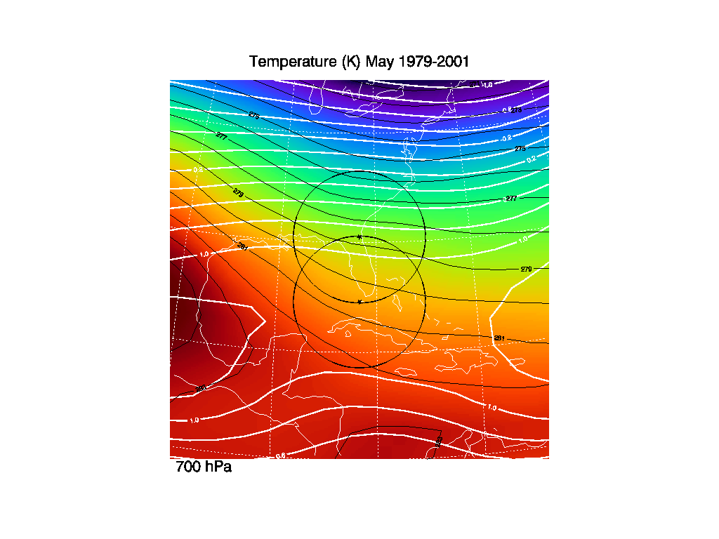
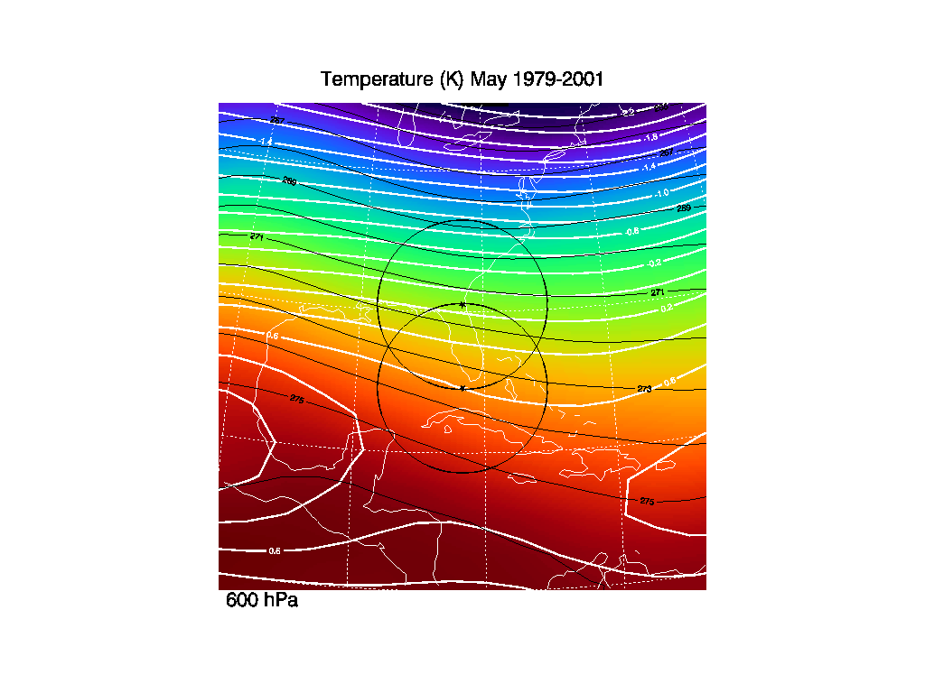
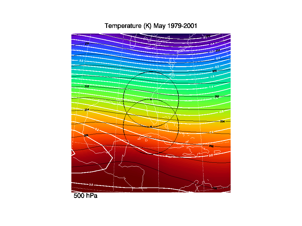
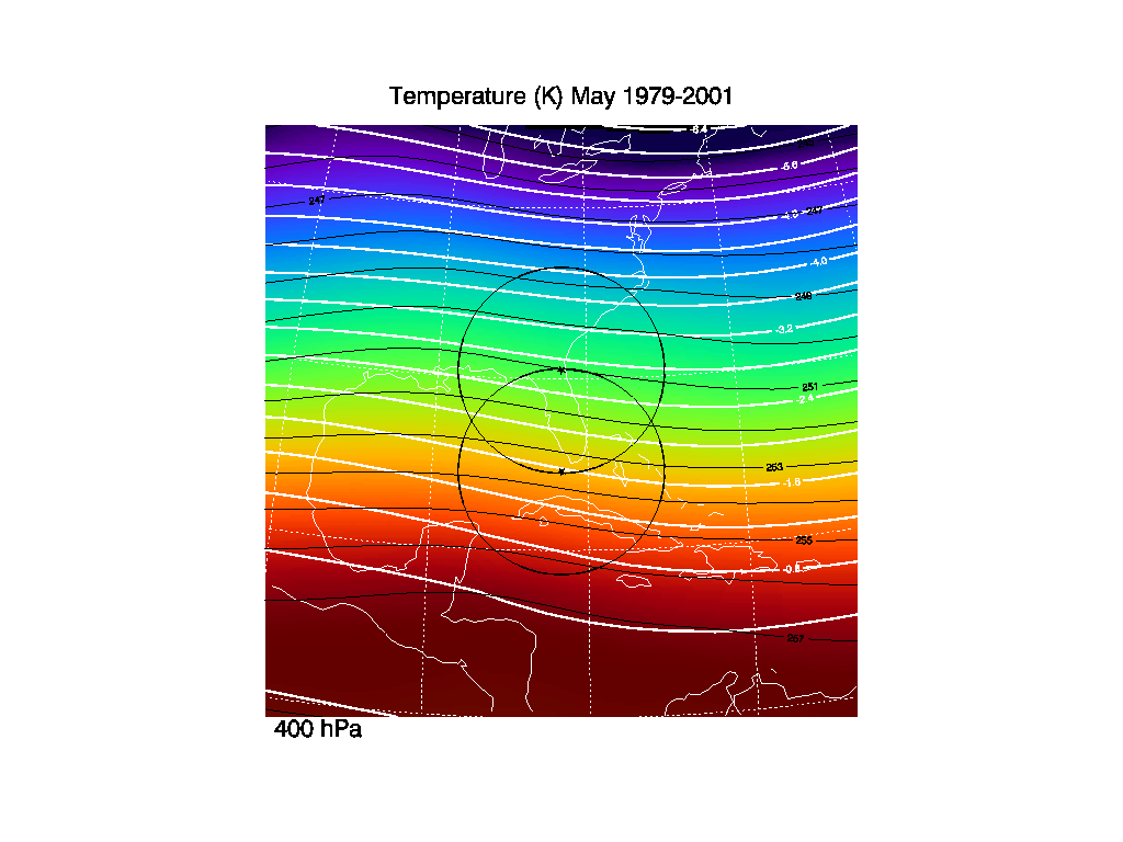
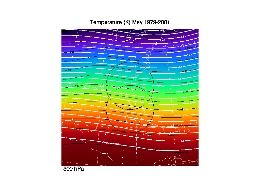
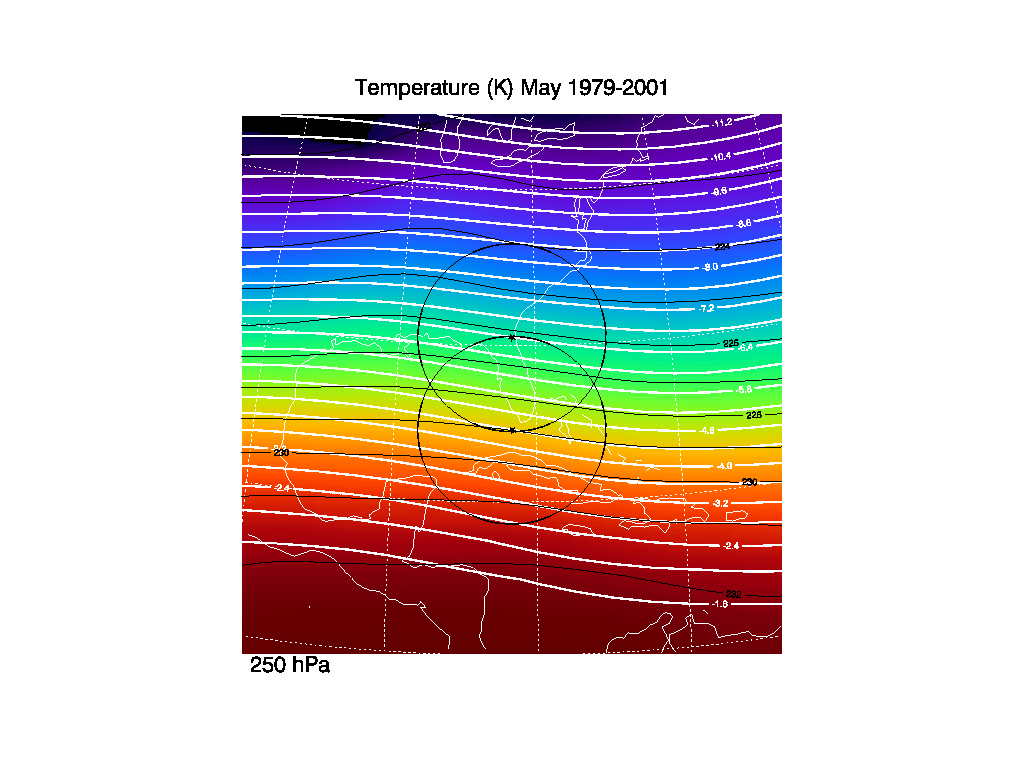
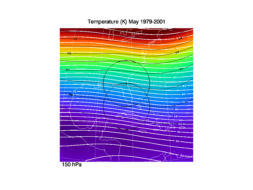
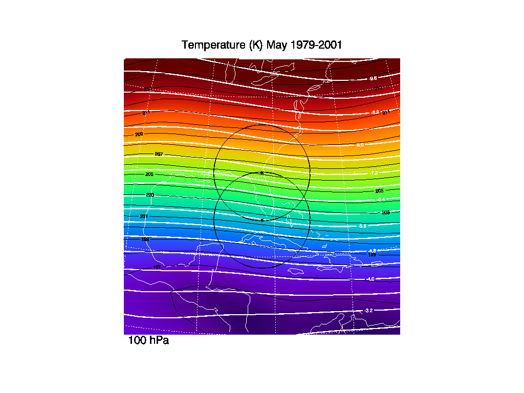
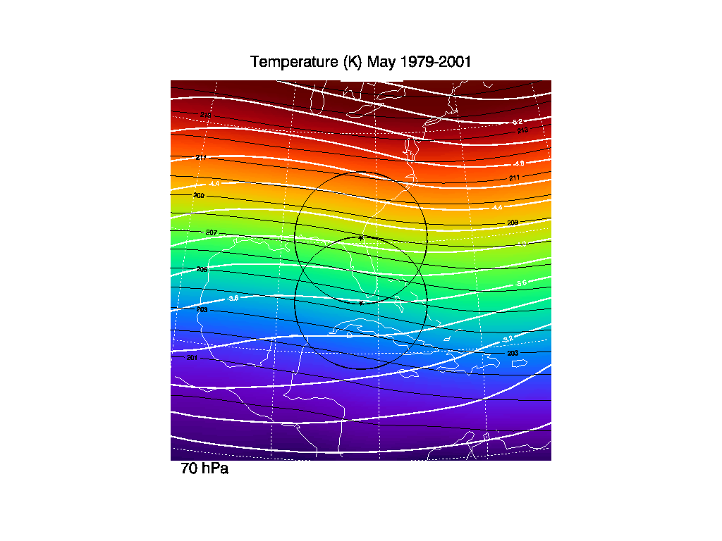
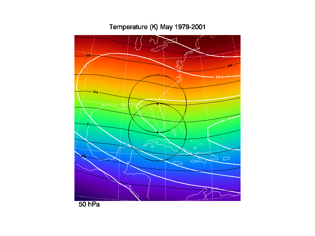
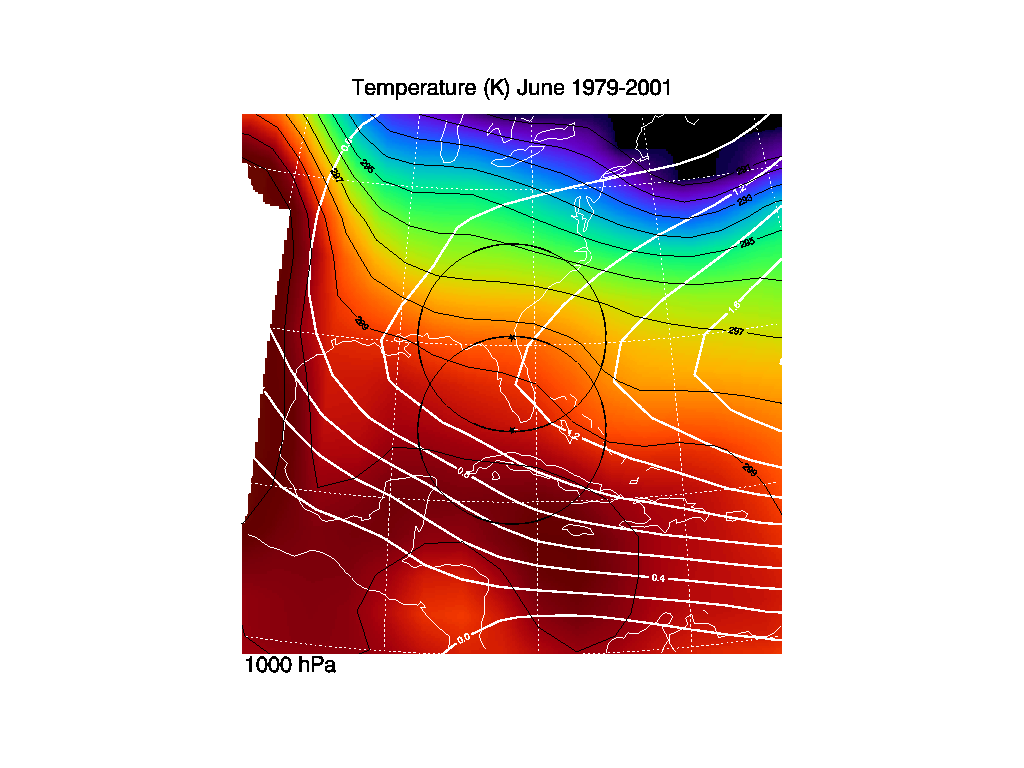
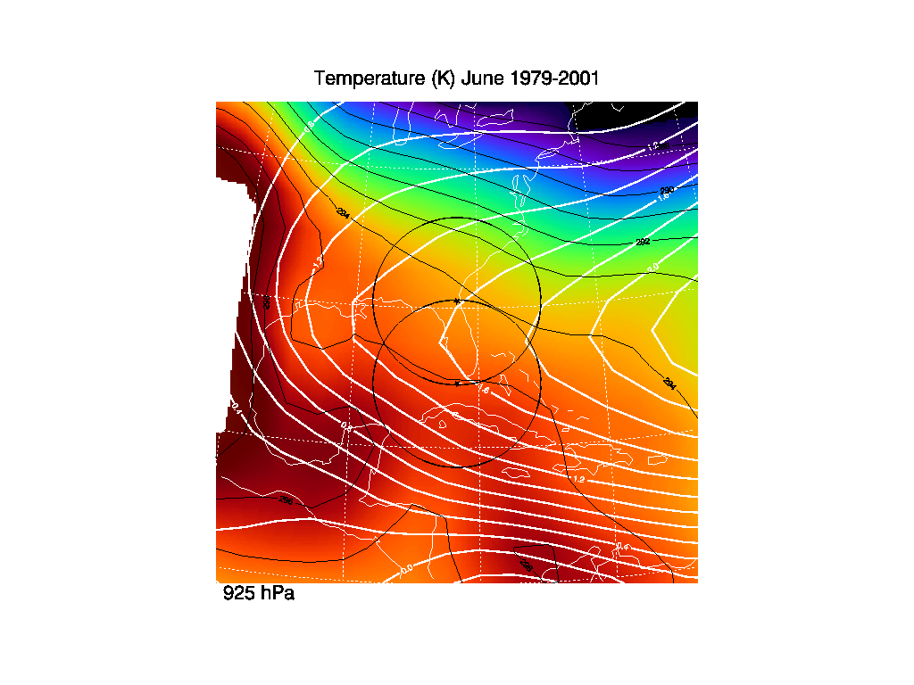
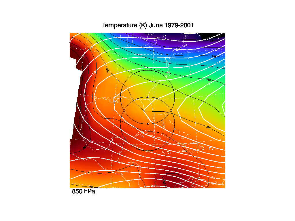
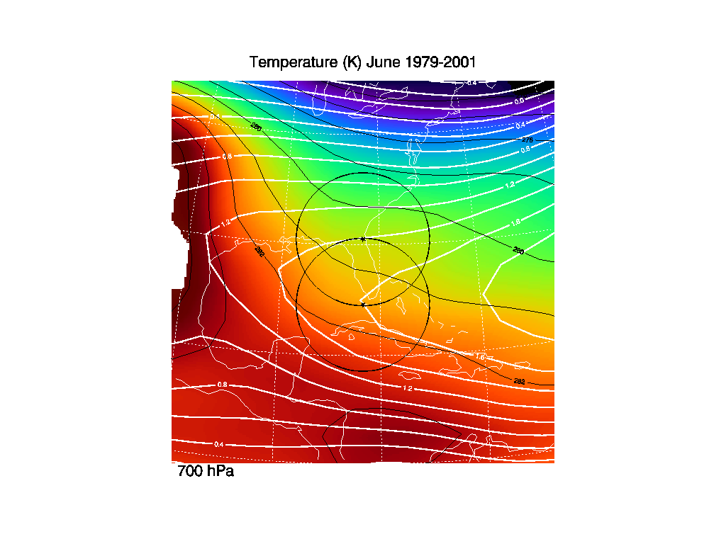
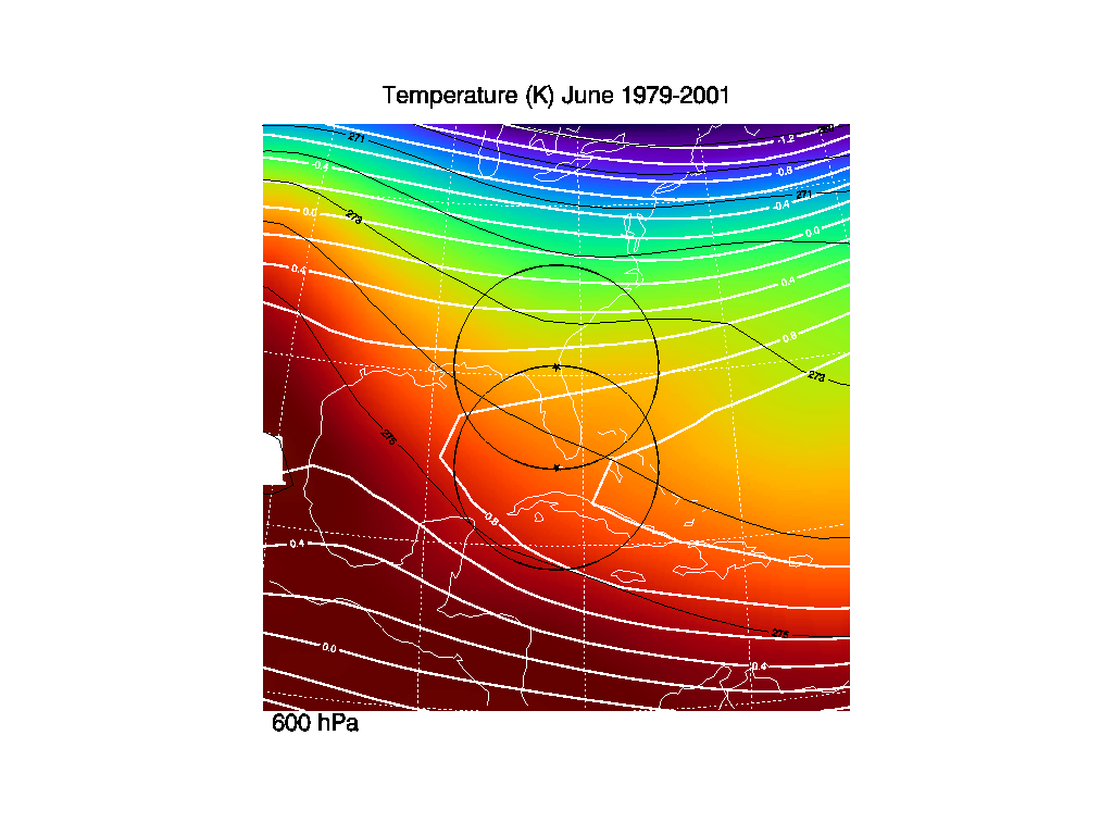
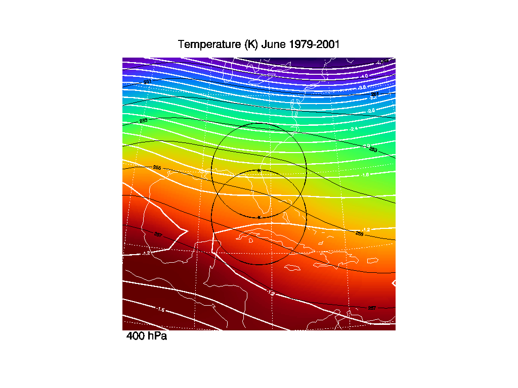
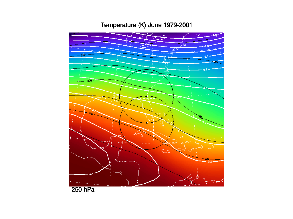
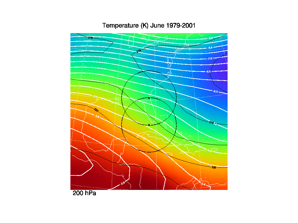
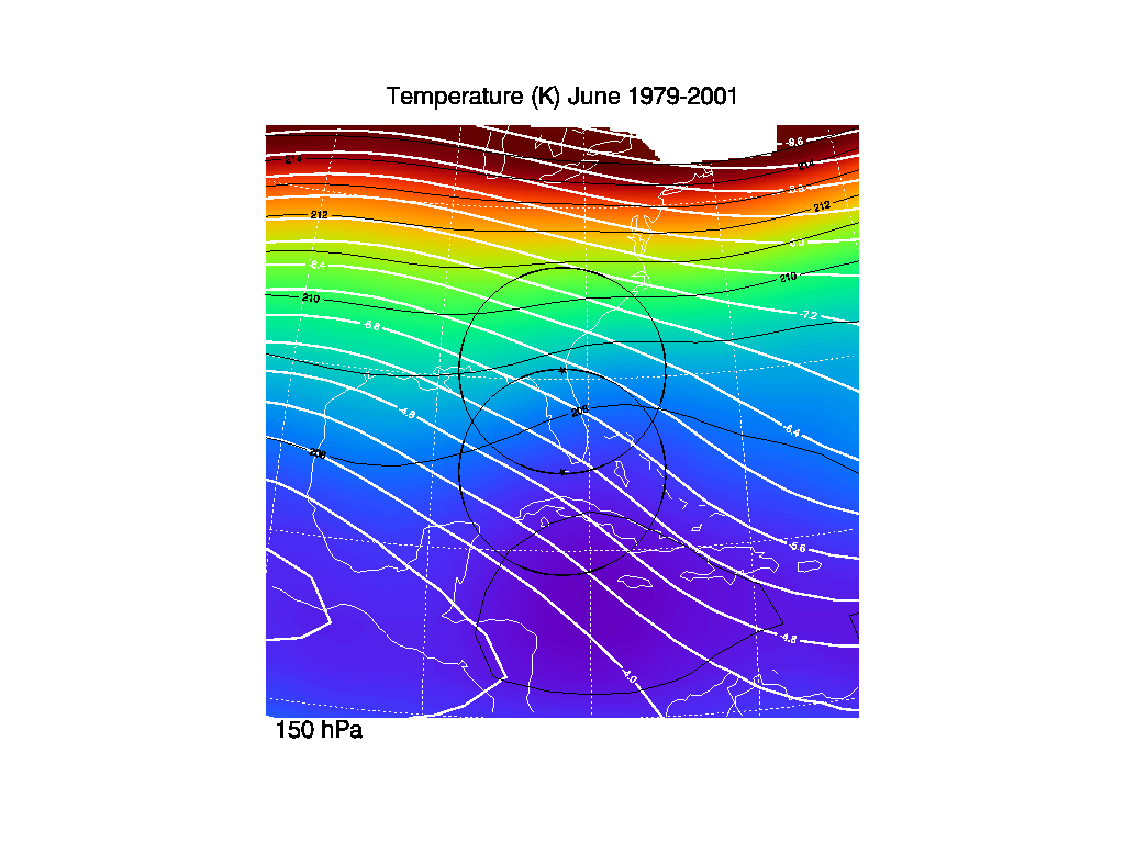
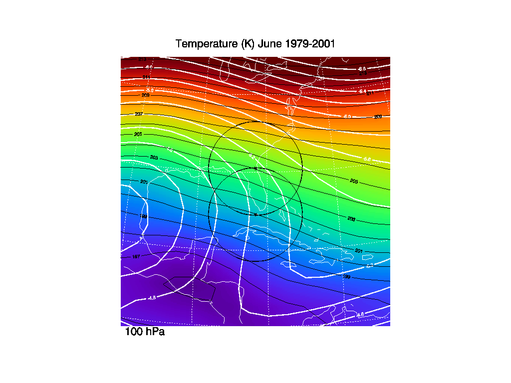
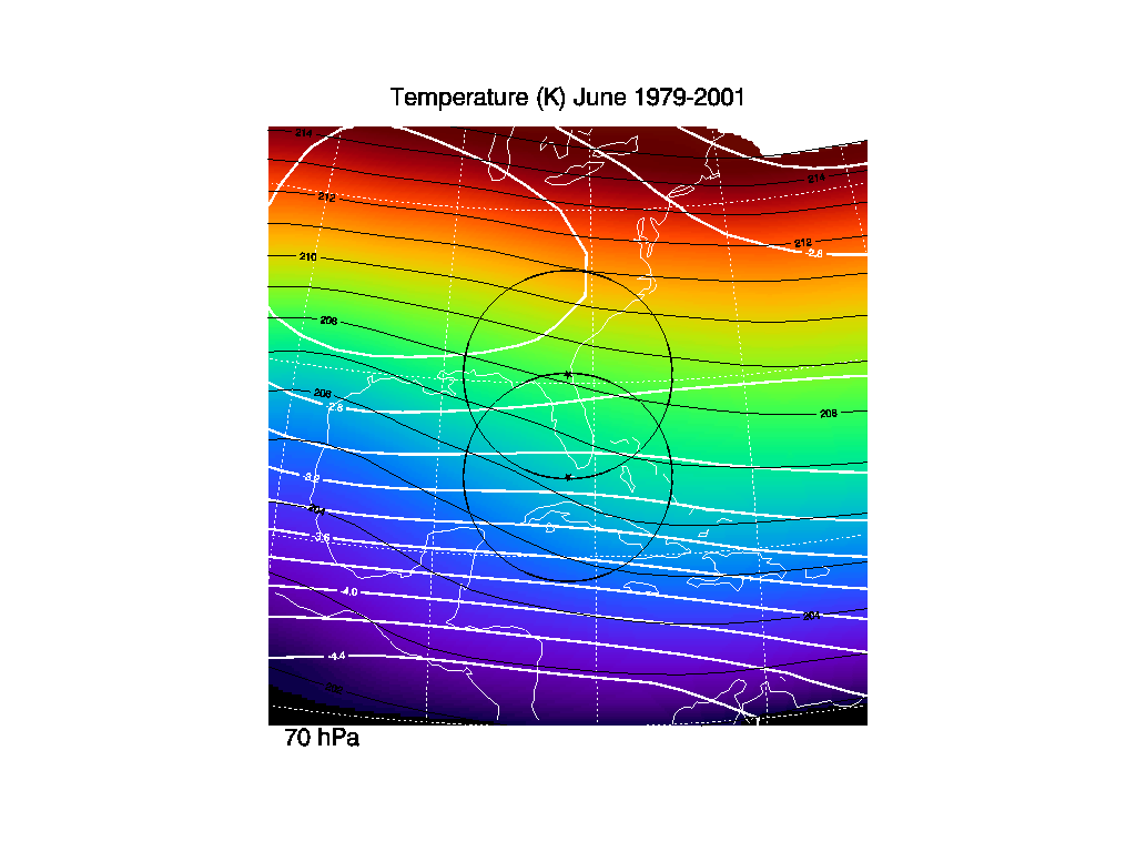
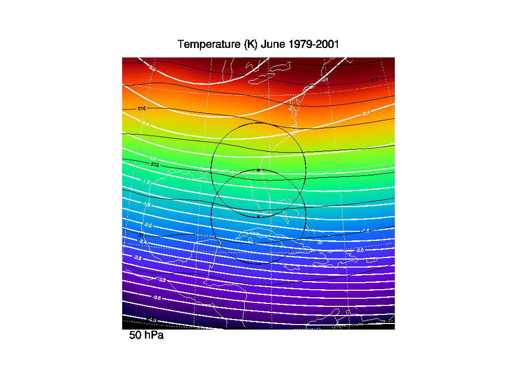
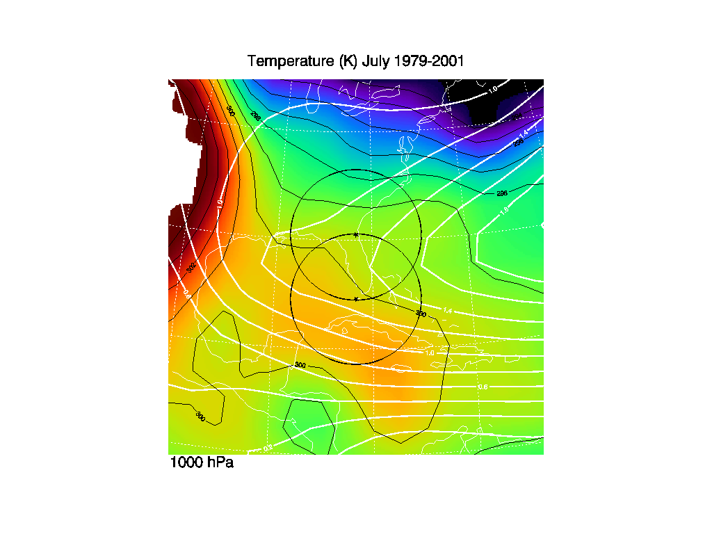
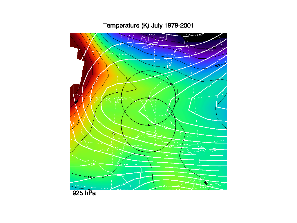
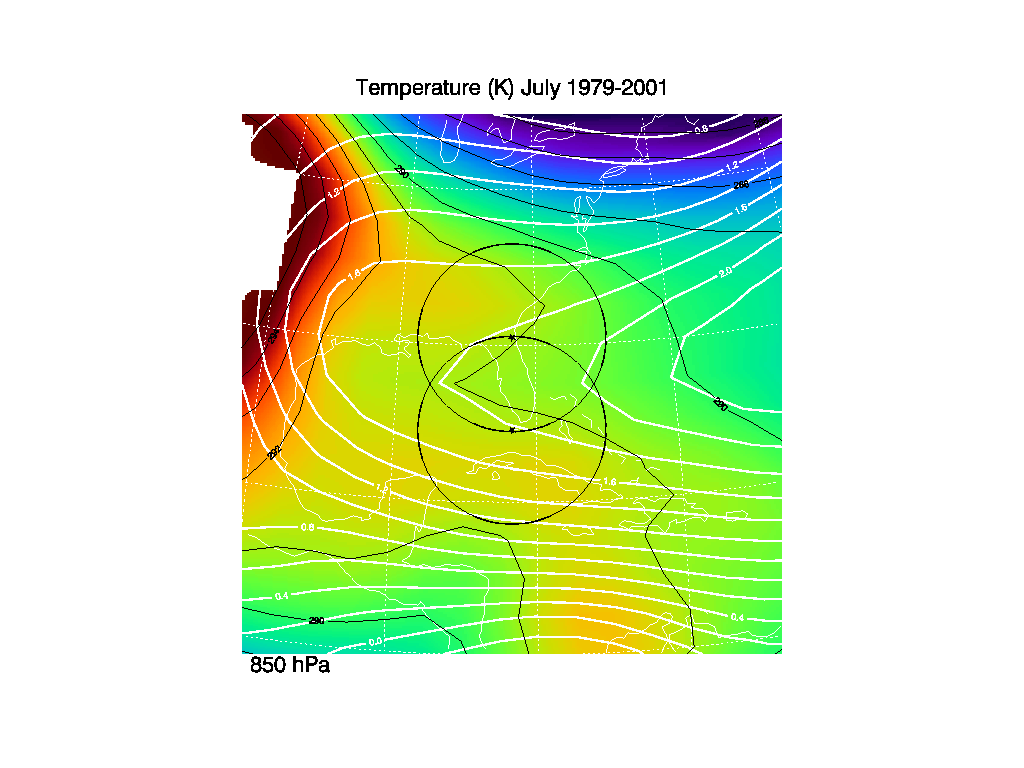
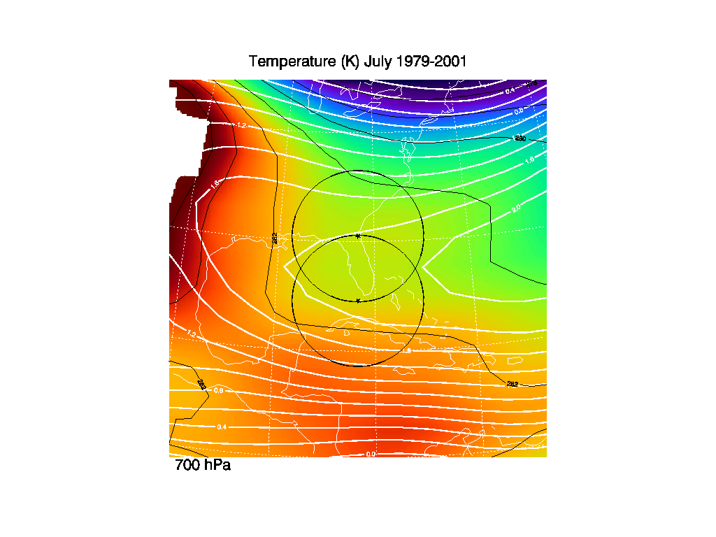
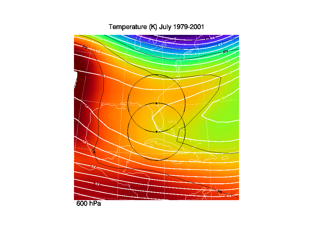
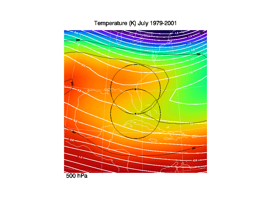
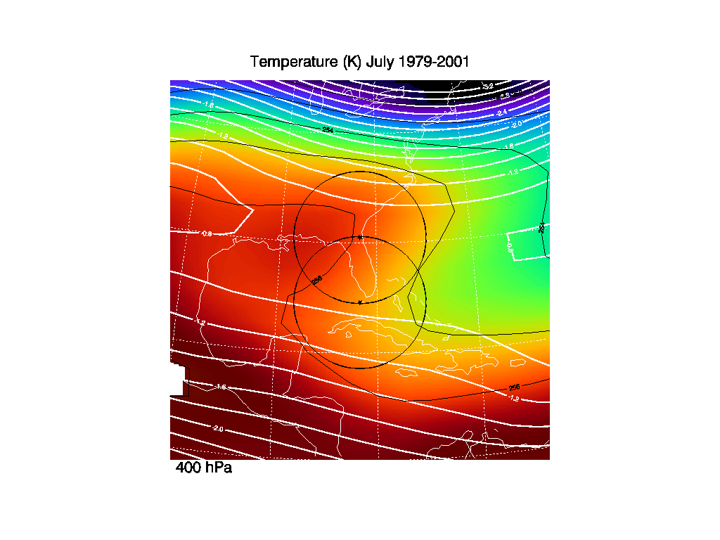
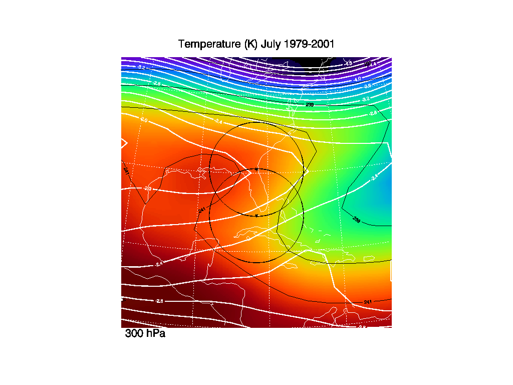
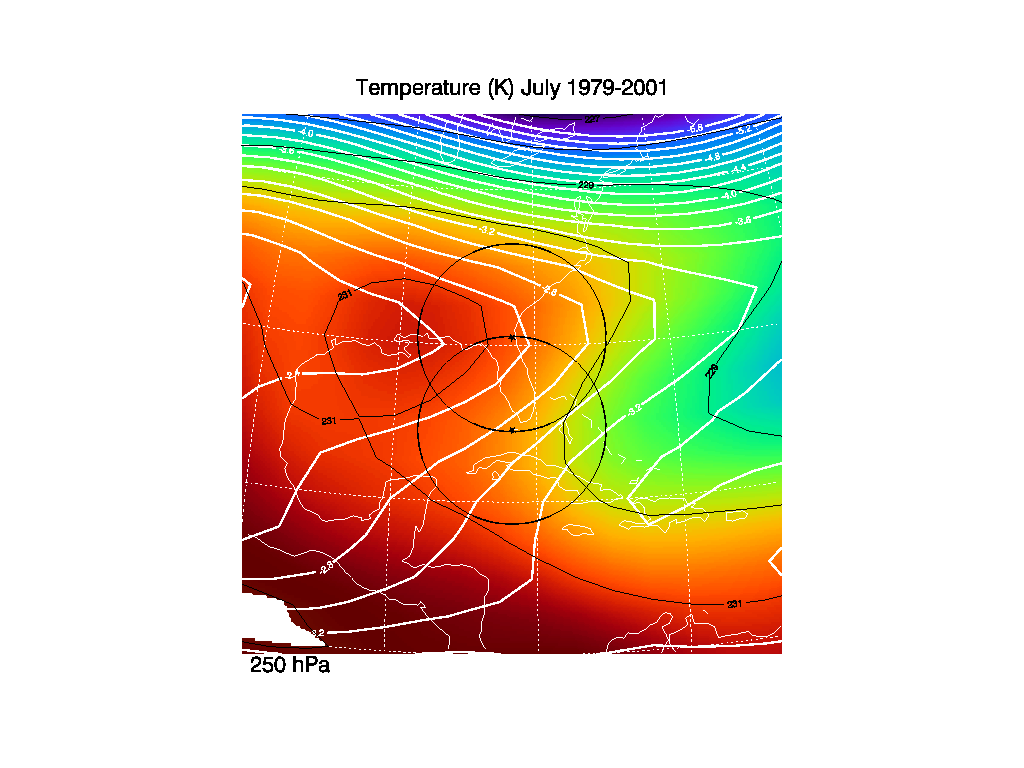
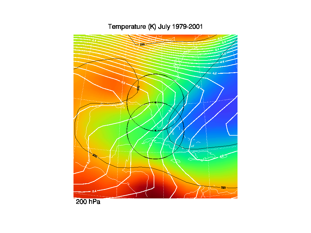
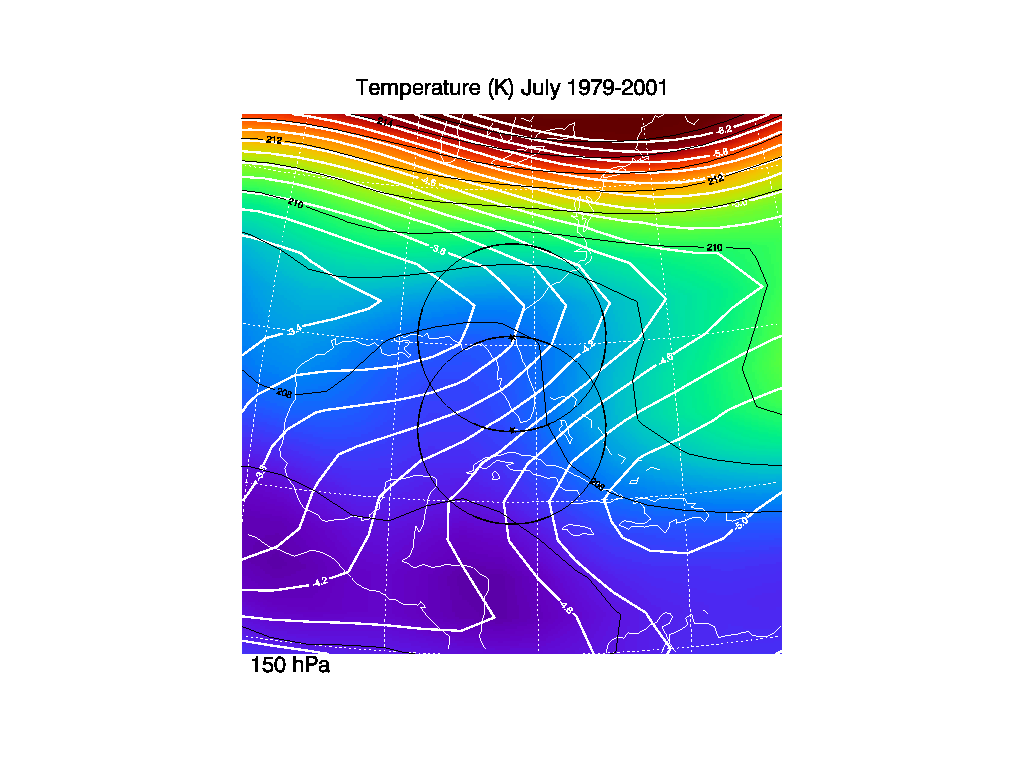
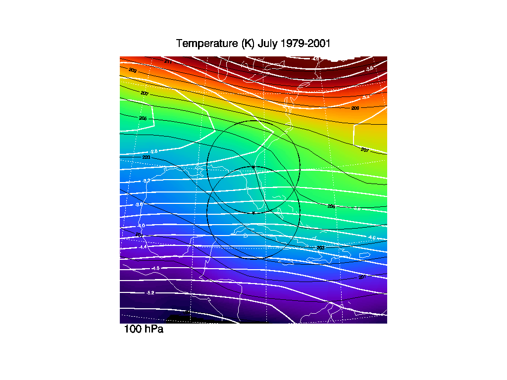
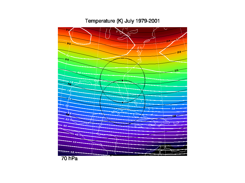
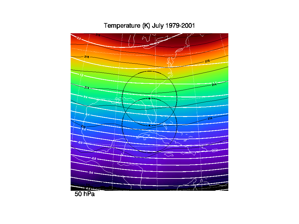
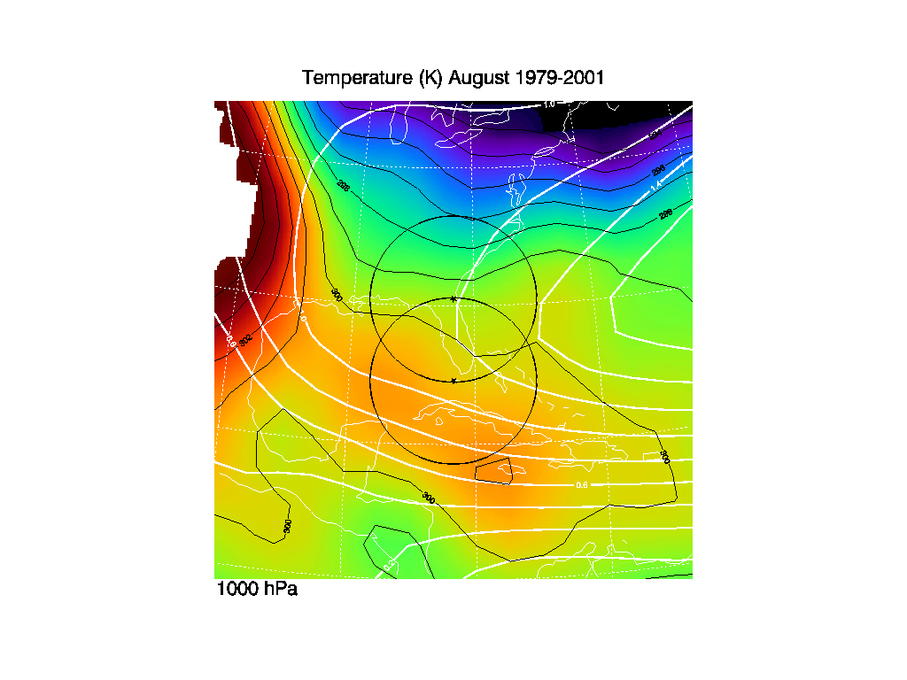
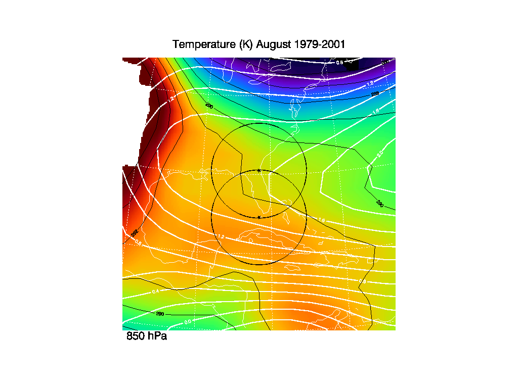
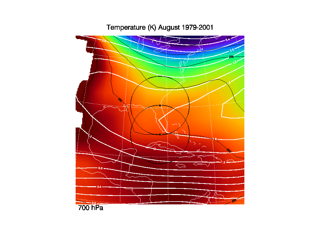
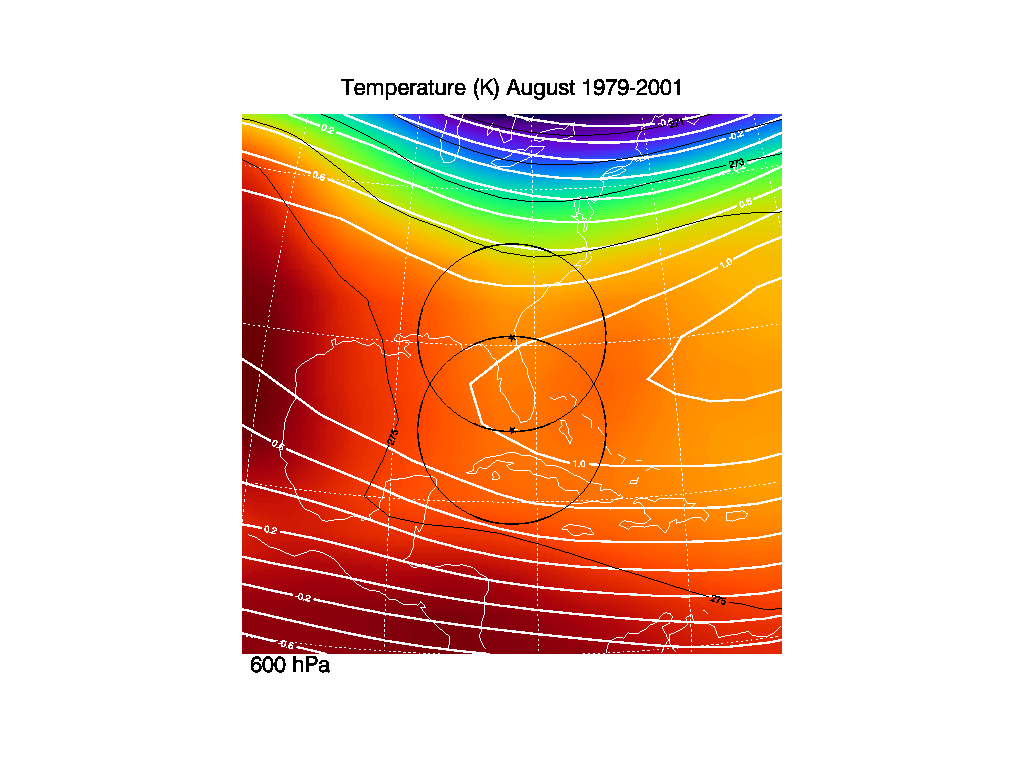
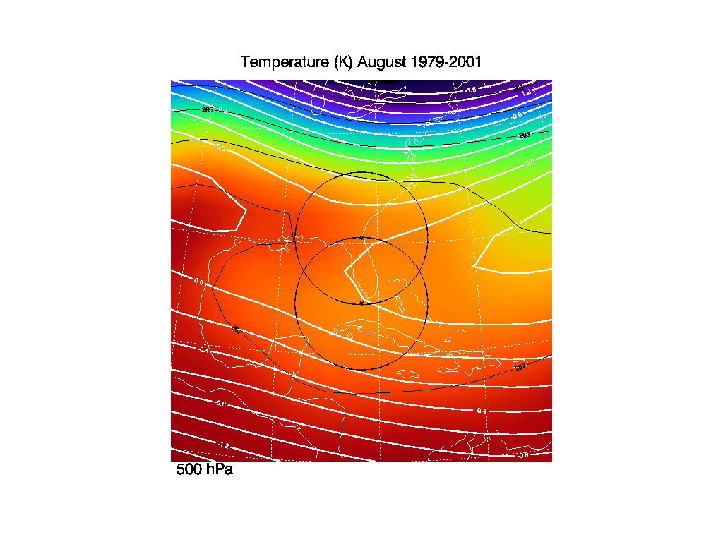
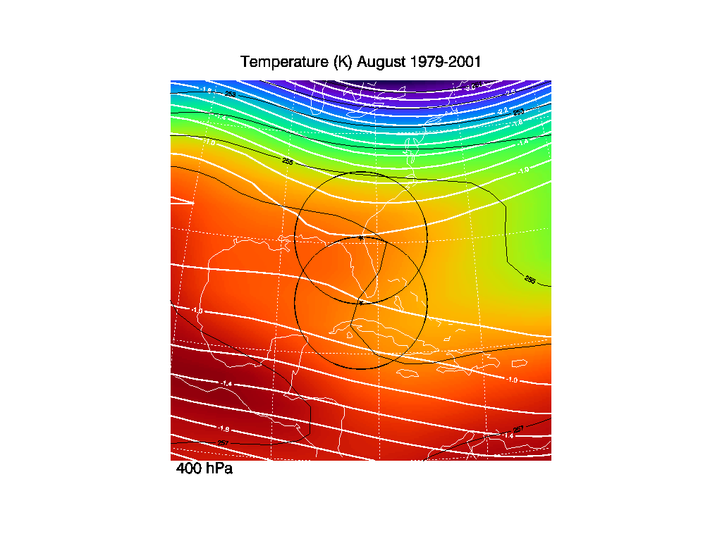
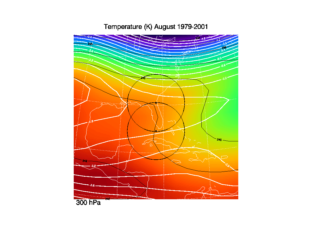
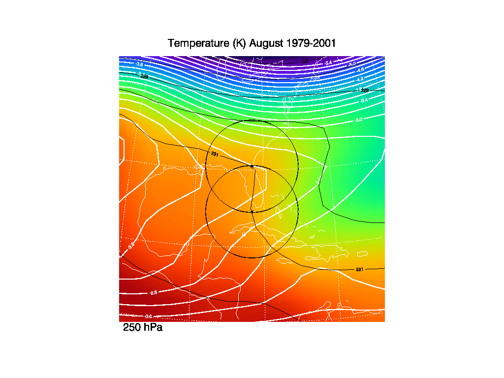
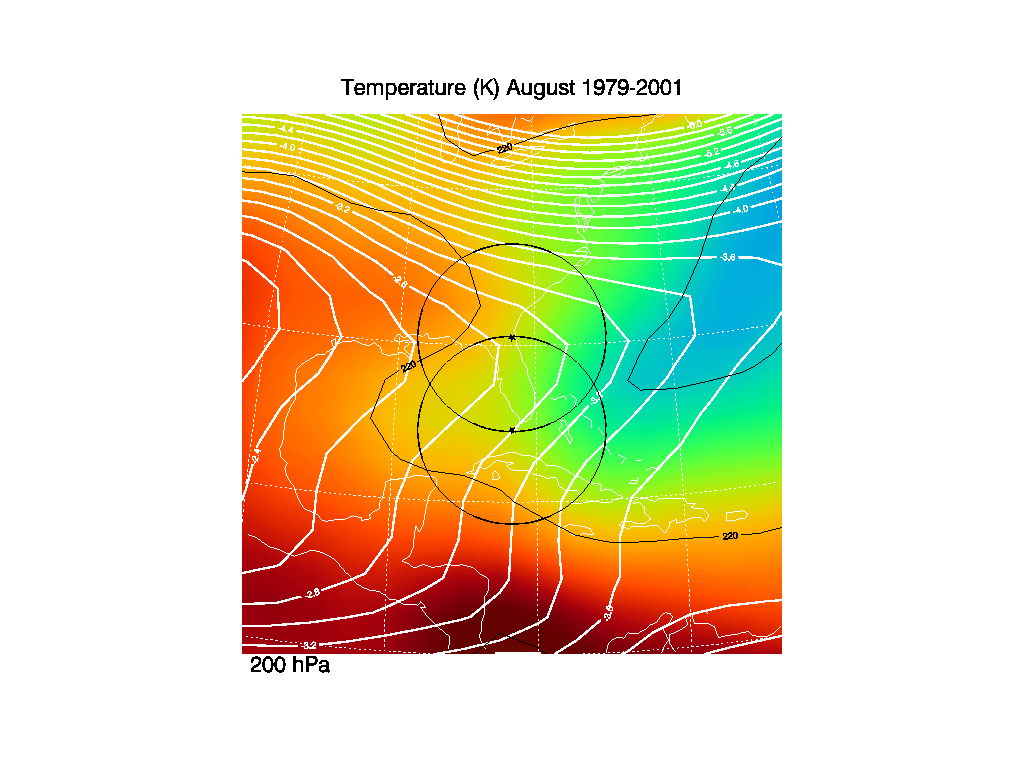
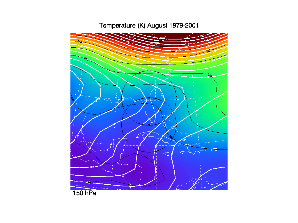
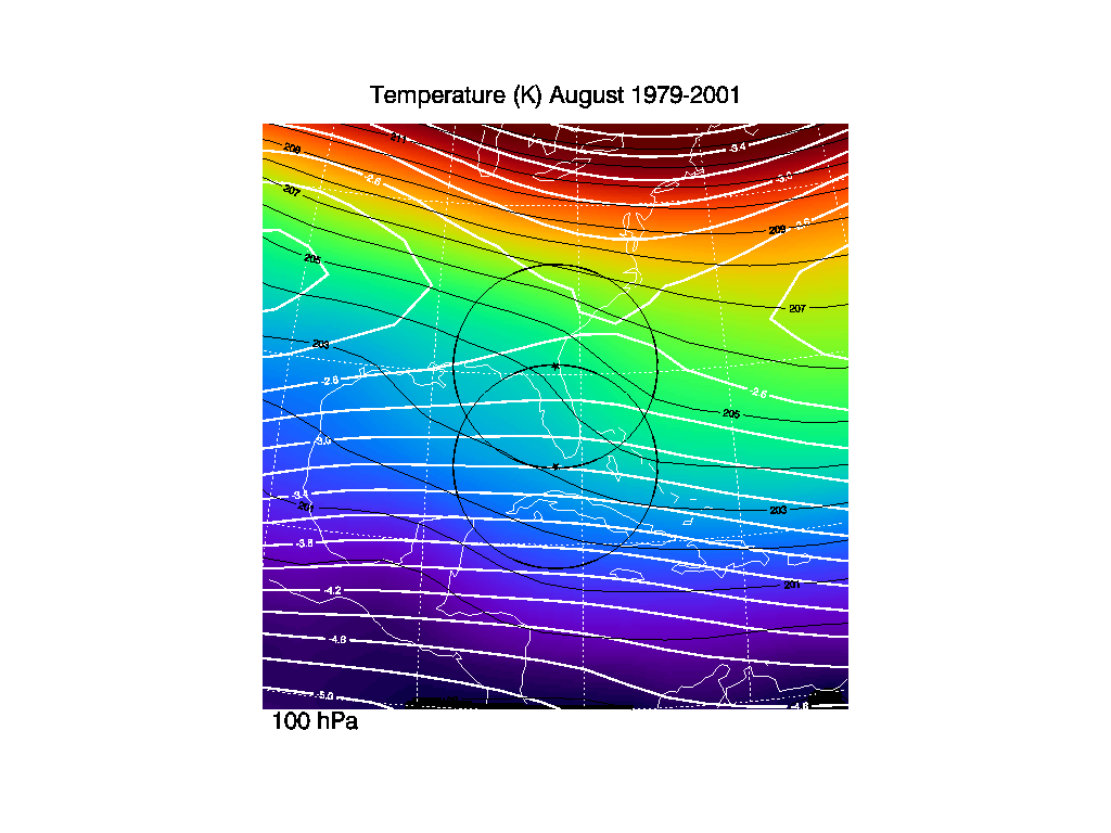
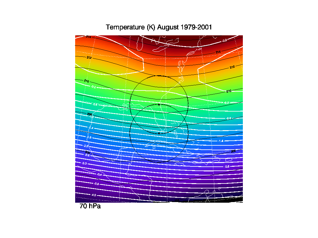
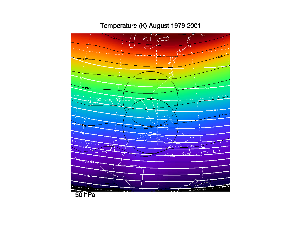
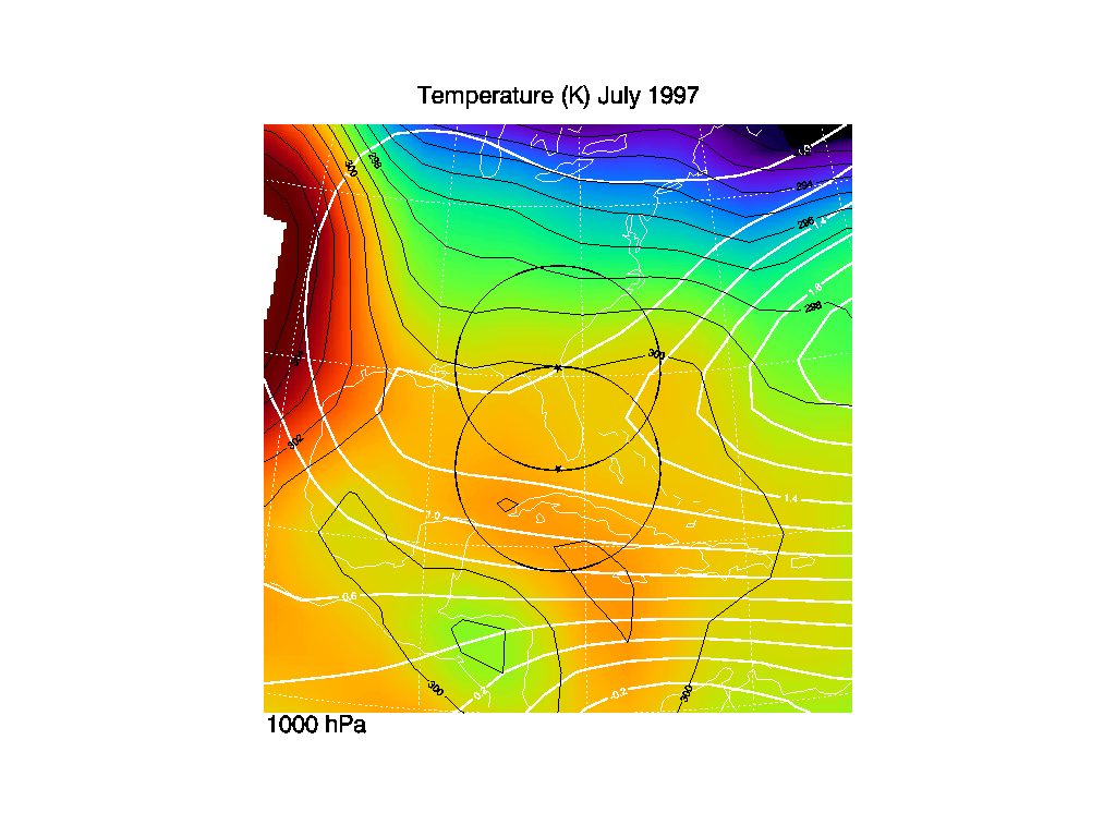
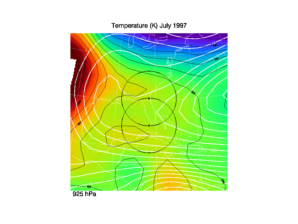
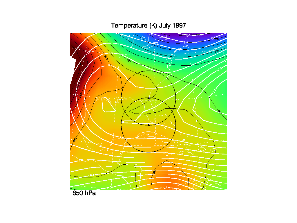
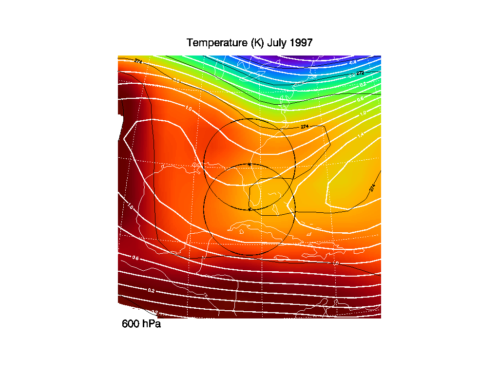
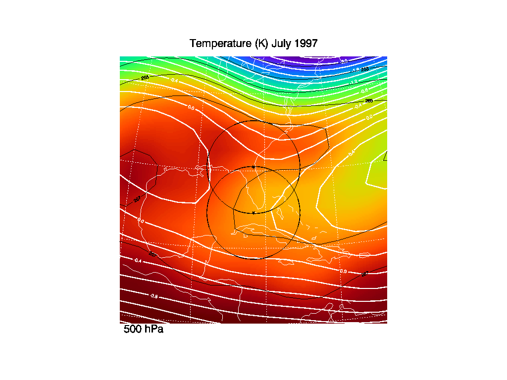
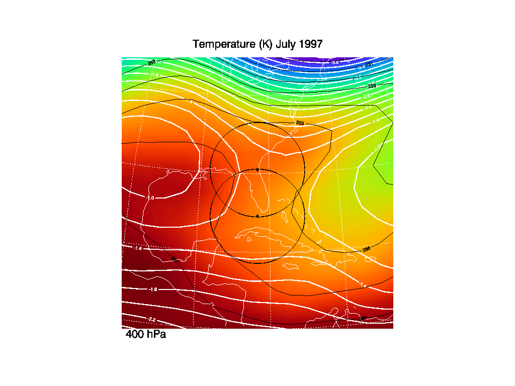
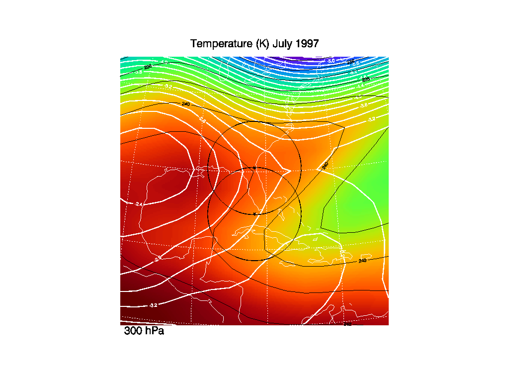
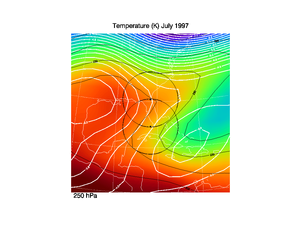
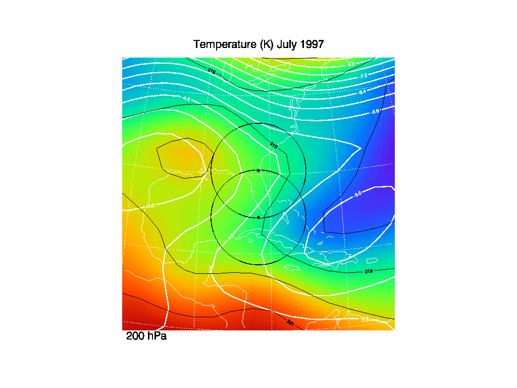
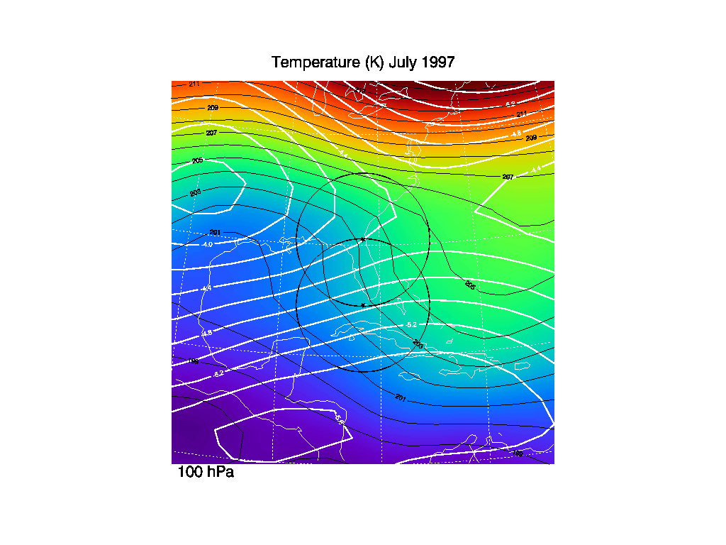
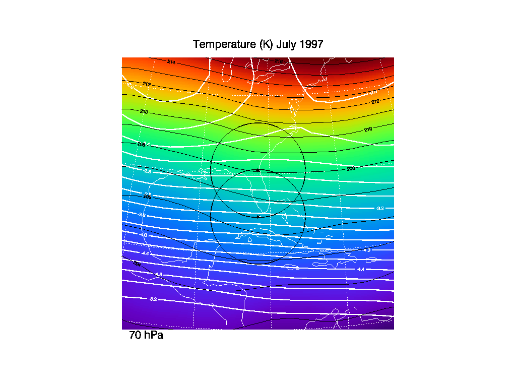
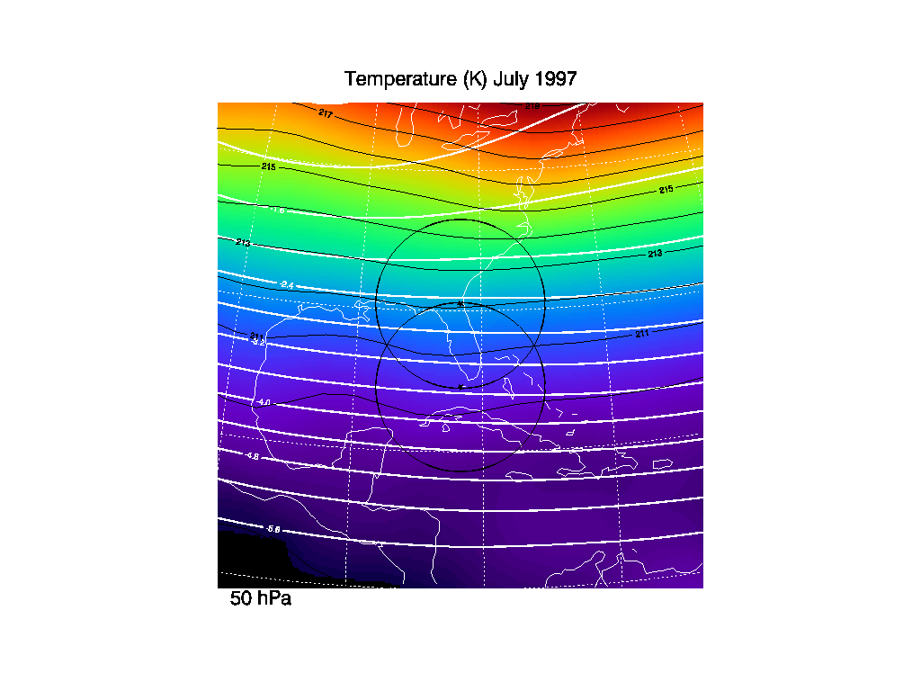
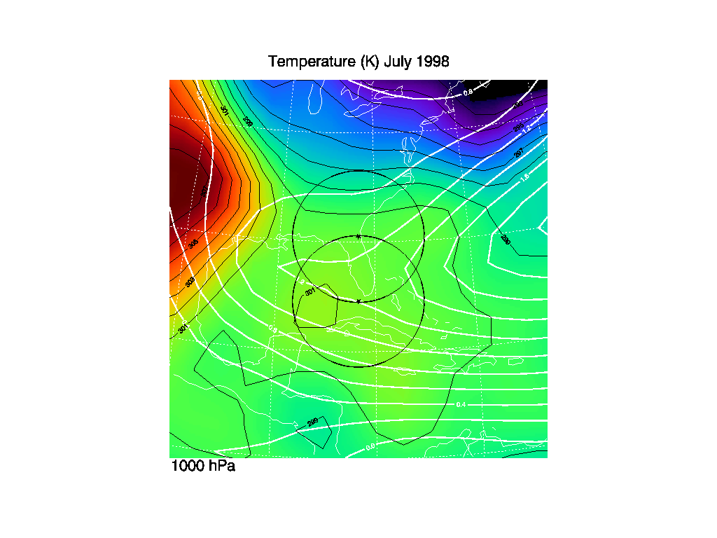
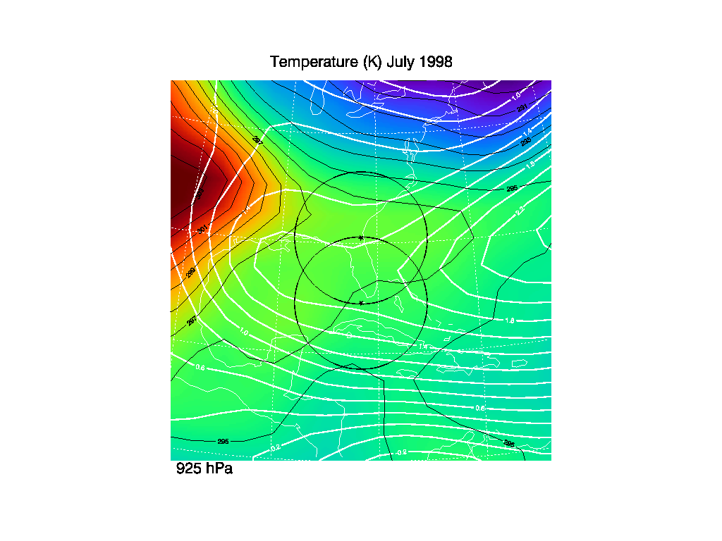
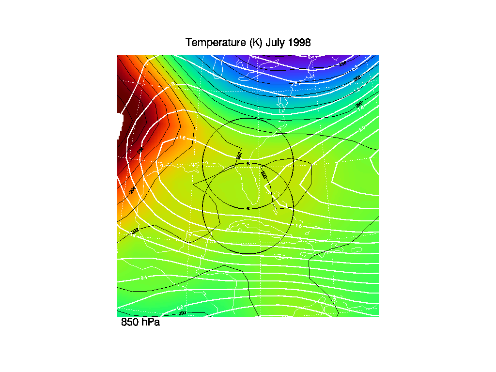
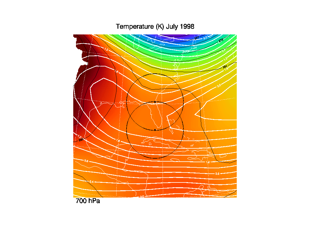
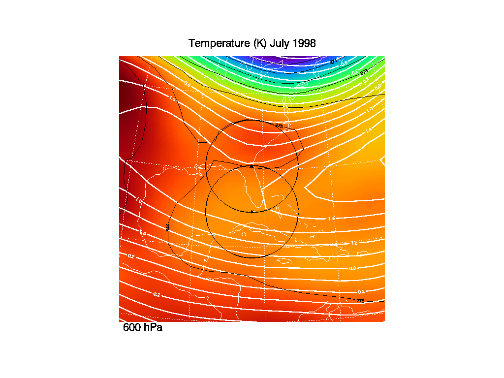
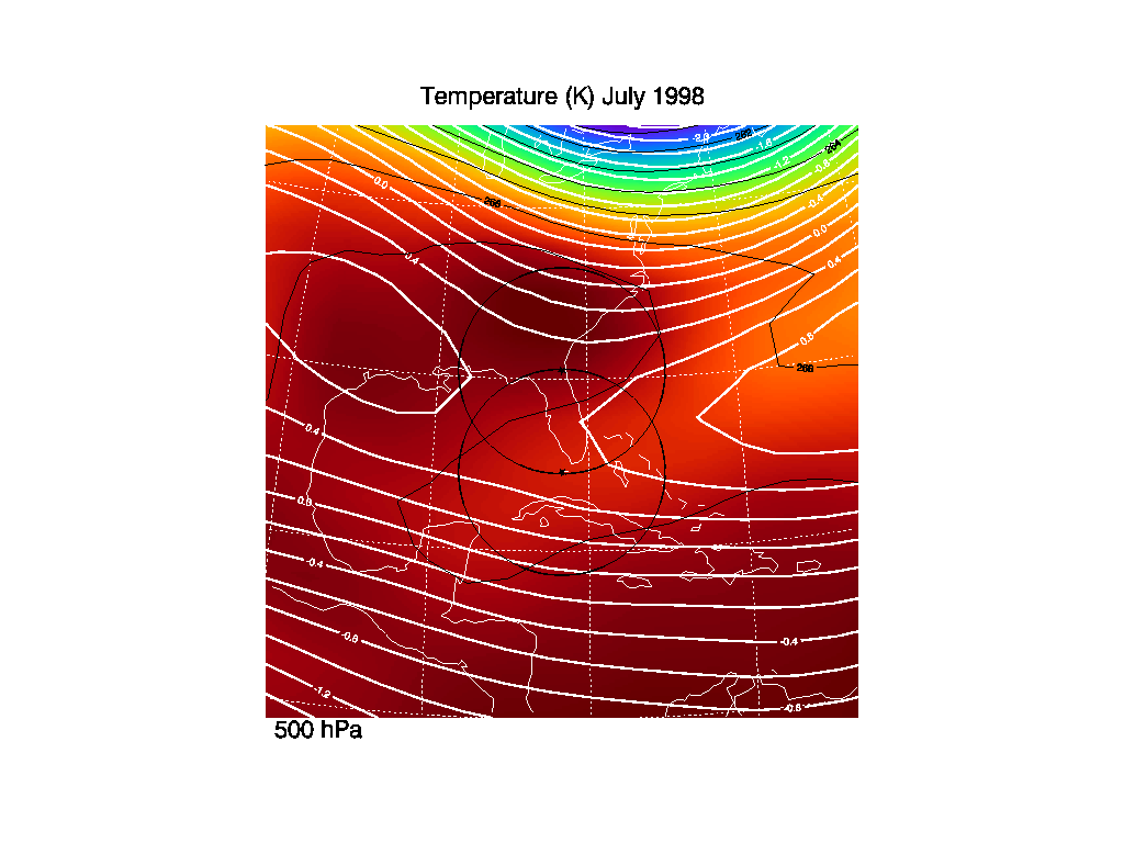
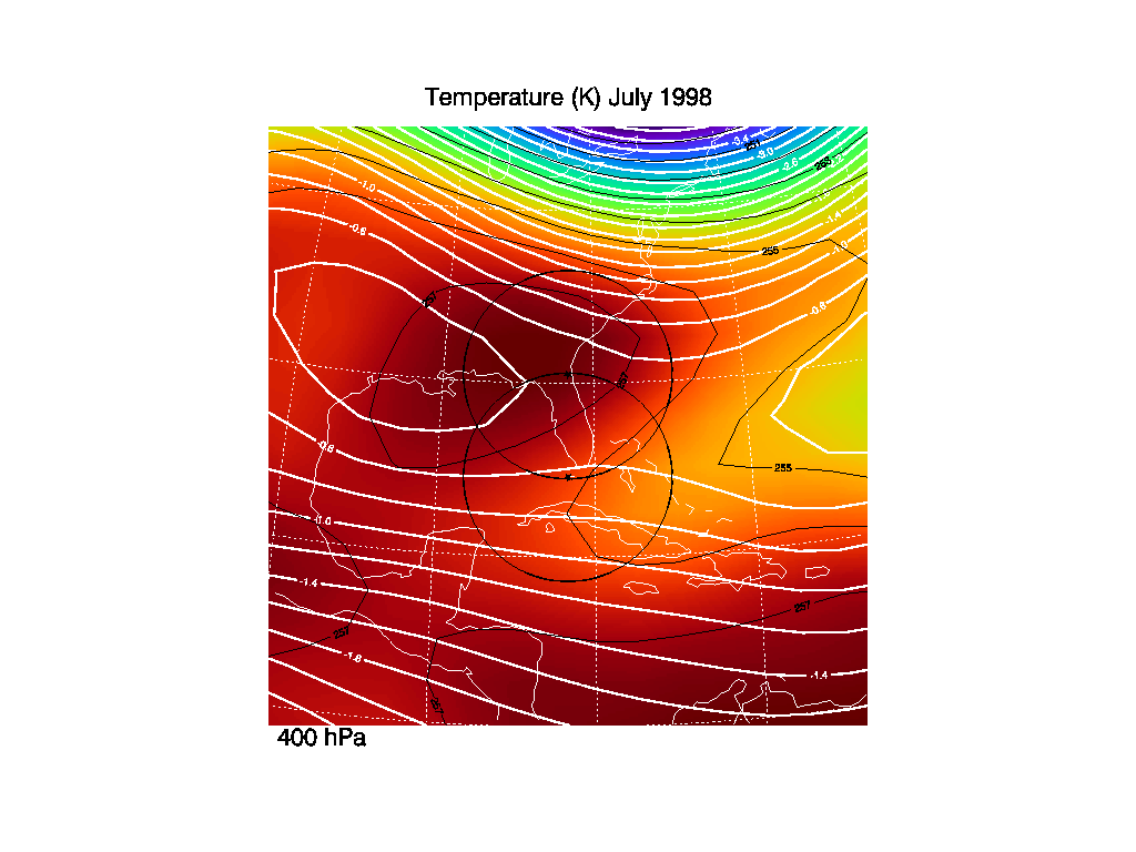
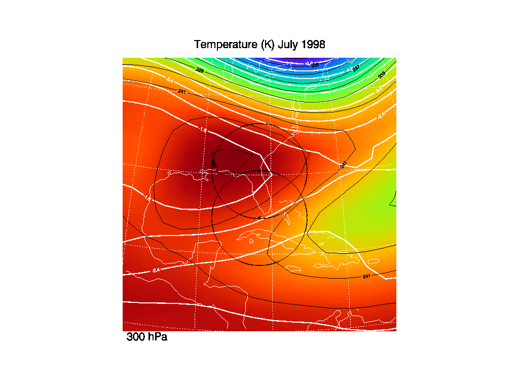
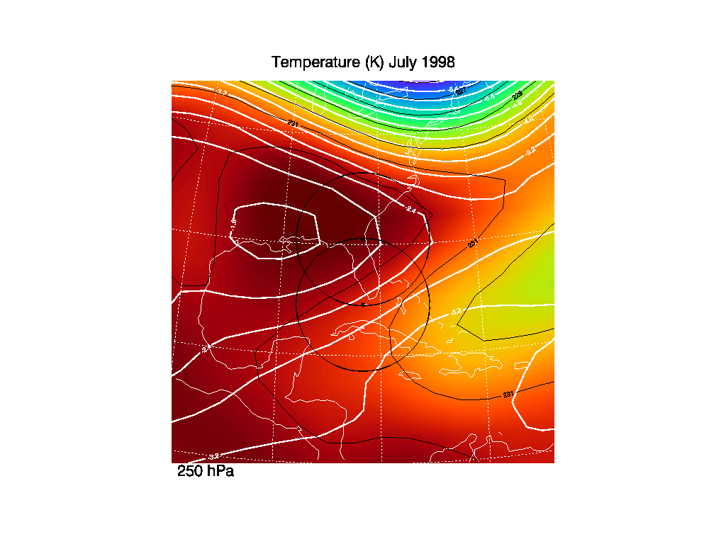
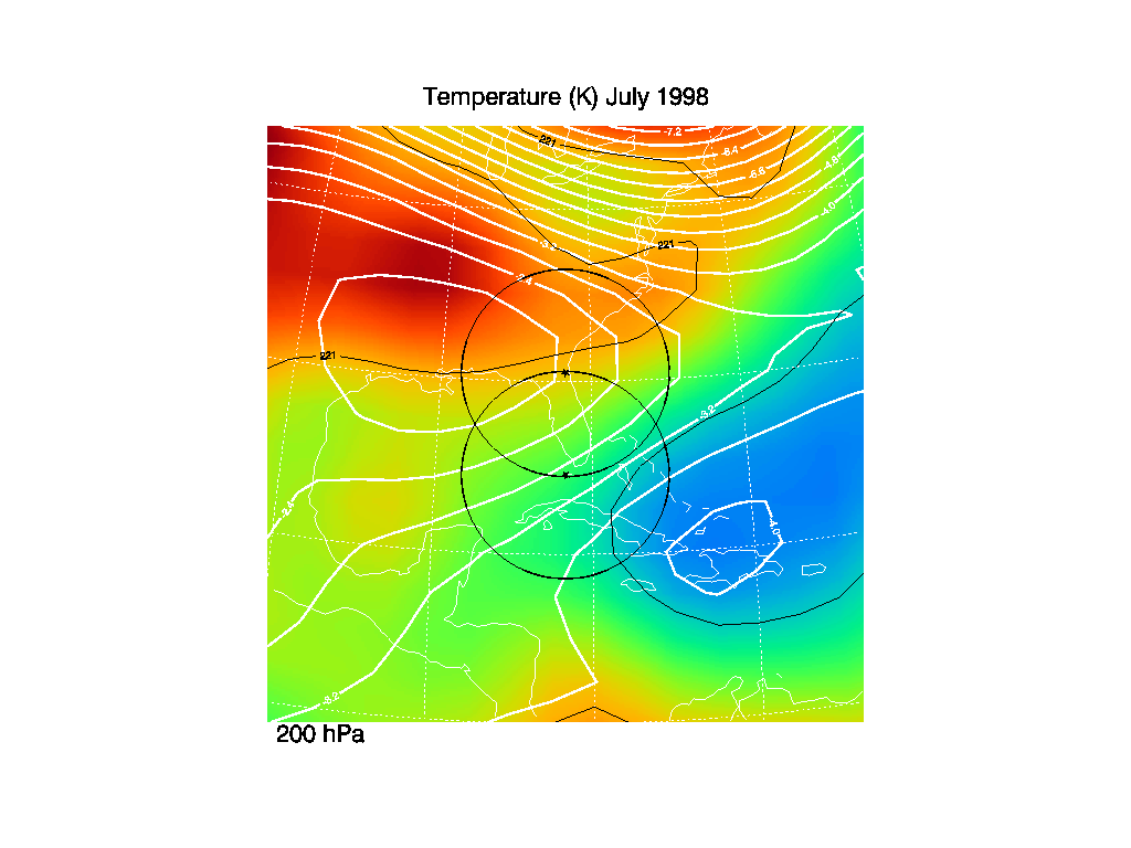
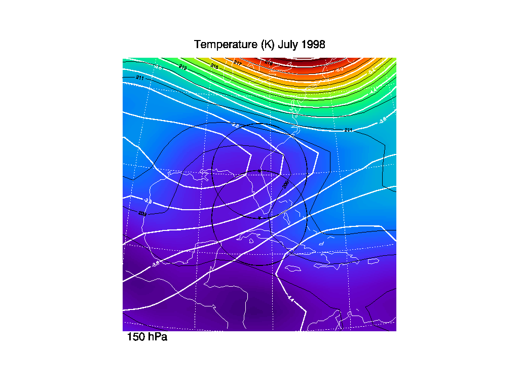
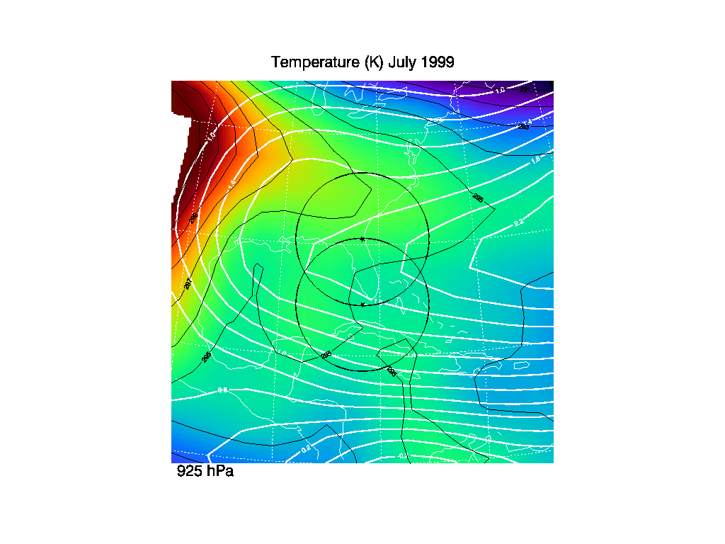
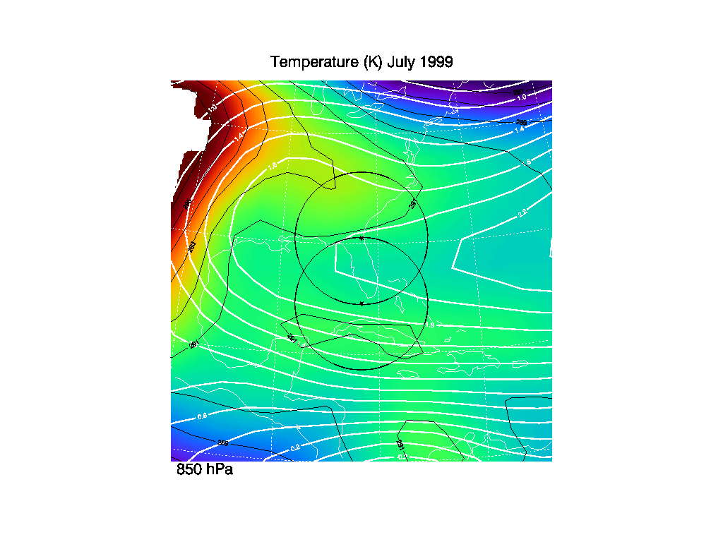
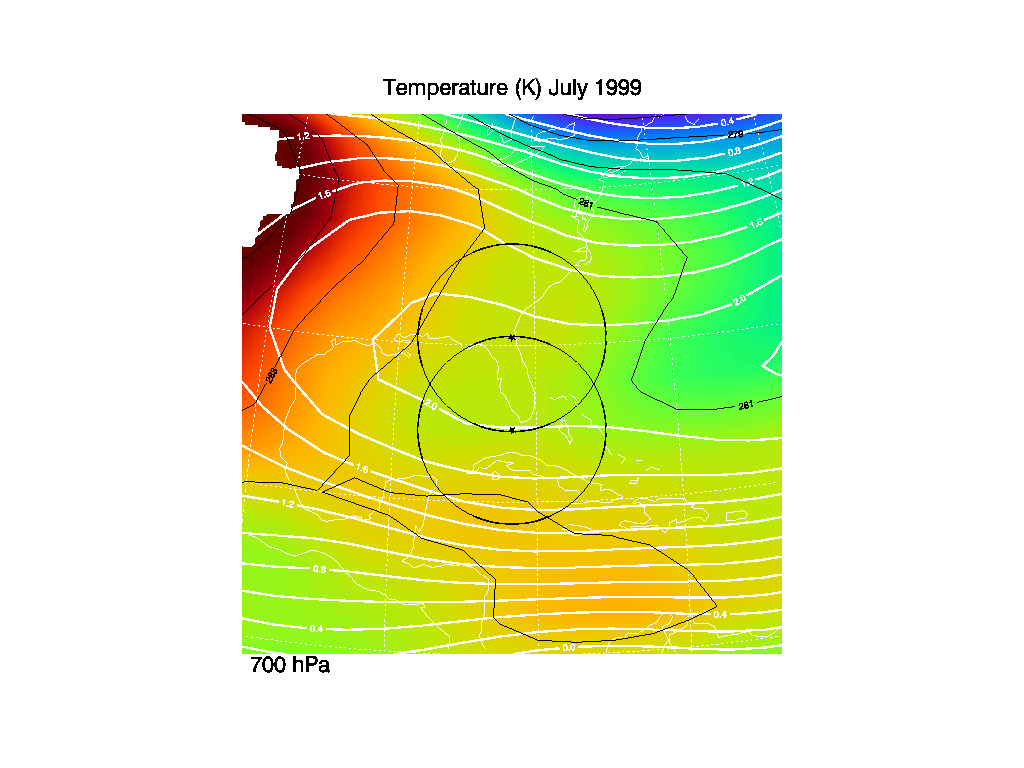
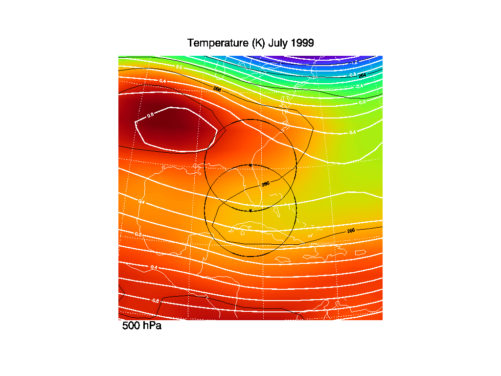
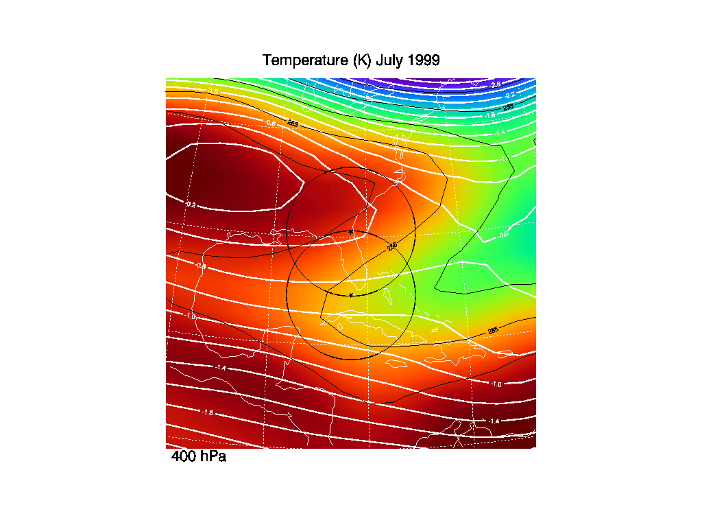
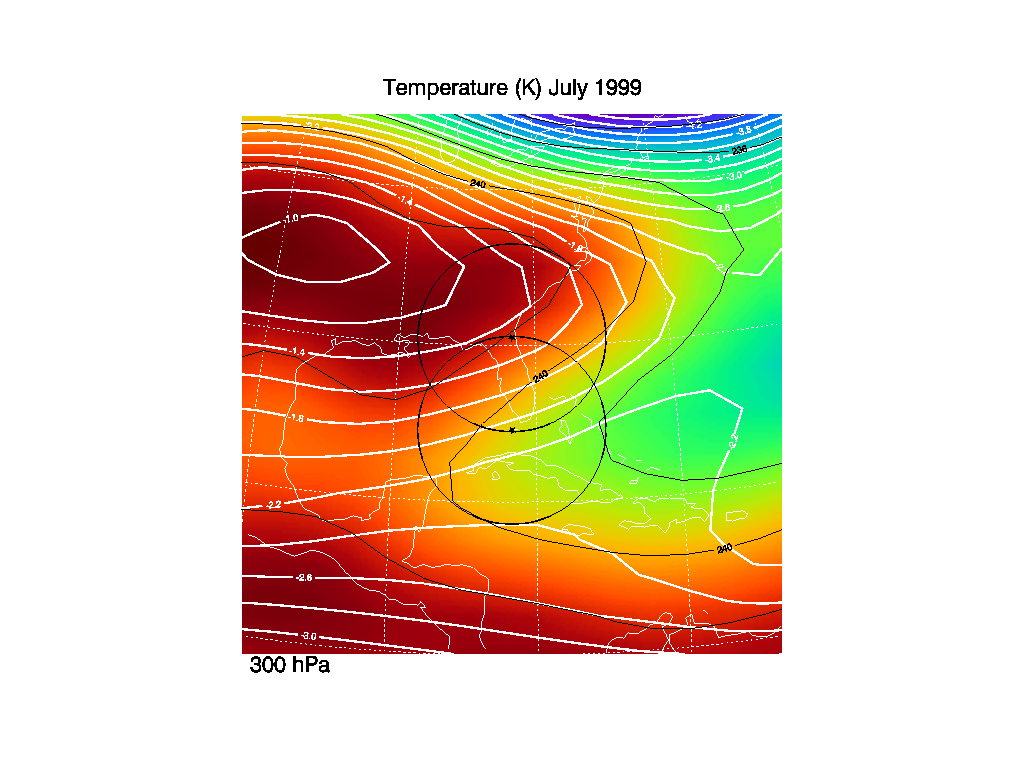
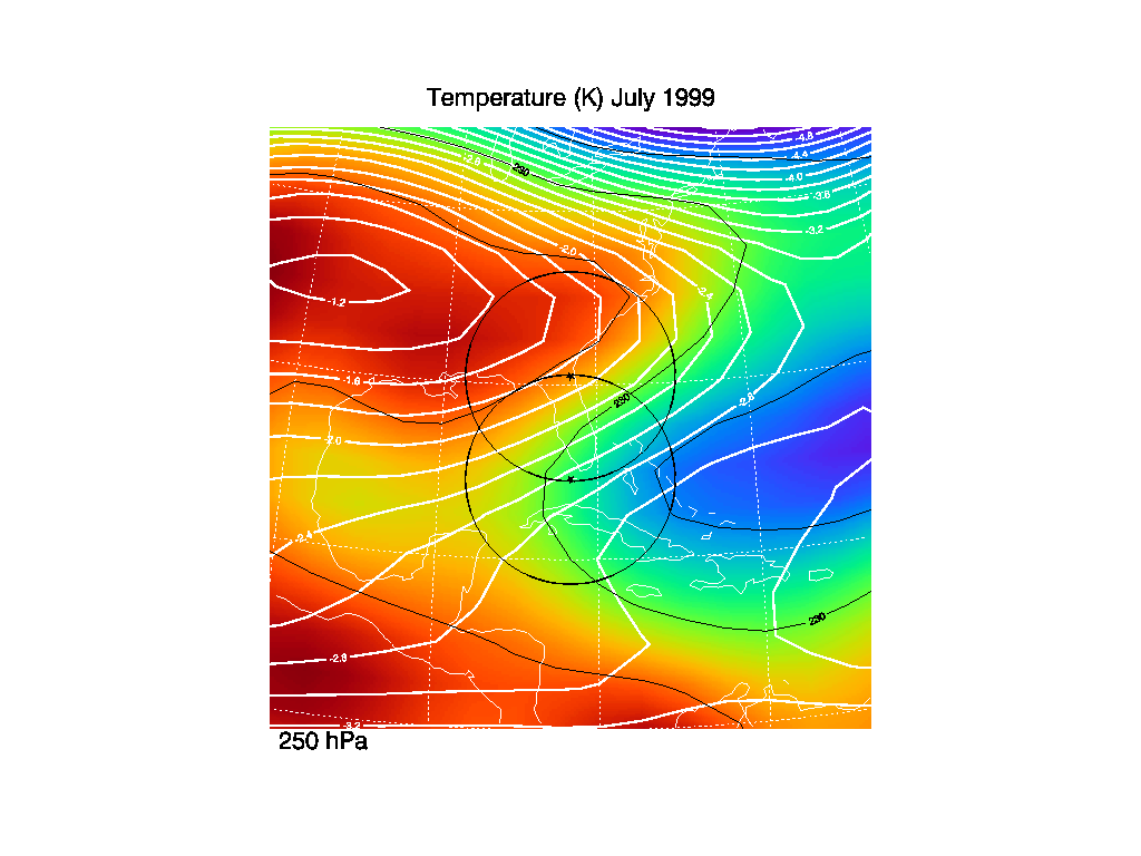
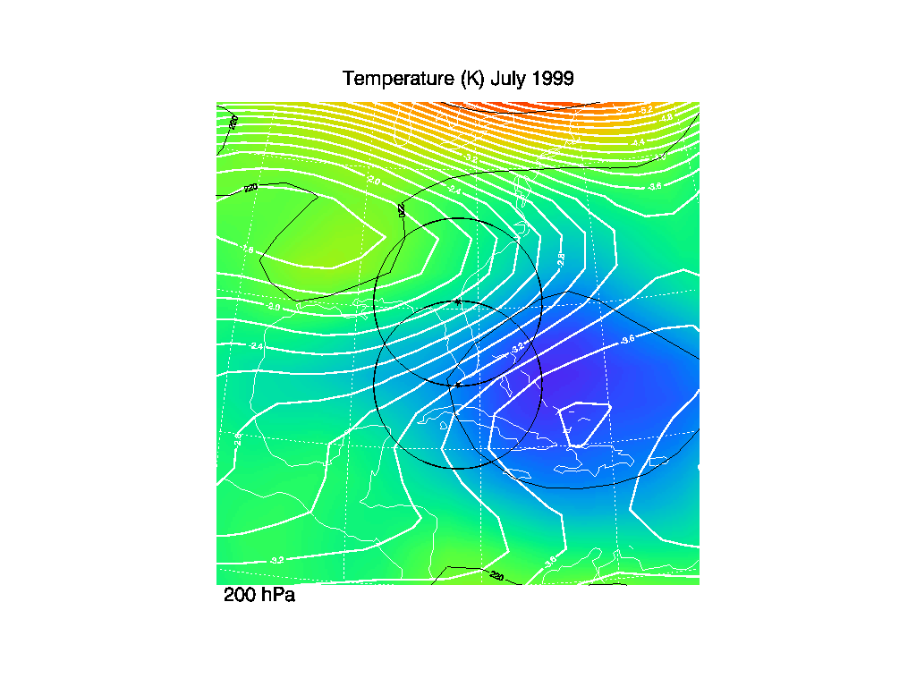
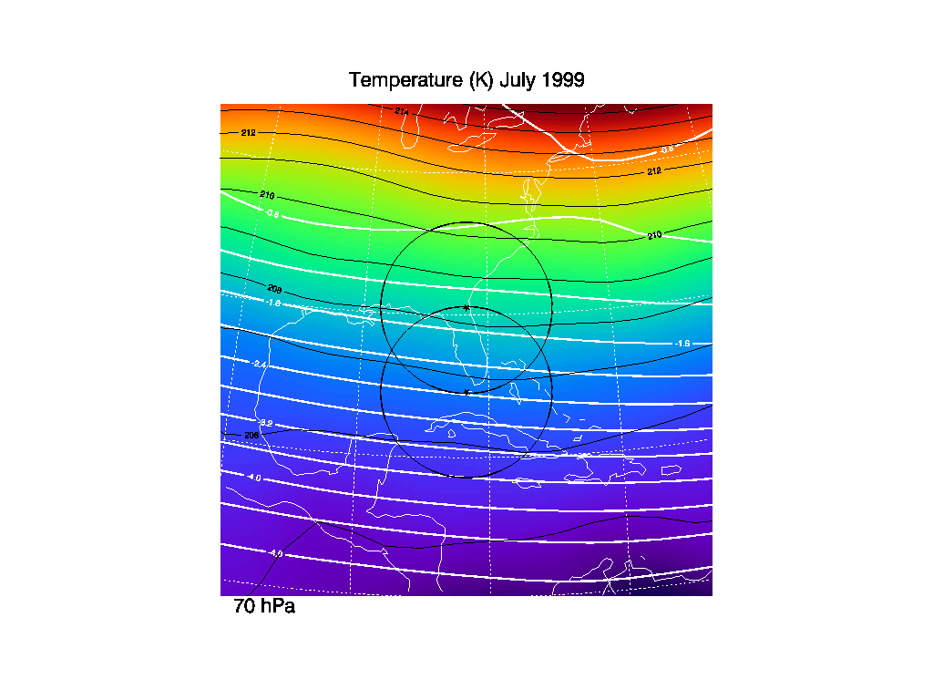
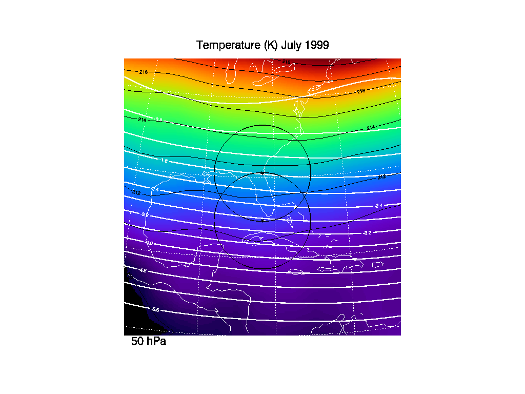
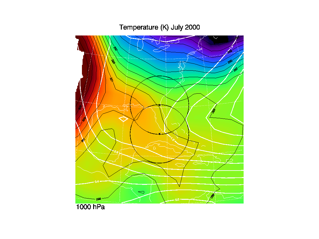
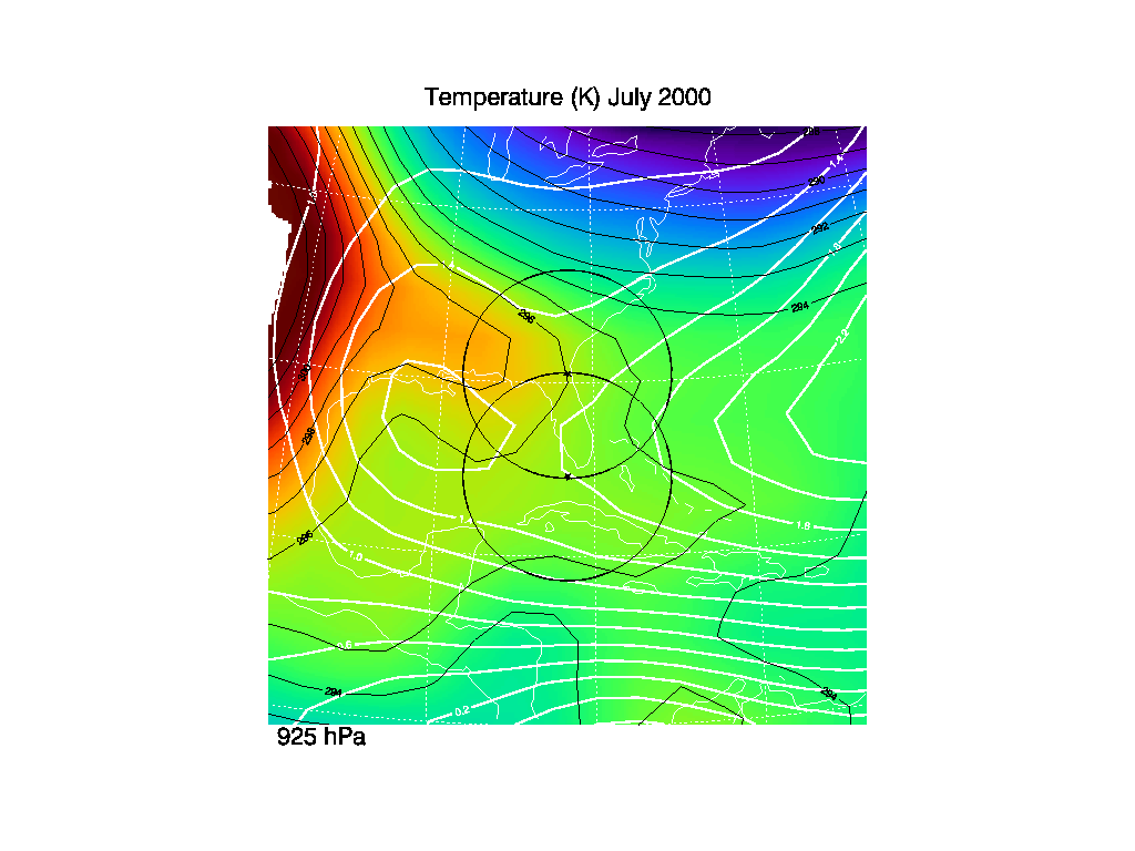
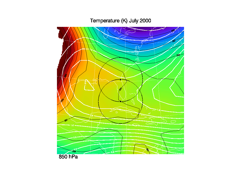
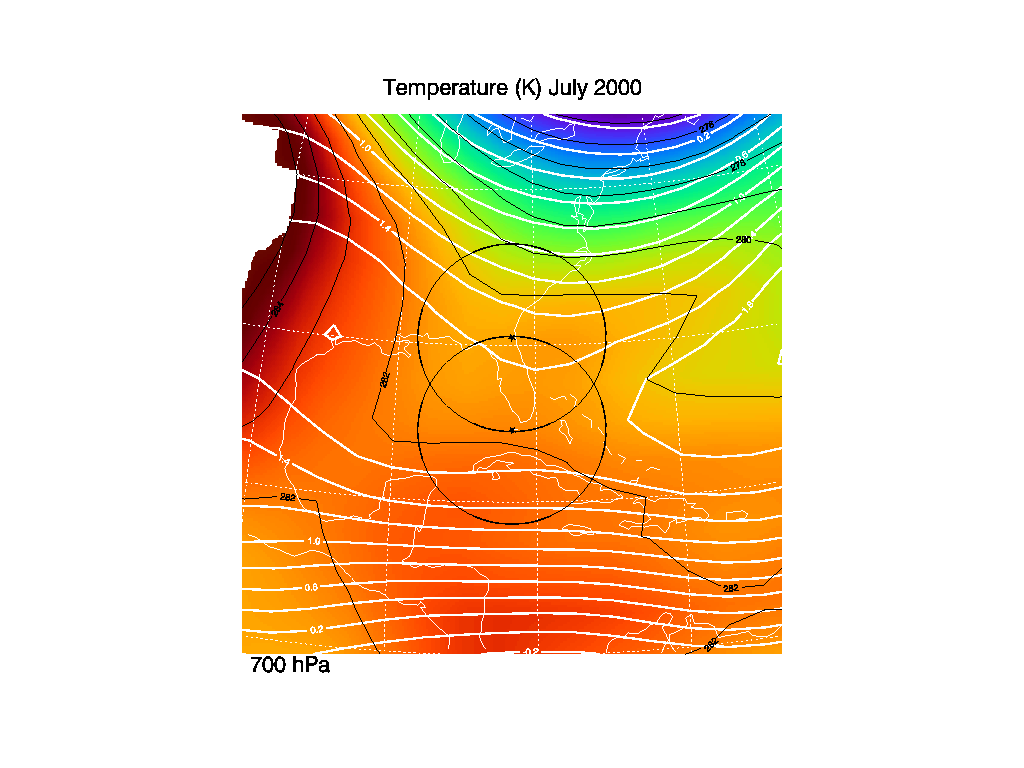
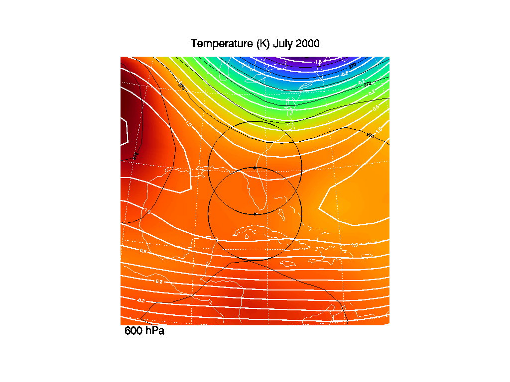
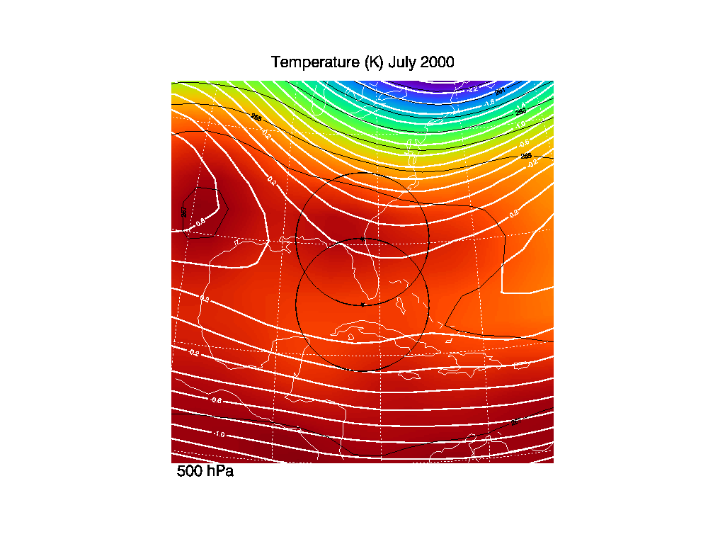
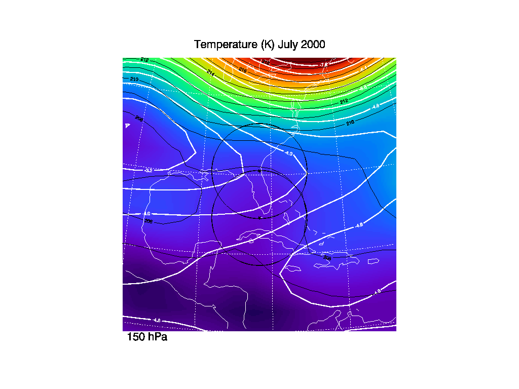
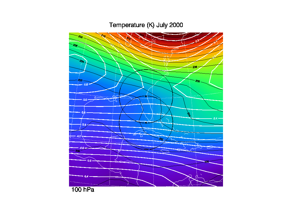
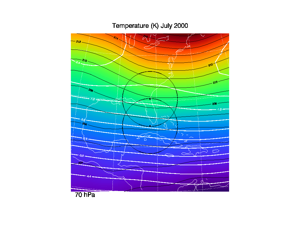
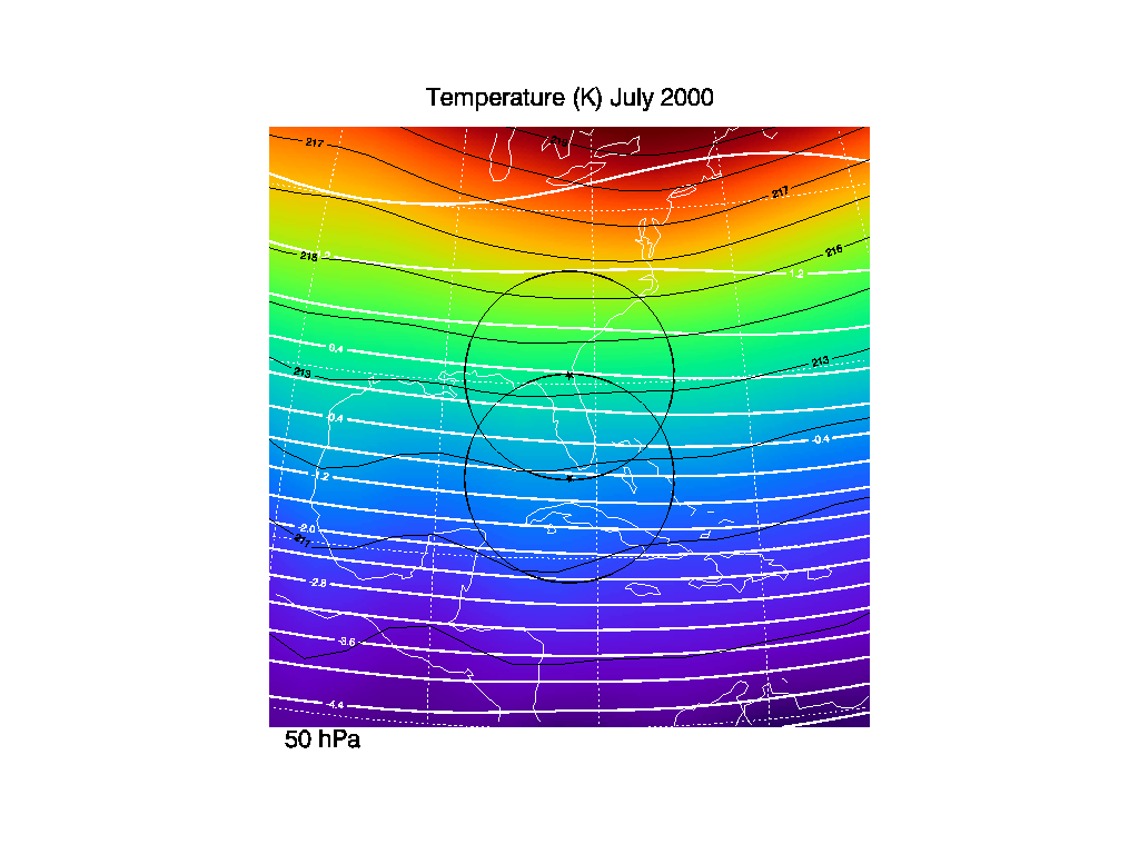
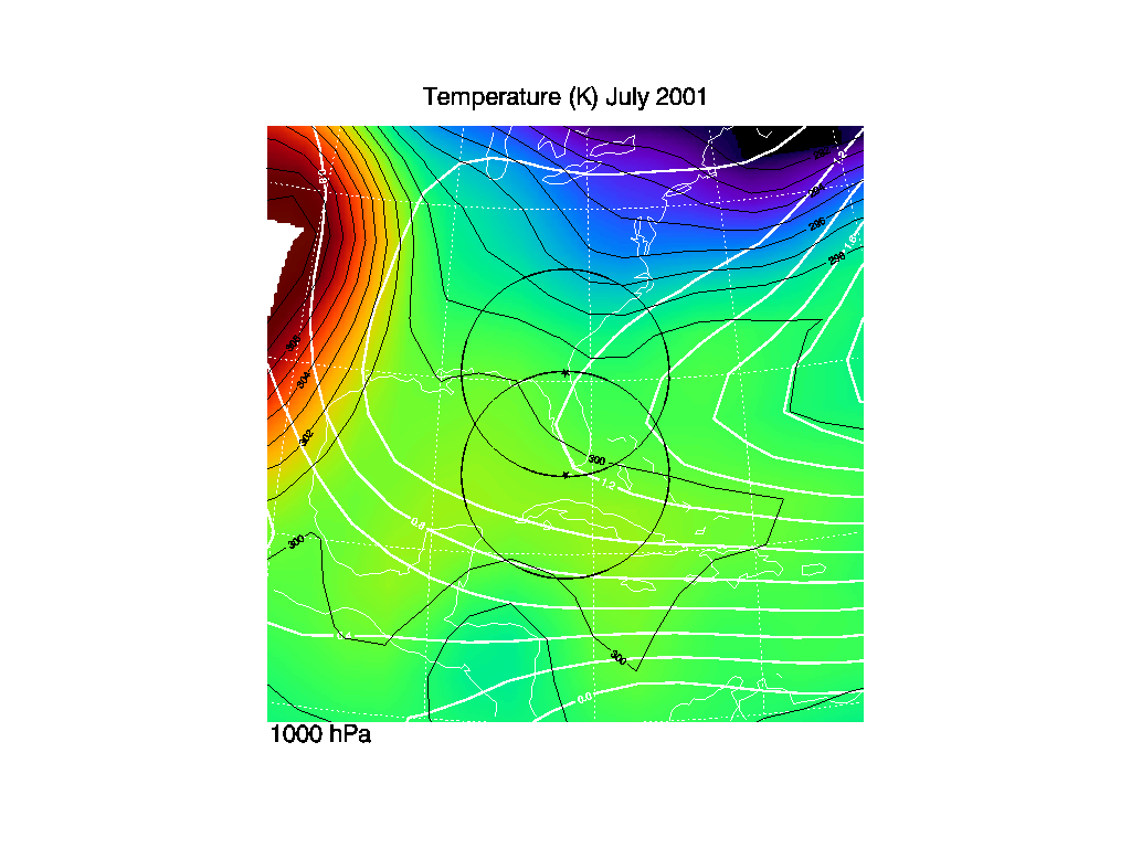
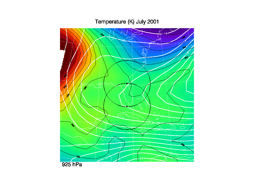
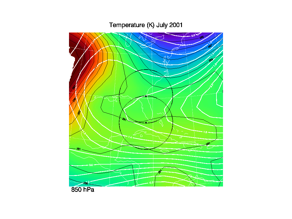
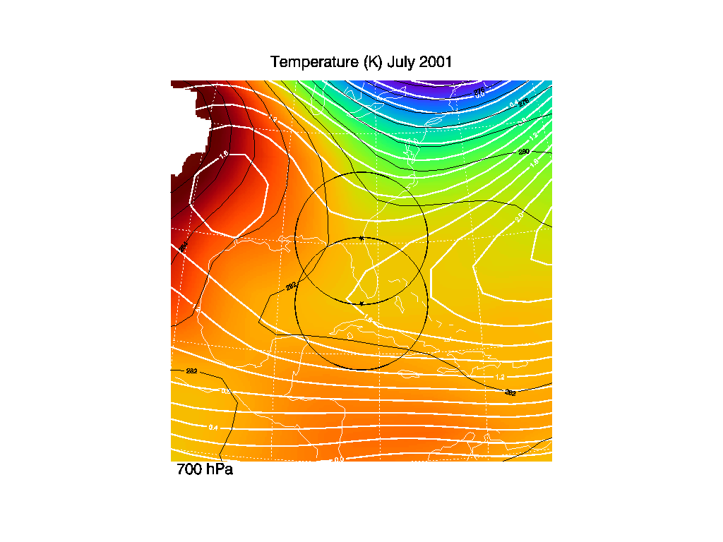
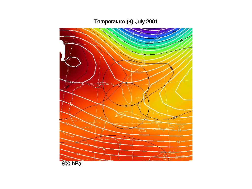
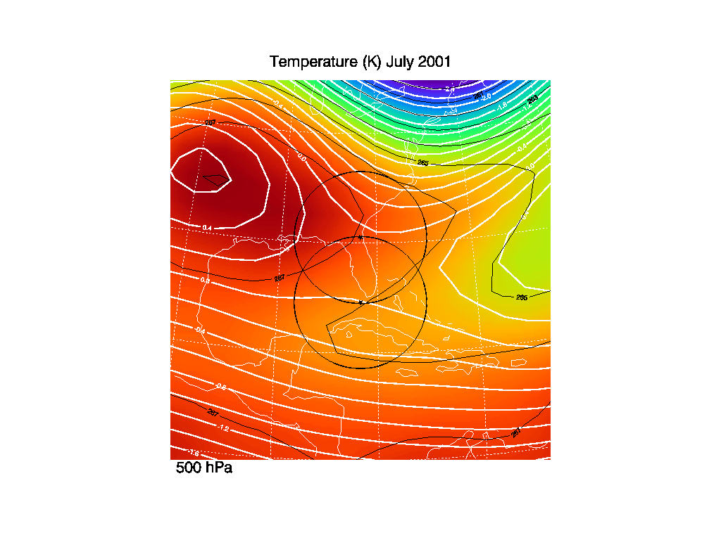
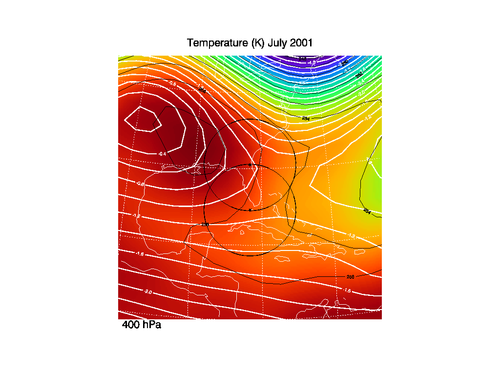
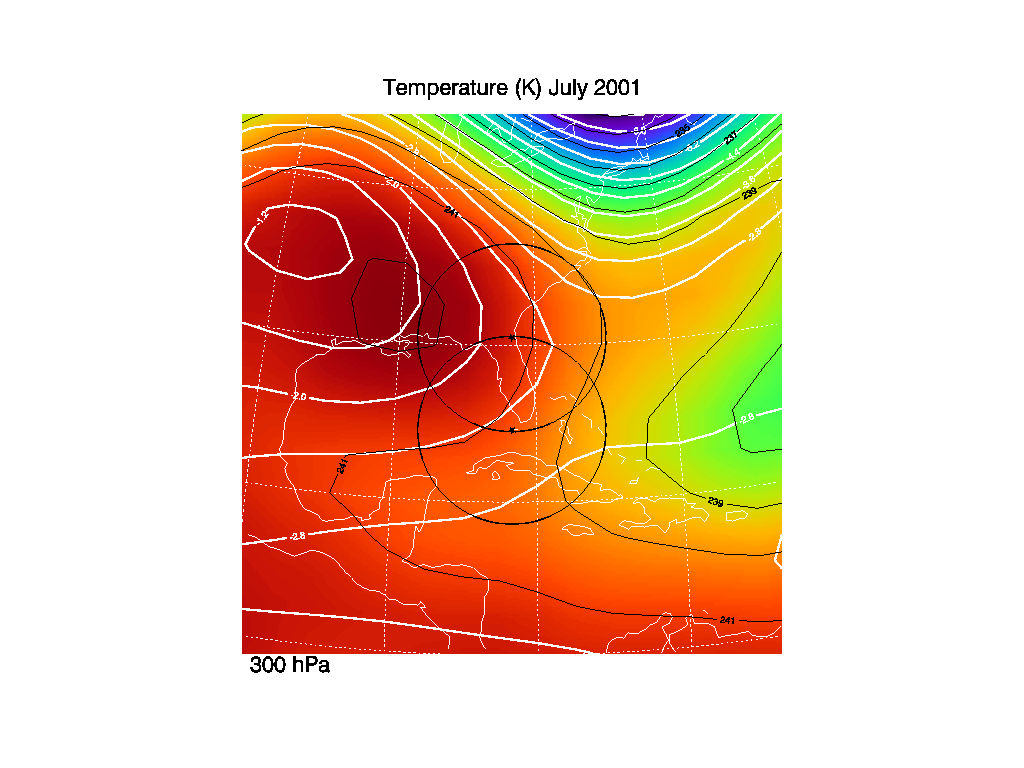
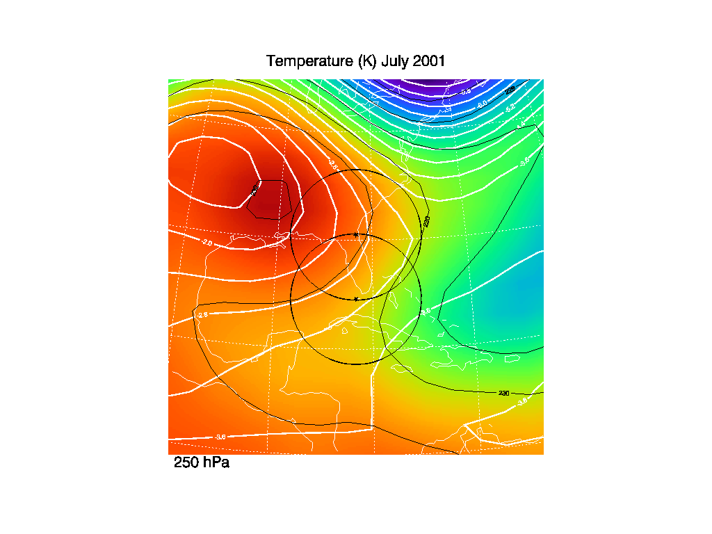
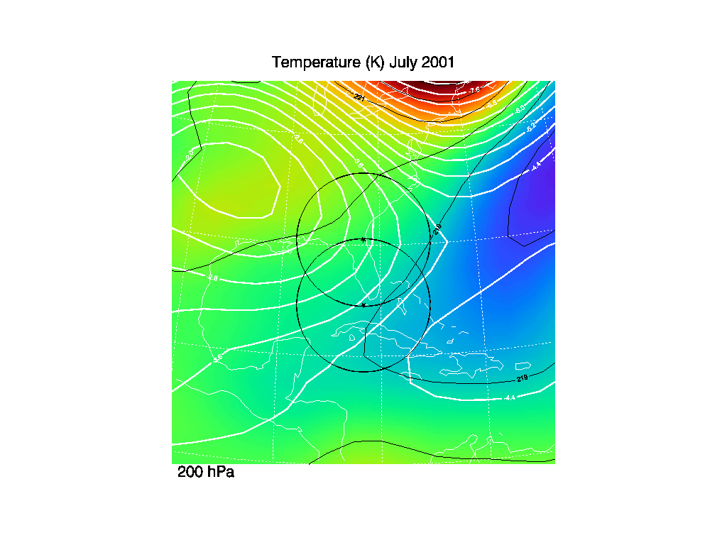
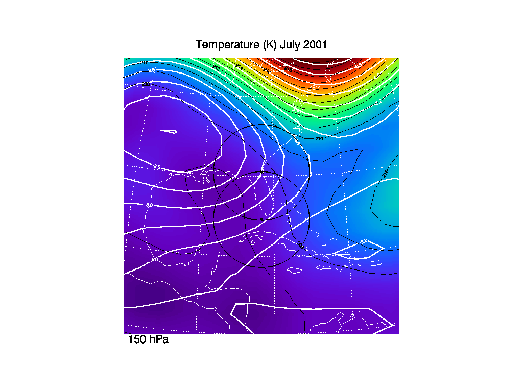
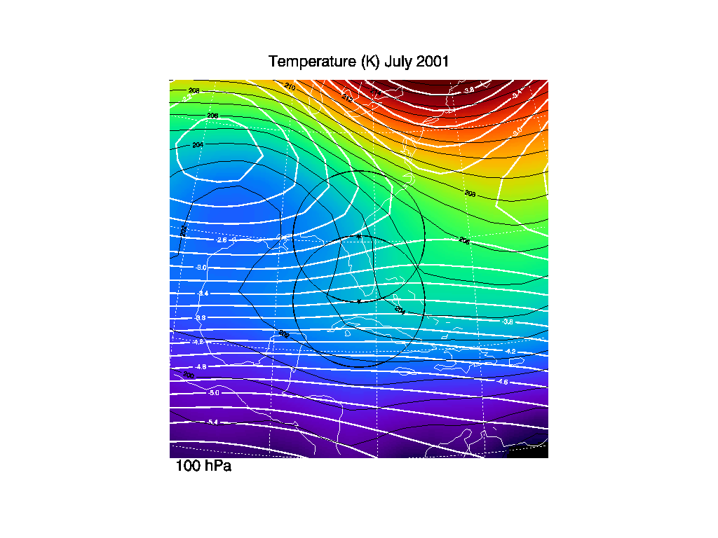
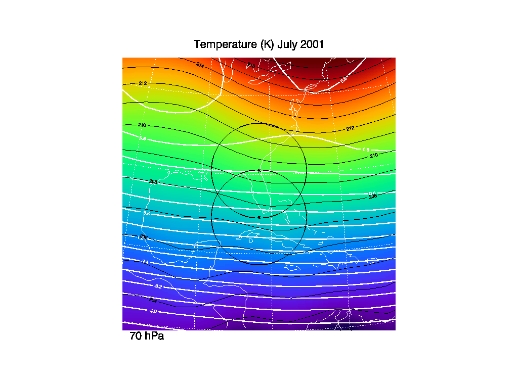
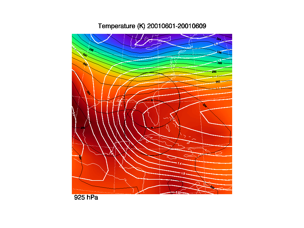
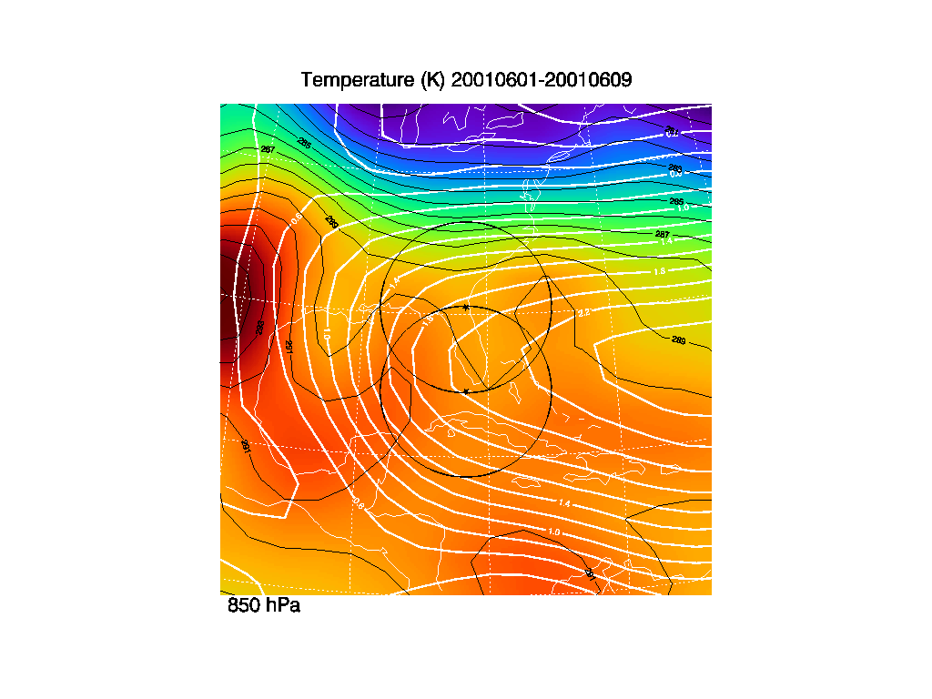
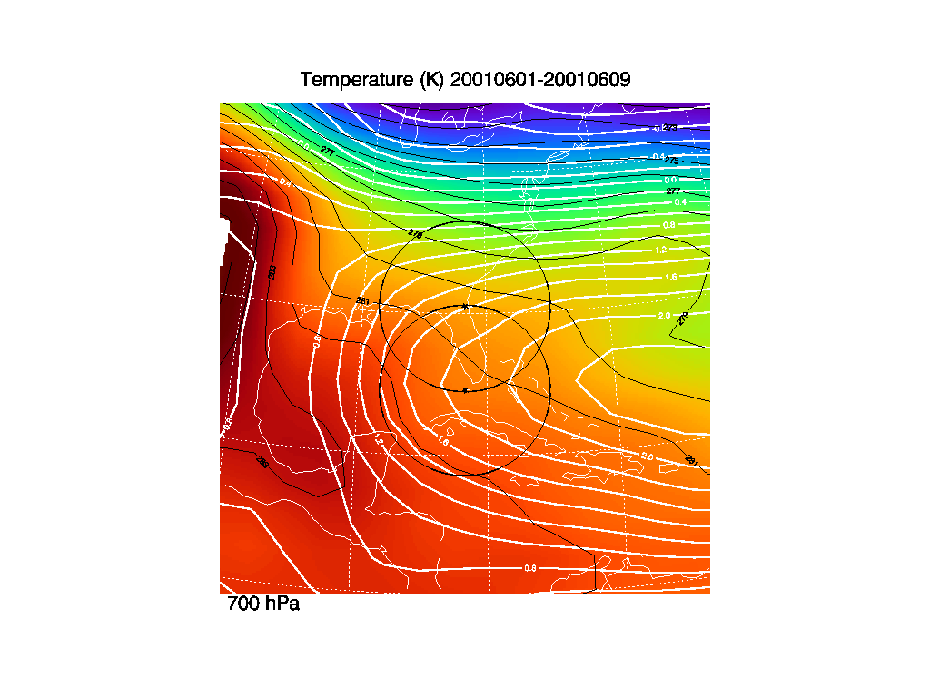
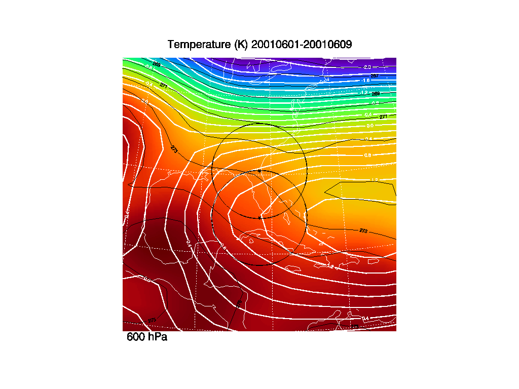
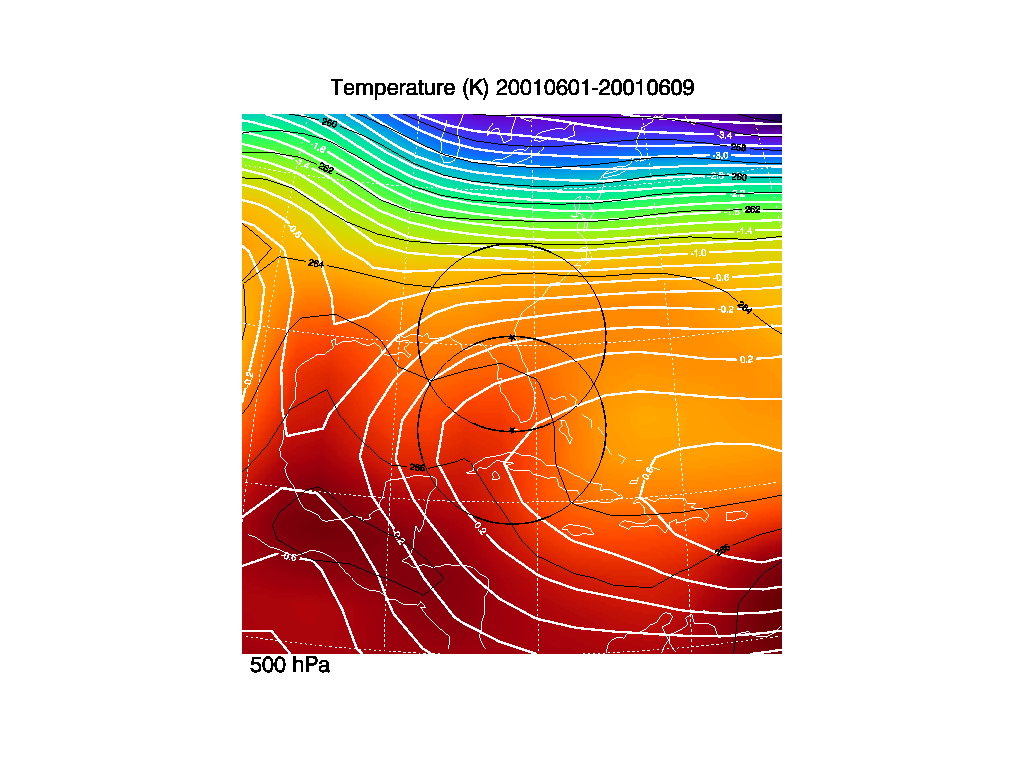
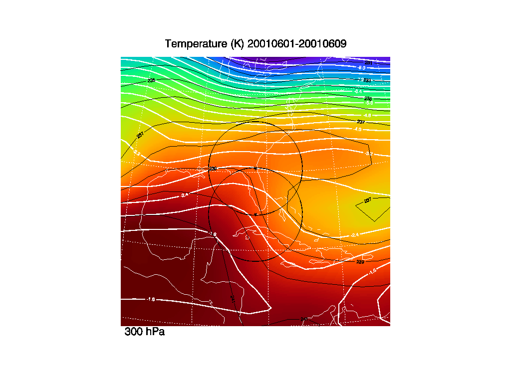
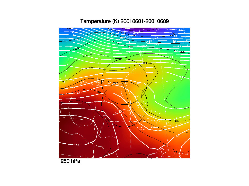
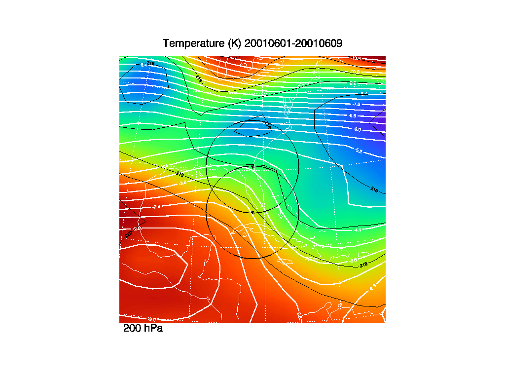
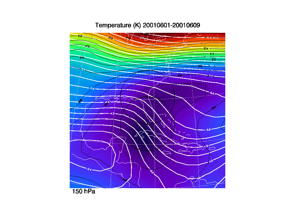
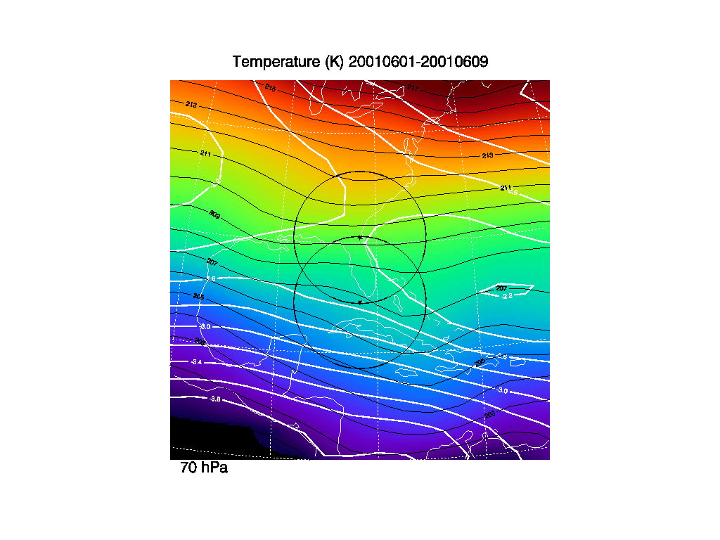
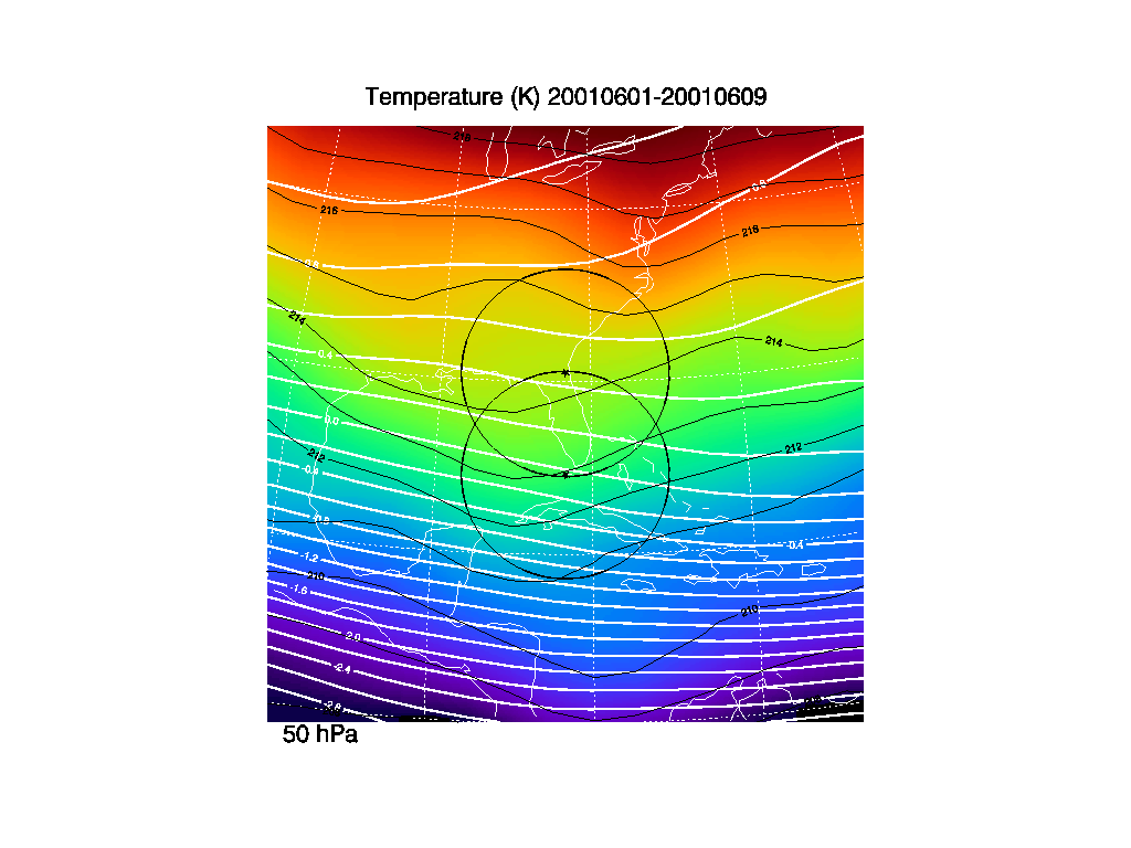
3. Temperature averages
These temperature time averages (color) are derived from the NCEP/NCAR
reanalysis data from 1979-2000. Black contours are indicated for every
1 K. The thick solid white lines are the stream lines derived from the
zonal and meridional wind averages. The stream line values have been
normalized by dividing by the Earth's radius.
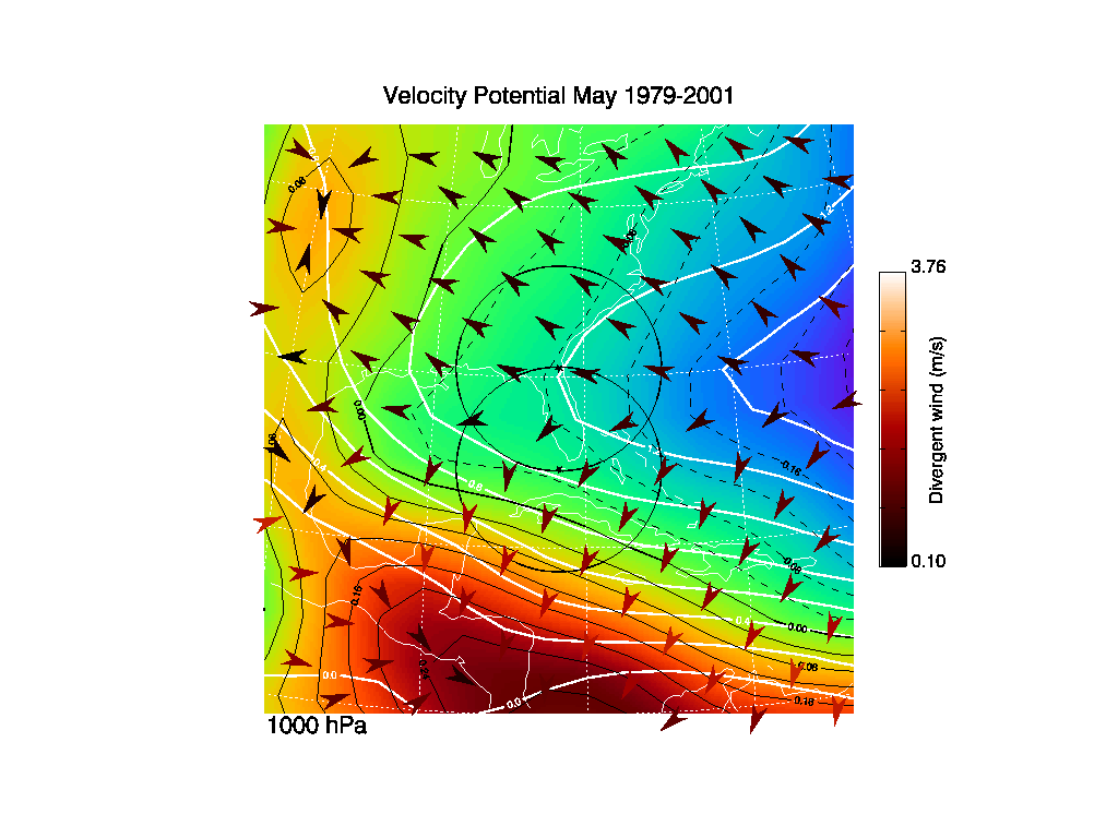
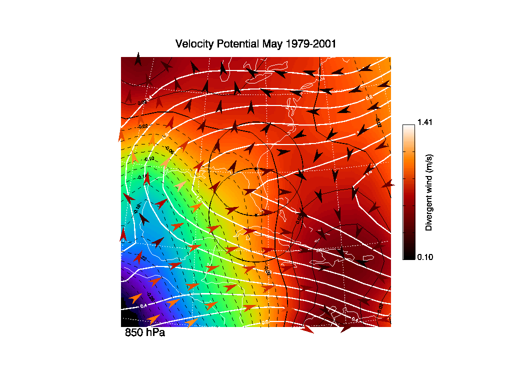
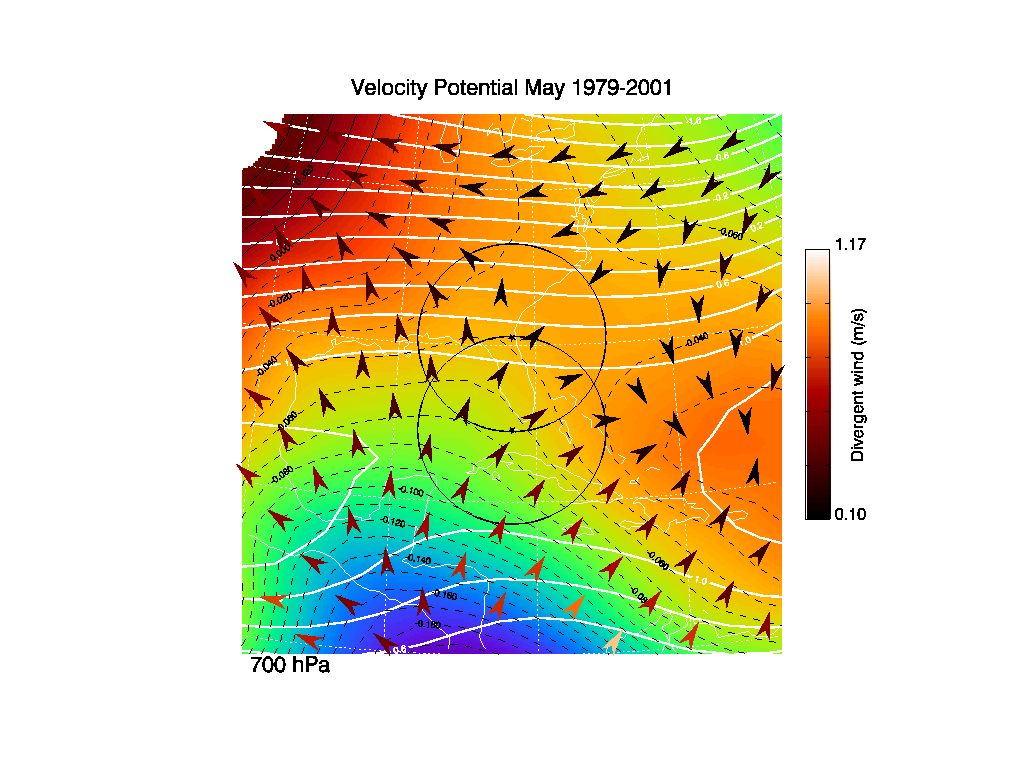
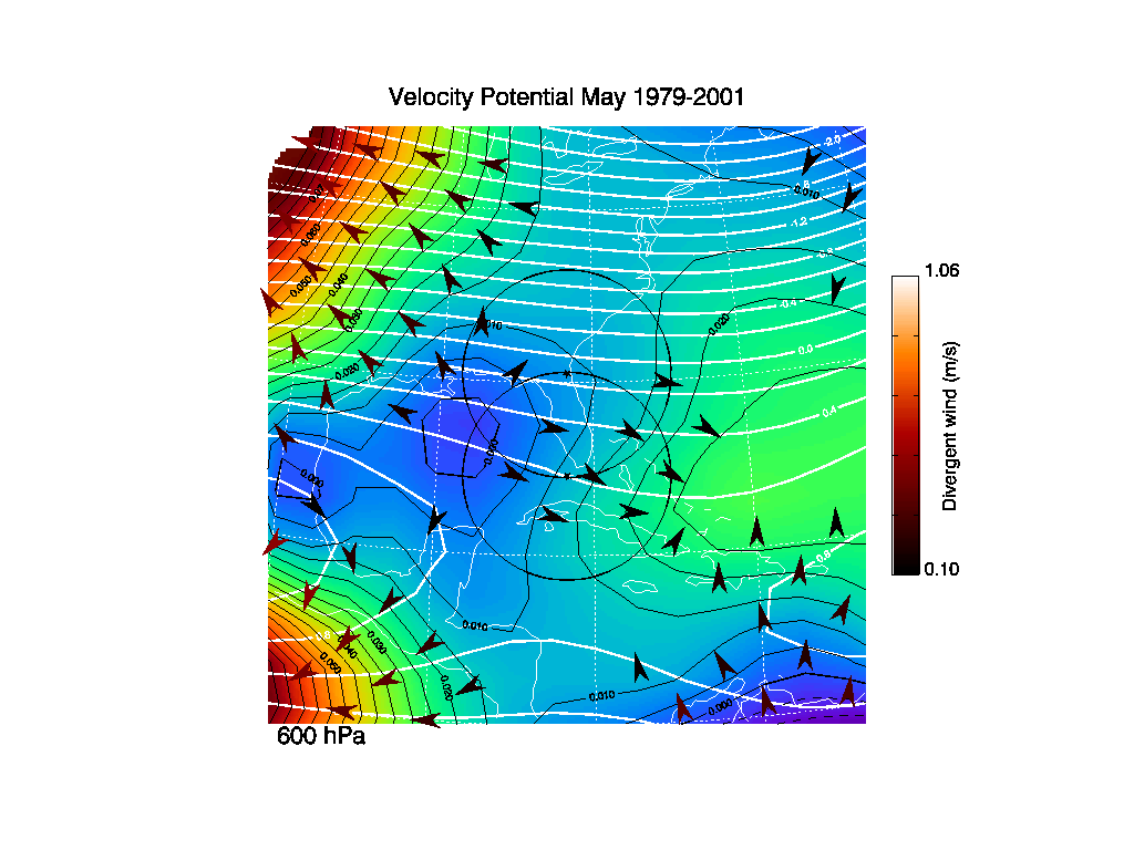
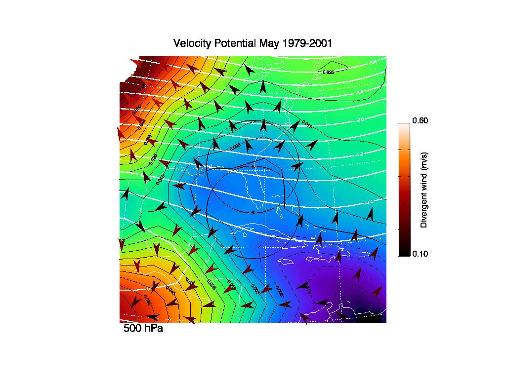
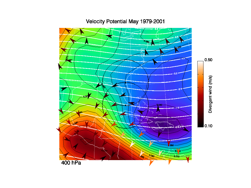
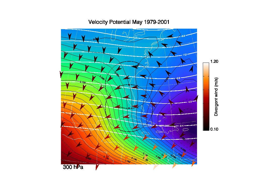
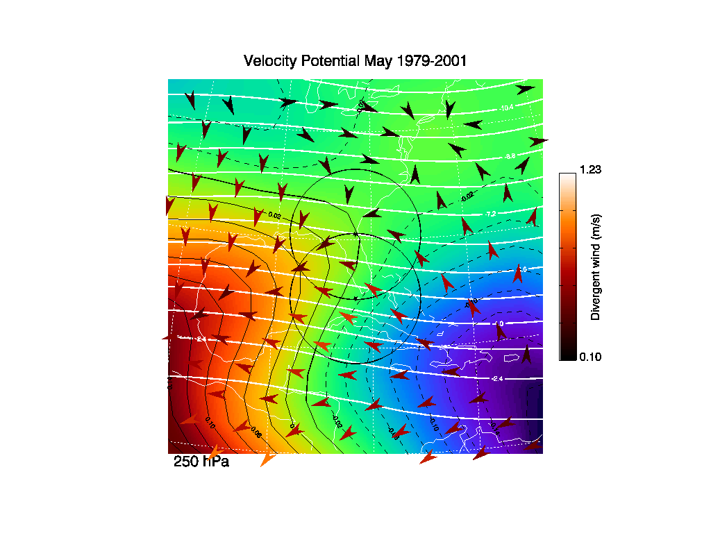
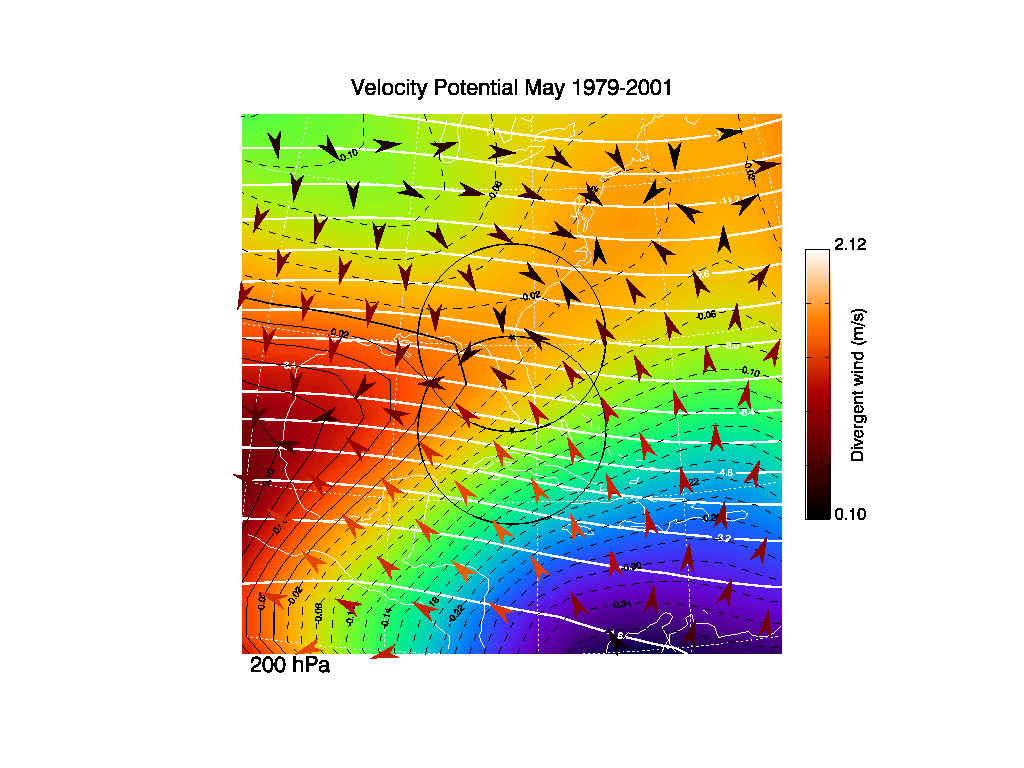
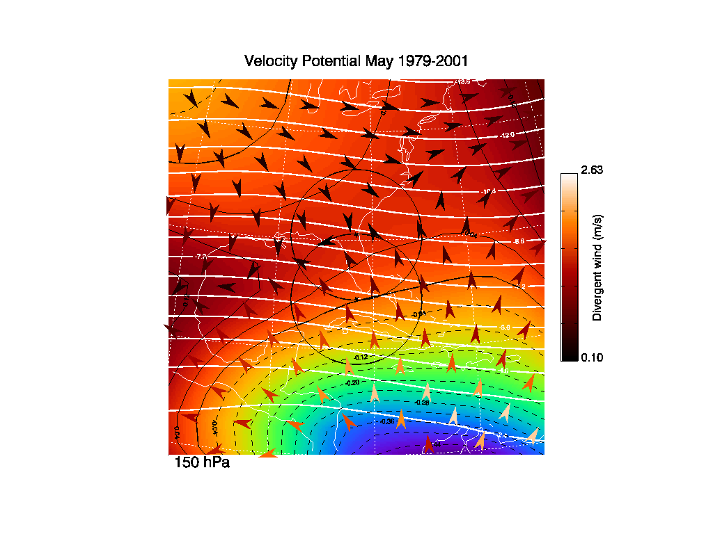
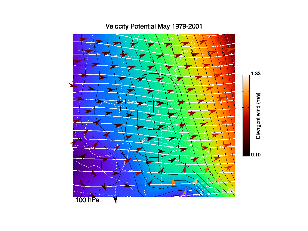
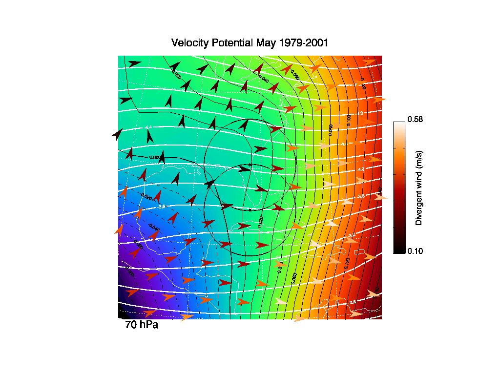
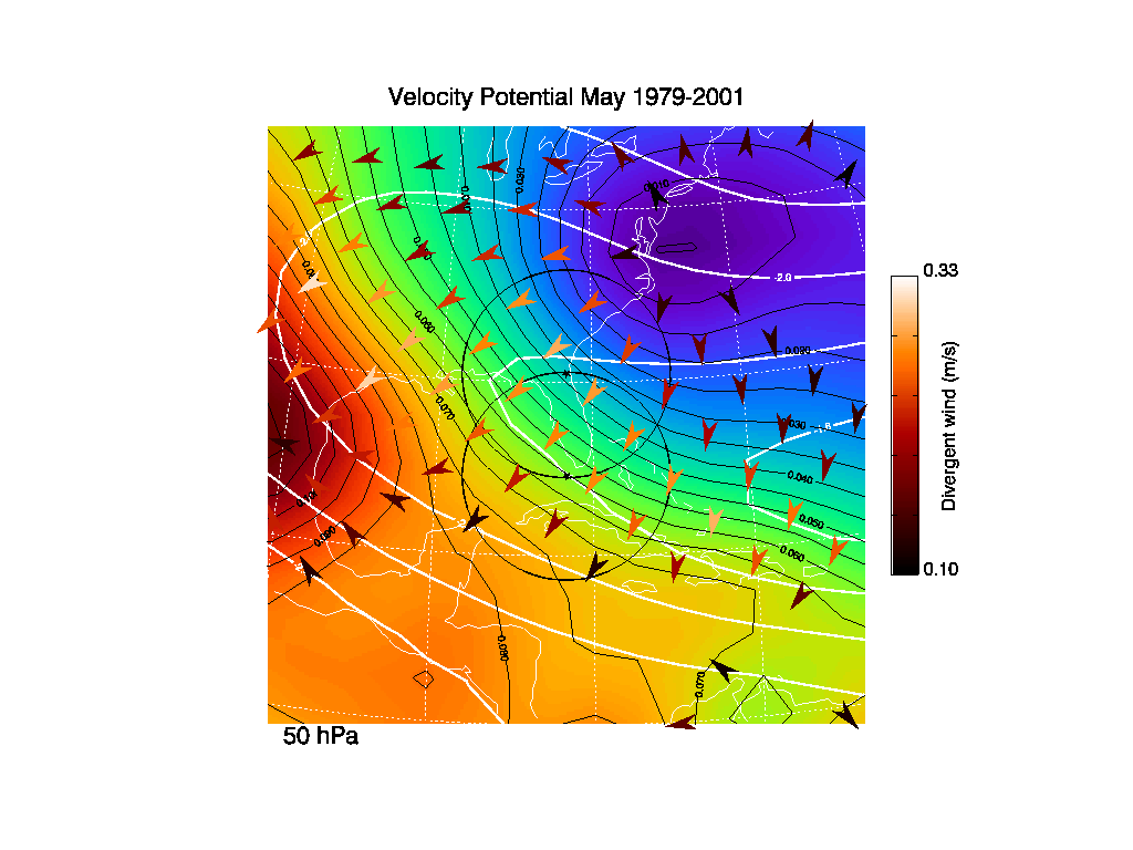
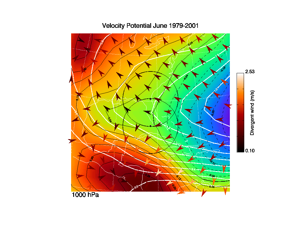
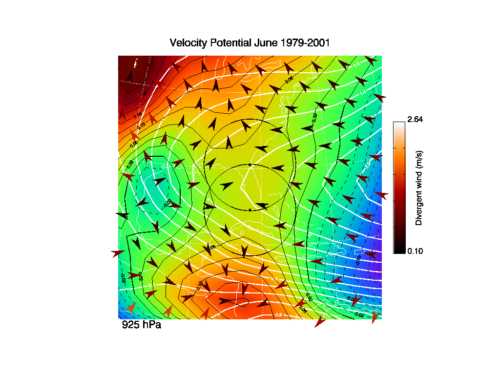
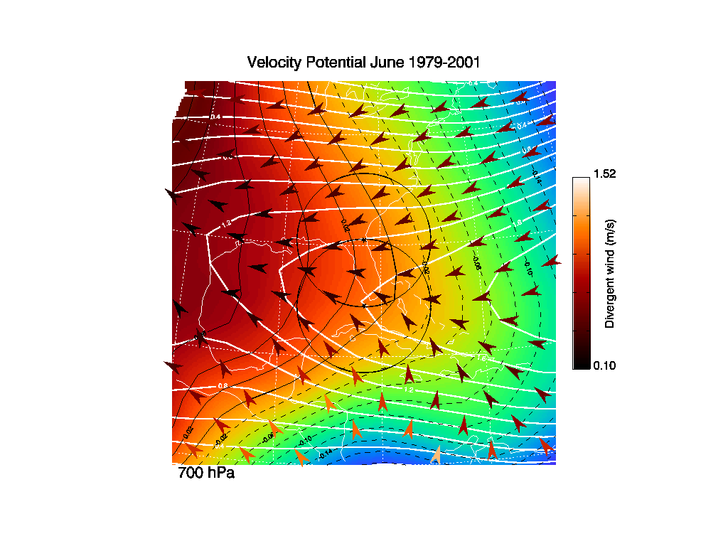
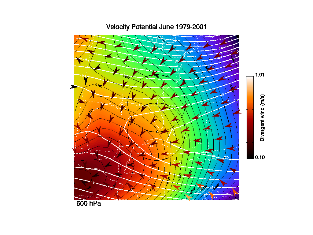
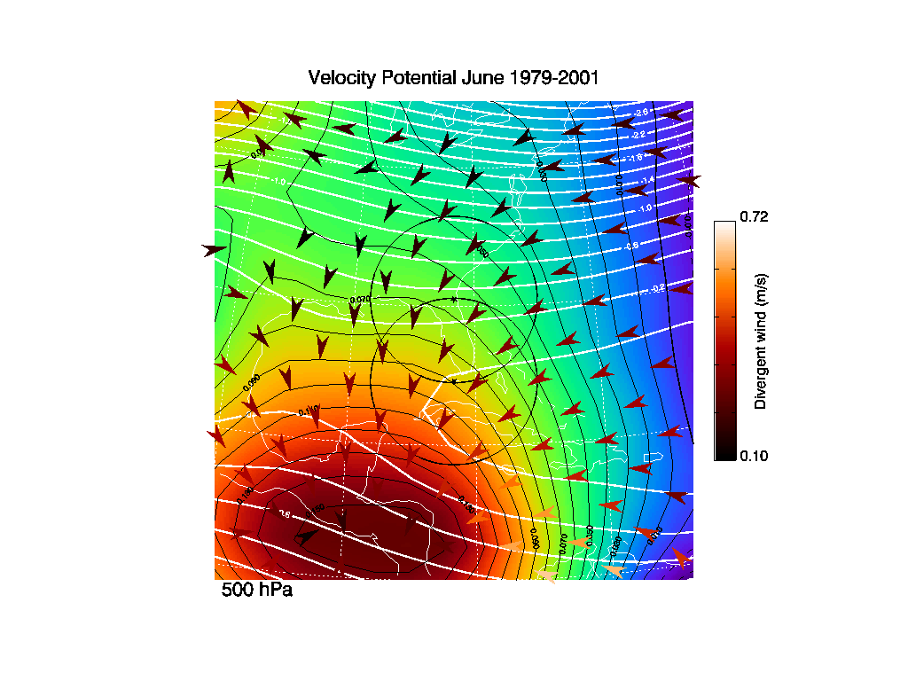
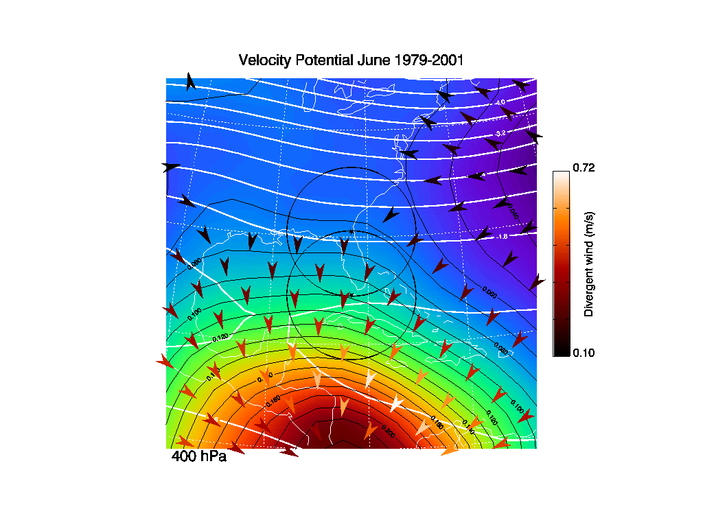
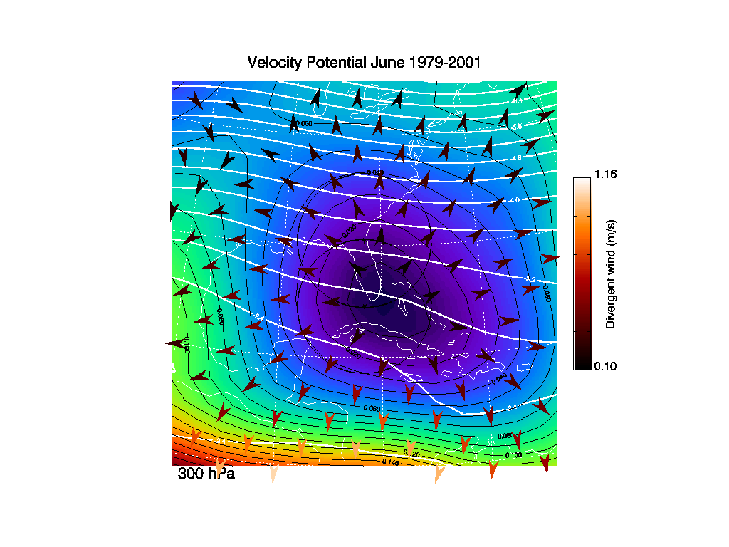
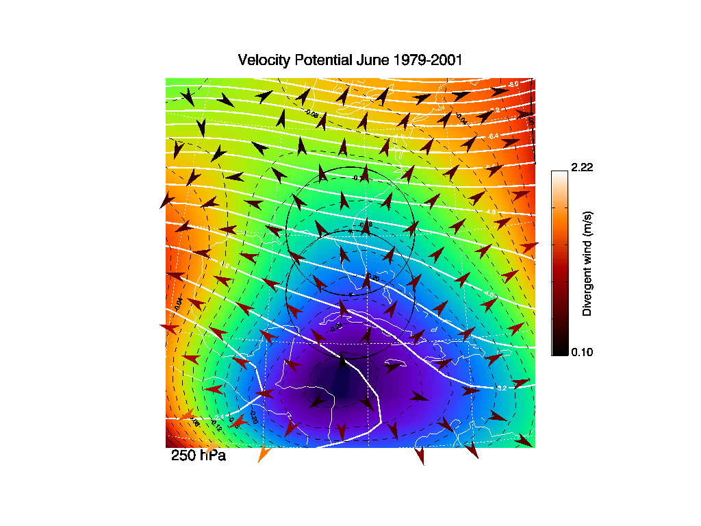
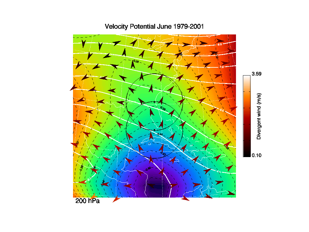
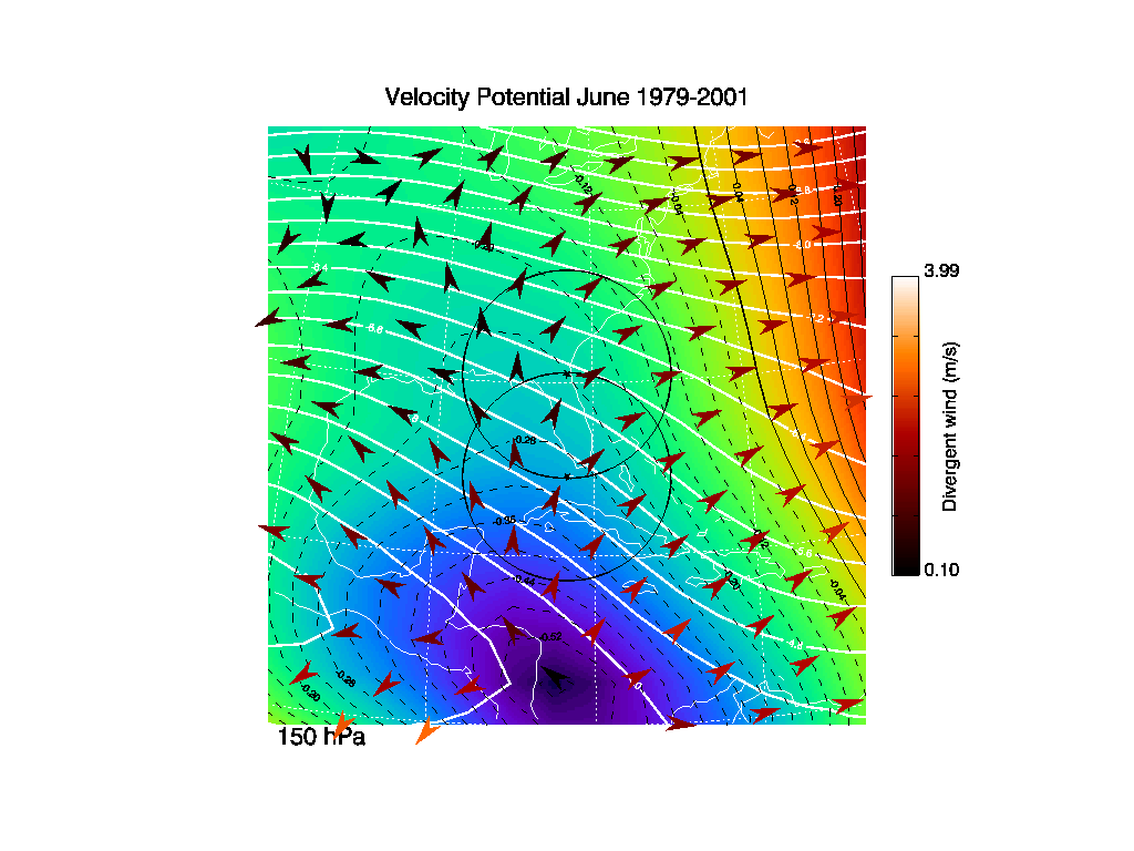
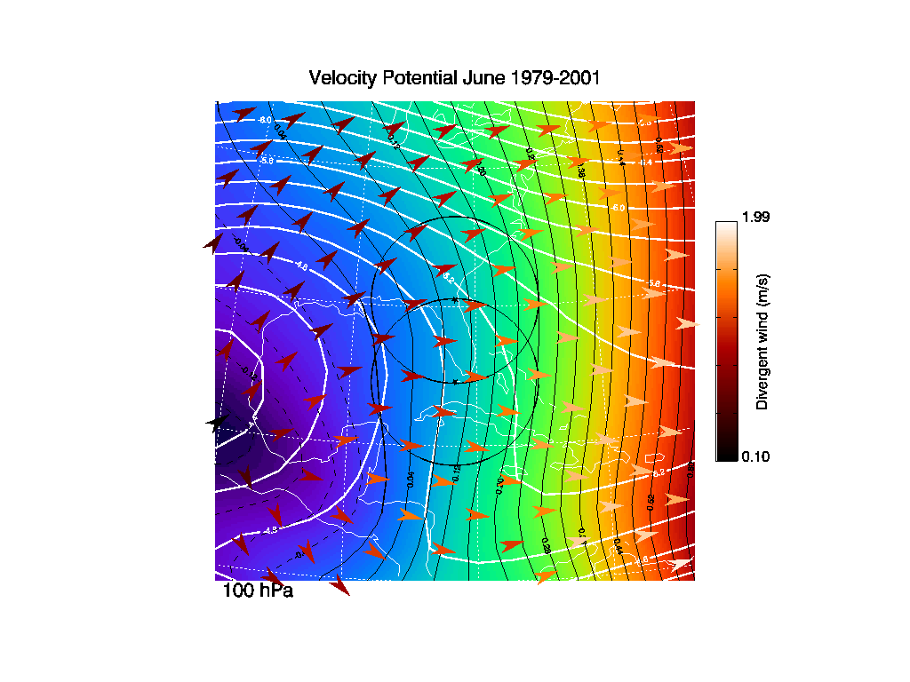
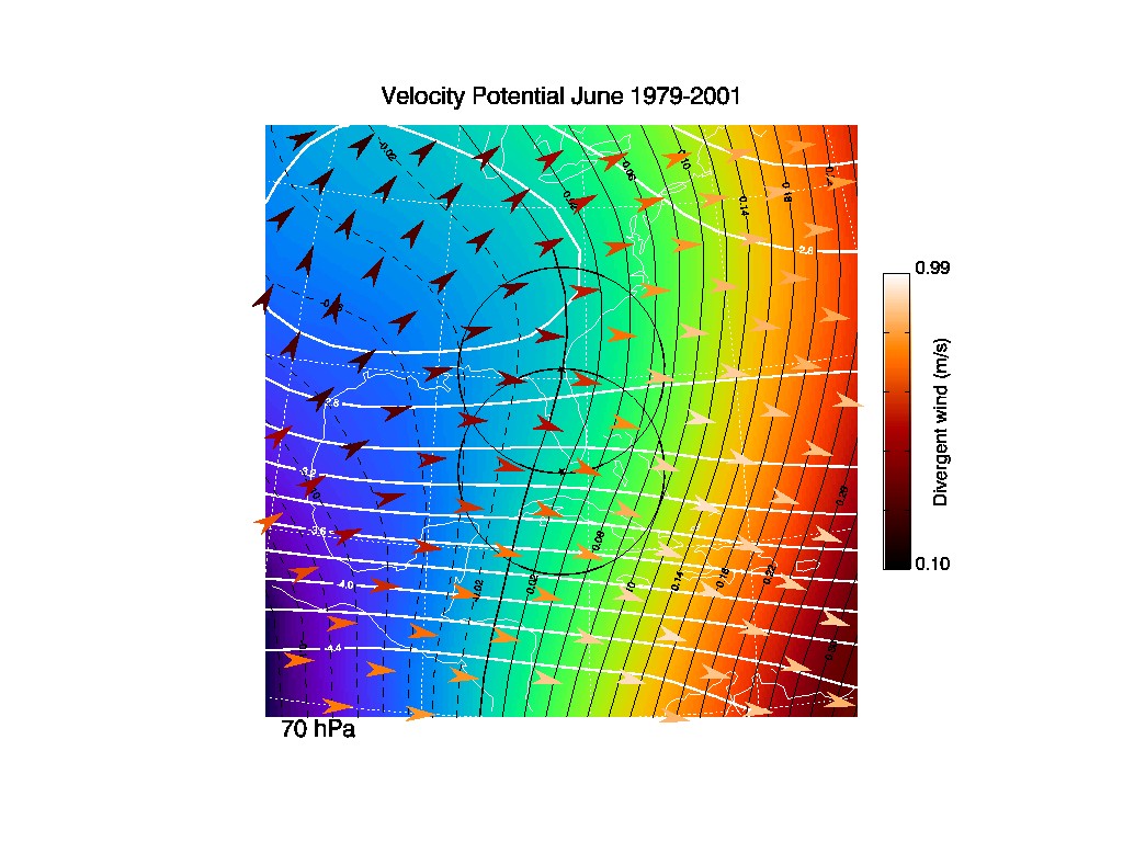
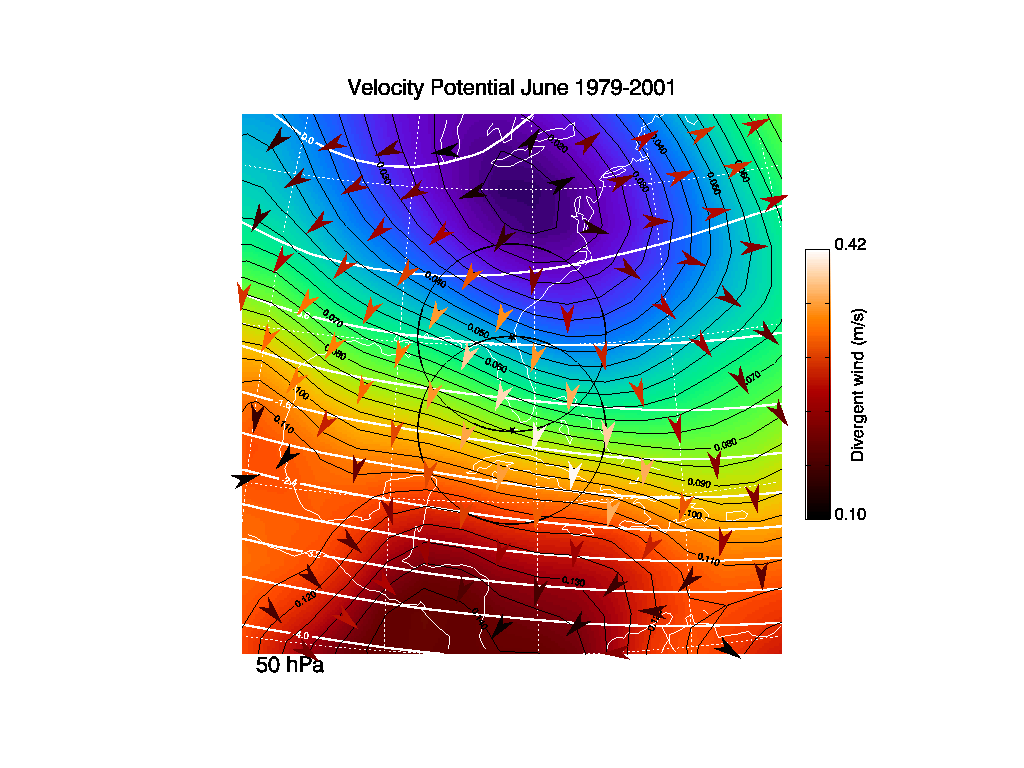
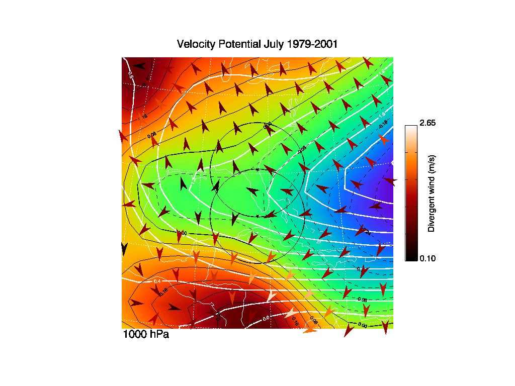
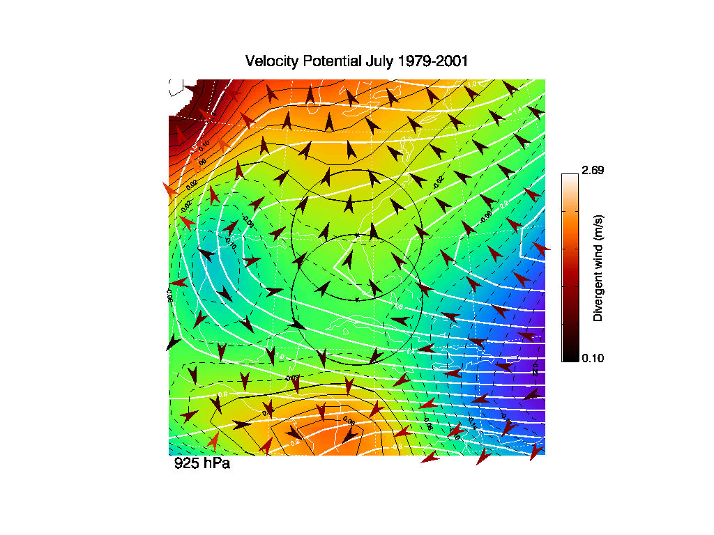
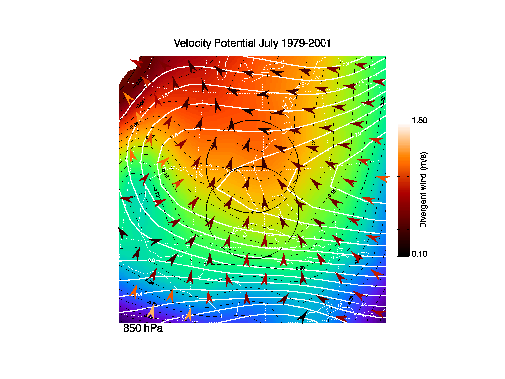
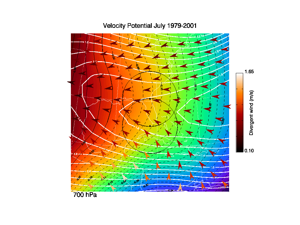
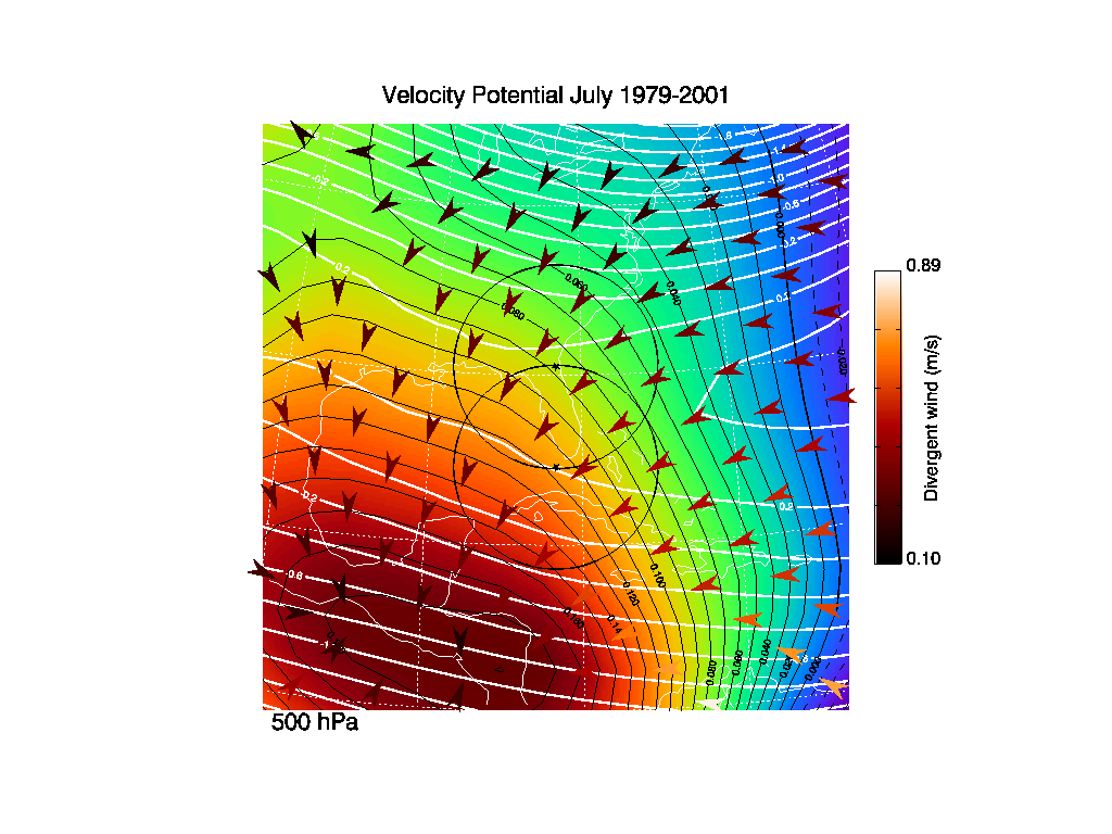
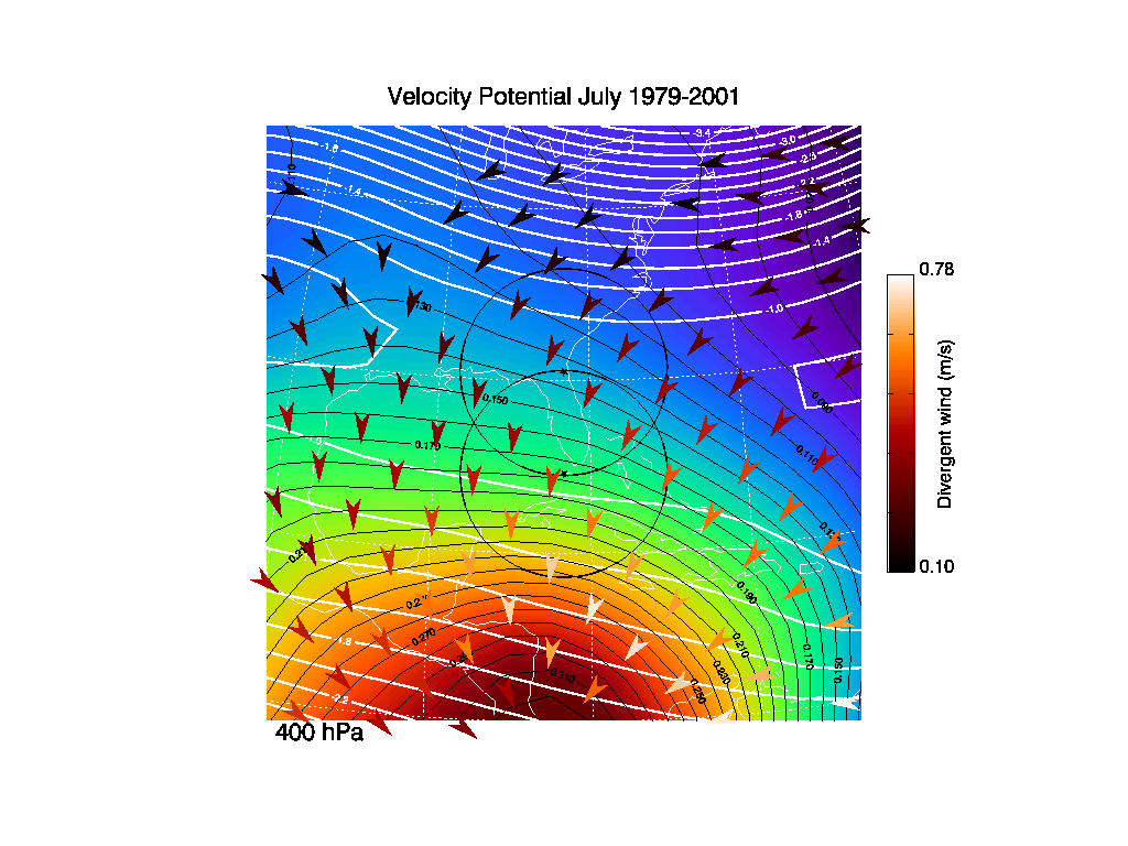
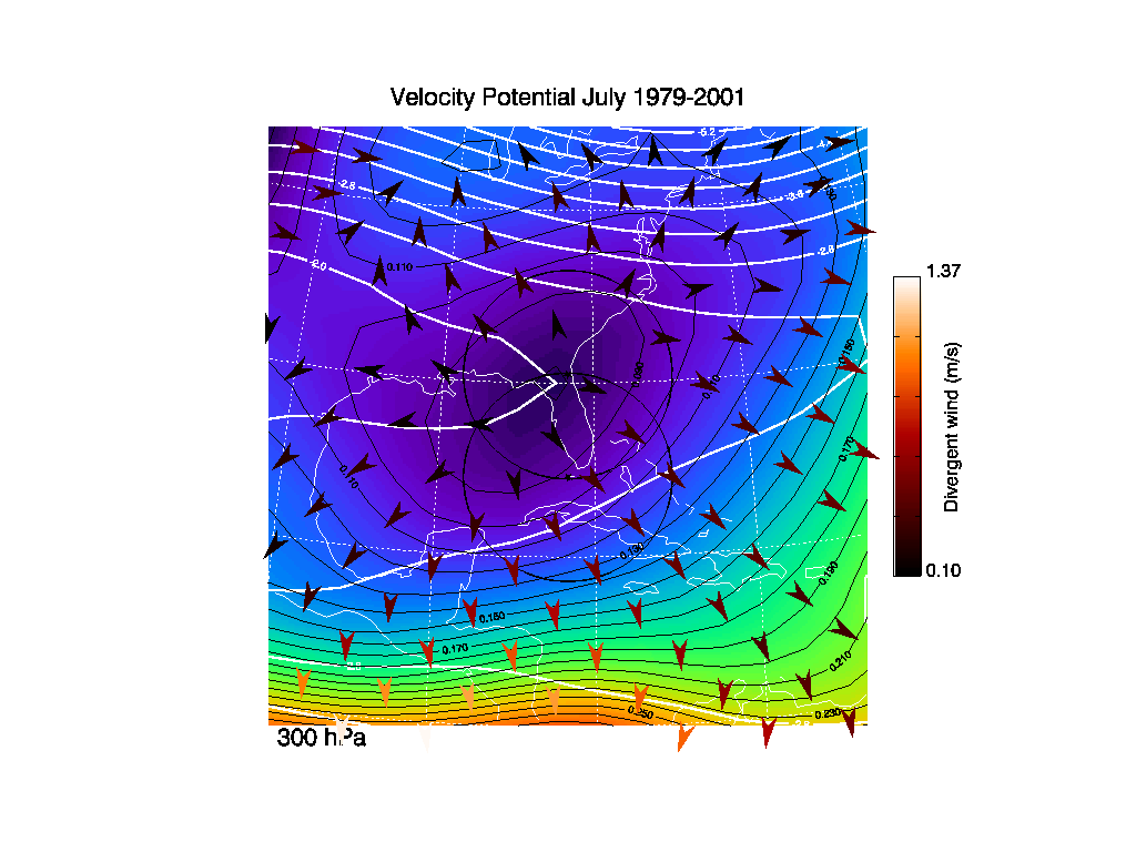
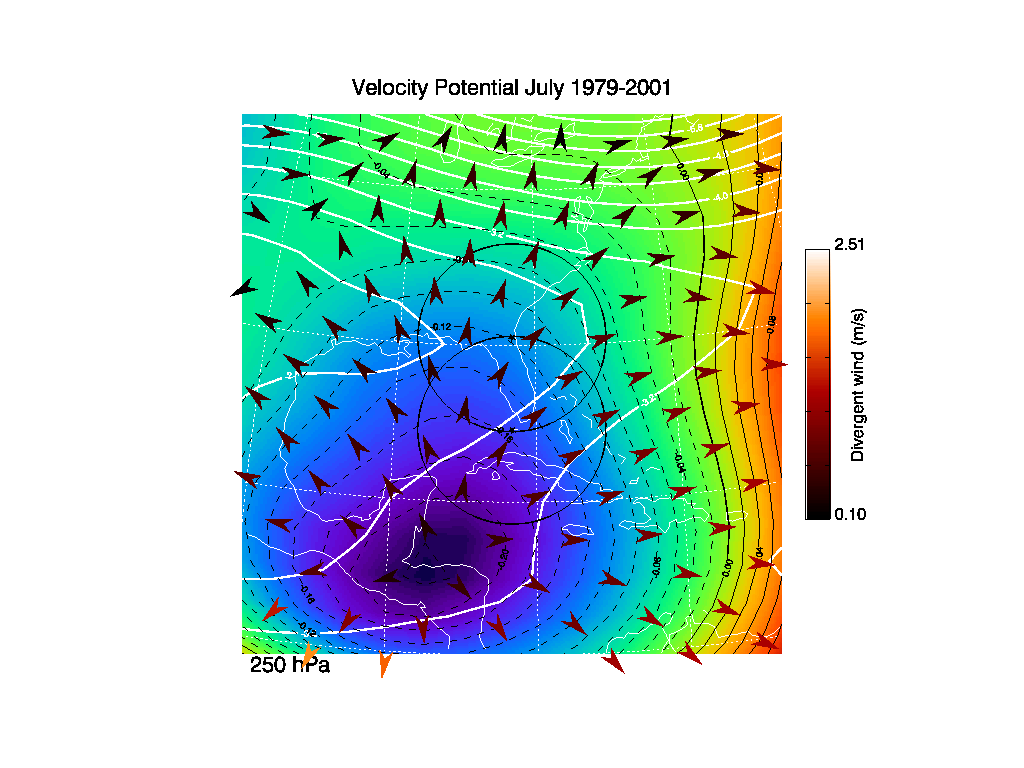
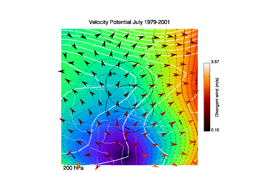
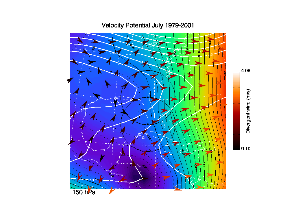
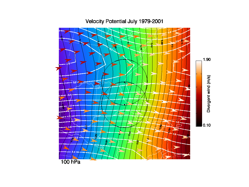
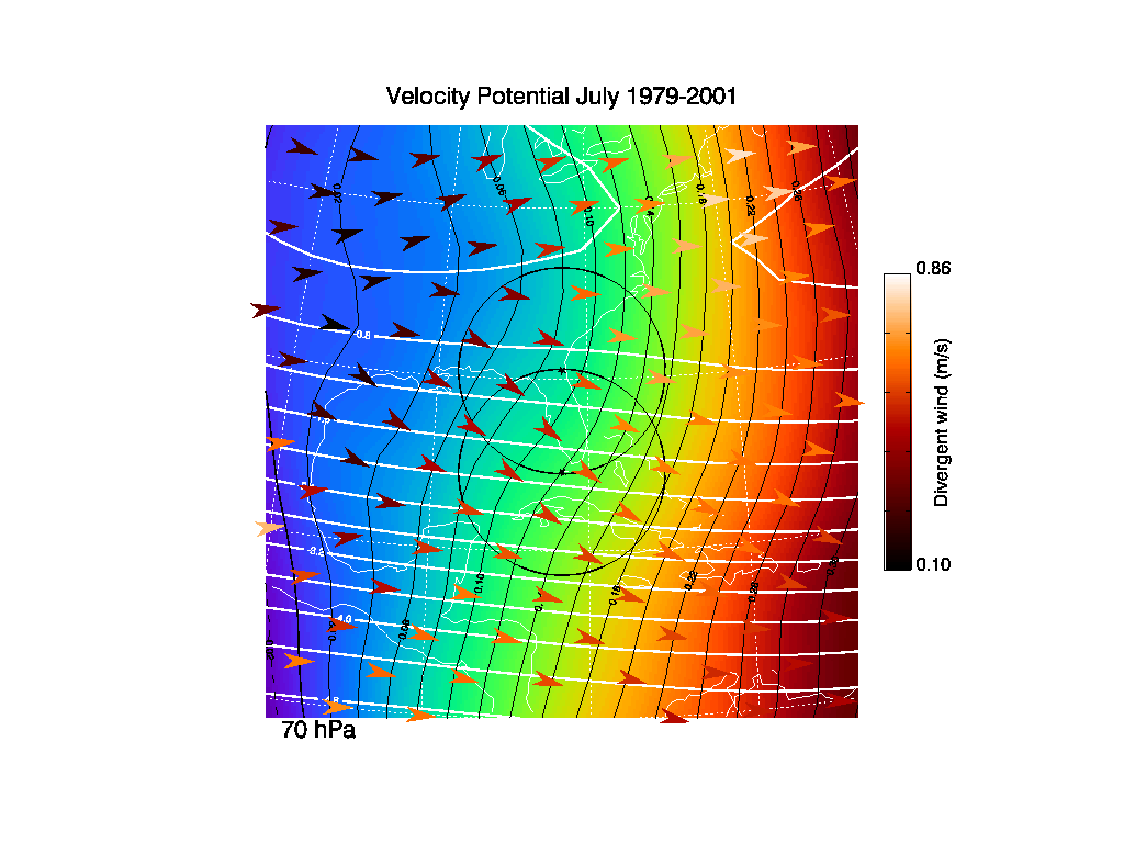
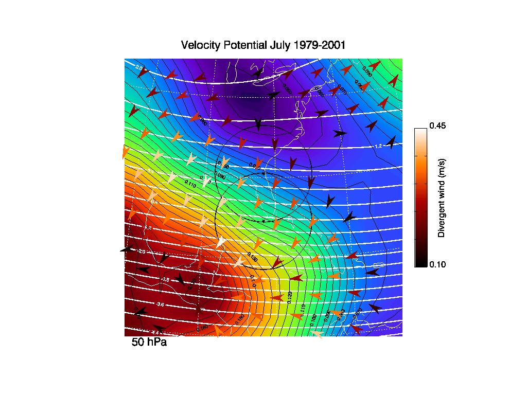
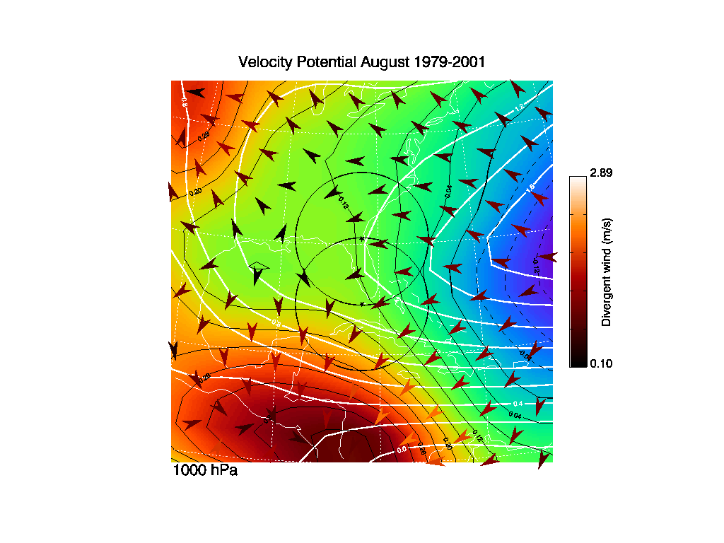
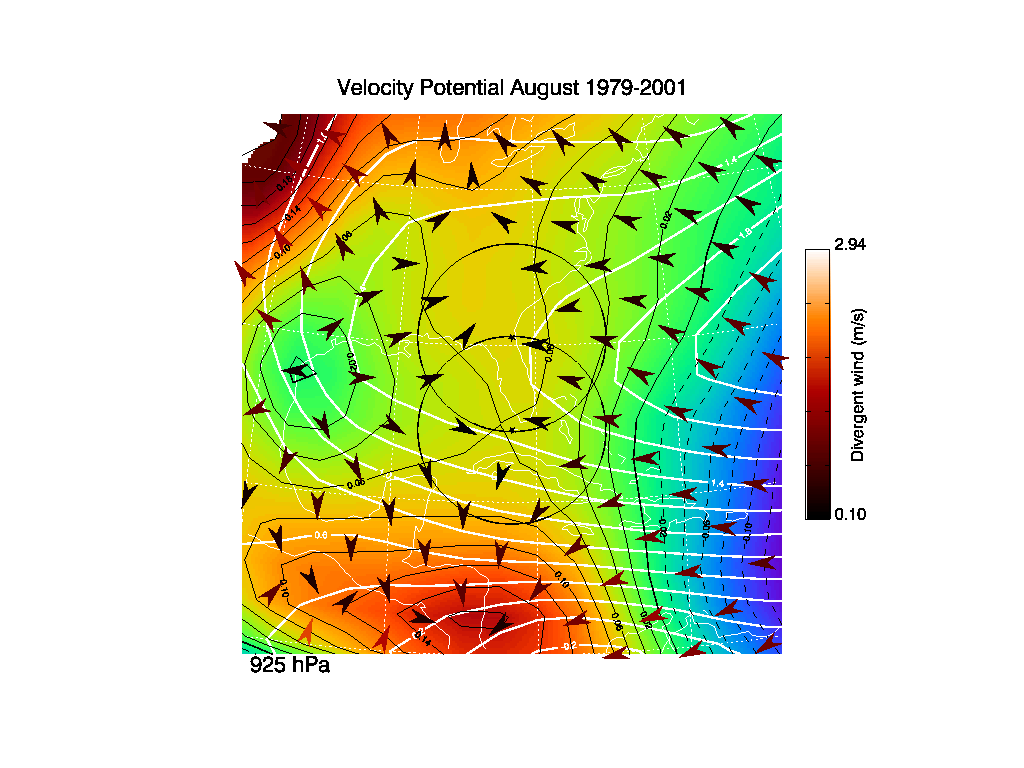
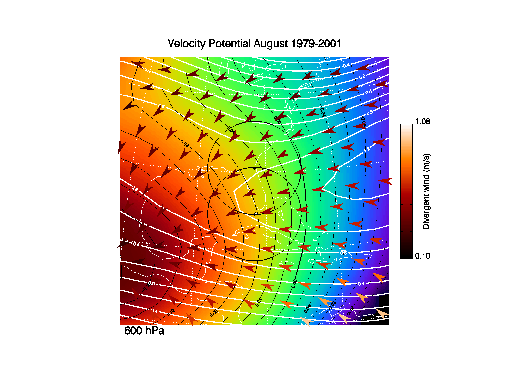
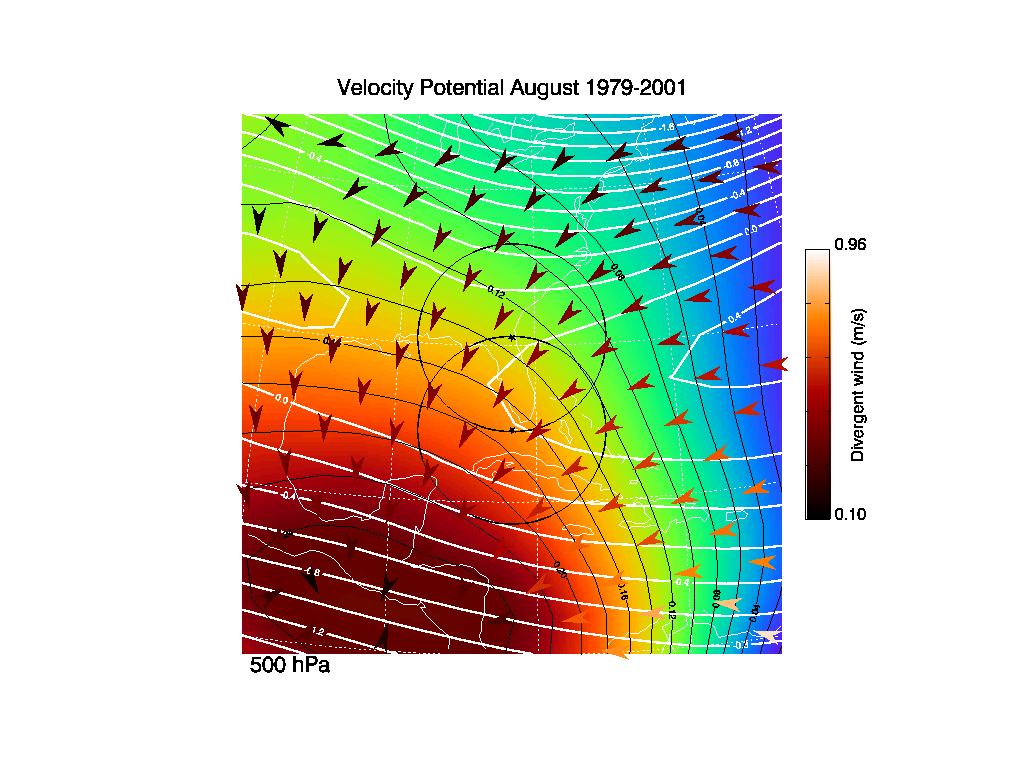
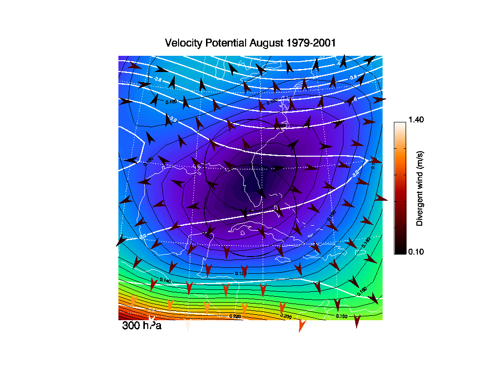
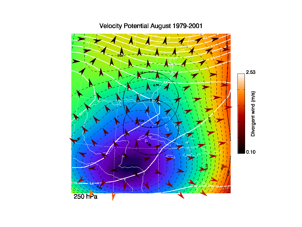
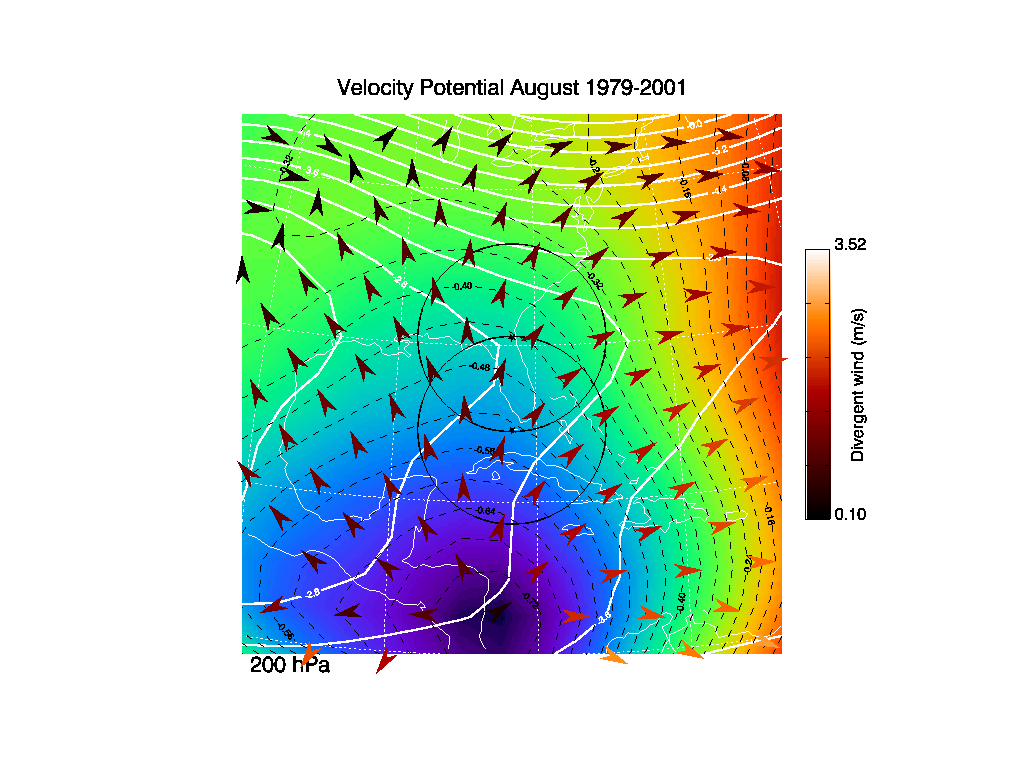
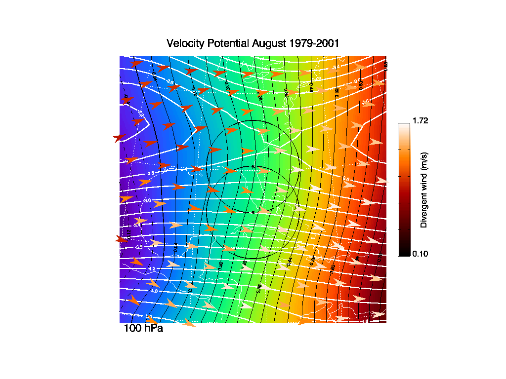
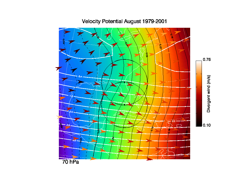
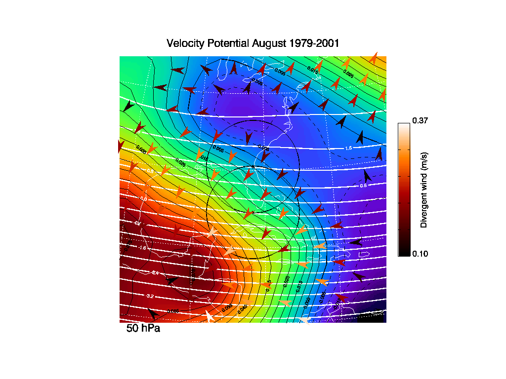
4. Velocity potential and stream function averages
The velocity potential time average (color images) is derived from the divergent
part of the wind field, while the streamlines (white solid contours)
are derived from the non-divergent part of the flow field. The
divergent wind is calculated by taking the gradient of the velocity
potential. Hence, air is diverging away from lows (blues and purples),
and towards the highs (reds and oranges) in the color image. The
divergent wind is proportional to the color spacing, and perpendicular
to those color contours. The non-divergent wind is calculated by
taking the curl of the streamlines. Hence, the non-divergent wind is
proportional to the contour spacing, and parallel to those color
contours.
The stream line and velocity potential values
have been normalized by dividing by the Earth's radius.
The arrows indicate the direction of the divergent wind and the strength
of this divergent wind is indicated by the color scale on the RHS of each
figure.
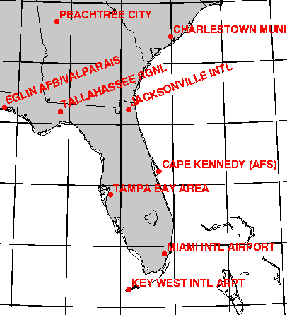
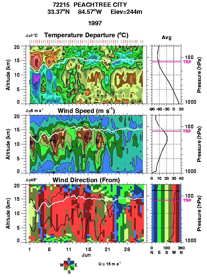
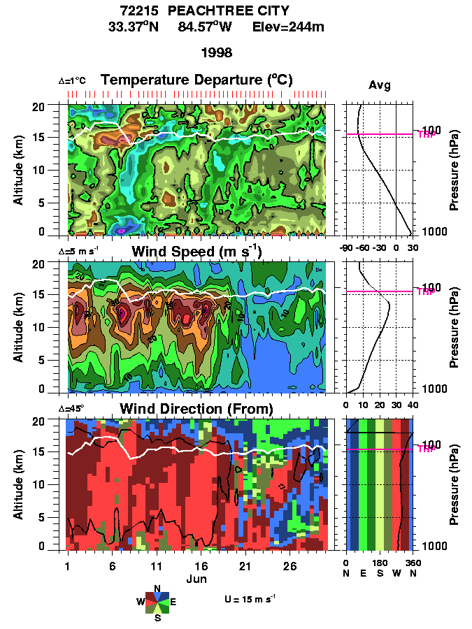
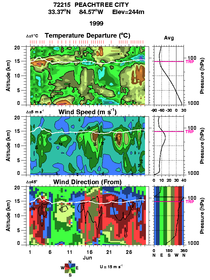
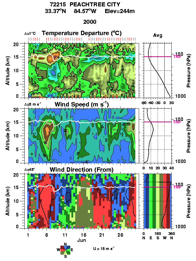
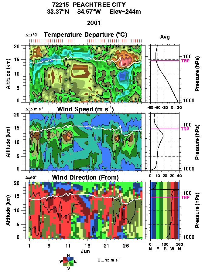
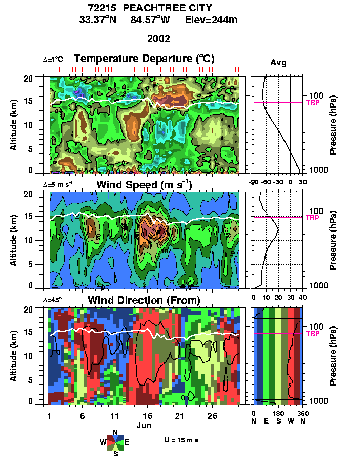
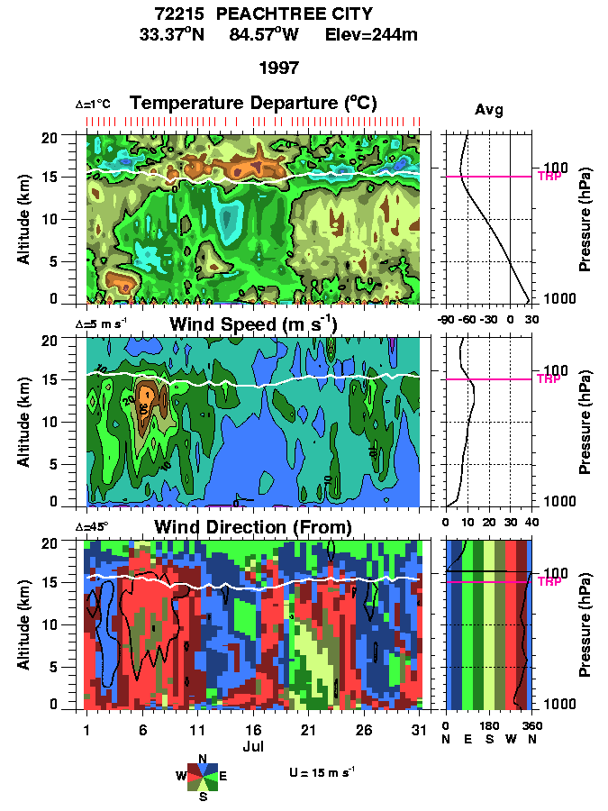
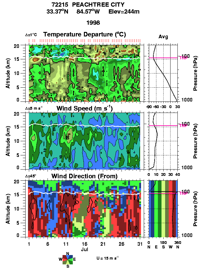
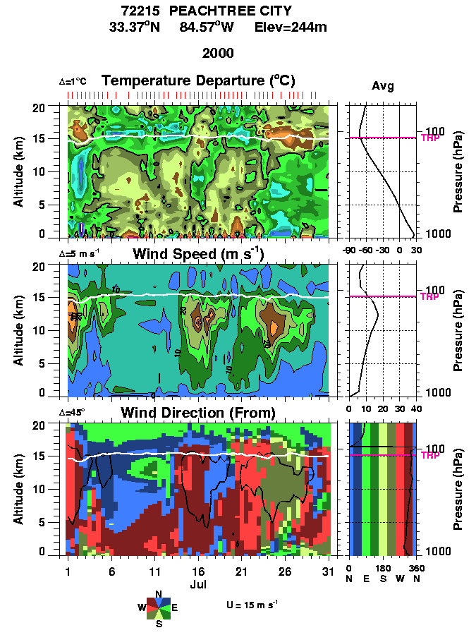
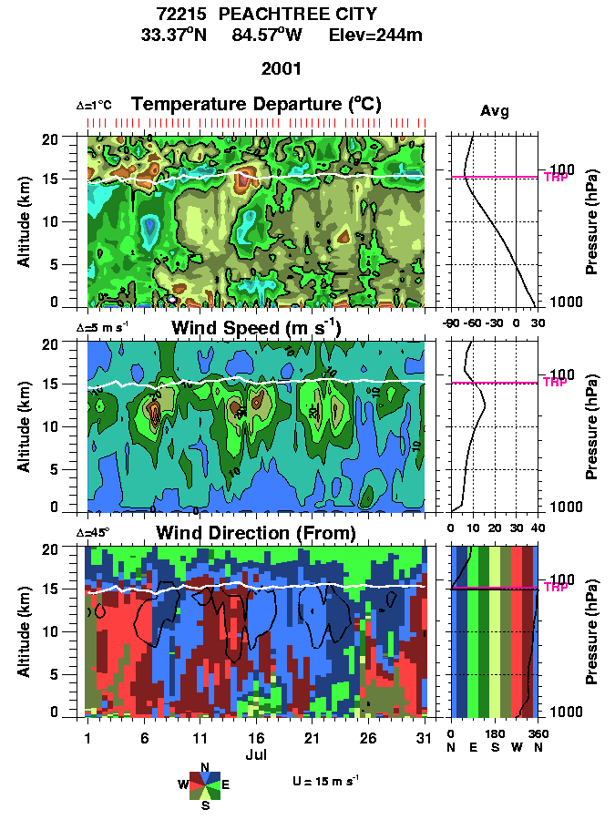
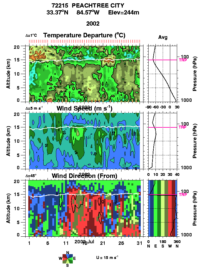
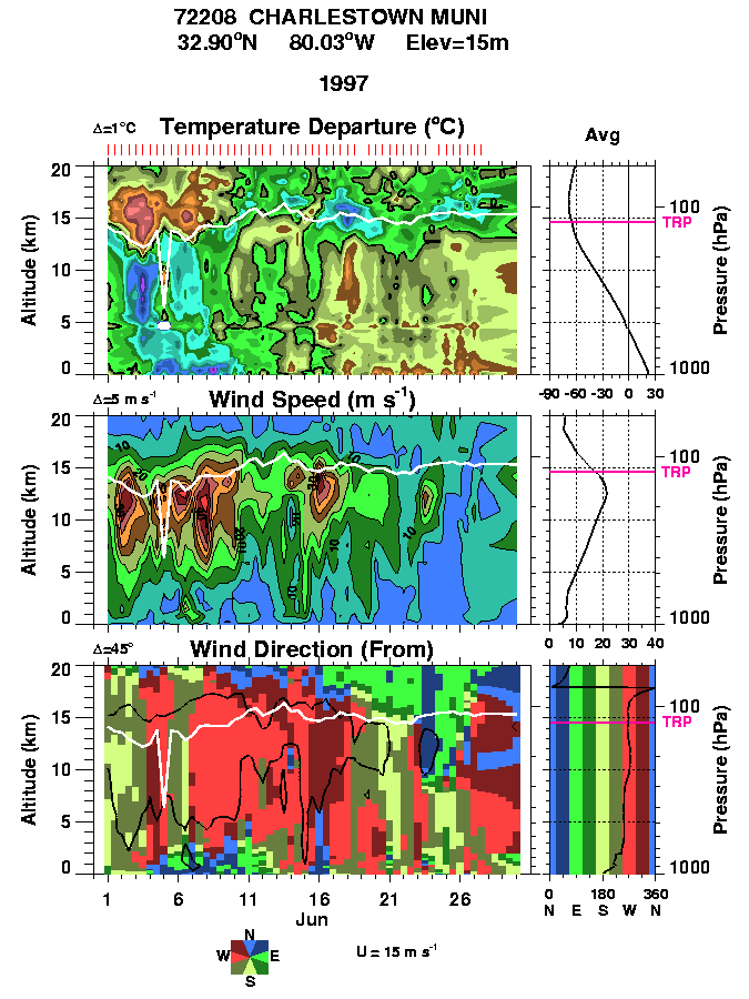
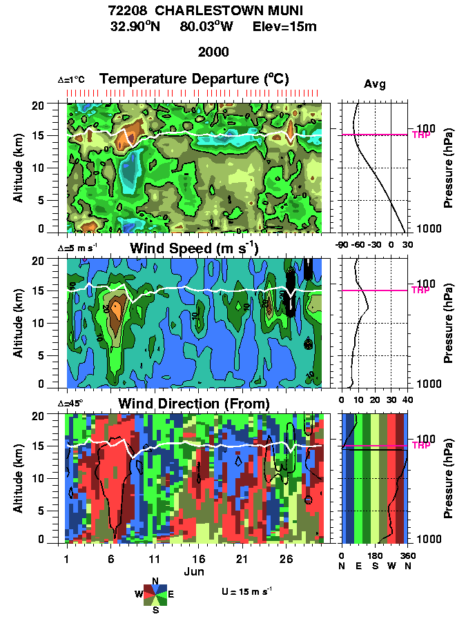
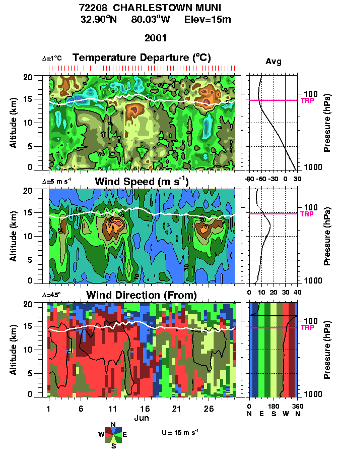
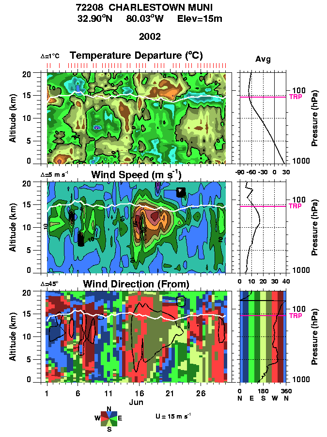
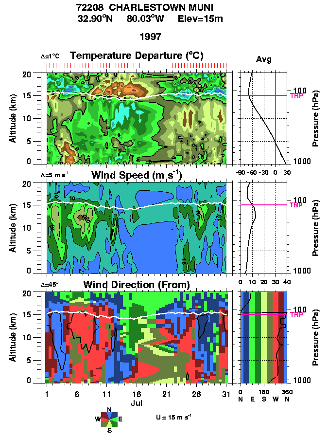
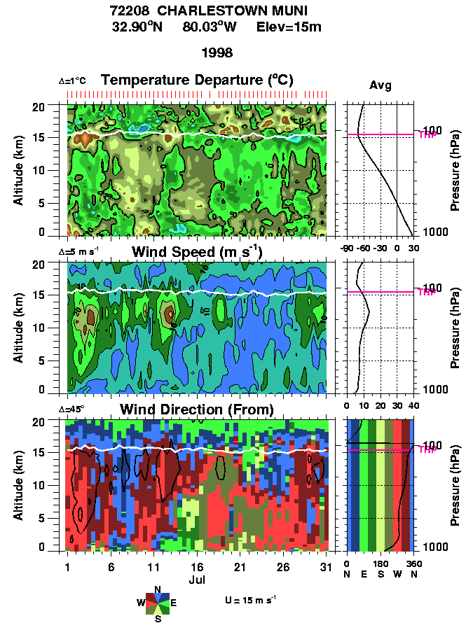
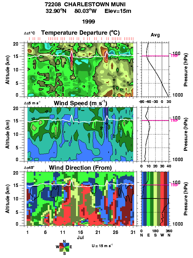
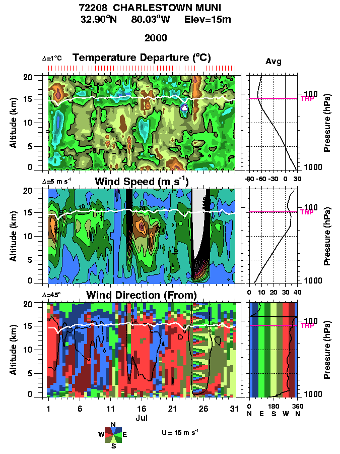
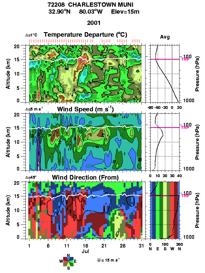
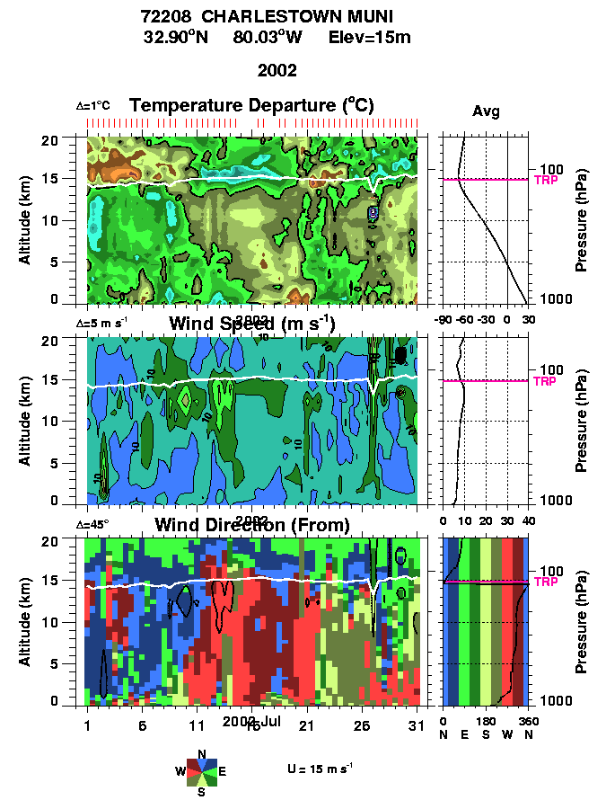
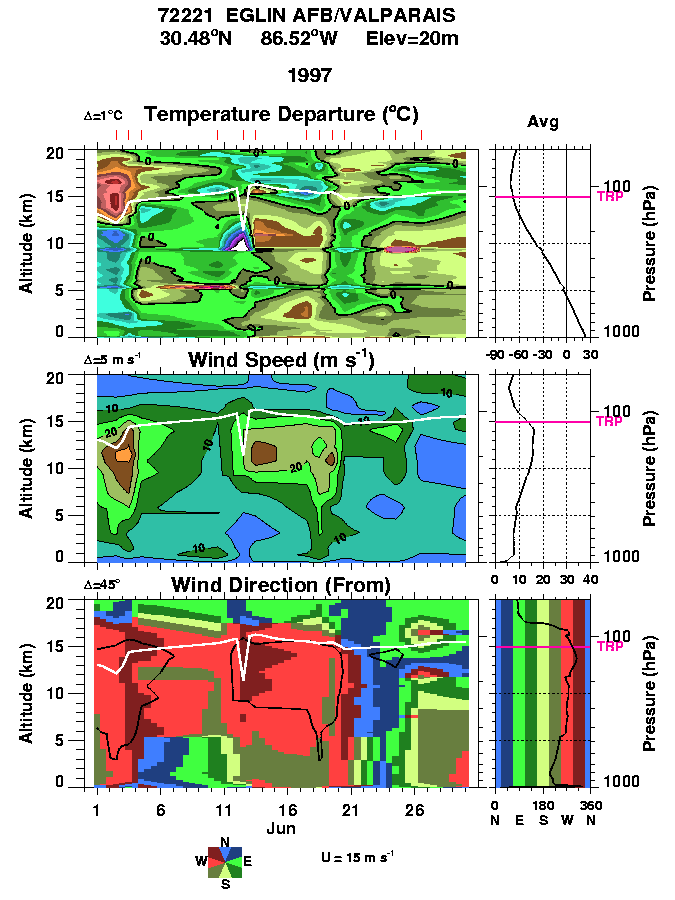
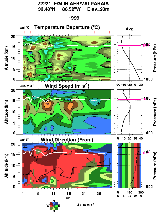
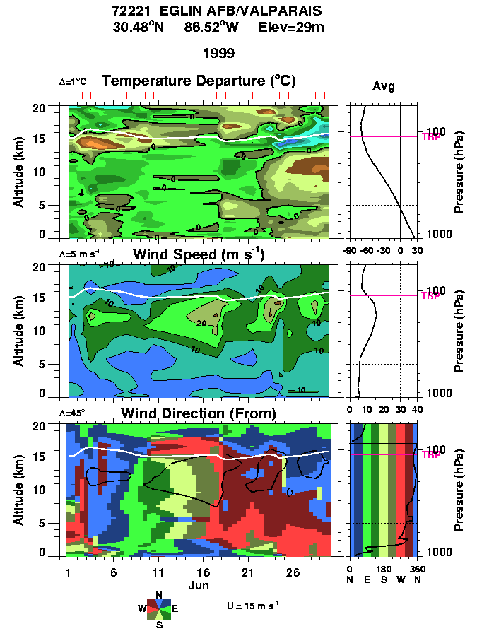
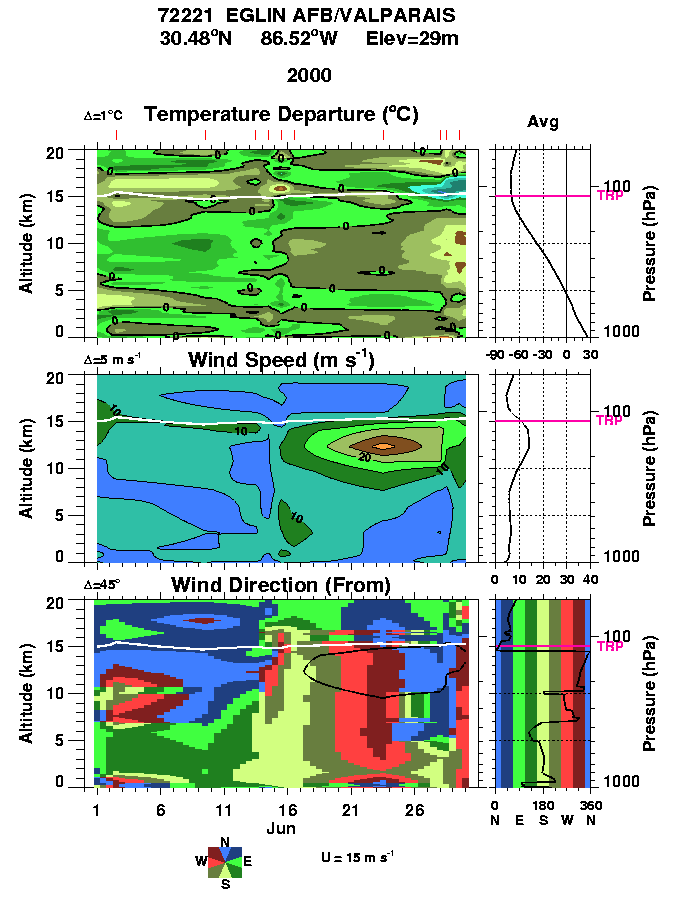
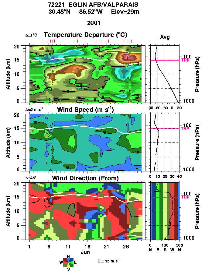
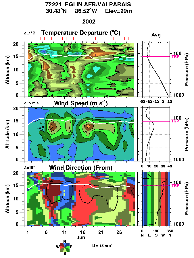
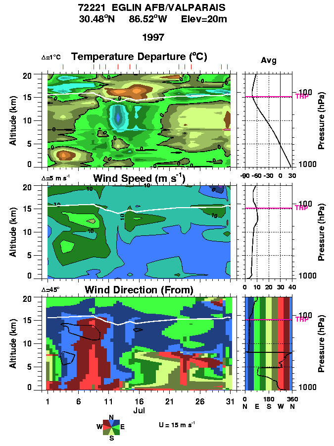
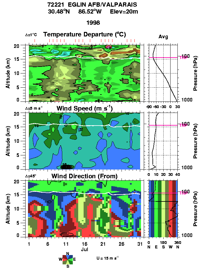
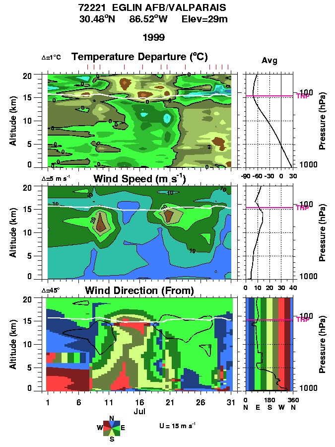
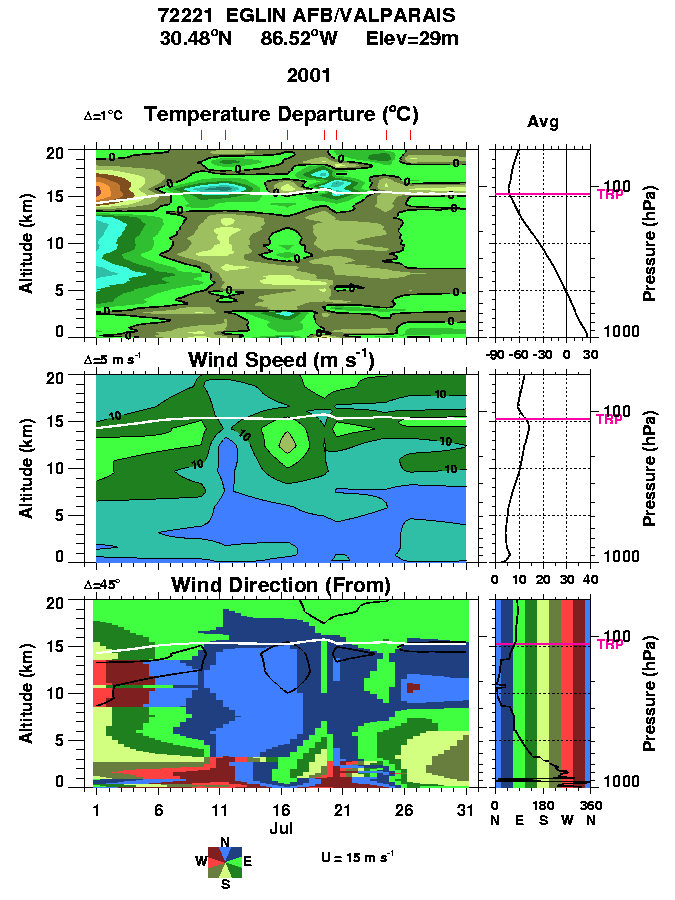
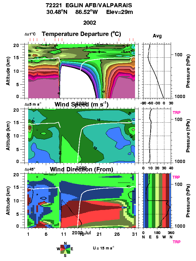
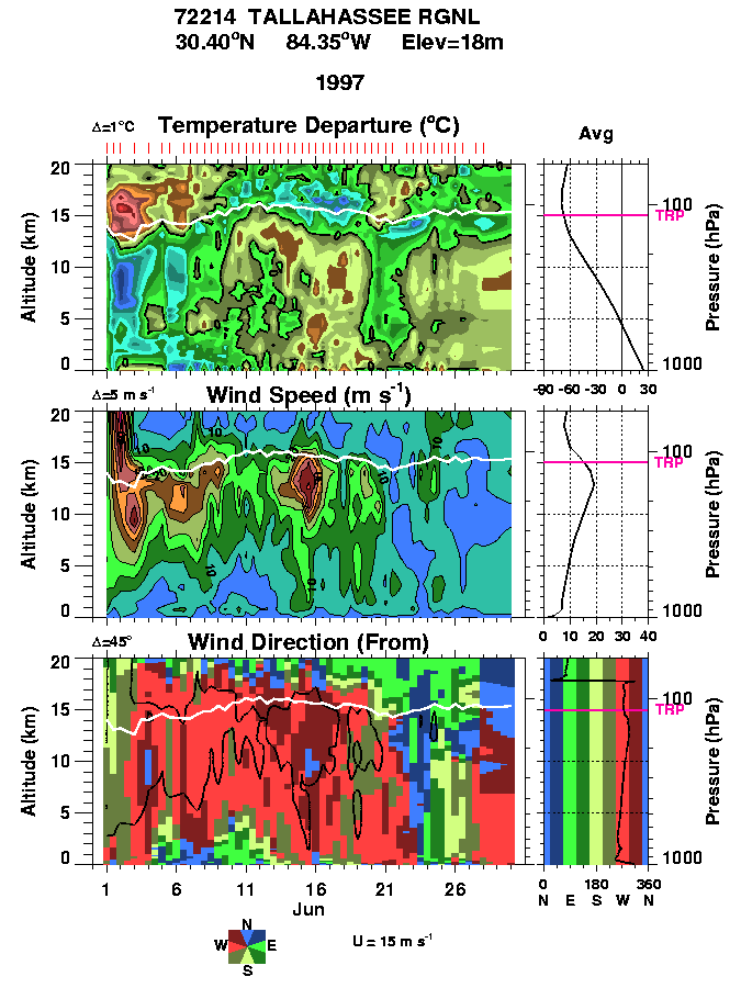
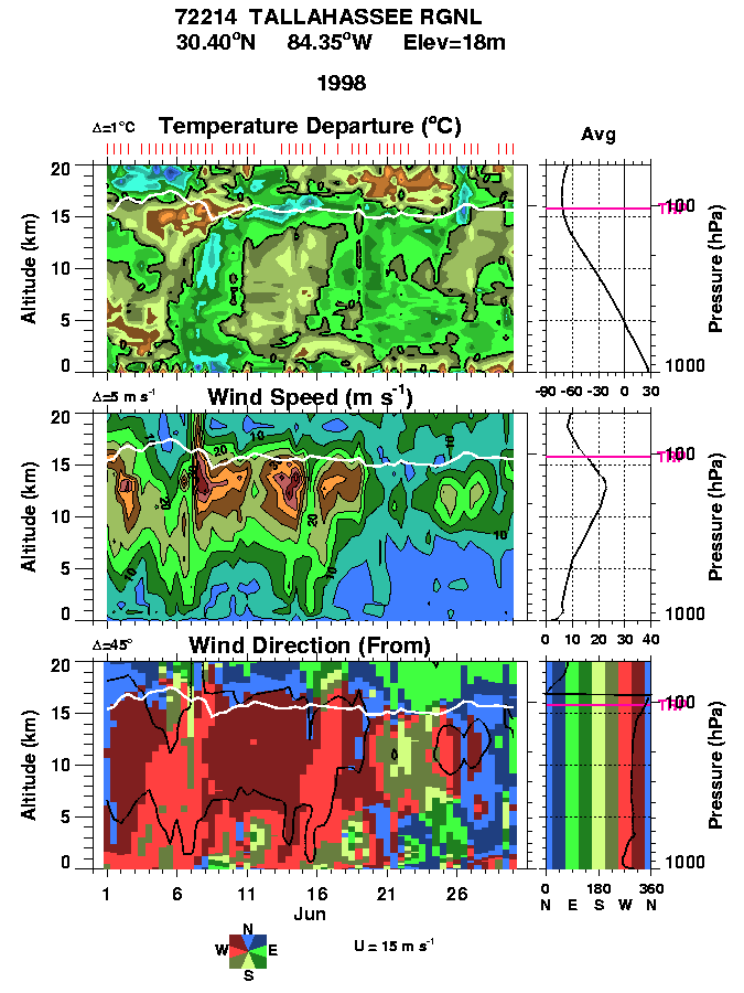
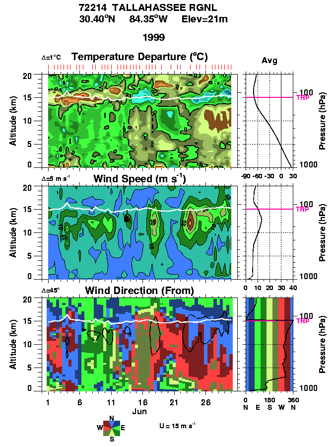
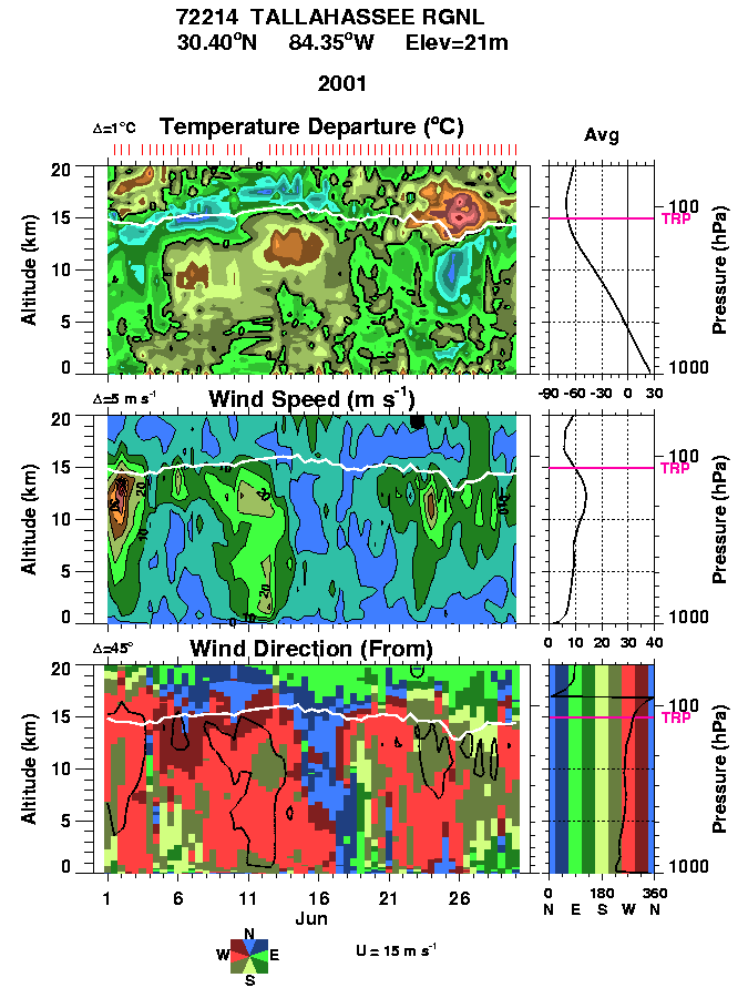
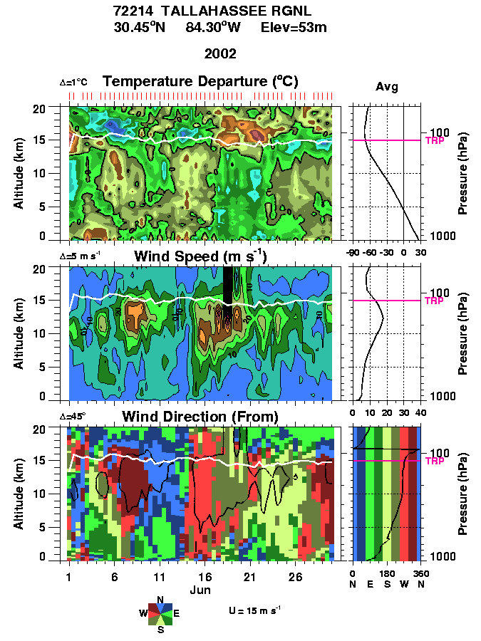
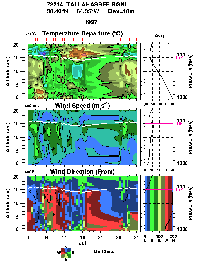
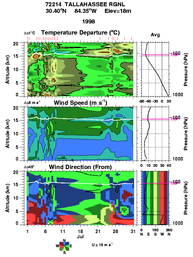
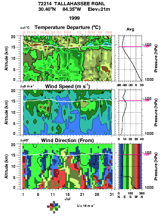
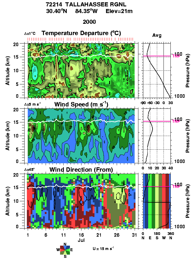
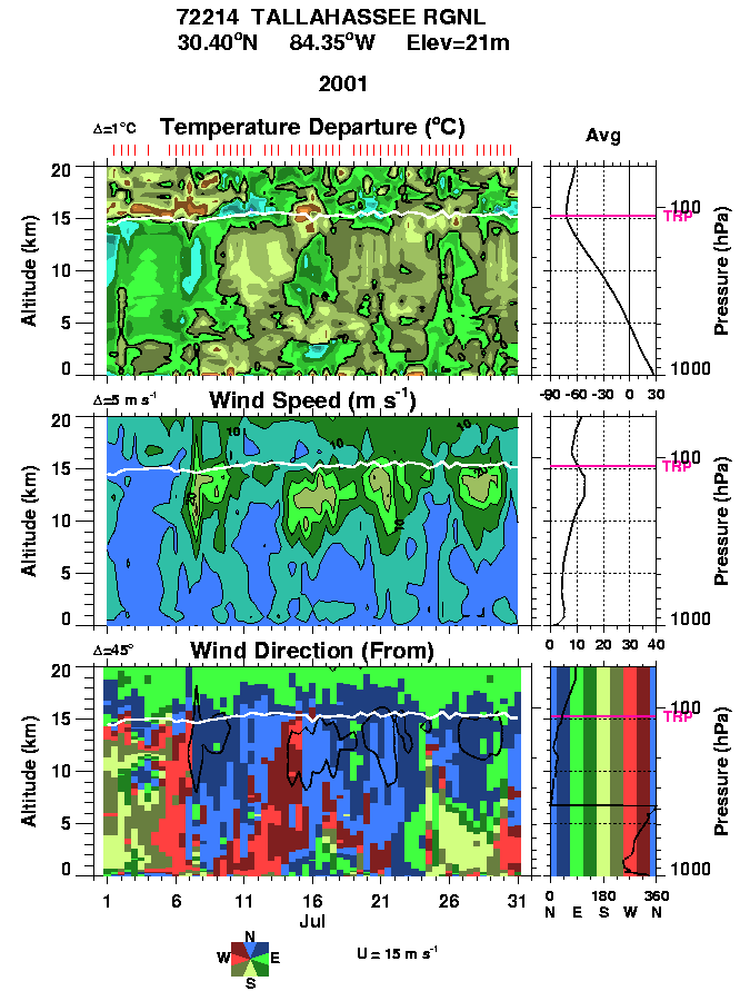
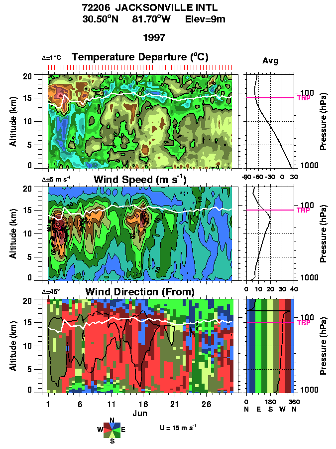
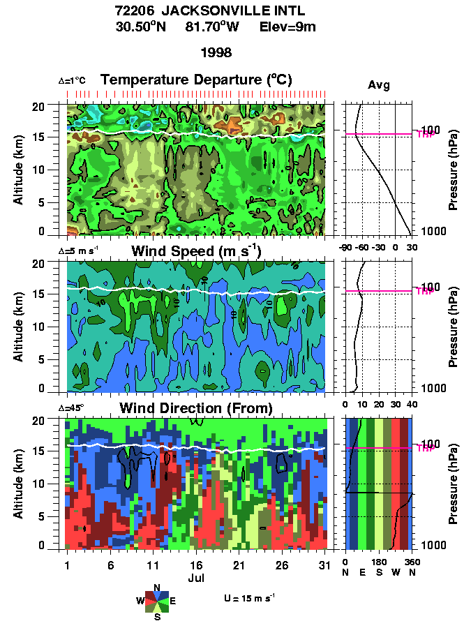
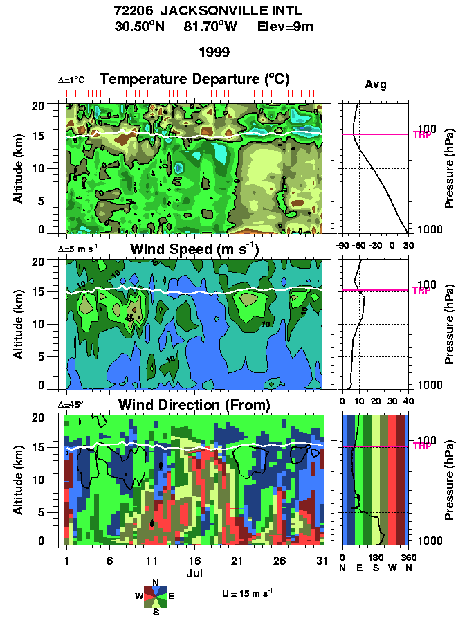
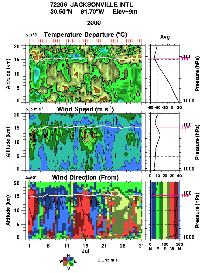
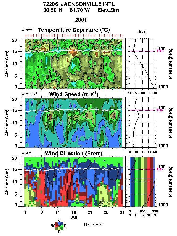
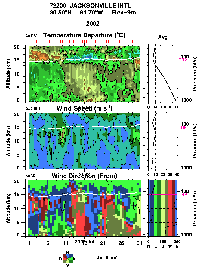
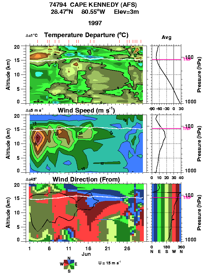
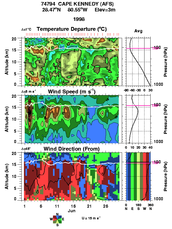
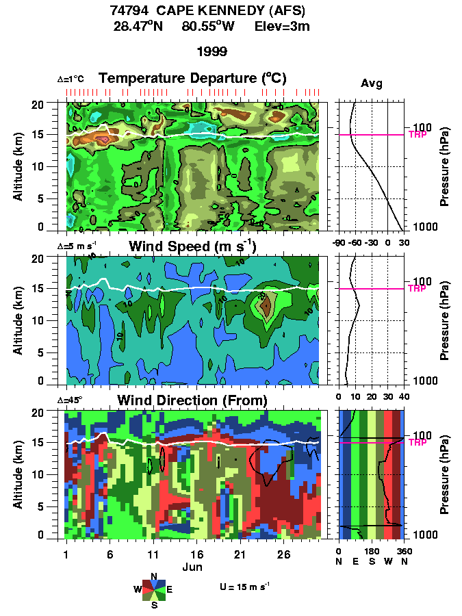
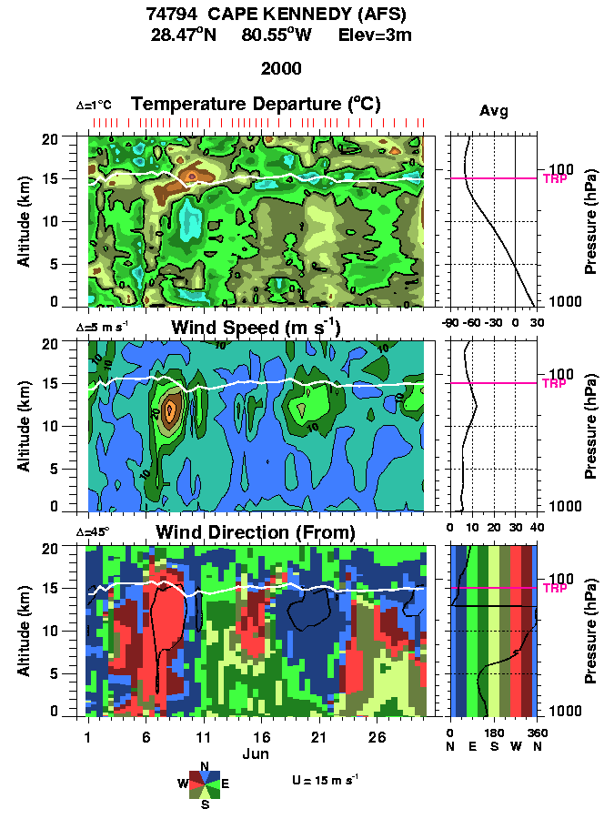
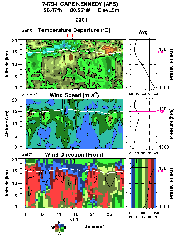
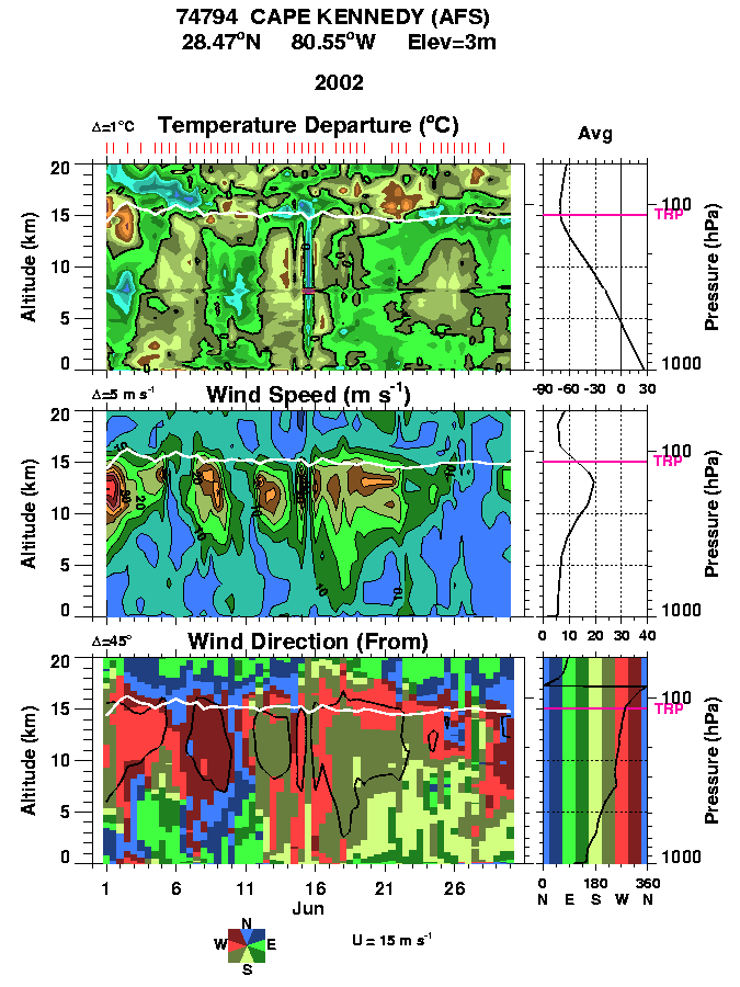
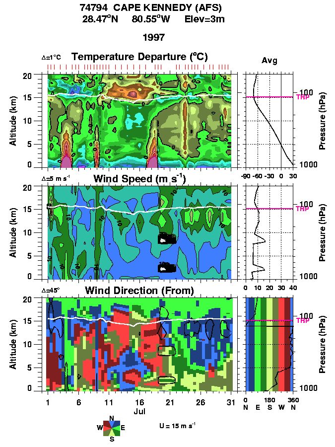
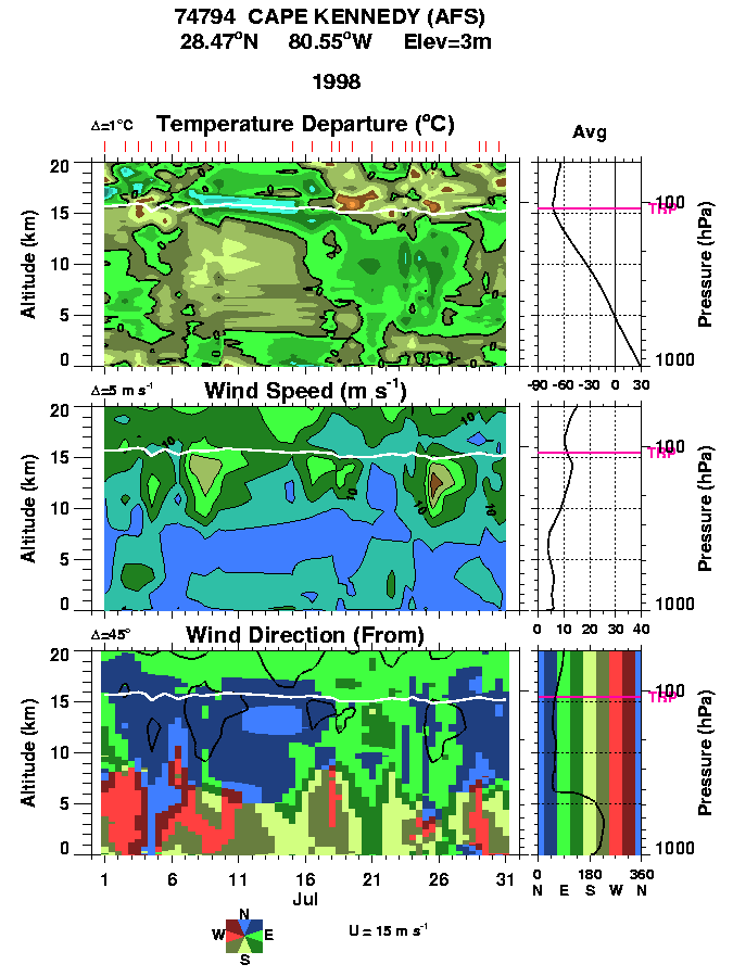
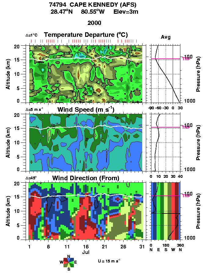
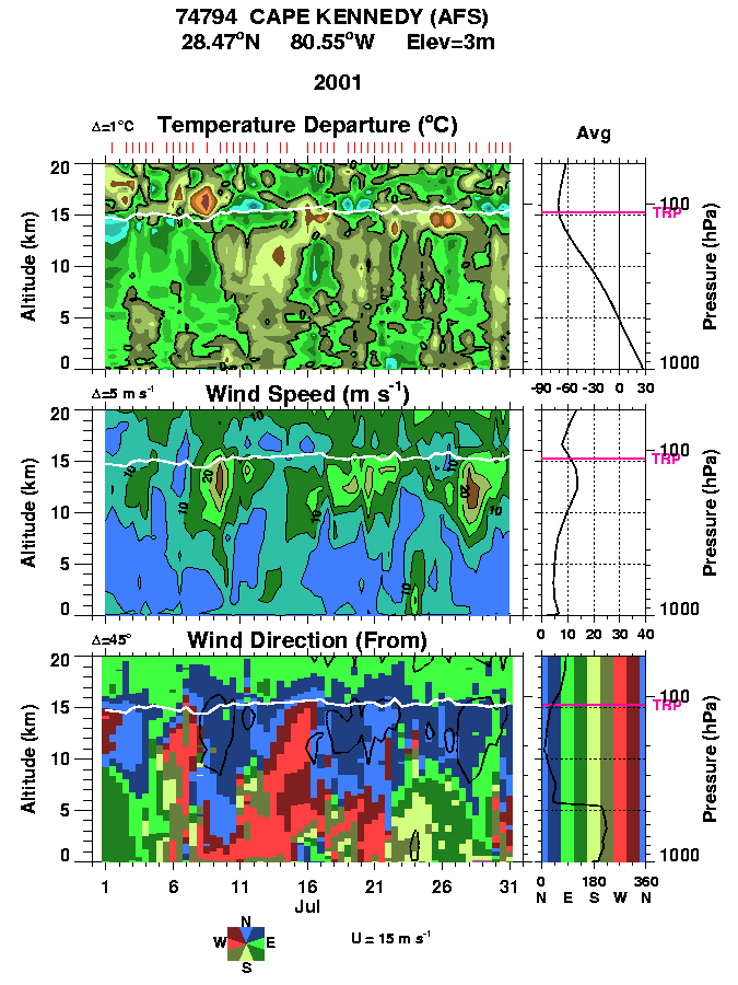
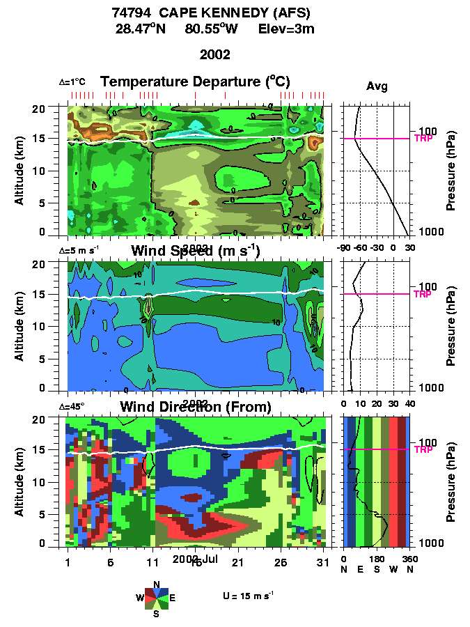
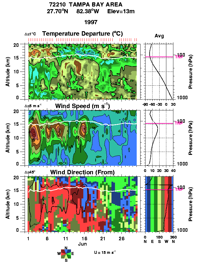
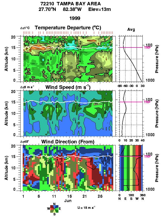
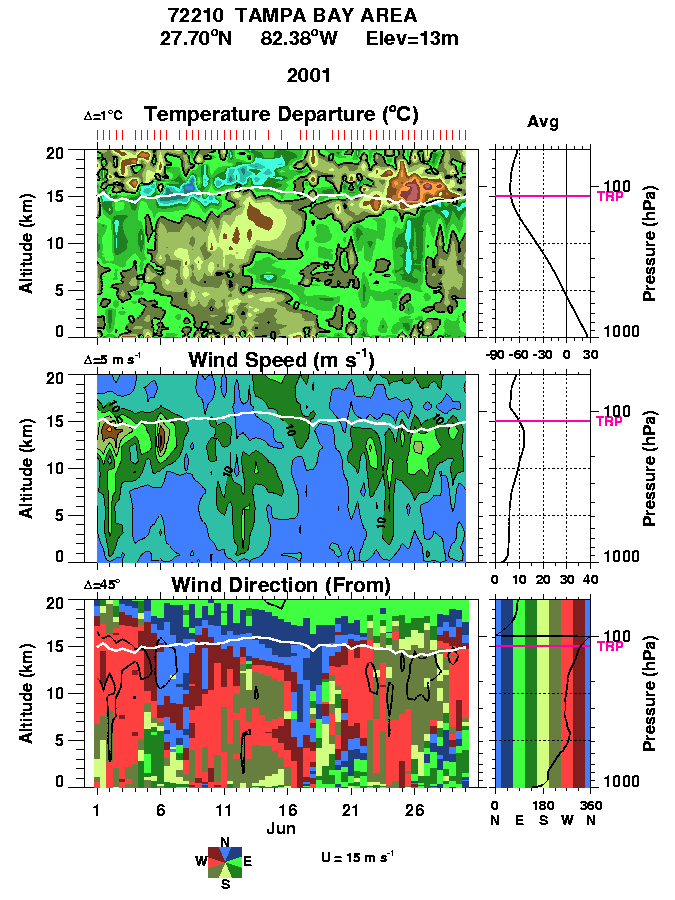
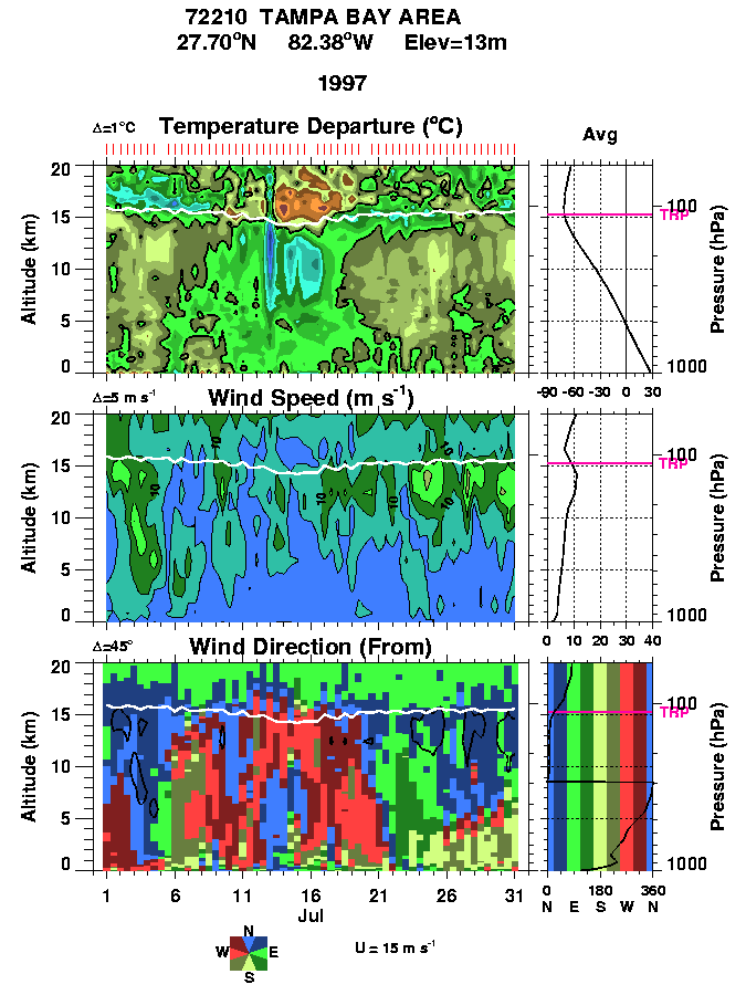
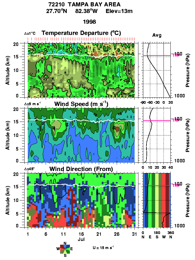
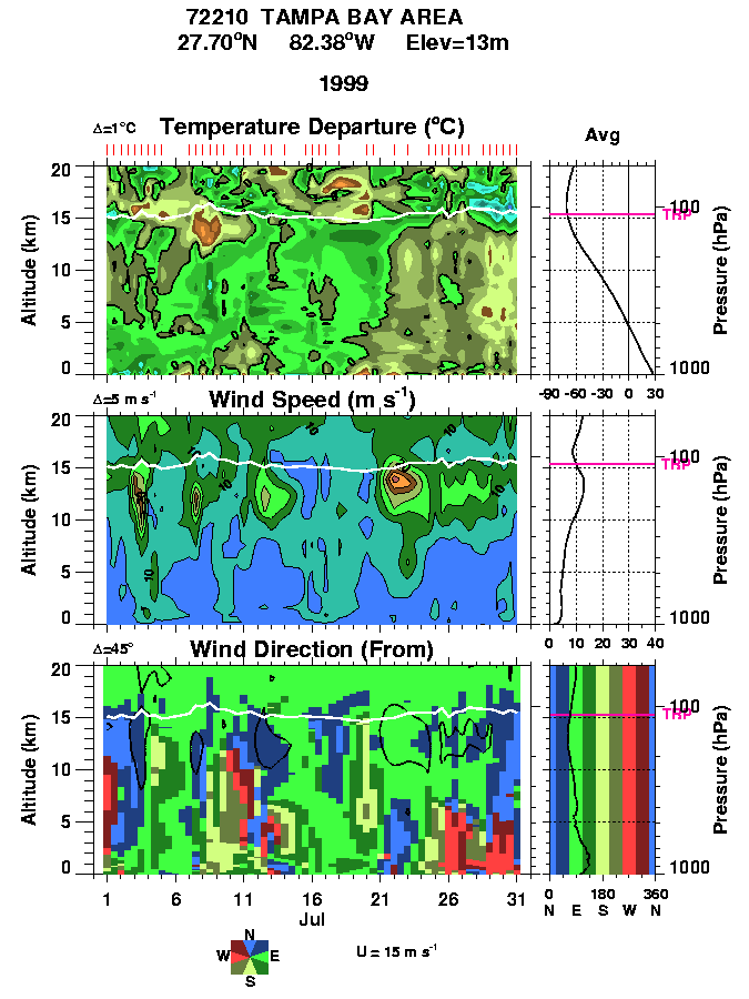
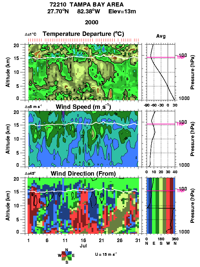
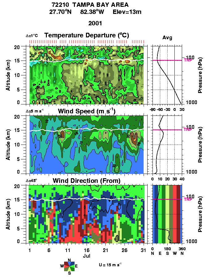
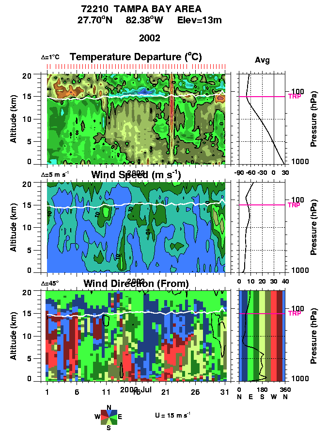
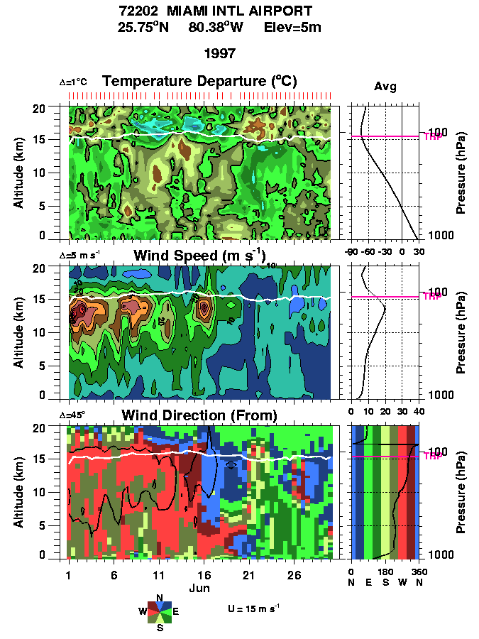
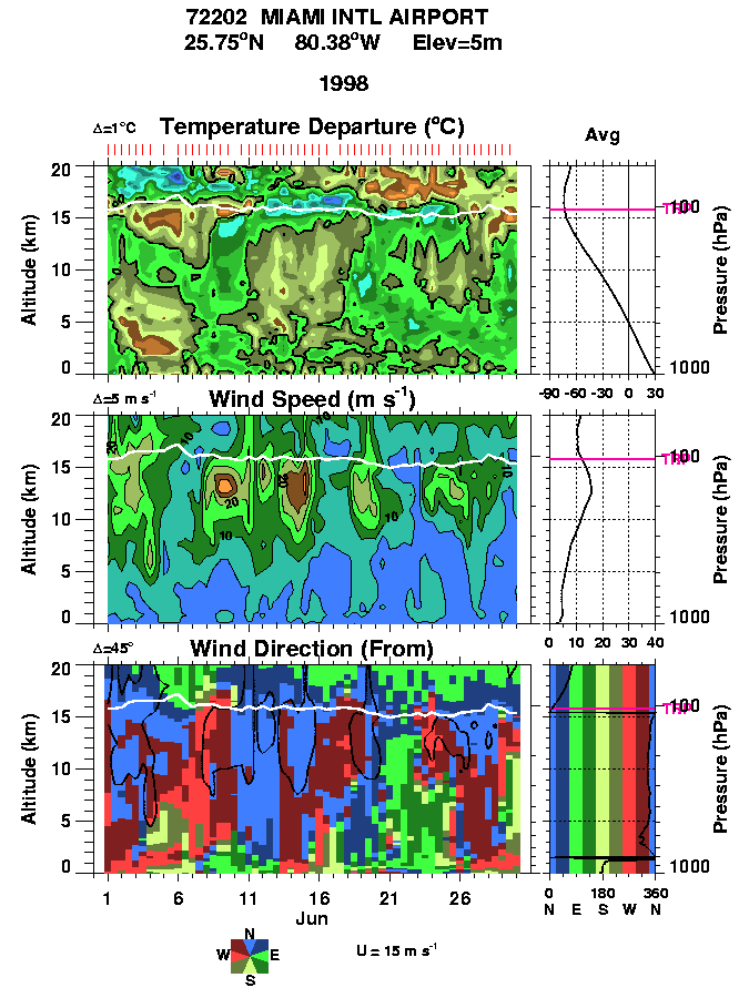
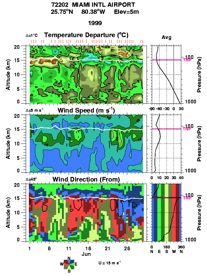
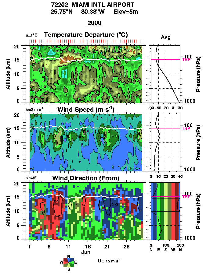
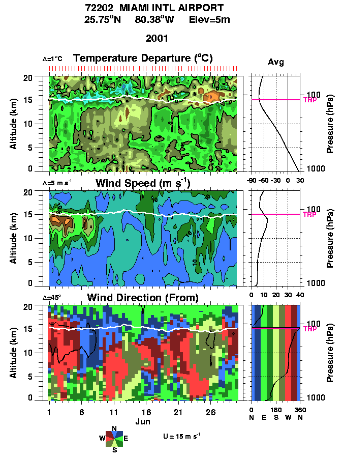
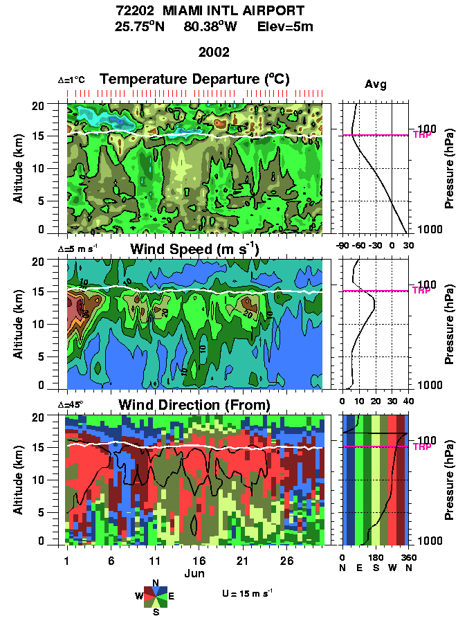
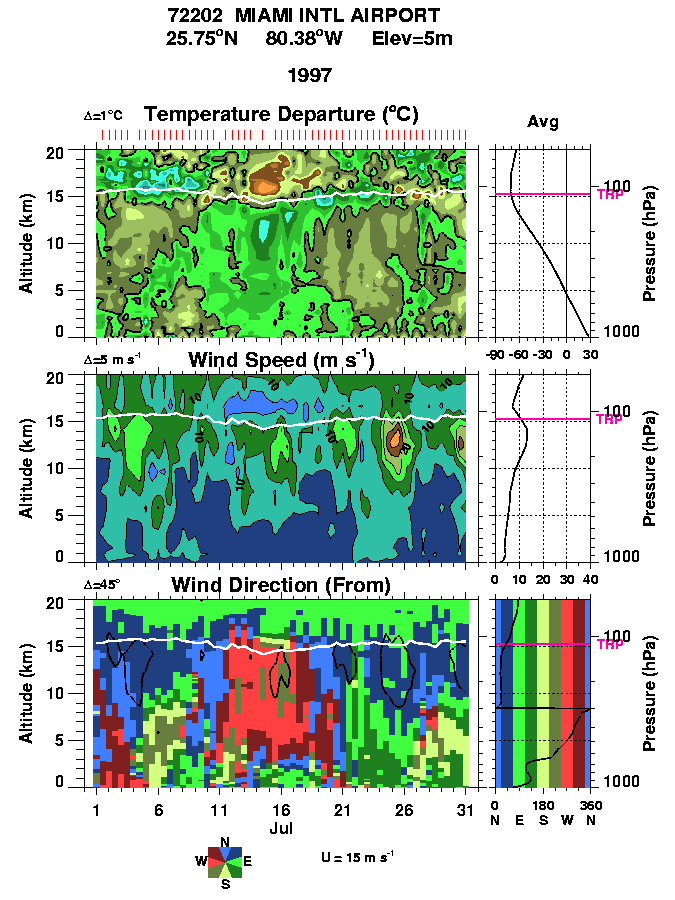
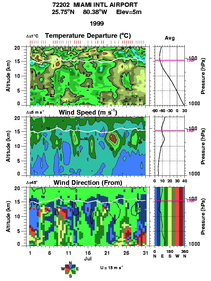
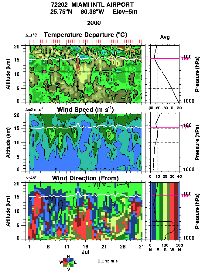
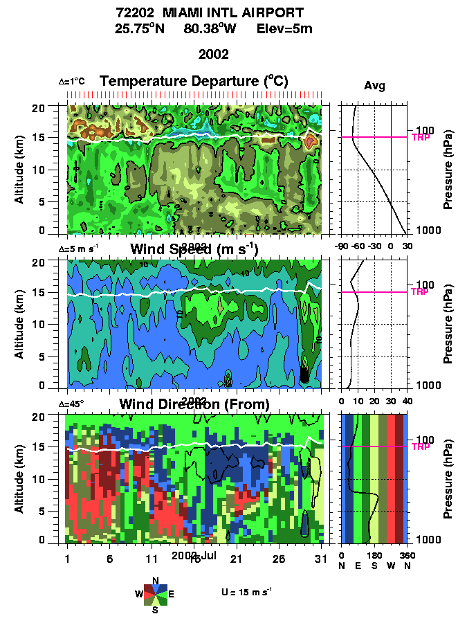
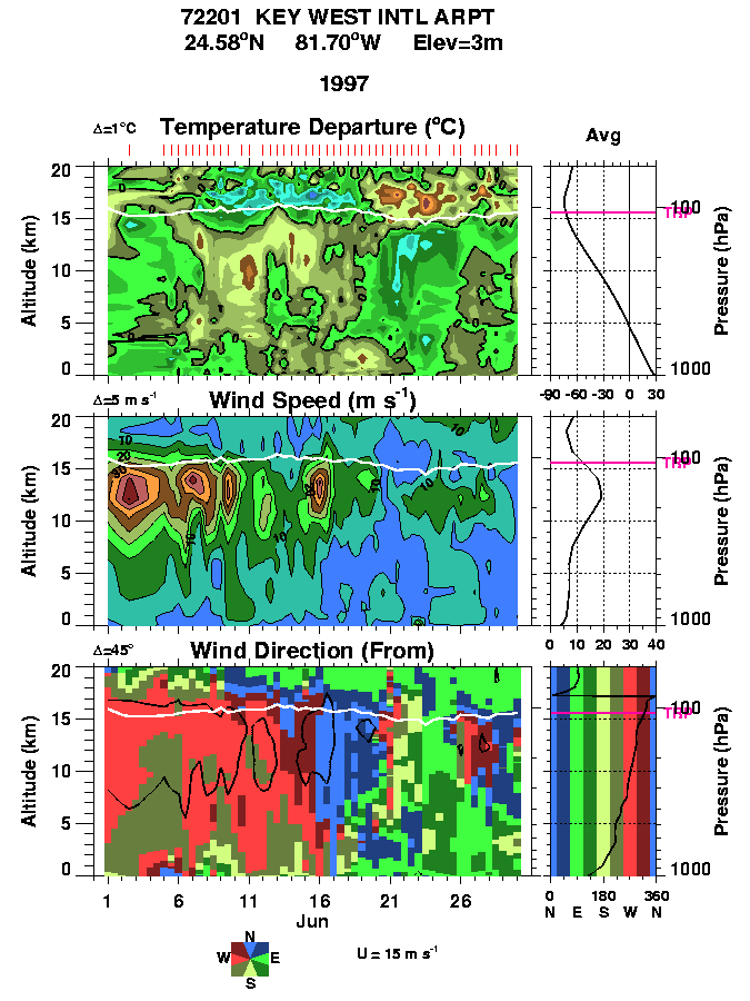
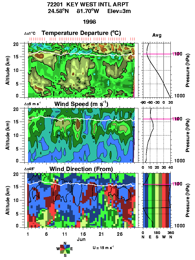
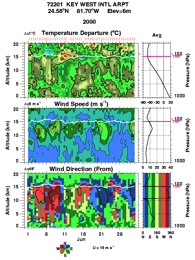
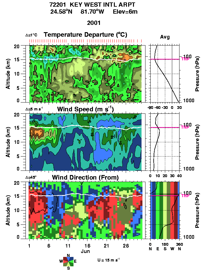
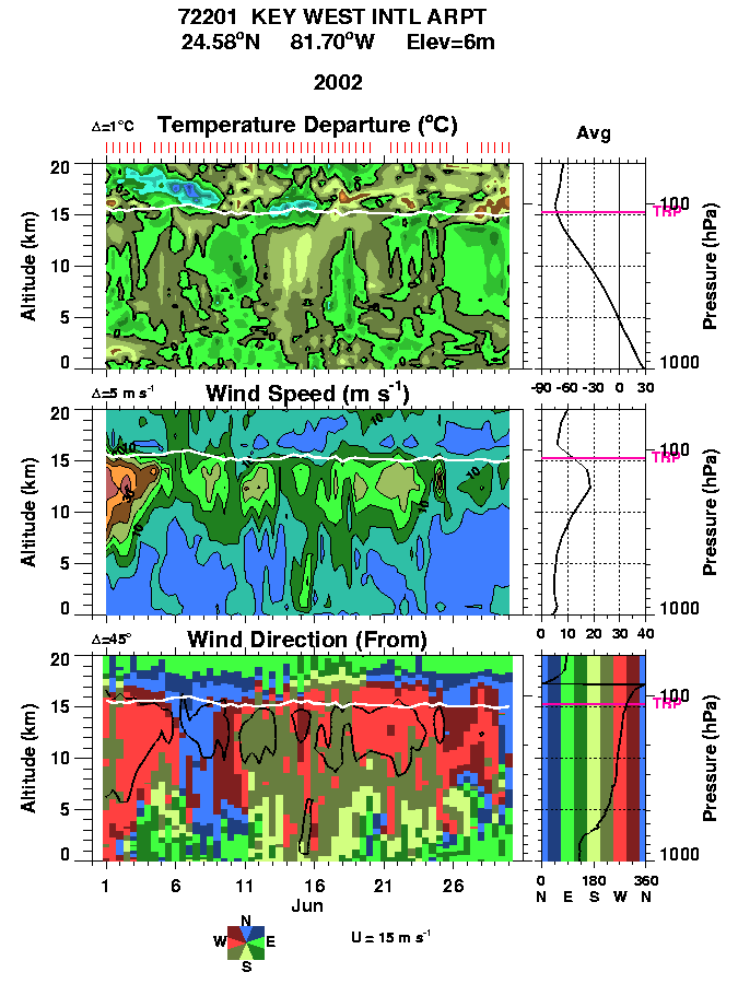
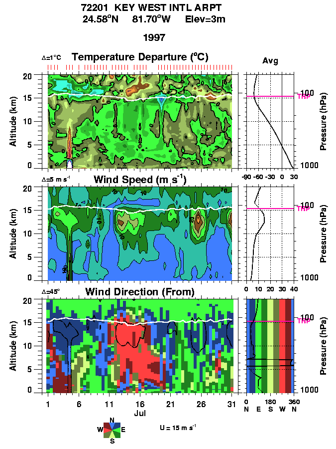
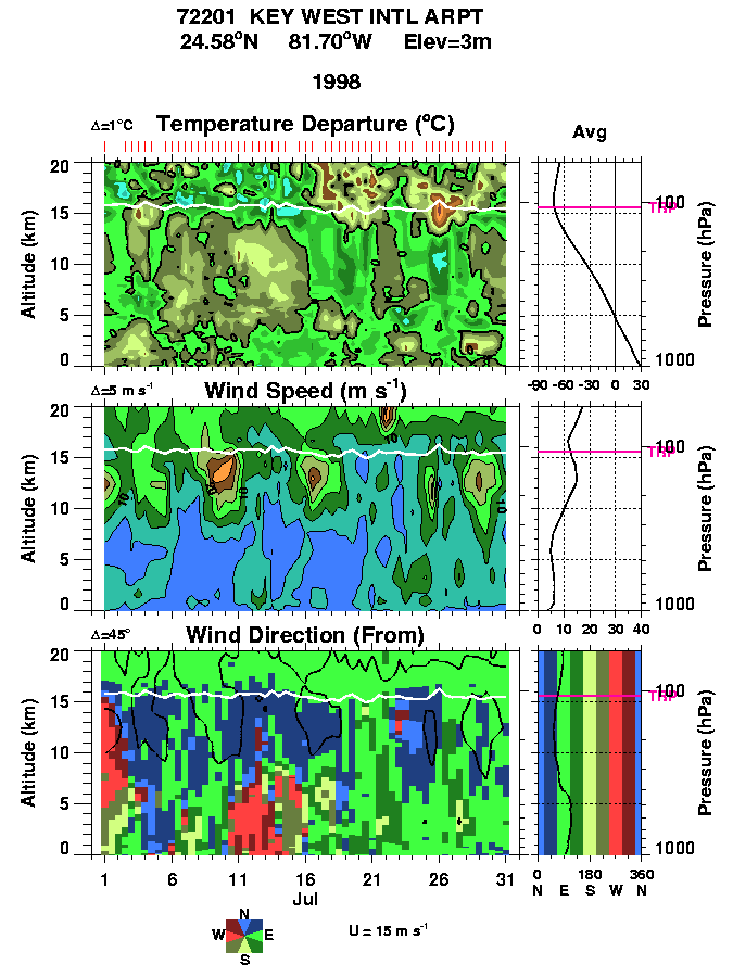
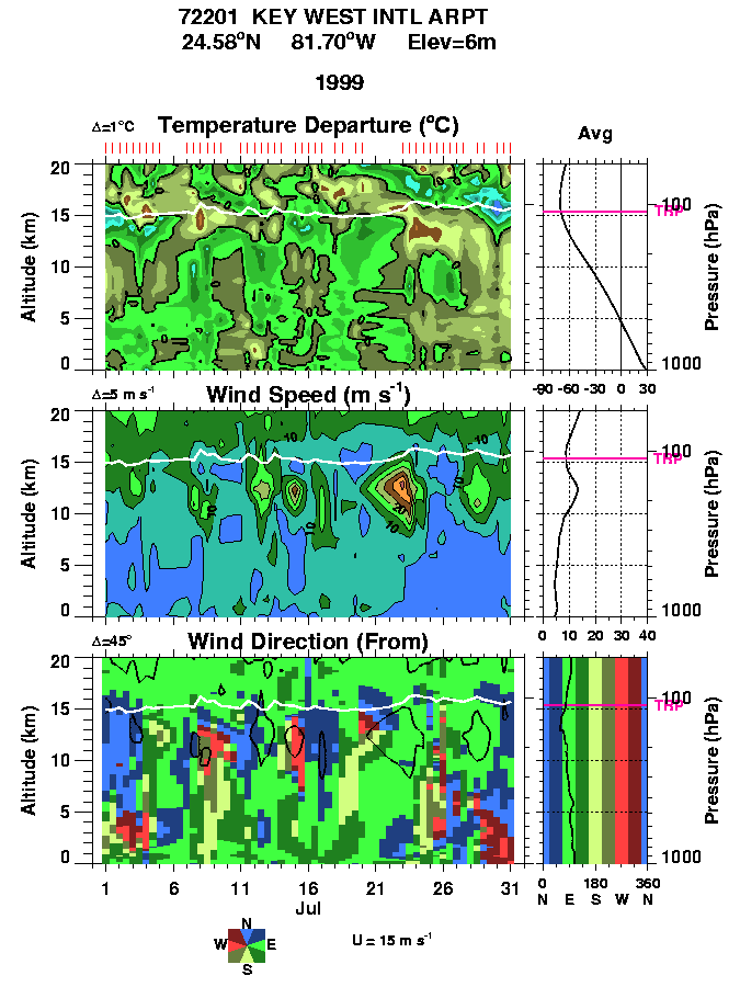
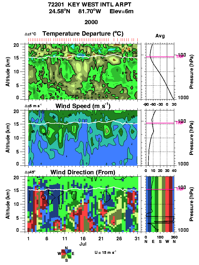
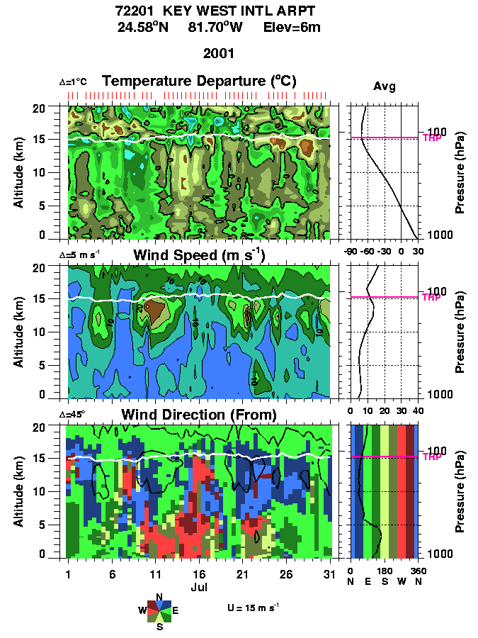
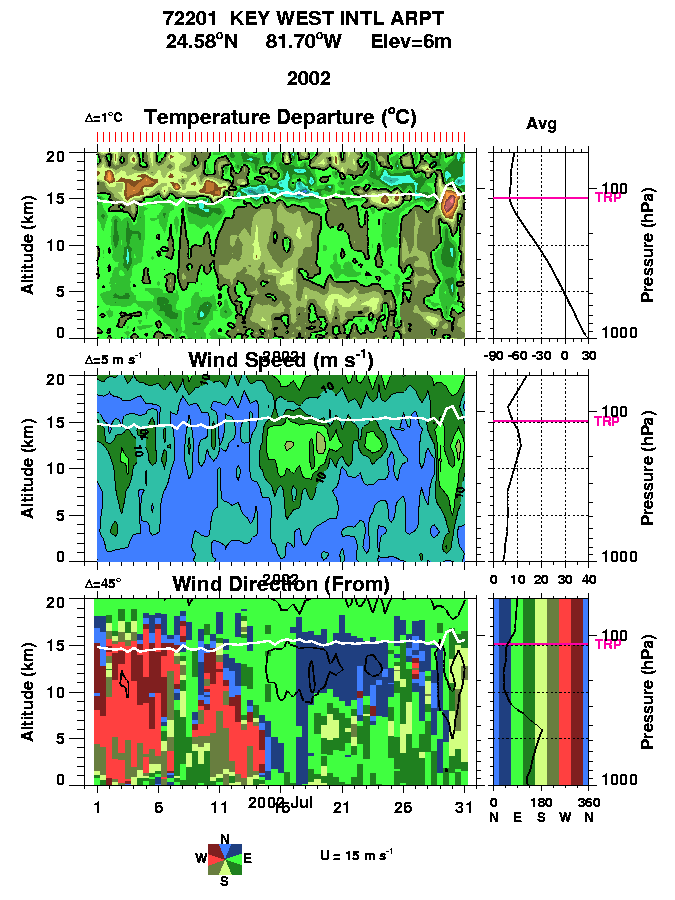
5. Florida region sondes
The following are the 8 radiosonde sites that relatively
consistently report over a region that extends from Central Florida
outward about 900 km. There are 3 color panels on each plot for
Temperature (top), wind Speed (middle), and wind direction (bottom) as
a function of altitude (0-20 km) and time (May 15 to July 15). The
time-mean profiles are shown on each plot on the right hand side. The
tropopause is indicated by the white line on each plot. The red ticks
just above the temperature plot show the actual sonde launches. The
color coding on the wind direction is indicated by the compass rose on
the just below the wind direction chart (note that westerlies are red
and easterlie are green.
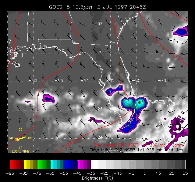
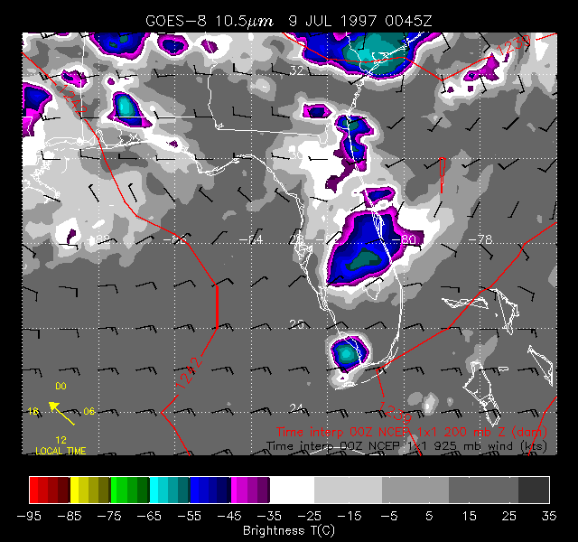
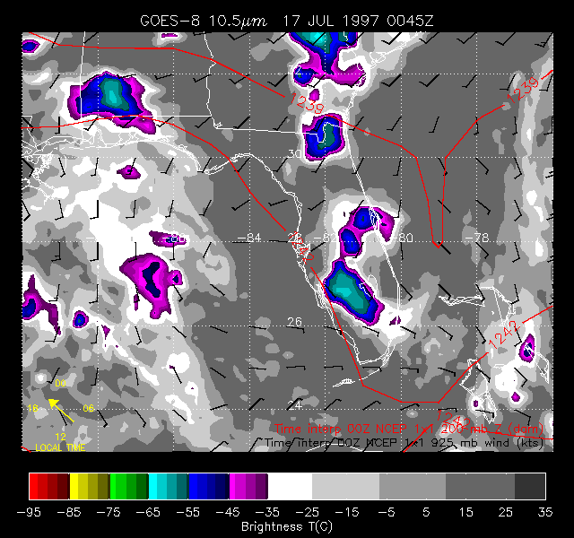
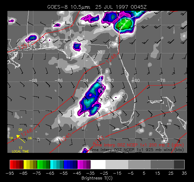
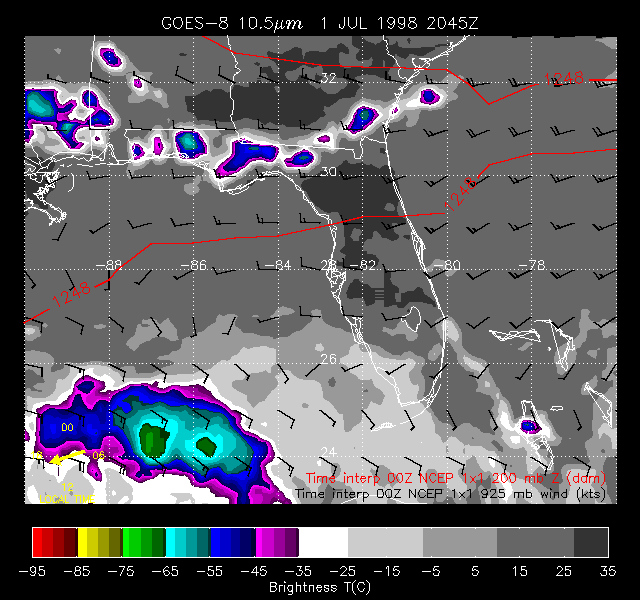
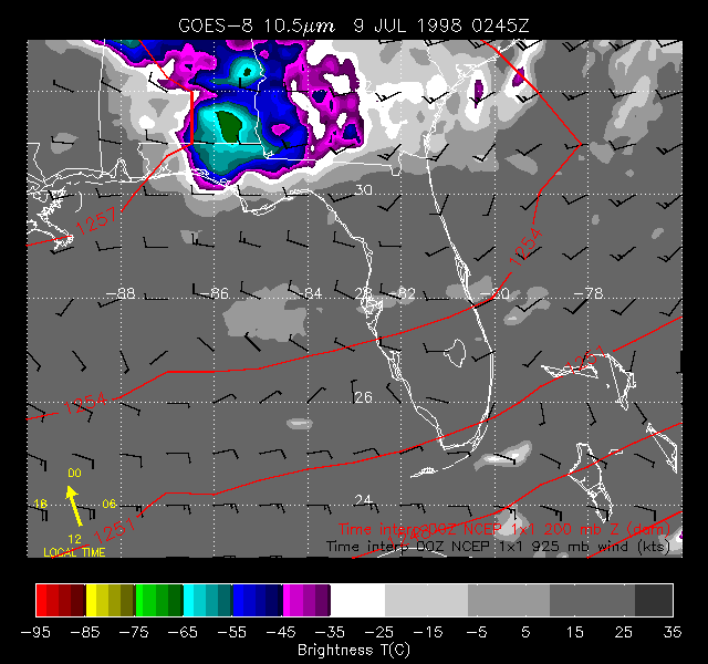
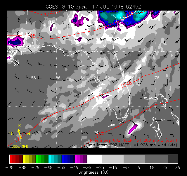
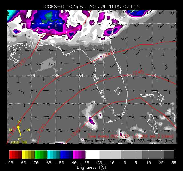
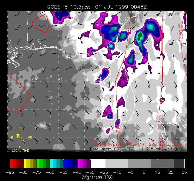
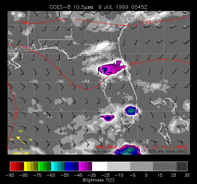
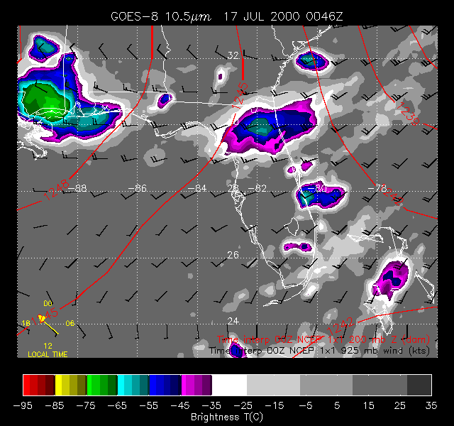
6. Florida GOES-8 movies
Convection over south Florida is typically tied to the sea breezes
that develop during the day on the east and west coasts. As a result,
particularly on days with weak synoptic-scale forcing, thunderstorm
activity and the associated growth of thick cirrus shields tend to
maximize in the afternoon and decay at night. This diurnal
variability is evident in the GOES-8 IR image animations here. These
are QuickTime movies and animated GIFs of hourly
magery over the greater Florida
region from GOES-8 channel 4 (centered at 10.7 microns). Animations
were created for each of the four Julys 1997-2000; to keep them to a
reasonable size, each July is broken up into 4 separate .mov files
spanning days (A) 1-8, (B) 9-16, (C) 17-24 and (D) 25-31. The
imagery was extracted from reduced-resolution GOES-8 data files
kindly provided by Dennis Chesters, Code 910, NASA-Goddard Space
Flight Center.
| July 1997 |
(A) July 01-08 |
Quicktime (12,363 K) |
Anim. Gif (6,329 K) |
| (B) July 09-16 |
Quicktime (19,061 K) |
Anim. Gif (6,076 K) |
| (C) July 17-24 |
Quicktime (20,826 K) |
Anim. Gif (6,796 K) |
| (D) July 25-31 |
Quicktime (16,737 K) |
Anim. Gif (5,331 K) |
| July 1998 |
(A) July 01-08 |
Quicktime ( 5,335 K) |
Anim. Gif (1,643 K) |
| (B) July 09-16 |
Quicktime ( 7,131 K) |
Anim. Gif (2,356 K) |
| (C) July 17-24 |
Quicktime ( 6,033 K) |
Anim. Gif (1,944 K) |
| (D) July 25-31 |
Quicktime ( 4,595 K) |
Anim. Gif (1,504 K) |
| July 1999 |
(A) July 01-08 |
Quicktime (16,972 K) |
Anim. Gif (5,512 K) |
| (B) July 09-16 |
Quicktime (16,760 K) |
Anim. Gif (5,294 K) |
| (C) July 17-24 |
Quicktime (15,956 K) |
Anim. Gif (5,092 K) |
| (D) July 25-31 |
Quicktime (11,106 K) |
Anim. Gif (3,616 K) |
| July 2000 |
(A) July 01-08 |
Quicktime (17,466 K) |
Anim. Gif (5,767 K) |
| (B) July 09-16 |
Quicktime (15,809 K) |
Anim. Gif (5,336 K) |
| (C) July 17-24 |
Quicktime (11,359 K) |
Anim. Gif (3,830 K) |
| (D) July 25-31 |
- n/a - |
- n/a - |
To aid in interpretation, brightness temperatures were enhanced at
-35C (238K) and below; a color bar is provided at the bottom of each
frame. We have also superposed on the images the 925mb wind barbs
(in knots) and 200 mb geopotential height fields (3-dam contours in
red) interpolated to time of the image from the 00 UT NCEP 1x1
analyses.
Minimum brightness temperatures achieved over the center portions of
the larger cirrus shields typically reach -65C and lower (green on
the enhancement curves.) Assuming that these minimum temperatures are
over optically thick cloud, these are comparable to the cloud top
temperature and equivalent to a pressure level of 150 mb or higher.
At this time of year, the tropopause is close to 15 km and the
highest shields are clearly approaching this level.
Particularly interesting is the contrast in day-to-day variability of
convection between the northern half of the Florida penisula and the
south. To the south, as mentioned above, the diurnal variabilty is
particularly pronounced, and is often evident when tropical
disturbances are in the vicinity. Over the northern peninsula,
synoptic scale influences are more pronounced and the diurnal
variability accordingly weaker in comparison.
Dr. Paul A. Newman
Code 916
Atmospheric Chemistry and Dynamics Branch
Laboratory for Atmospheres
NASA's Goddard Space Flight Center
Greenbelt, MD 20771
Building 33, Room E320
(301) 614-5985 fax: x-5903
Last Updated: 2001-06-22
Author: Dr. Paul A. Newman
(NASA/GSFC, Code 916) (newman@notus.gsfc.nasa.gov)